Academic Profile
Statistics
Similar Authors
Papers on arXiv
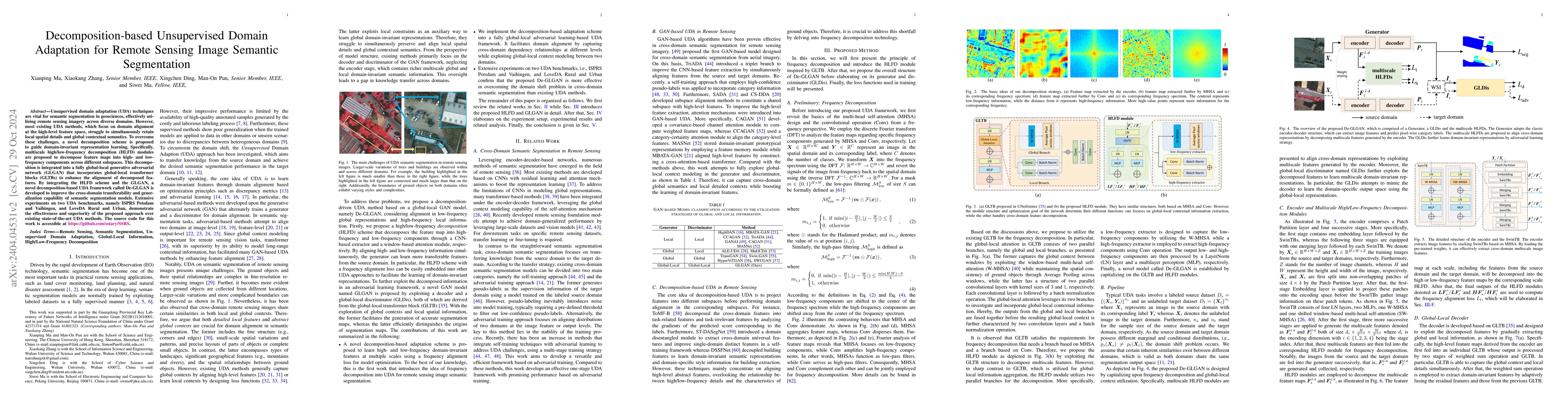
Cross-domain semantic segmentation of remote sensing (RS) imagery based on unsupervised domain adaptation (UDA) techniques has significantly advanced deep-learning applications in the geosciences. R...
Semantic segmentation of remote sensing images is a fundamental task in geoscience research. However, there are some significant shortcomings for the widely used convolutional neural networks (CNNs)...
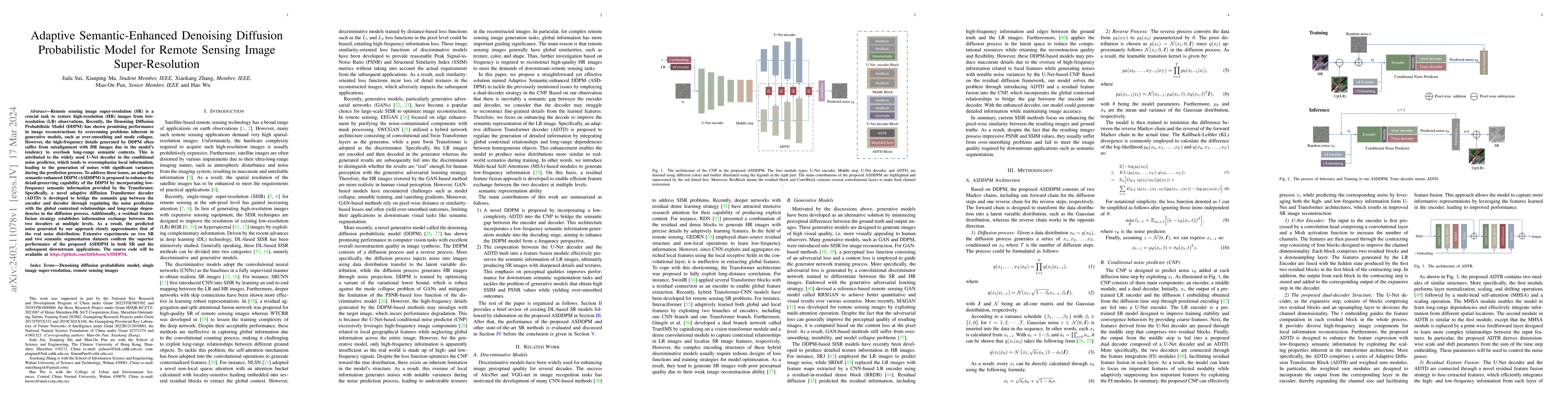
Remote sensing image super-resolution (SR) is a crucial task to restore high-resolution (HR) images from low-resolution (LR) observations. Recently, the Denoising Diffusion Probabilistic Model (DDPM...
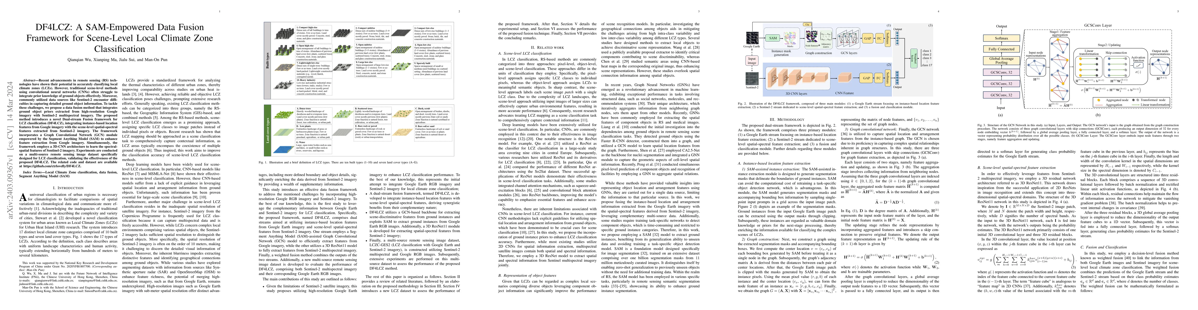
Recent advancements in remote sensing (RS) technologies have shown their potential in accurately classifying local climate zones (LCZs). However, traditional scene-level methods using convolutional ...
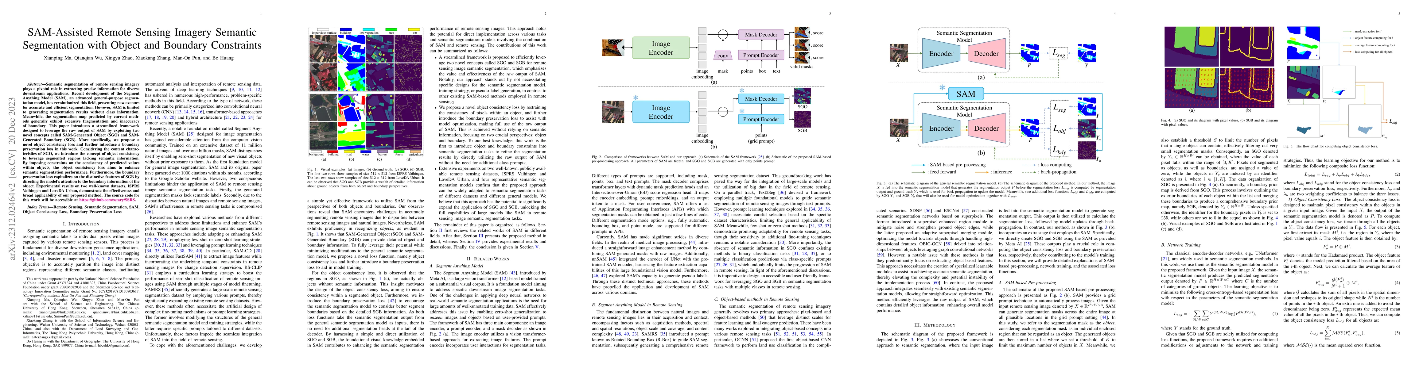
Semantic segmentation of remote sensing imagery plays a pivotal role in extracting precise information for diverse down-stream applications. Recent development of the Segment Anything Model (SAM), a...
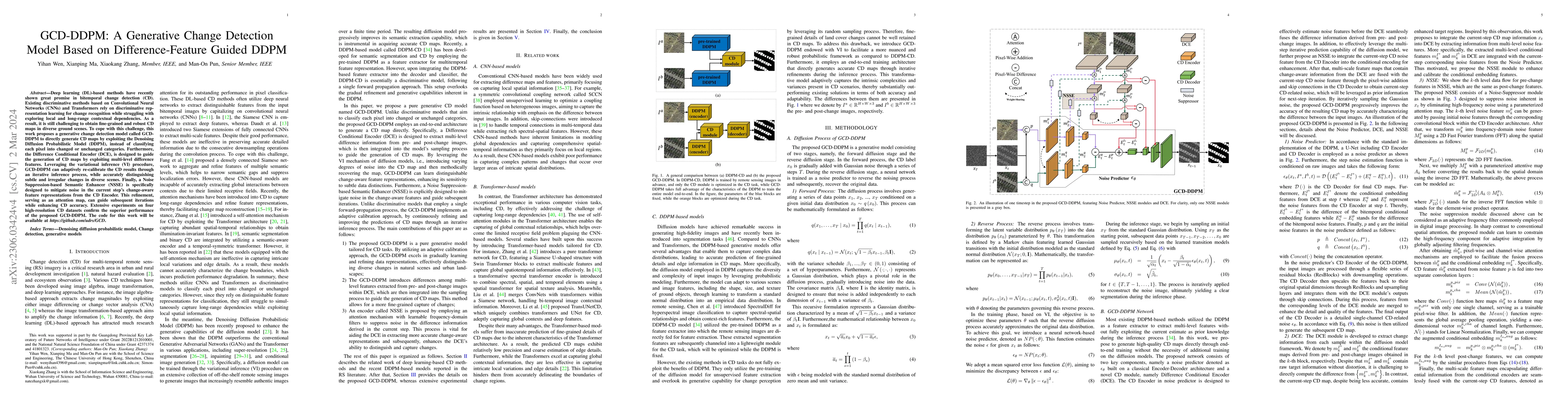
Deep learning (DL)-based methods have recently shown great promise in bitemporal change detection (CD). Existing discriminative methods based on Convolutional Neural Networks (CNNs) and Transformers...
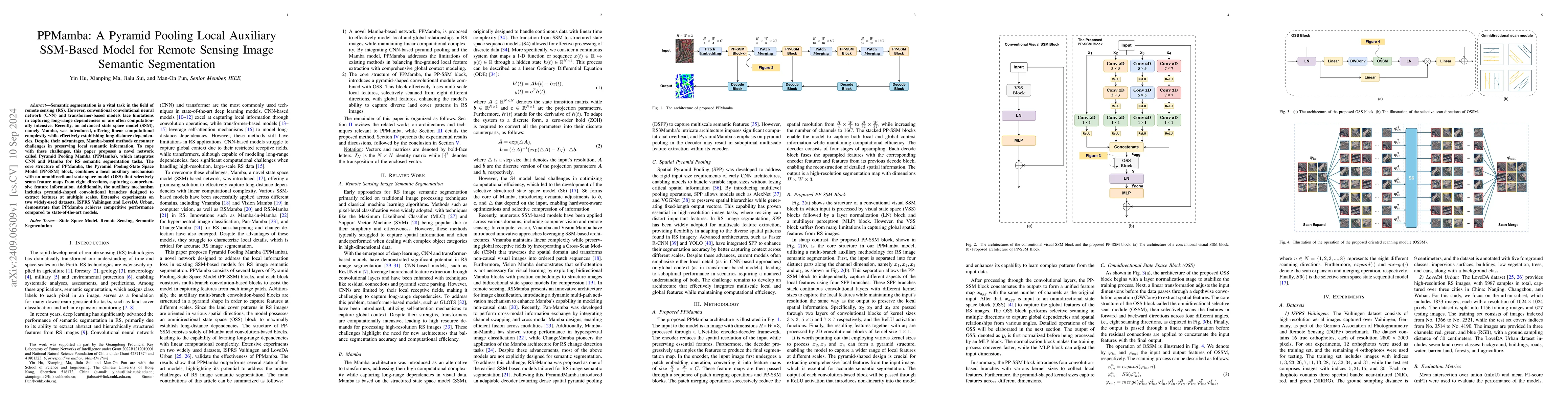
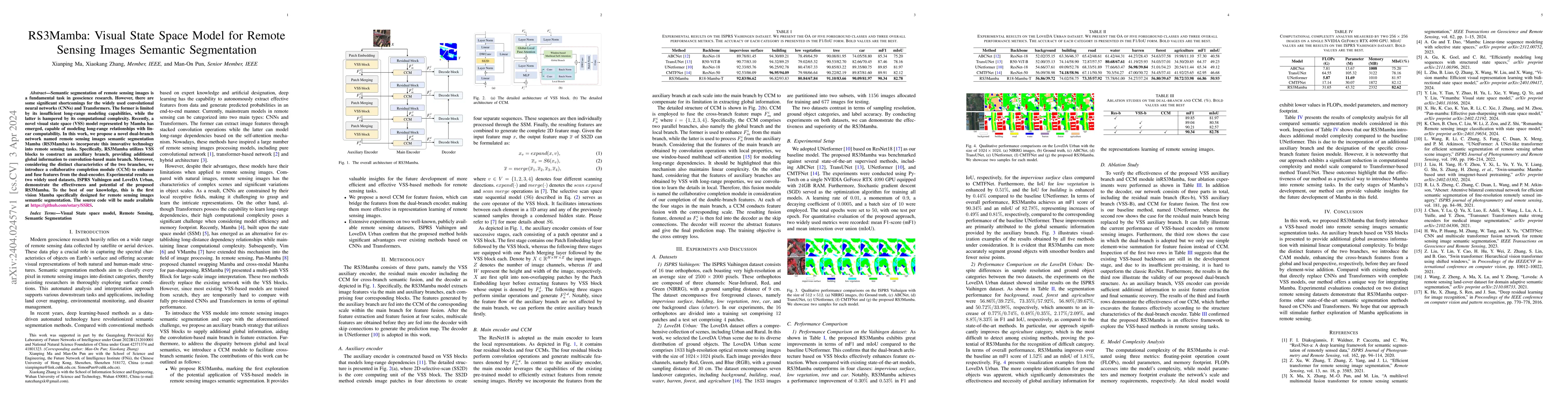
Semantic segmentation is a vital task in the field of remote sensing (RS). However, conventional convolutional neural network (CNN) and transformer-based models face limitations in capturing long-rang...
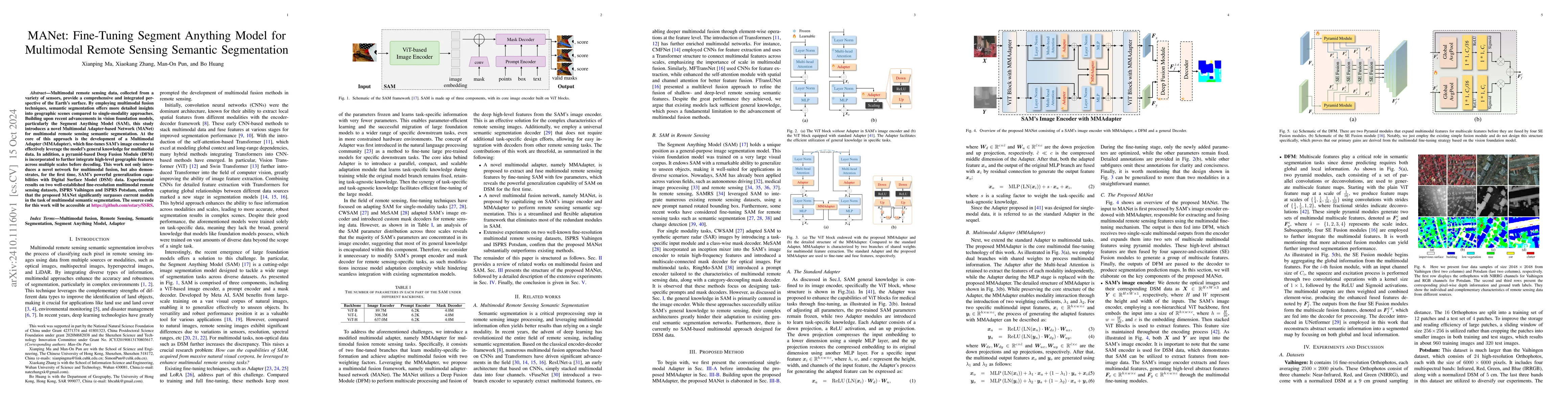
Multimodal remote sensing data, collected from a variety of sensors, provide a comprehensive and integrated perspective of the Earth's surface. By employing multimodal fusion techniques, semantic segm...
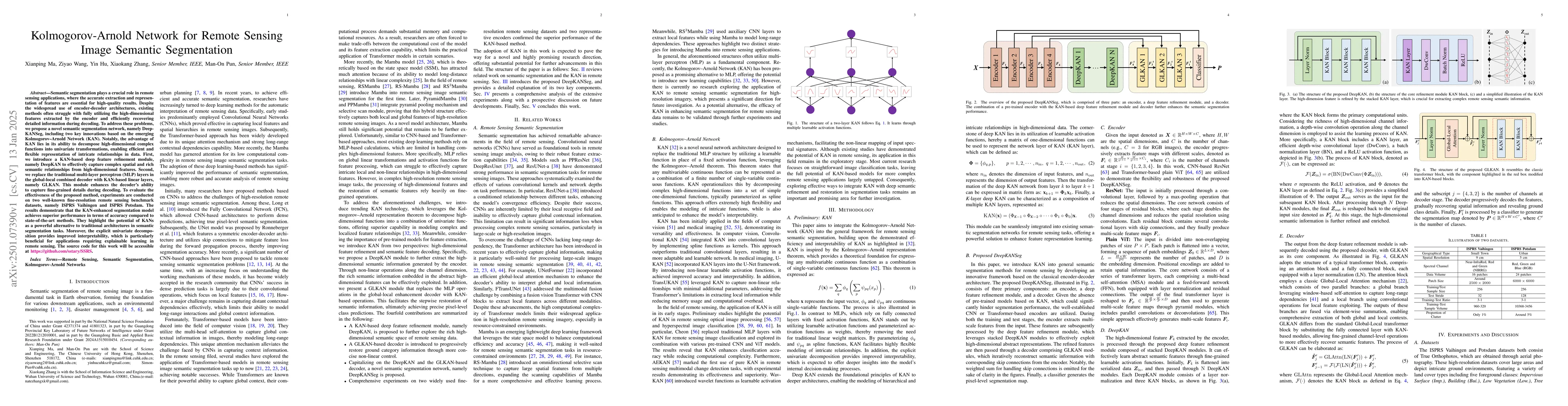
Semantic segmentation plays a crucial role in remote sensing applications, where the accurate extraction and representation of features are essential for high-quality results. Despite the widespread u...
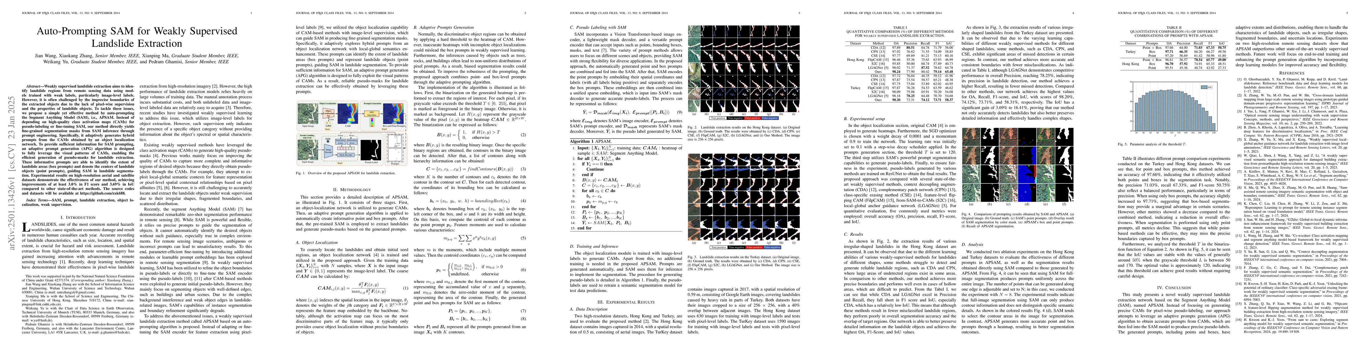
Weakly supervised landslide extraction aims to identify landslide regions from remote sensing data using models trained with weak labels, particularly image-level labels. However, it is often challeng...
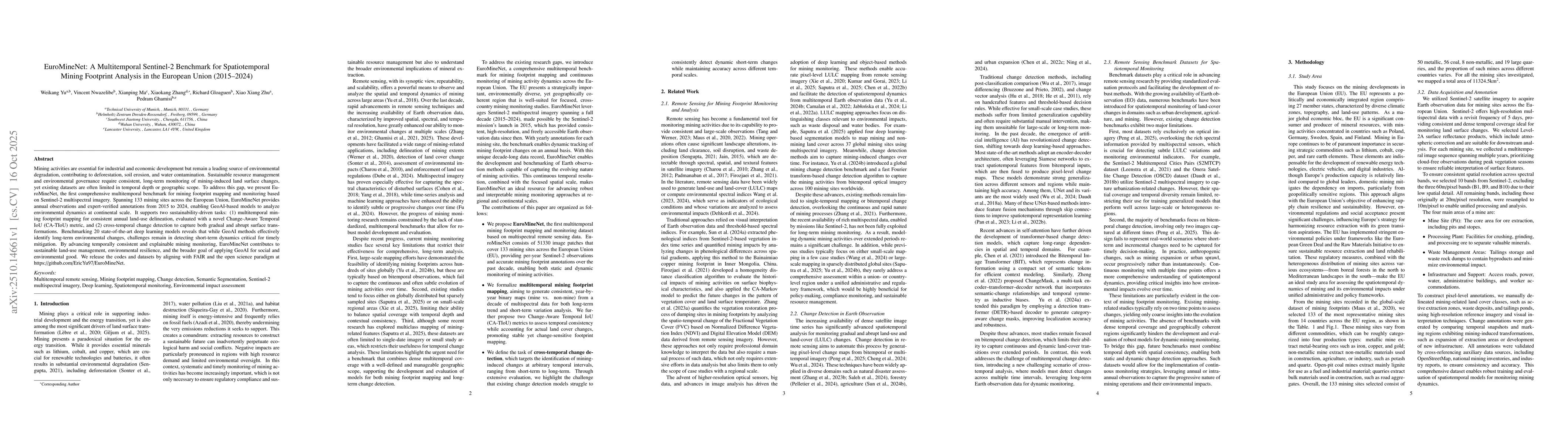
Mining activities are essential for industrial and economic development, but remain a leading source of environmental degradation, contributing to deforestation, soil erosion, and water contamination....
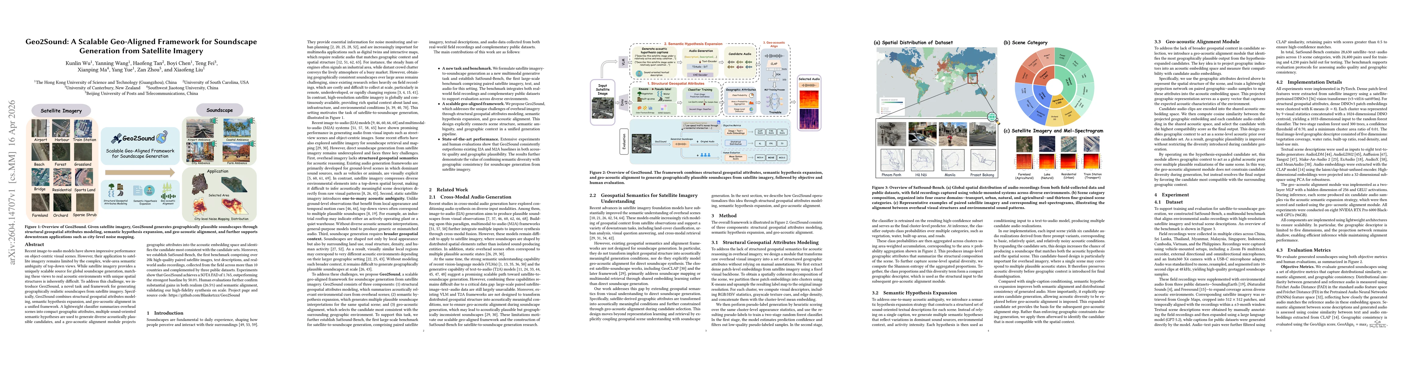
Recent image-to-audio models have shown impressive performance on object-centric visual scenes. However, their application to satellite imagery remains limited by the complex, wide-area semantic ambig...
Semantic segmentation of multi-modal remote sensing imagery plays a pivotal role in land use/land cover (LULC) mapping, environmental monitoring, and precision earth observation. Current multi-modal a...
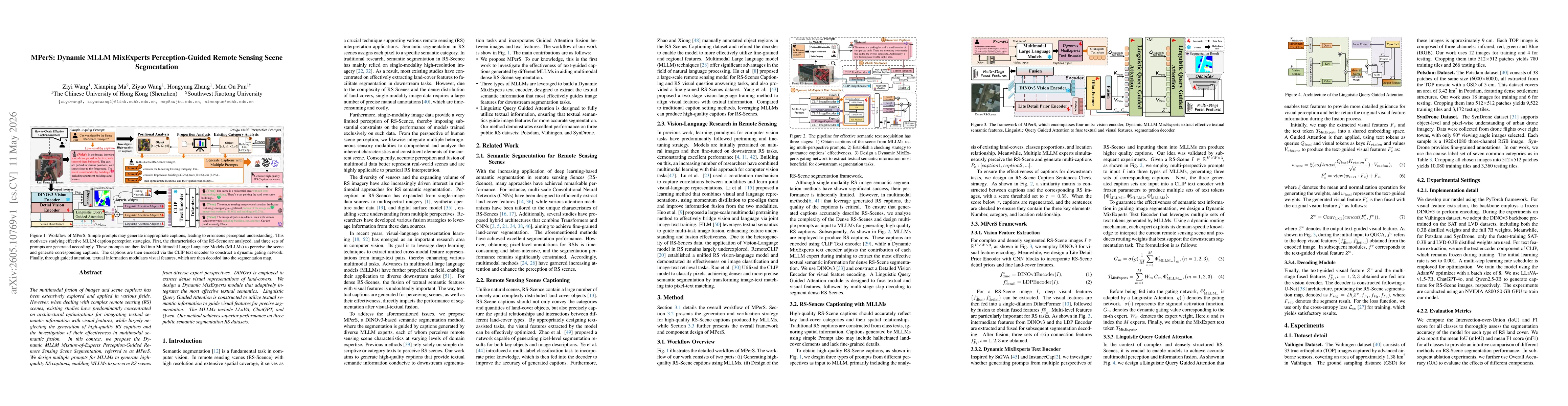
The multimodal fusion of images and scene captions has been extensively explored and applied in various fields. However, when dealing with complex remote sensing (RS) scenes, existing studies have pre...
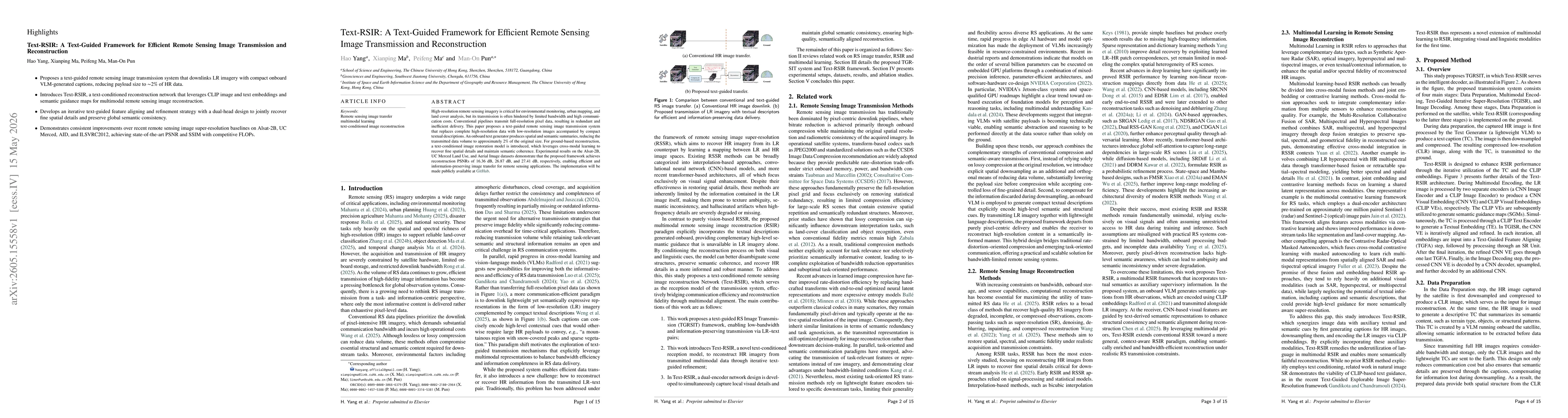
High-resolution remote sensing imagery is critical for environmental monitoring, urban mapping, and land cover analysis, but its transmission is often hindered by limited bandwidth and high communicat...
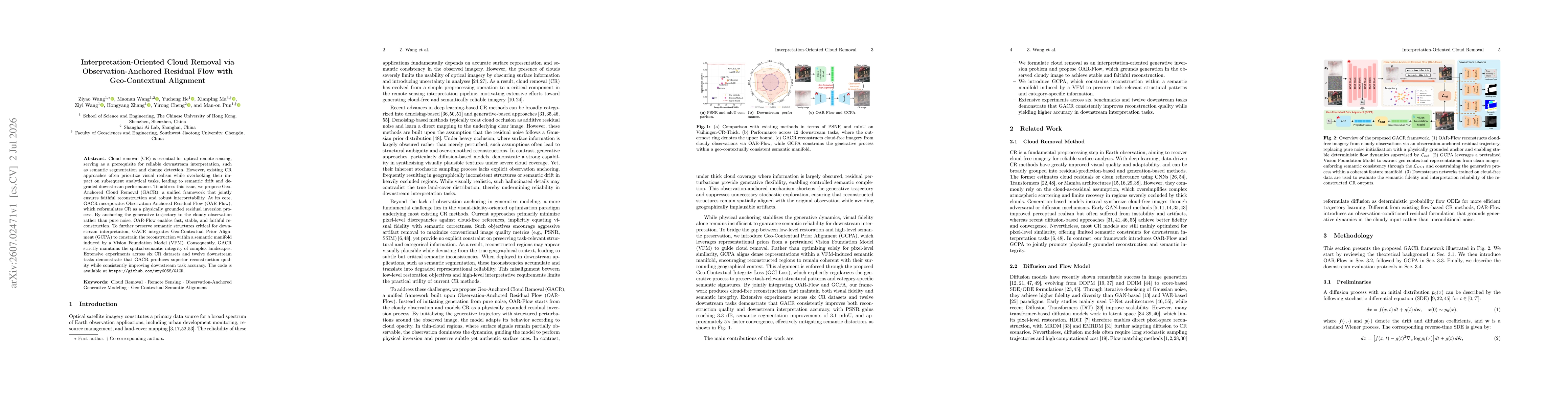
Cloud removal (CR) is essential for optical remote sensing, serving as a prerequisite for reliable downstream interpretation, such as semantic segmentation and change detection. However, existing CR a...

Cloud removal (CR) is essential for optical remote sensing, serving as a prerequisite for reliable downstream interpretation, such as semantic segmentation and change detection. However, existing CR a...