Academic Profile
Statistics
Similar Authors
Papers on arXiv
Footpath mapping, modeling, and analysis can provide important geospatial insights to many fields of study, including transport, health, environment and urban planning. The availability of robust Ge...
In recent decades, wildfires, as widespread and extremely destructive natural disasters, have caused tremendous property losses and fatalities, as well as extensive damage to forest ecosystems. Many...
Since large number of high-quality remote sensing images are readily accessible, exploiting the corpus of images with less manual annotation draws increasing attention. Self-supervised models acquir...
Large Language Models (LLMs) demonstrate human-like capabilities in language understanding, reasoning, and generation, driving interest in using LLM-based agents to simulate human feedback in recommen...
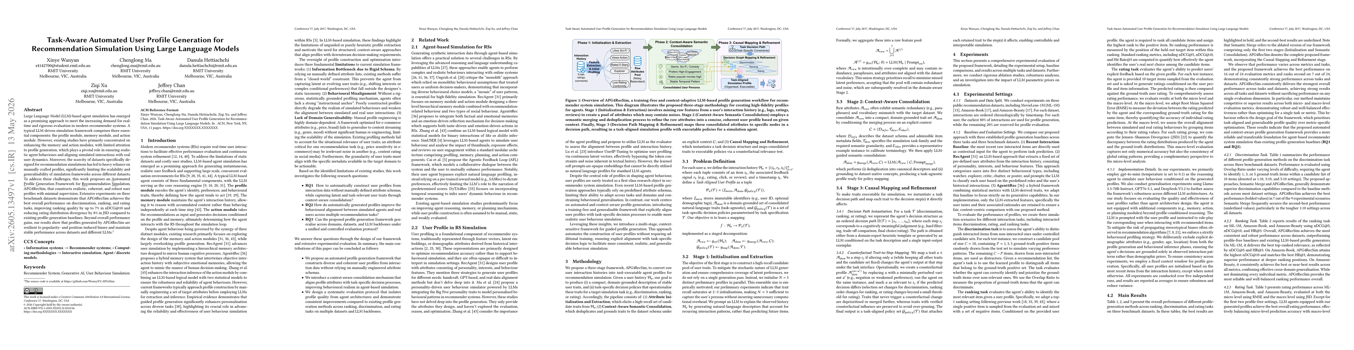
Large Language Model (LLM)-based agent simulation has emerged as a promising approach to meet the increasing demand for real-time and rigorous evaluation in modern recommender systems. A typical LLM-d...
Large-language-model (LLM) based user simulation is increasingly adopted for evaluating search engines, recommender systems, and retrieval-augmented generation pipelines, yet most simulators remain op...