Academic Profile
Statistics
Similar Authors
Papers on arXiv
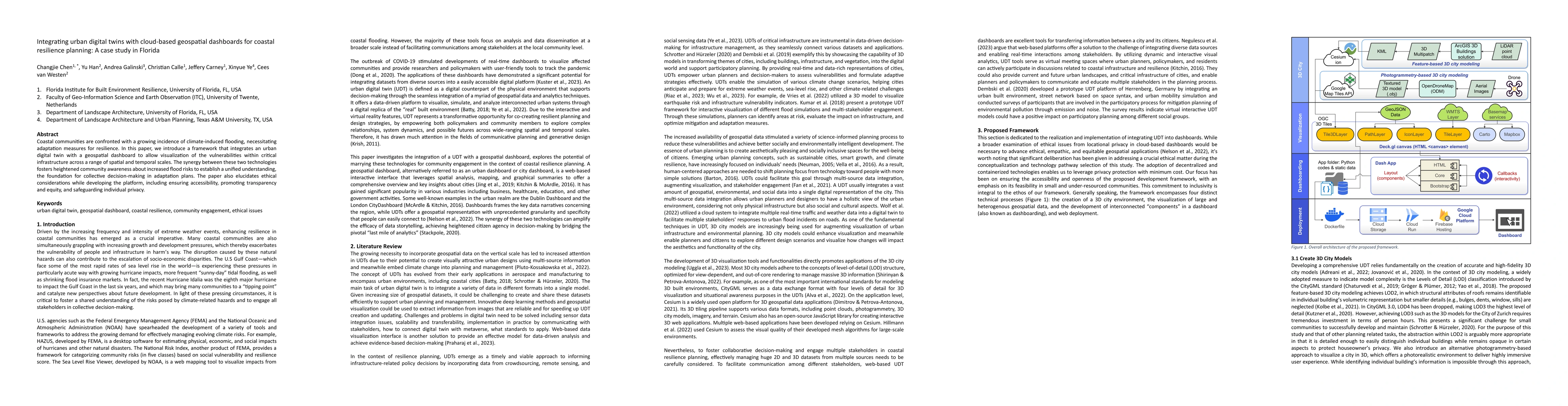
Coastal communities are confronted with a growing incidence of climate-induced flooding, necessitating adaptation measures for resilience. In this paper, we introduce a framework that integrates an ...
The advent of large language models (LLMs) has heightened interest in their potential for multimodal applications that integrate language and vision. This paper explores the capabilities of GPT-4V i...
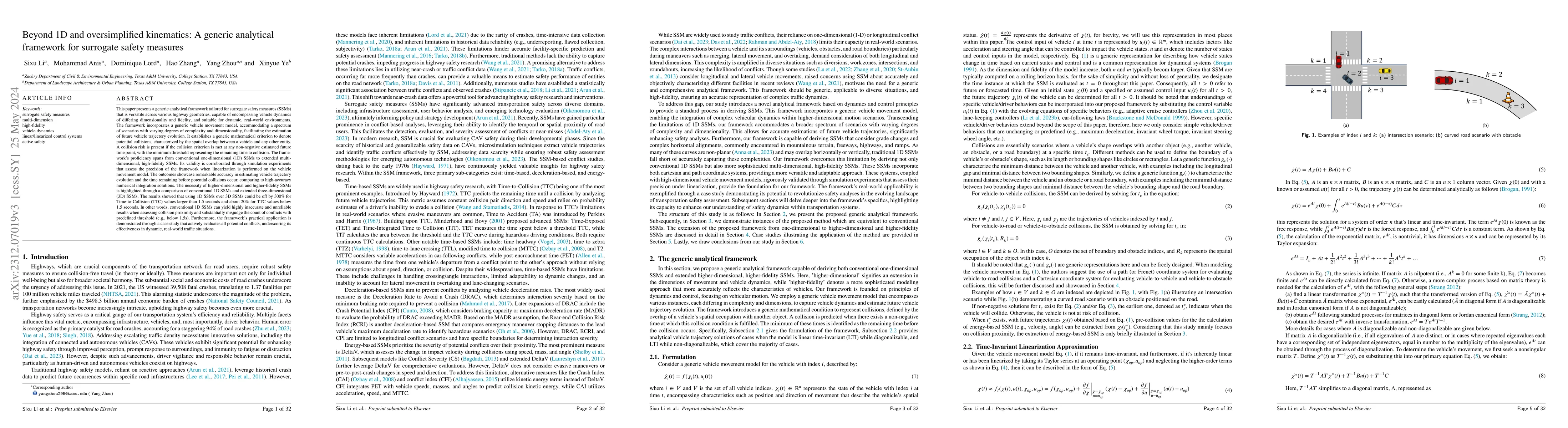
This paper presents a generic analytical framework tailored for surrogate safety measures (SSMs) that is versatile across various highway geometries, capable of encompassing vehicle dynamics of diff...
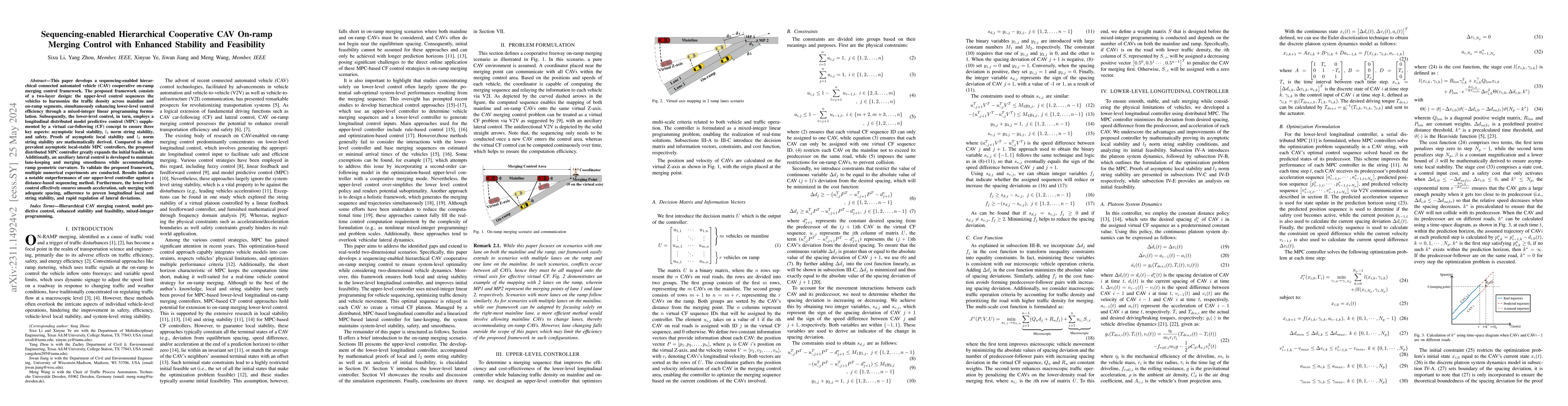
This paper develops a sequencing-enabled hierarchical connected automated vehicle (CAV) cooperative on-ramp merging control framework. The proposed framework consists of a two-layer design: the uppe...
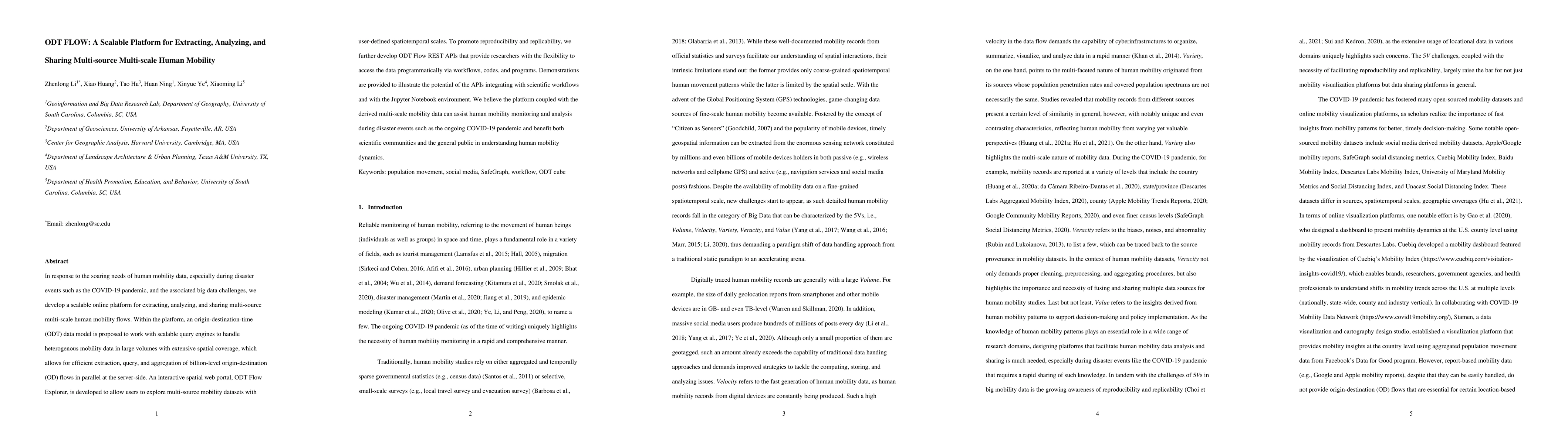
In response to the soaring needs of human mobility data, especially during disaster events such as the COVID-19 pandemic, and the associated big data challenges, we develop a scalable online platfor...
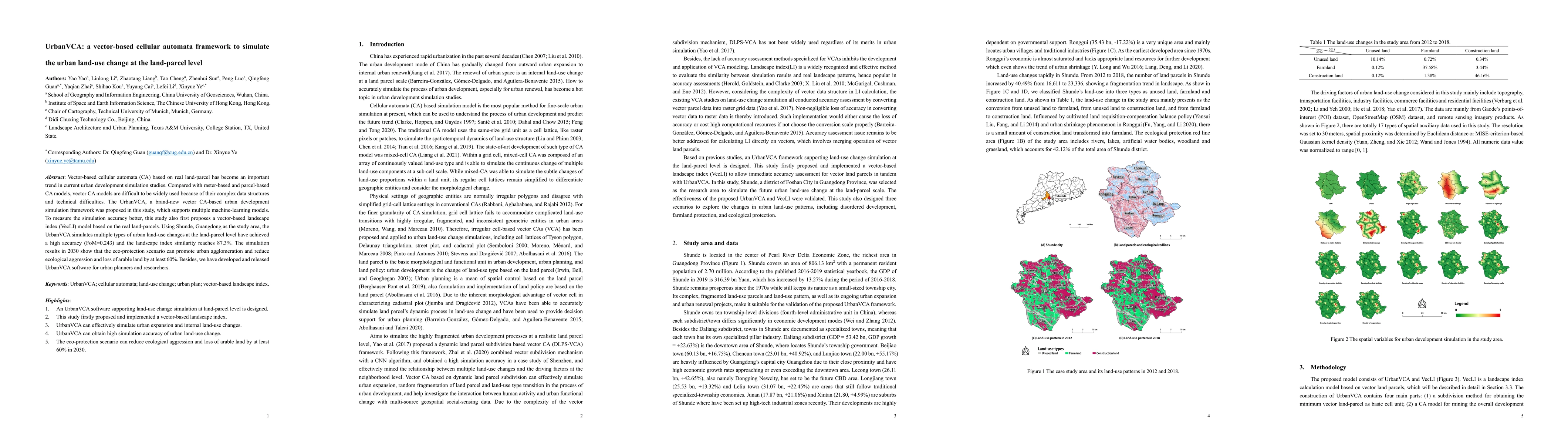
Vector-based cellular automata (CA) based on real land-parcel has become an important trend in current urban development simulation studies. Compared with raster-based and parcel-based CA models, ve...
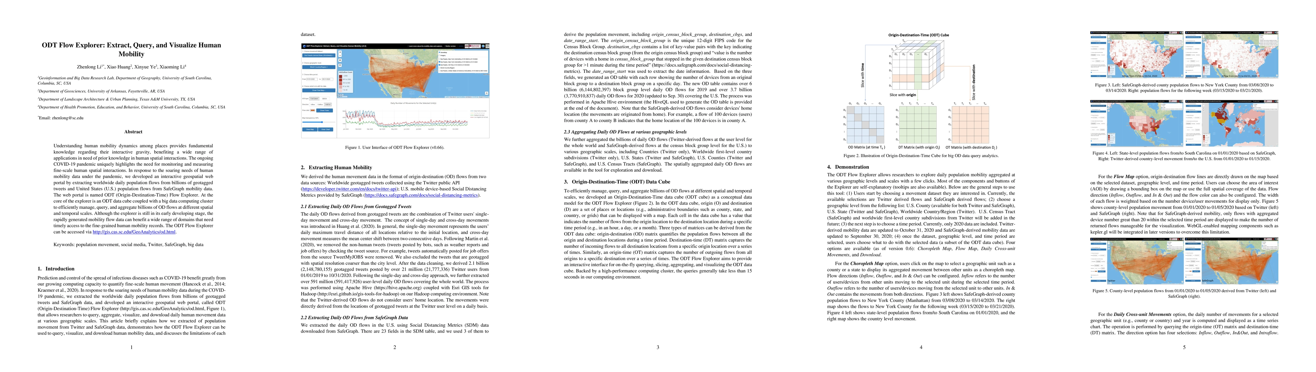
Understanding human mobility dynamics among places provides fundamental knowledge regarding their interactive gravity, benefiting a wide range of applications in need of prior knowledge in human spa...
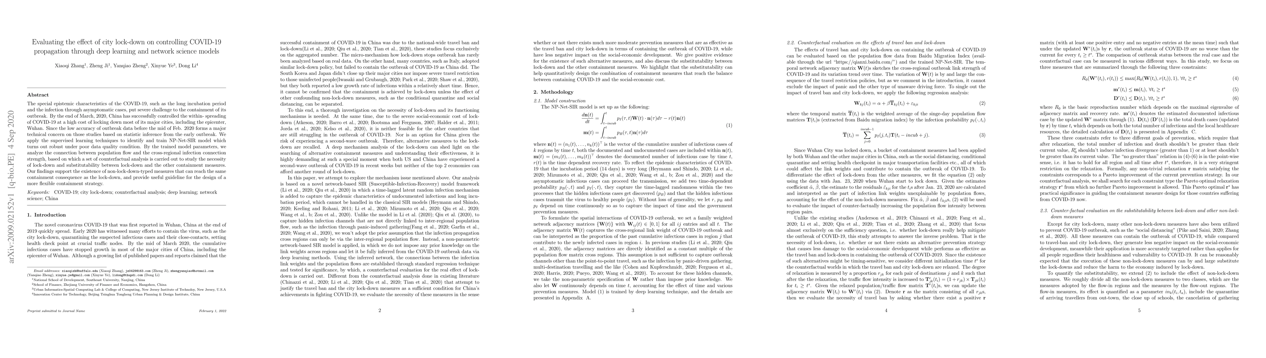
The special epistemic characteristics of the COVID-19, such as the long incubation period and the infection through asymptomatic cases, put severe challenge to the containment of its outbreak. By th...
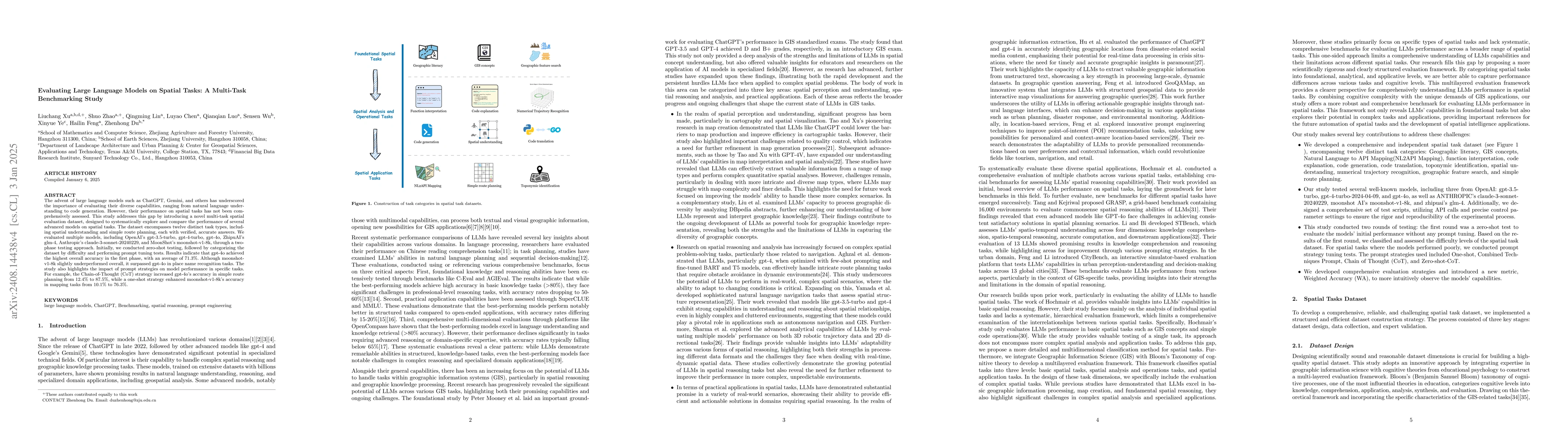
The advent of large language models such as ChatGPT, Gemini, and others has underscored the importance of evaluating their diverse capabilities, ranging from natural language understanding to code gen...
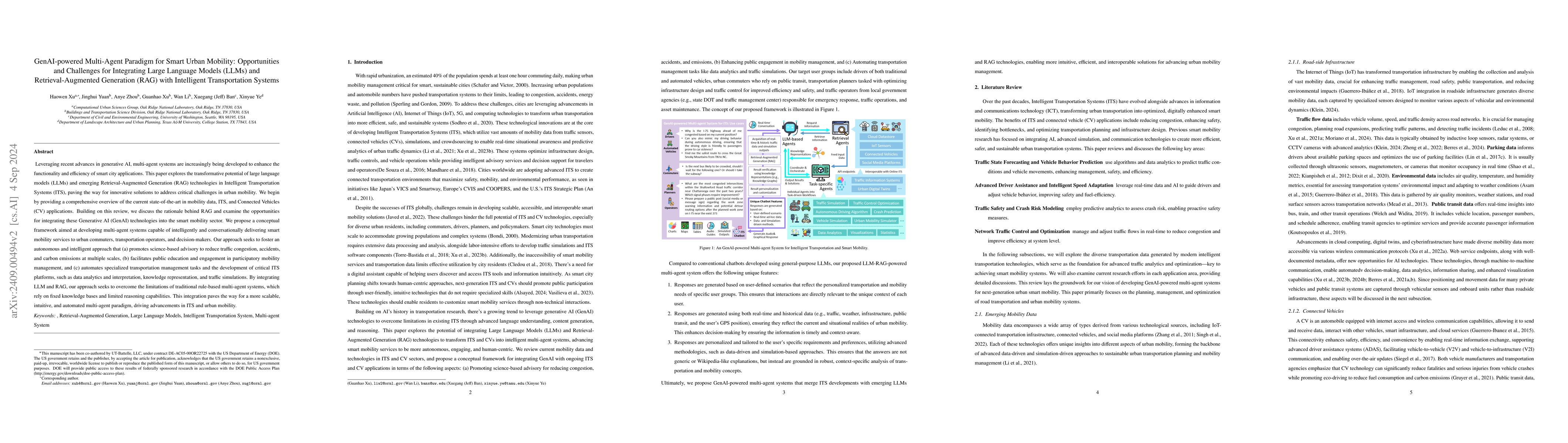
Leveraging recent advances in generative AI, multi-agent systems are increasingly being developed to enhance the functionality and efficiency of smart city applications. This paper explores the transf...
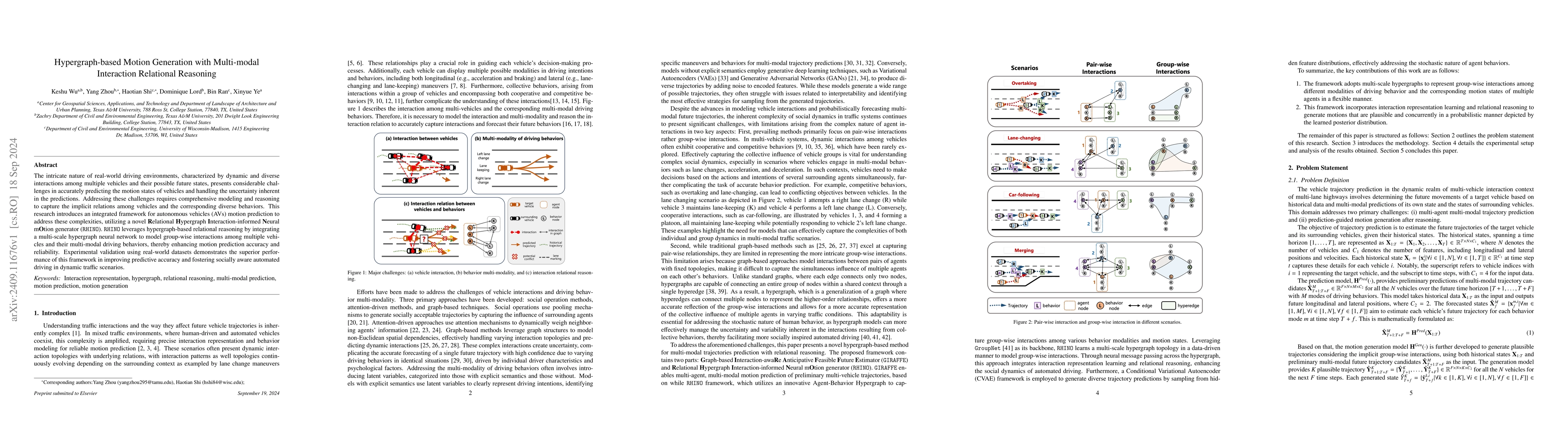
The intricate nature of real-world driving environments, characterized by dynamic and diverse interactions among multiple vehicles and their possible future states, presents considerable challenges in...
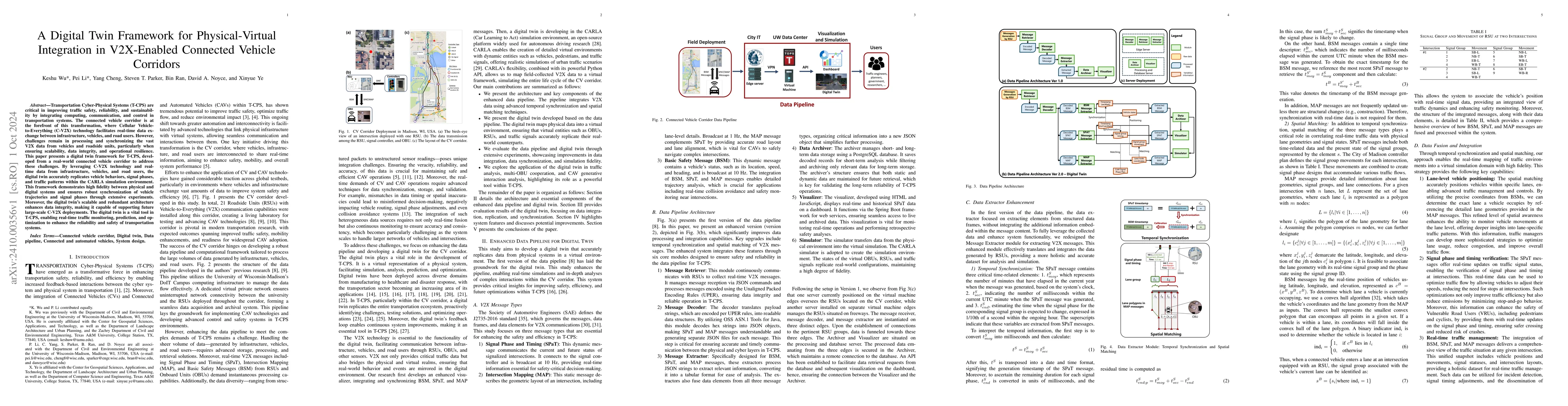
Transportation Cyber-Physical Systems (T-CPS) are critical in improving traffic safety, reliability, and sustainability by integrating computing, communication, and control in transportation systems. ...
Urban traffic safety is a pressing concern in modern transportation systems, especially in rapidly growing metropolitan areas where increased traffic congestion, complex road networks, and diverse dri...

Extreme heat events exacerbated by climate change pose significant challenges to urban resilience and planning. This study introduces a climate-responsive digital twin framework integrating the Spatio...
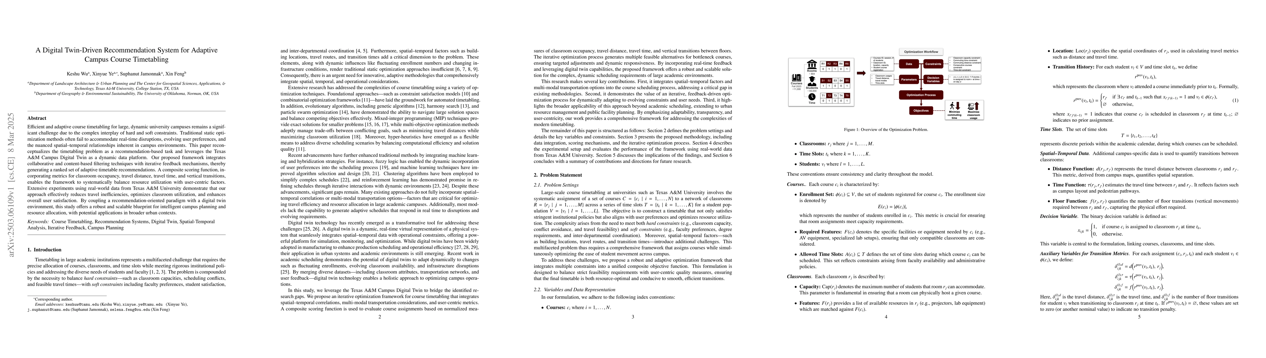
Efficient and adaptive course timetabling for large, dynamic university campuses remains a significant challenge due to the complex interplay of hard and soft constraints. Traditional static optimizat...
The advent of generative AI exemplified by large language models (LLMs) opens new ways to represent and compute geographic information and transcends the process of geographic knowledge production, dr...
This paper introduces an AI-enabled, interaction-aware active safety analysis framework that accounts for groupwise vehicle interactions. Specifically, the framework employs a bicycle model-augmented ...
Large Language Models (LLMs) are transforming geospatial artificial intelligence (GeoAI), offering new capabilities in data processing, spatial analysis, and decision support. This paper examines the ...
Wildfires have become increasingly frequent, irregular, and severe in recent years. Understanding how affected populations perceive and respond during wildfire crises is critical for timely and empath...
Generative Artificial Intelligence (GenAI) constitutes a transformative technological wave that reconfigures industries through its unparalleled capabilities for content creation, reasoning, planning,...
Communities worldwide increasingly confront flood hazards intensified by climate change, urban expansion, and environmental degradation. Addressing these challenges requires real-time flood analysis, ...
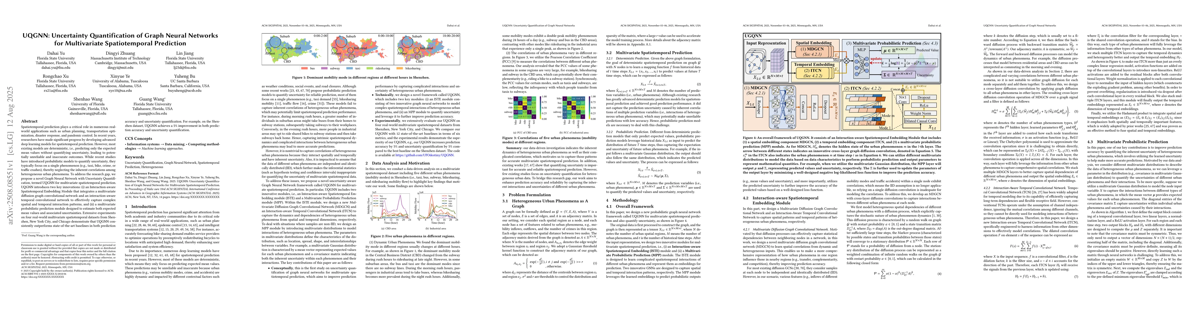
Spatiotemporal prediction plays a critical role in numerous real-world applications such as urban planning, transportation optimization, disaster response, and pandemic control. In recent years, resea...
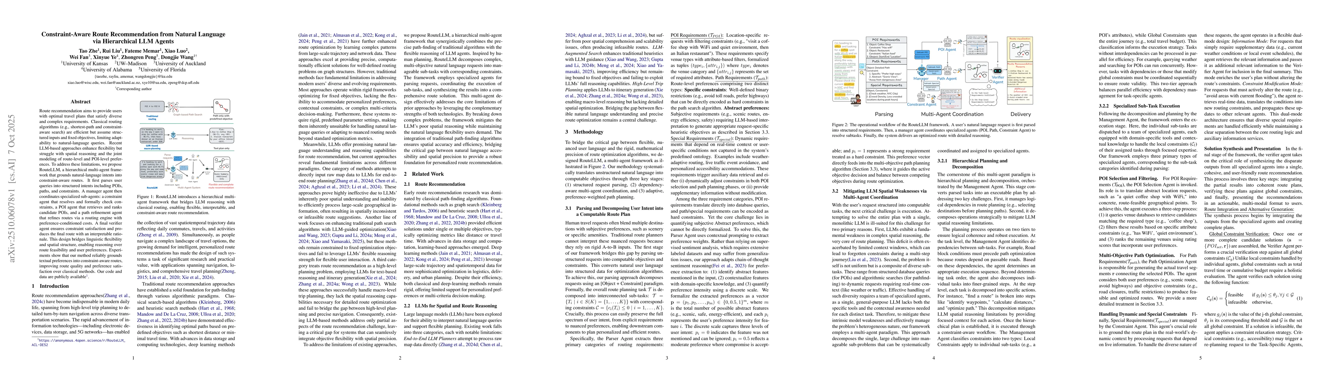
Route recommendation aims to provide users with optimal travel plans that satisfy diverse and complex requirements. Classical routing algorithms (e.g., shortest-path and constraint-aware search) are e...
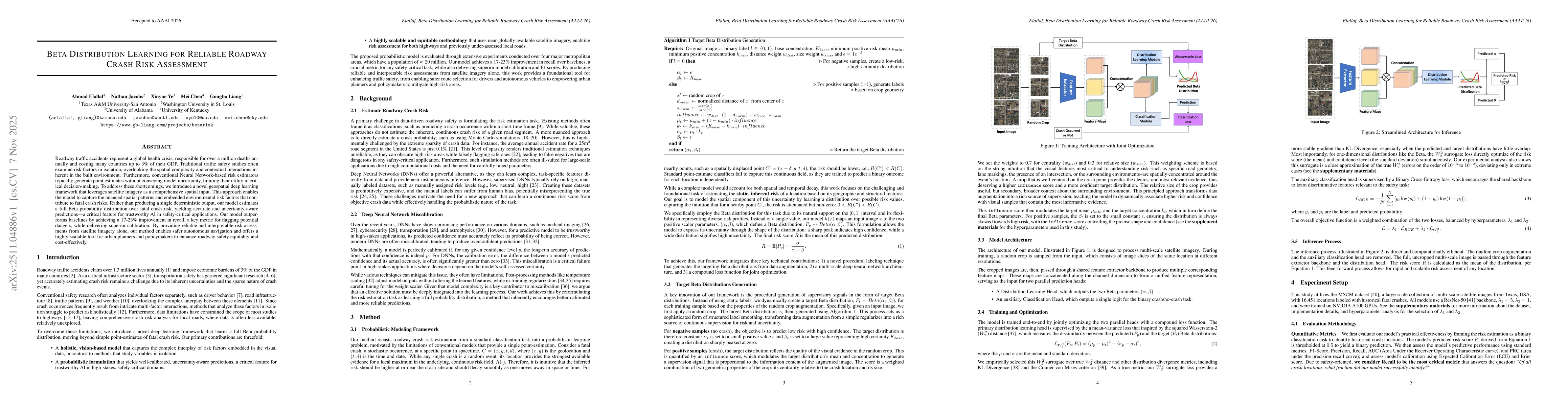
Roadway traffic accidents represent a global health crisis, responsible for over a million deaths annually and costing many countries up to 3% of their GDP. Traditional traffic safety studies often ex...
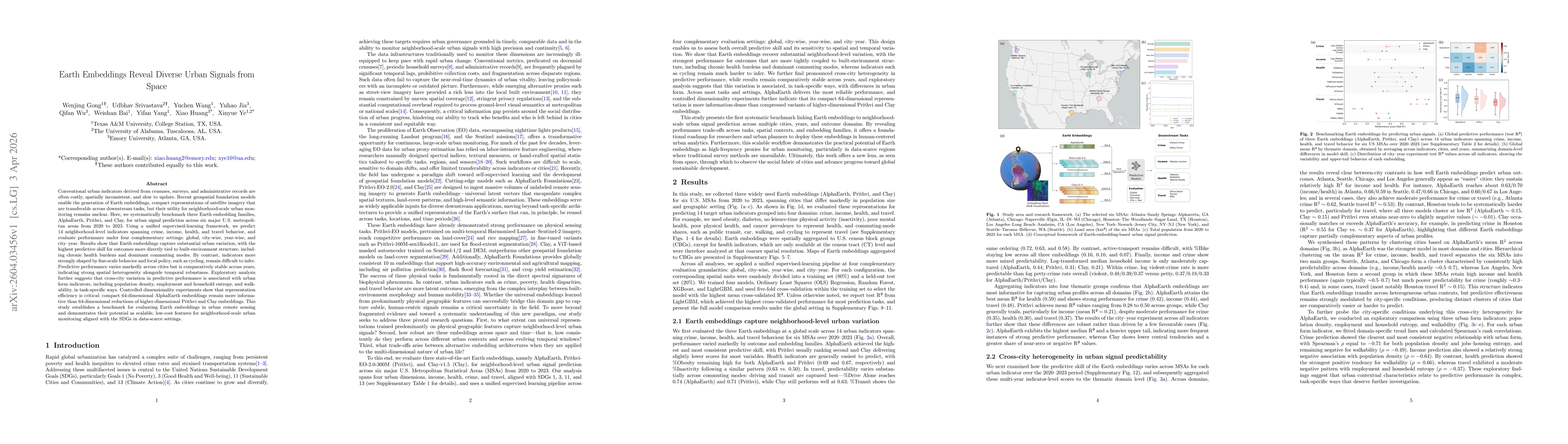
Conventional urban indicators derived from censuses, surveys, and administrative records are often costly, spatially inconsistent, and slow to update. Recent geospatial foundation models enable Earth ...
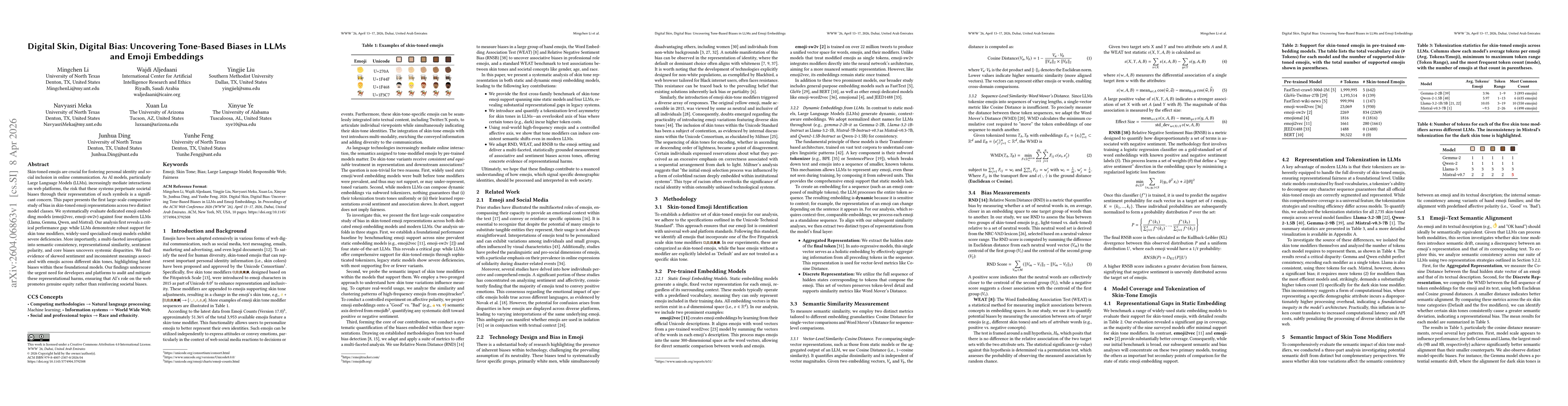
Skin-toned emojis are crucial for fostering personal identity and social inclusion in online communication. As AI models, particularly Large Language Models (LLMs), increasingly mediate interactions o...
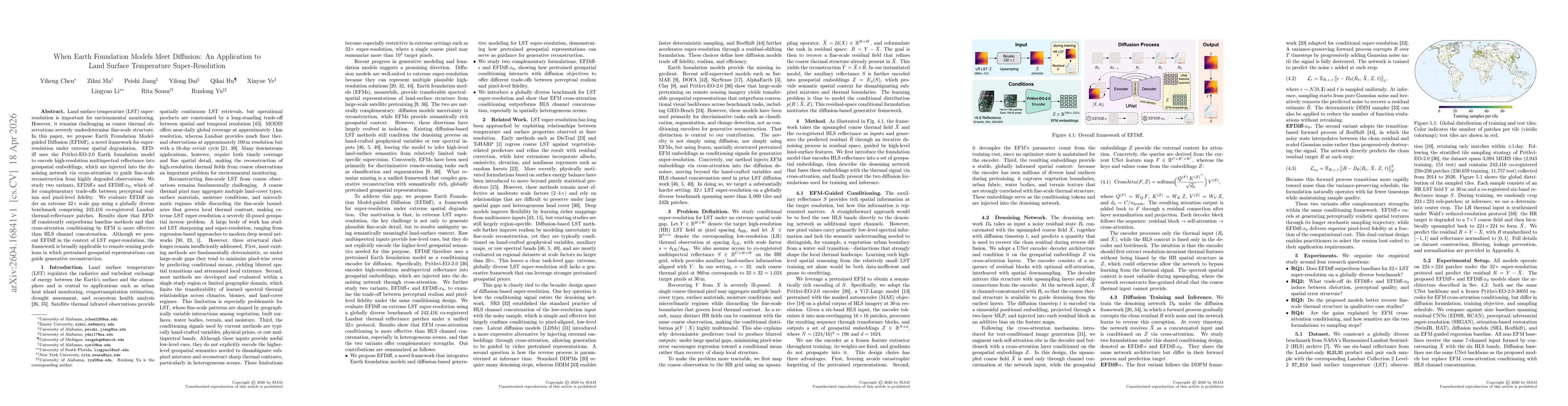
Land surface temperature (LST) super-resolution is important for environmental monitoring. However, it remains challenging as coarse thermal observations severely underdetermine fine-scale structure. ...
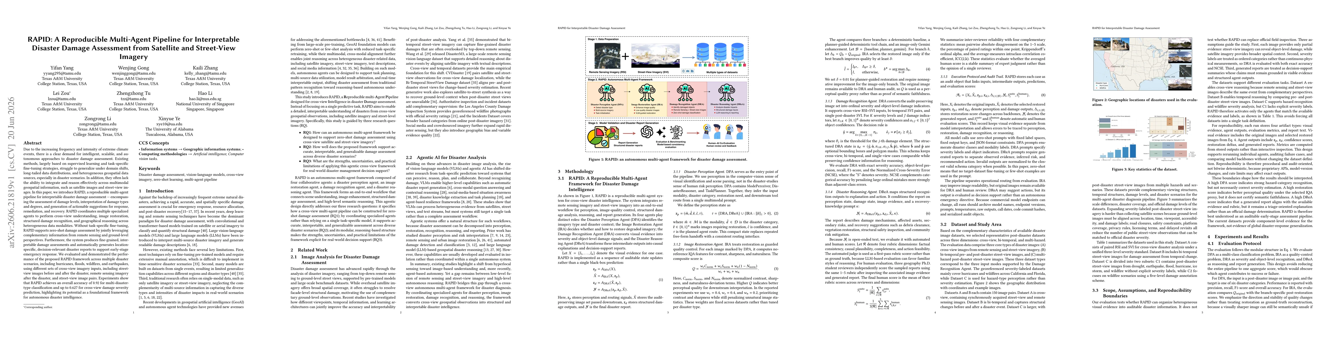
Due to the increasing frequency and intensity of extreme climate events, there is a clear demand for intelligent, scalable, and autonomous approaches to disaster damage assessment. Existing methods, l...