Academic Profile
Statistics
Similar Authors
Papers on arXiv
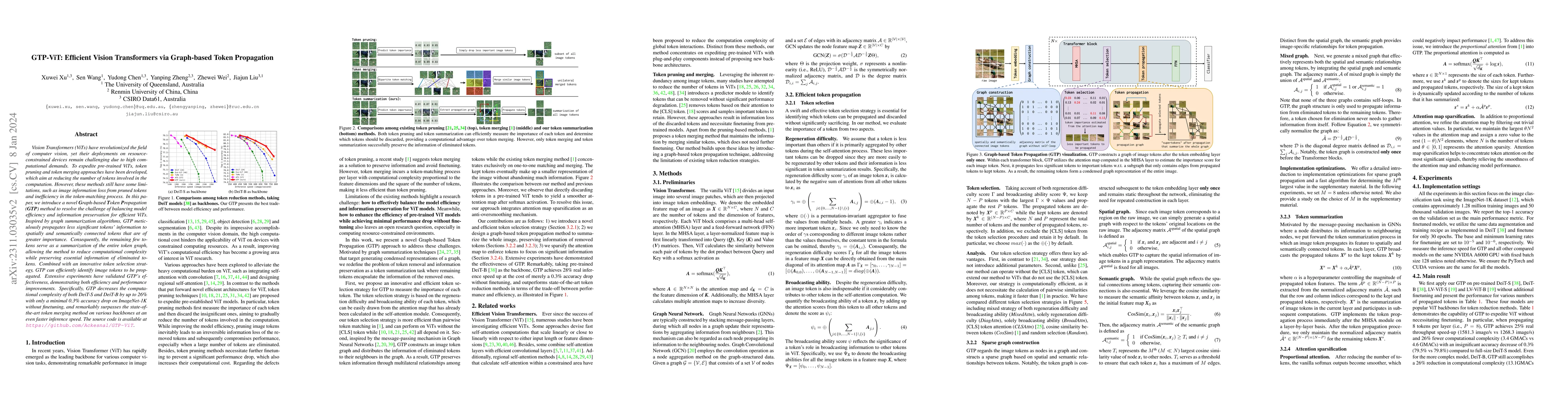
Vision Transformers (ViTs) have revolutionized the field of computer vision, yet their deployments on resource-constrained devices remain challenging due to high computational demands. To expedite p...
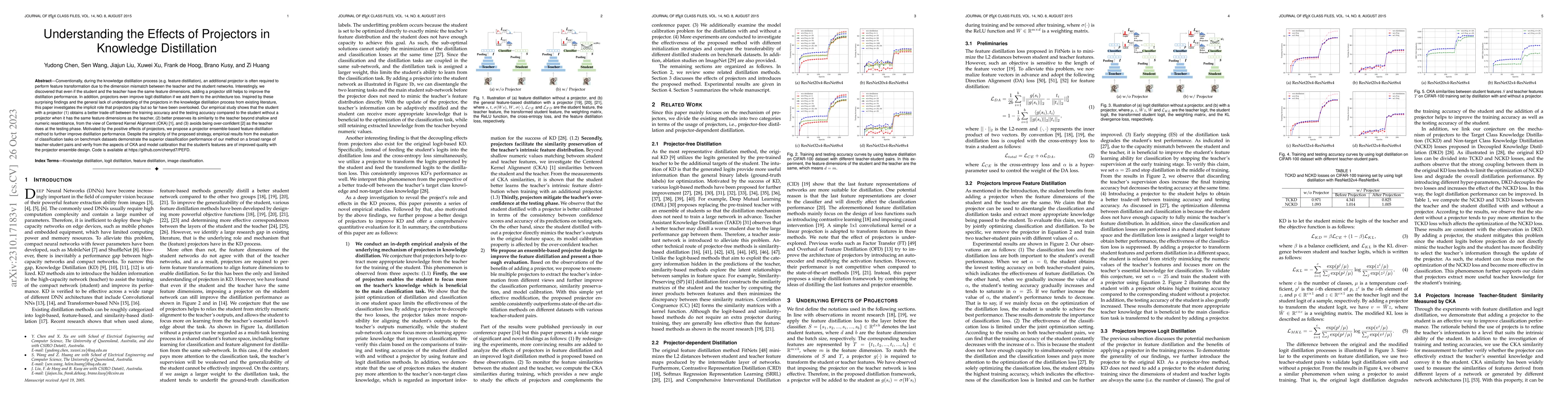
Conventionally, during the knowledge distillation process (e.g. feature distillation), an additional projector is often required to perform feature transformation due to the dimension mismatch betwe...
Vision Transformers (ViTs) have demonstrated outstanding performance in computer vision tasks, yet their high computational complexity prevents their deployment in computing resource-constrained env...
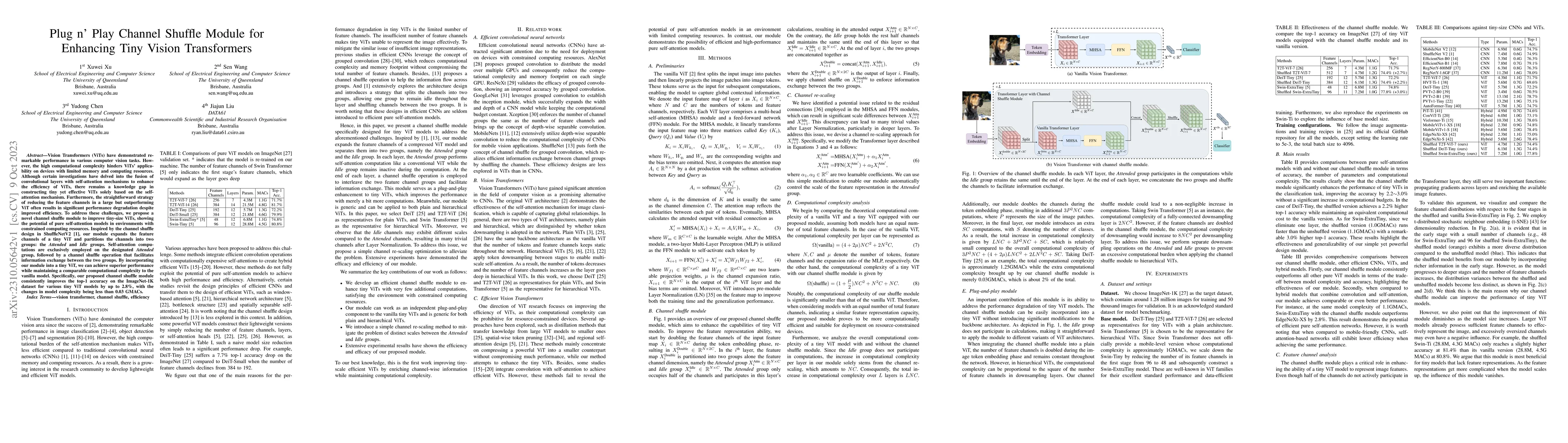
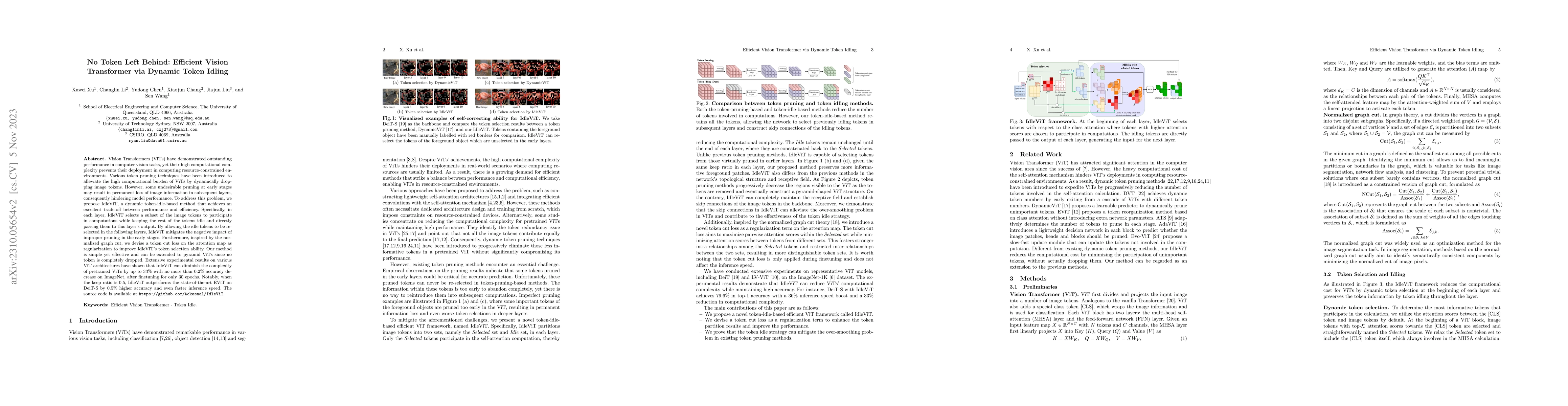
Vision Transformers (ViTs) have demonstrated remarkable performance in various computer vision tasks. However, the high computational complexity hinders ViTs' applicability on devices with limited m...
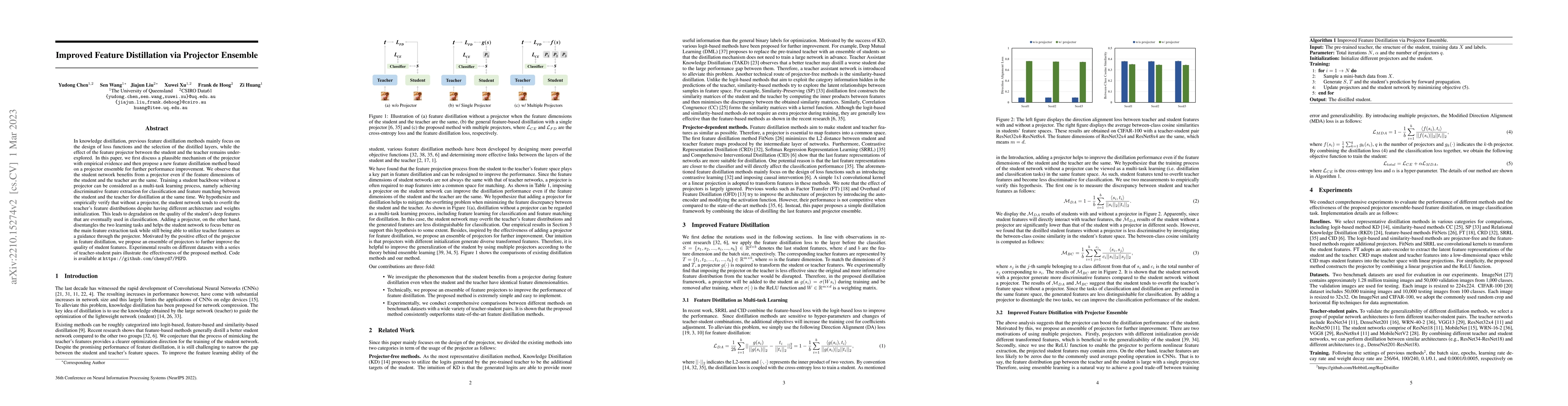
In knowledge distillation, previous feature distillation methods mainly focus on the design of loss functions and the selection of the distilled layers, while the effect of the feature projector bet...
Multi-scale maps are essential representations of surveying and cartographic results, serving as fundamental components of geographic services. Current image generation networks can quickly produce ma...
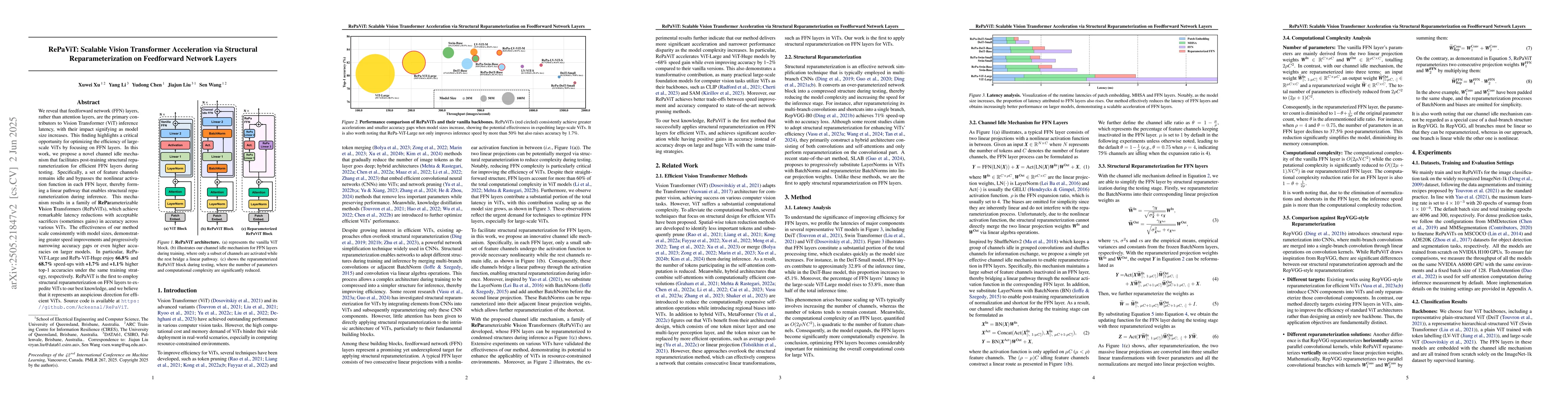
We reveal that feedforward network (FFN) layers, rather than attention layers, are the primary contributors to Vision Transformer (ViT) inference latency, with their impact signifying as model size in...
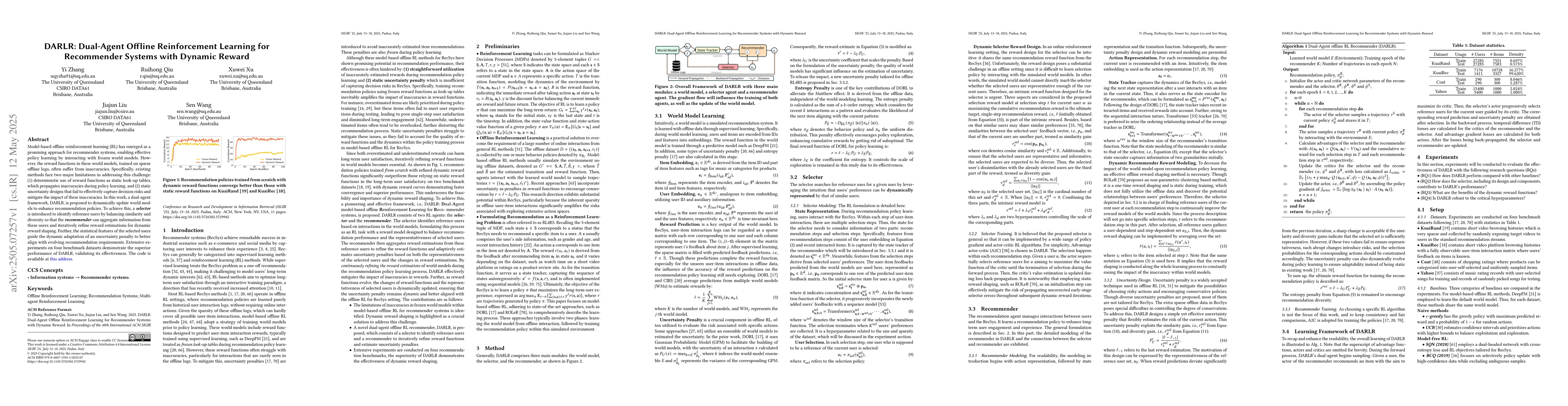
Model-based offline reinforcement learning (RL) has emerged as a promising approach for recommender systems, enabling effective policy learning by interacting with frozen world models. However, the re...