Academic Profile
Statistics
Similar Authors
Papers on arXiv
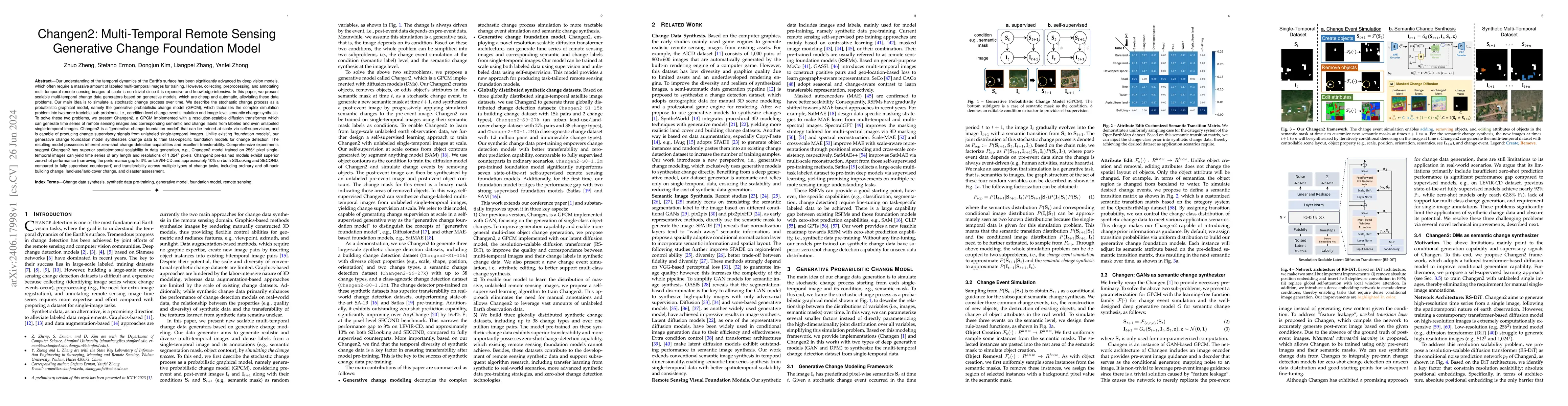
Our understanding of the temporal dynamics of the Earth's surface has been advanced by deep vision models, which often require lots of labeled multi-temporal images for training. However, collecting, ...
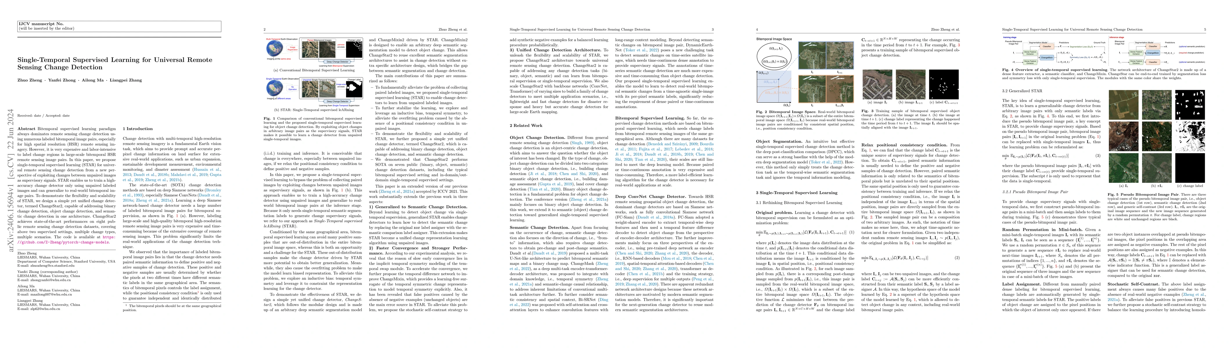
Bitemporal supervised learning paradigm always dominates remote sensing change detection using numerous labeled bitemporal image pairs, especially for high spatial resolution (HSR) remote sensing im...
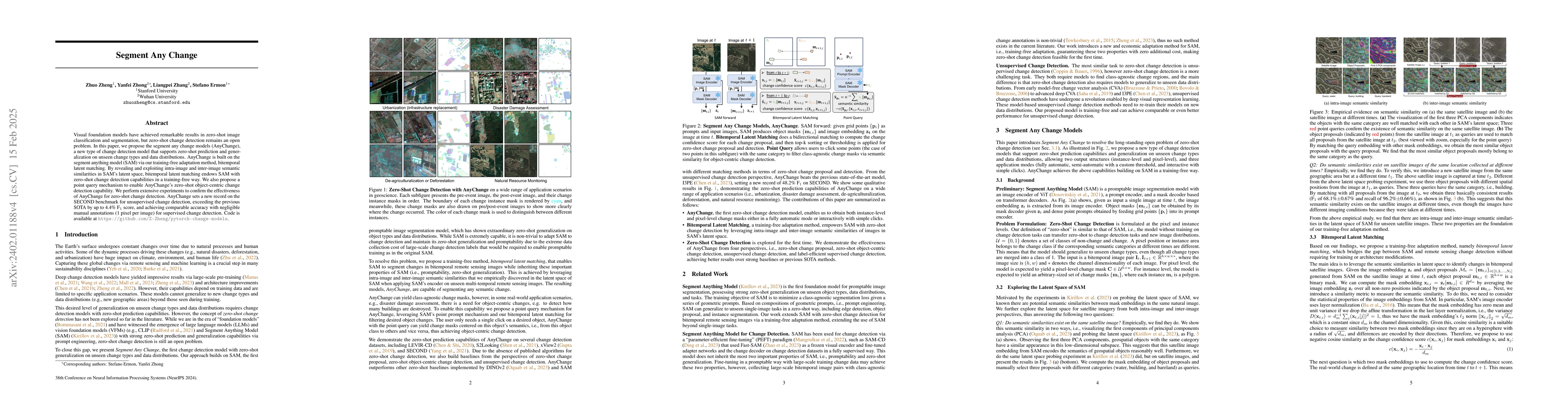
Visual foundation models have achieved remarkable results in zero-shot image classification and segmentation, but zero-shot change detection remains an open problem. In this paper, we propose the se...
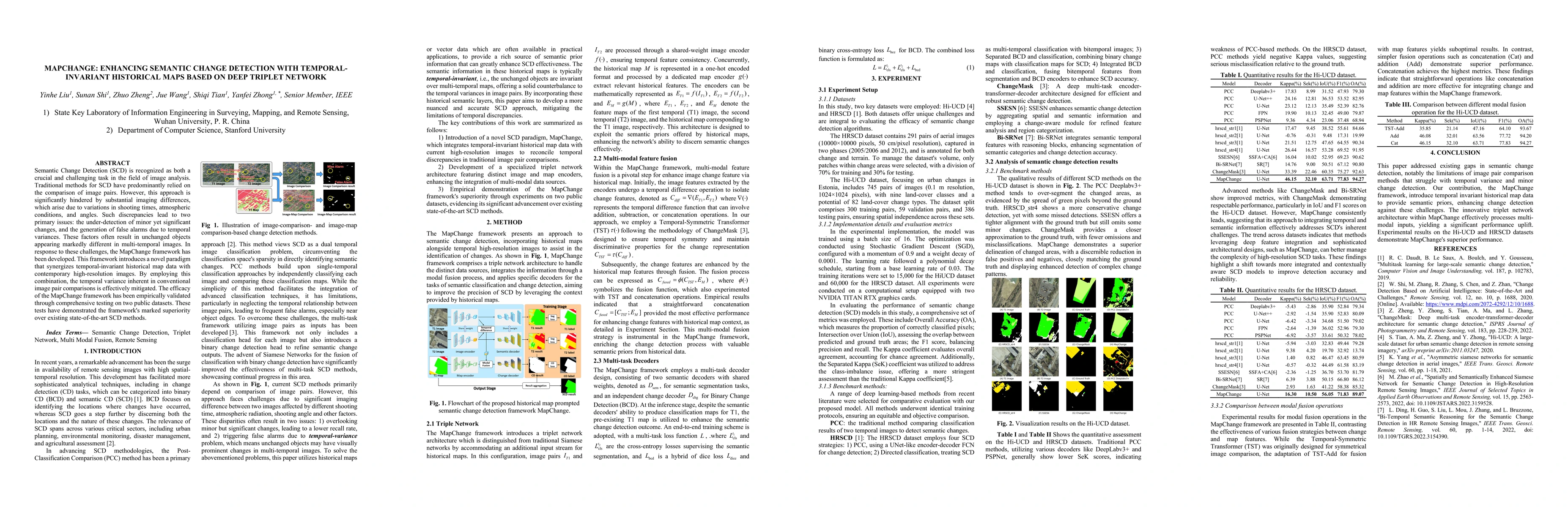
Semantic Change Detection (SCD) is recognized as both a crucial and challenging task in the field of image analysis. Traditional methods for SCD have predominantly relied on the comparison of image ...
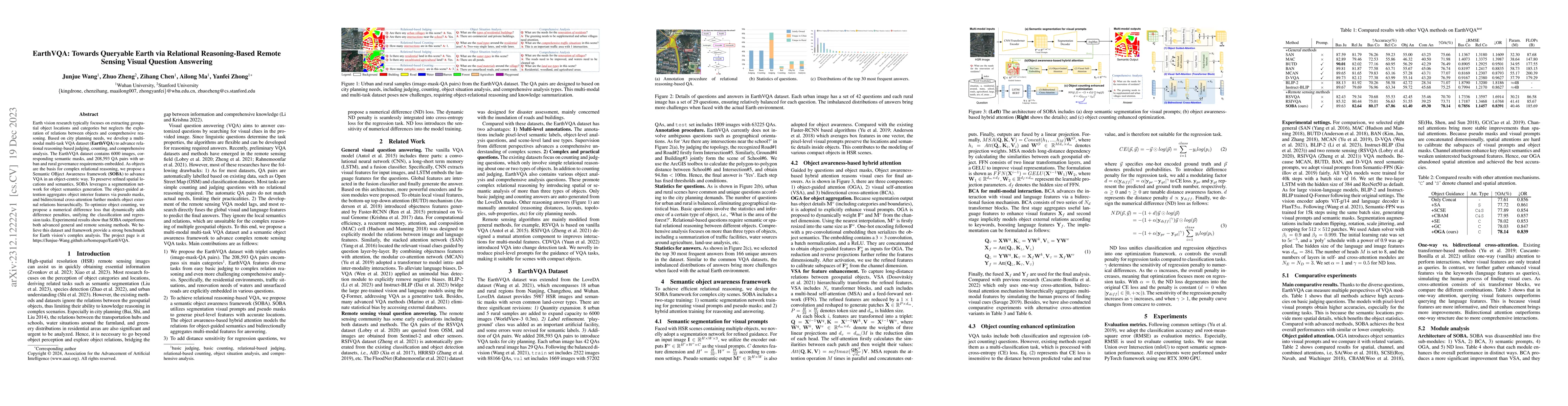
Earth vision research typically focuses on extracting geospatial object locations and categories but neglects the exploration of relations between objects and comprehensive reasoning. Based on city ...
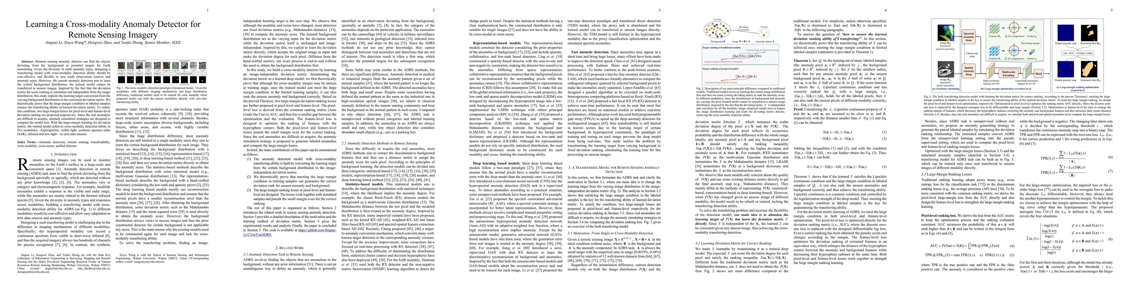
Remote sensing anomaly detector can find the objects deviating from the background as potential targets. Given the diversity in earth anomaly types, a unified anomaly detector across modalities and ...
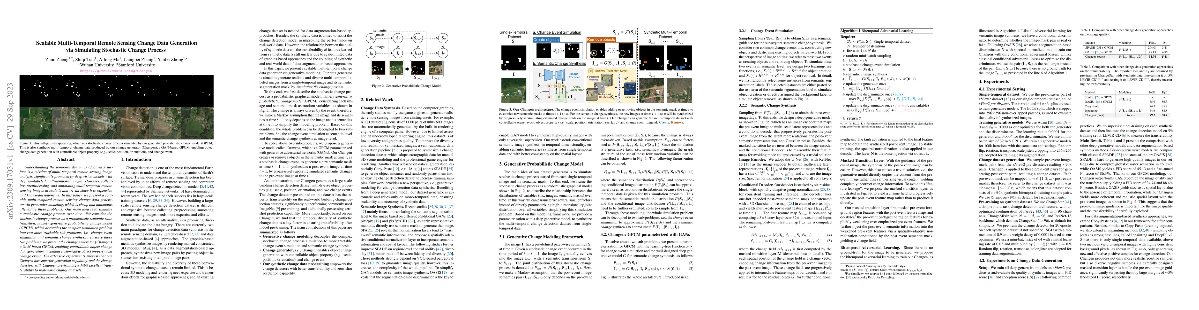
Understanding the temporal dynamics of Earth's surface is a mission of multi-temporal remote sensing image analysis, significantly promoted by deep vision models with its fuel -- labeled multi-tempo...
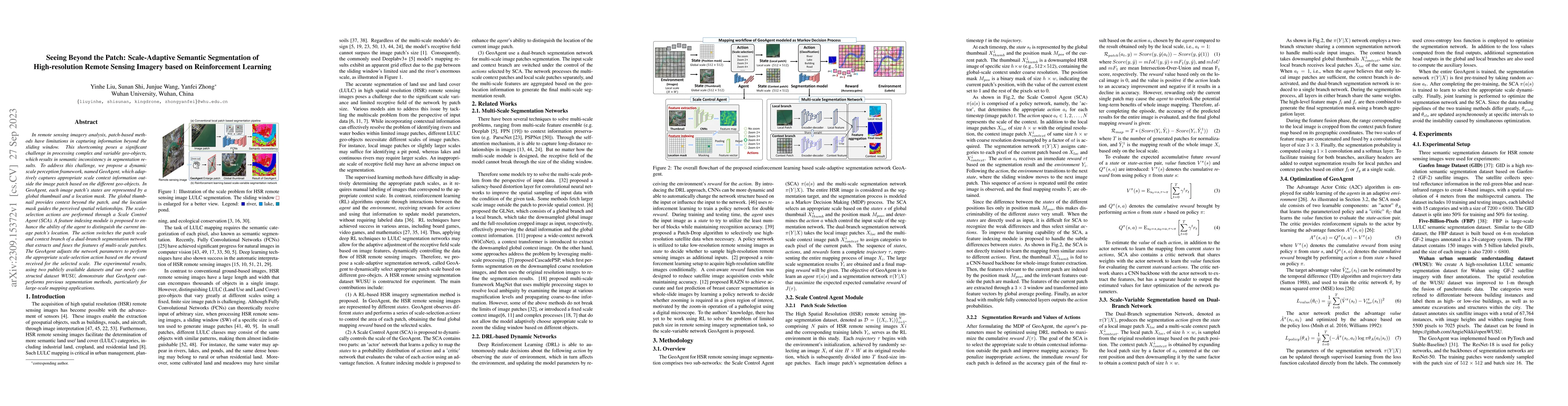
In remote sensing imagery analysis, patch-based methods have limitations in capturing information beyond the sliding window. This shortcoming poses a significant challenge in processing complex and ...
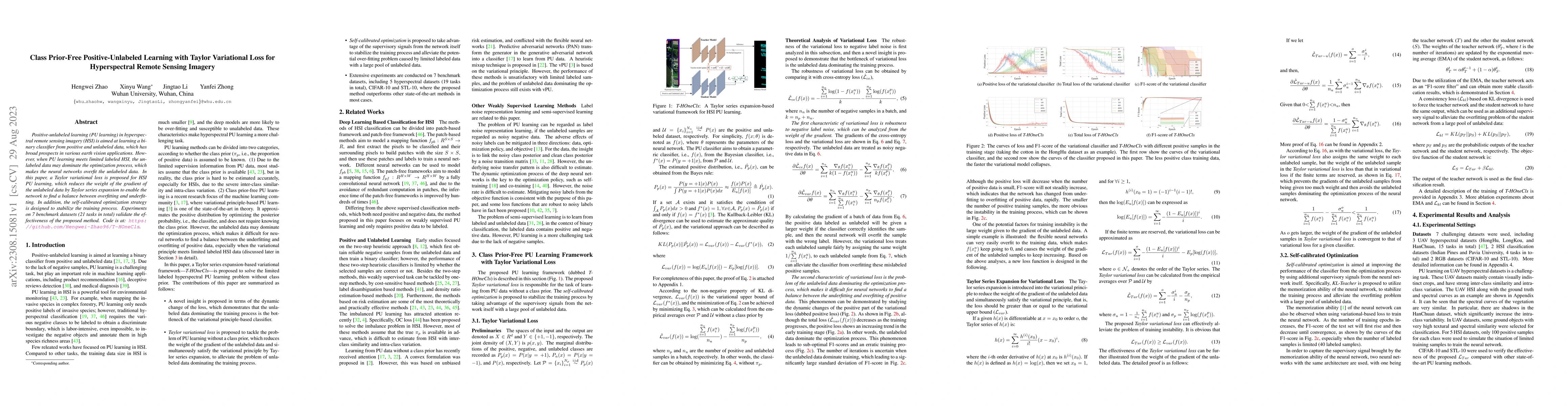
Positive-unlabeled learning (PU learning) in hyperspectral remote sensing imagery (HSI) is aimed at learning a binary classifier from positive and unlabeled data, which has broad prospects in variou...
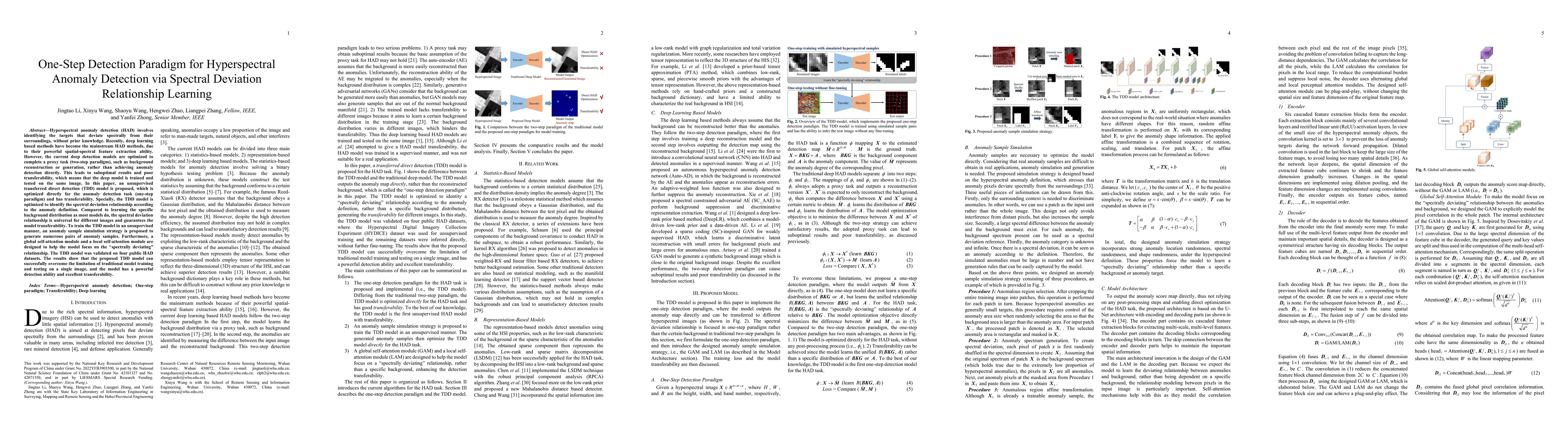
Hyperspectral anomaly detection (HAD) involves identifying the targets that deviate spectrally from their surroundings, without prior knowledge. Recently, deep learning based methods have become the...
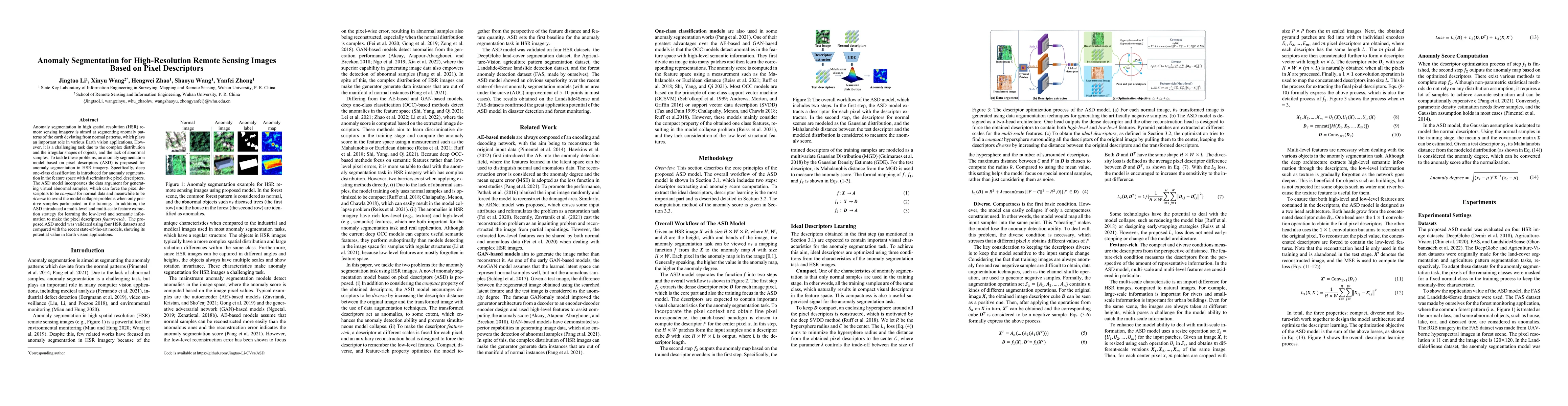
Anomaly segmentation in high spatial resolution (HSR) remote sensing imagery is aimed at segmenting anomaly patterns of the earth deviating from normal patterns, which plays an important role in var...
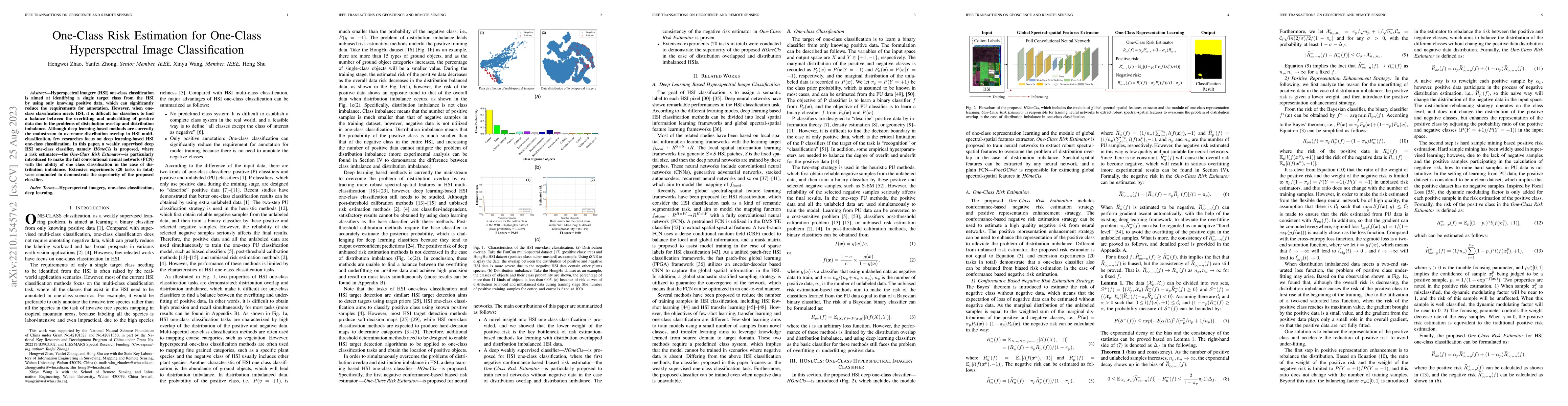
Hyperspectral imagery (HSI) one-class classification is aimed at identifying a single target class from the HSI by using only knowing positive data, which can significantly reduce the requirements f...
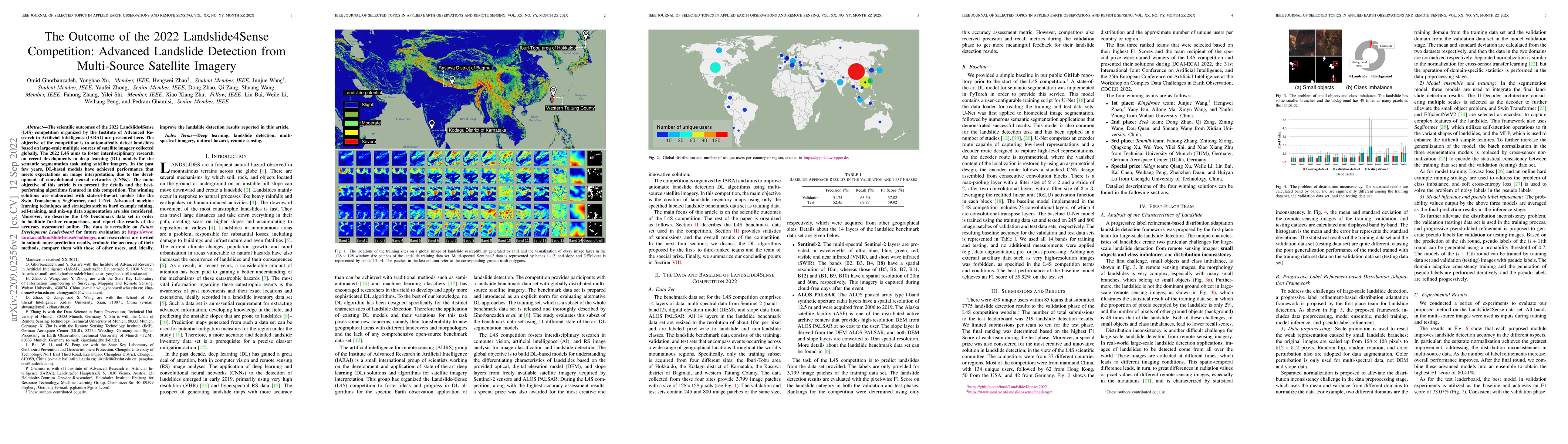
The scientific outcomes of the 2022 Landslide4Sense (L4S) competition organized by the Institute of Advanced Research in Artificial Intelligence (IARAI) are presented here. The objective of the comp...
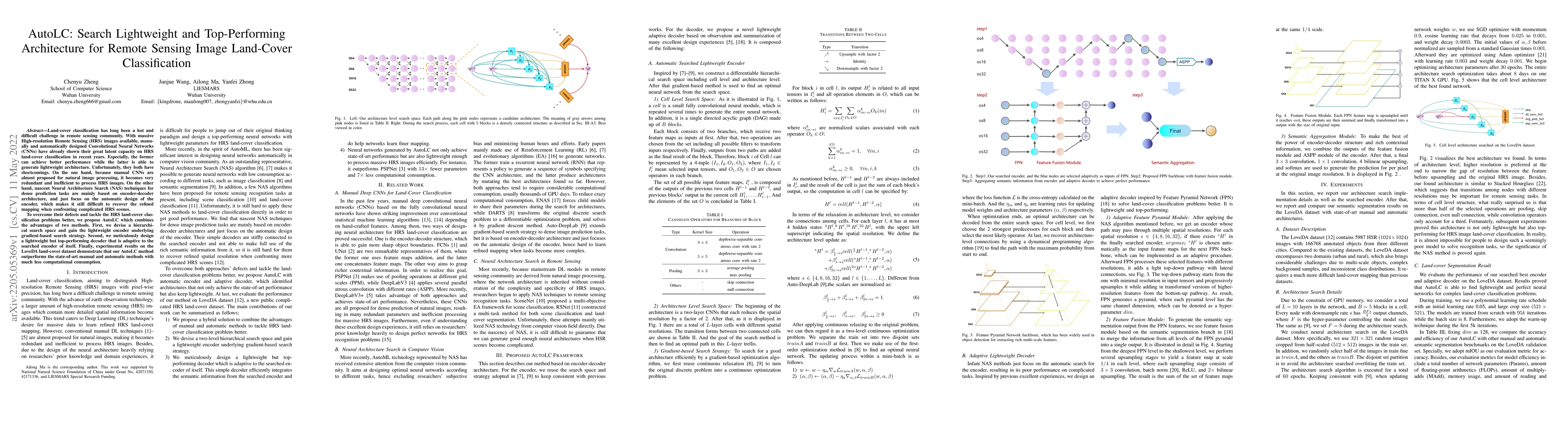
Land-cover classification has long been a hot and difficult challenge in remote sensing community. With massive High-resolution Remote Sensing (HRS) images available, manually and automatically desi...
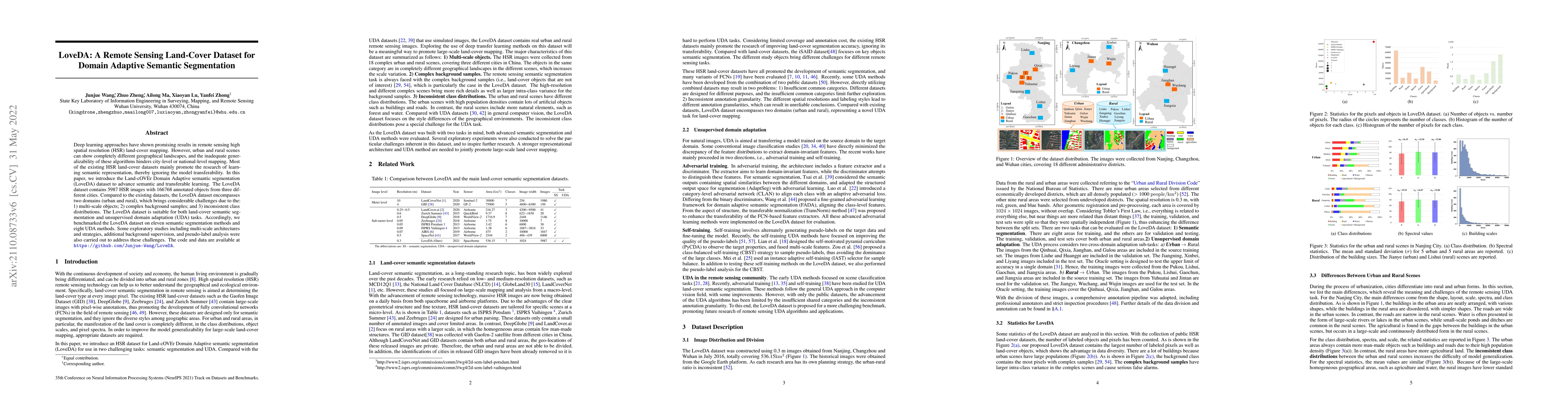
Deep learning approaches have shown promising results in remote sensing high spatial resolution (HSR) land-cover mapping. However, urban and rural scenes can show completely different geographical l...
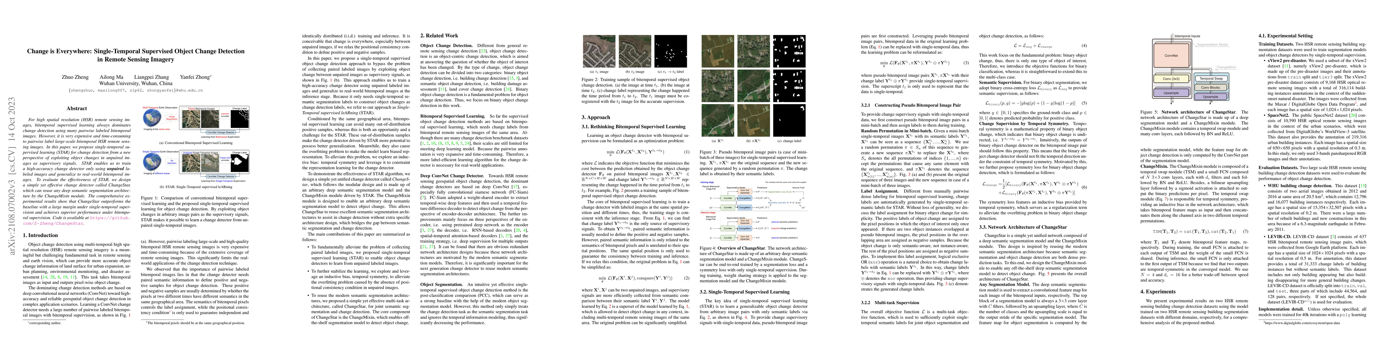
For high spatial resolution (HSR) remote sensing images, bitemporal supervised learning always dominates change detection using many pairwise labeled bitemporal images. However, it is very expensive...
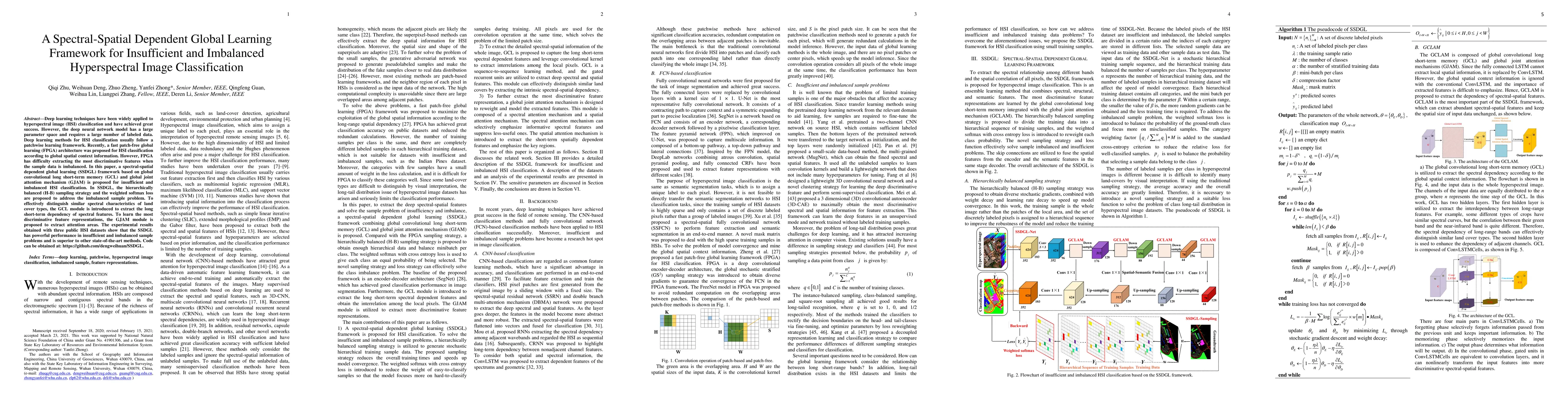
Deep learning techniques have been widely applied to hyperspectral image (HSI) classification and have achieved great success. However, the deep neural network model has a large parameter space and ...
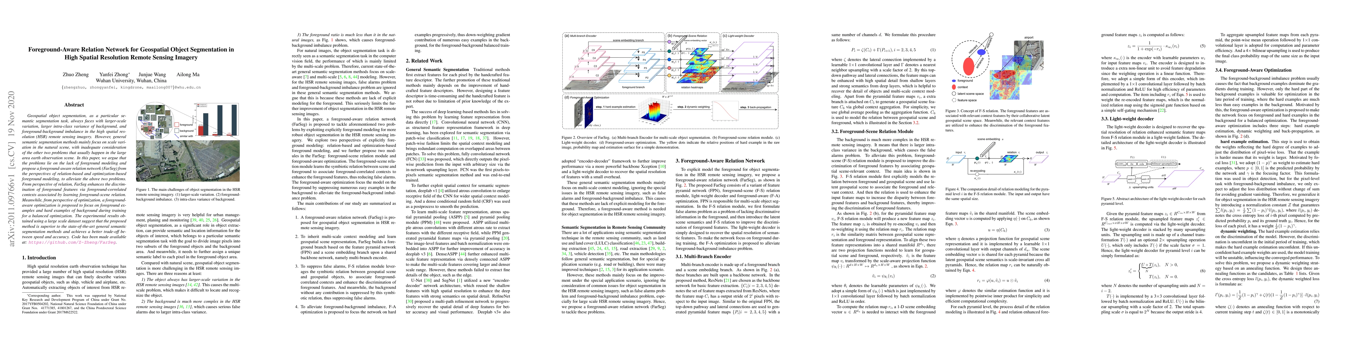
Geospatial object segmentation, as a particular semantic segmentation task, always faces with larger-scale variation, larger intra-class variance of background, and foreground-background imbalance i...
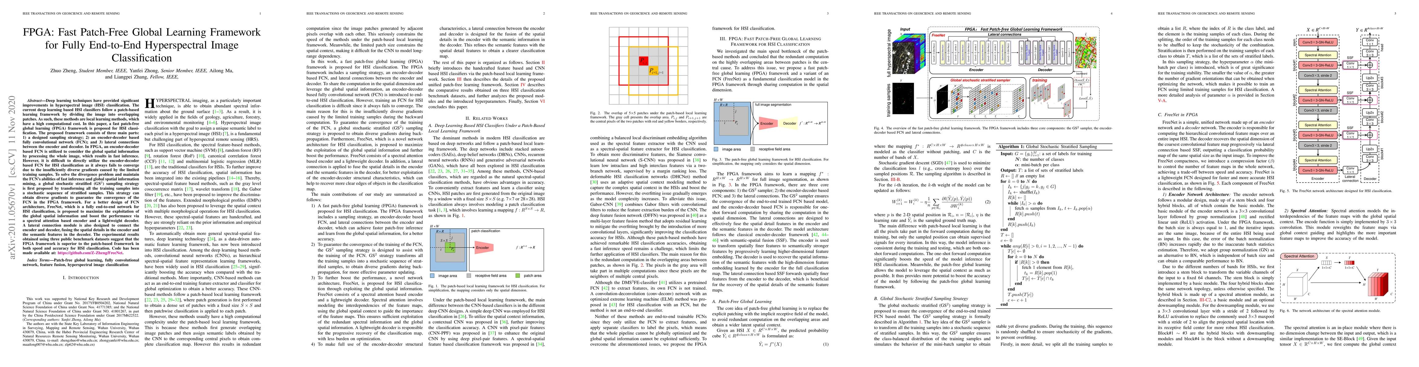
Deep learning techniques have provided significant improvements in hyperspectral image (HSI) classification. The current deep learning based HSI classifiers follow a patch-based learning framework b...
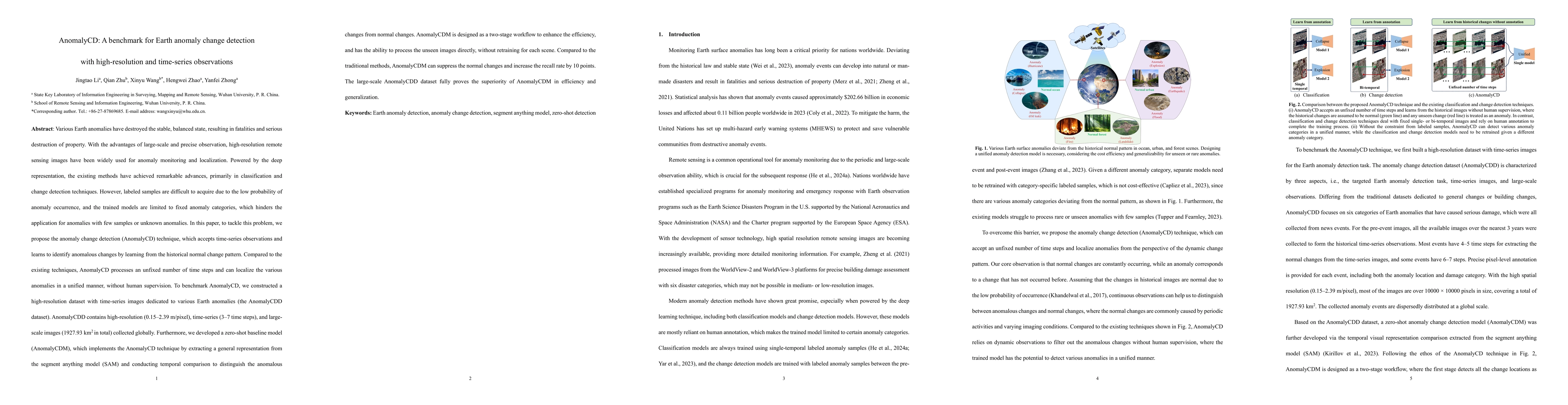
Various Earth anomalies have destroyed the stable, balanced state, resulting in fatalities and serious destruction of property. With the advantages of large-scale and precise observation, high-resolut...
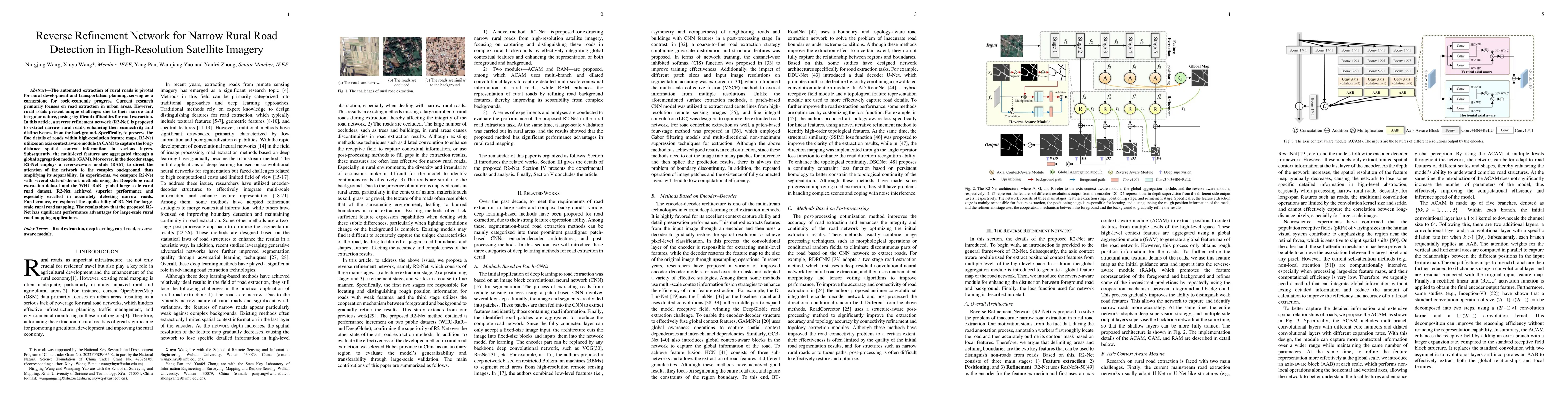
The automated extraction of rural roads is pivotal for rural development and transportation planning, serving as a cornerstone for socio-economic progress. Current research primarily focuses on road e...
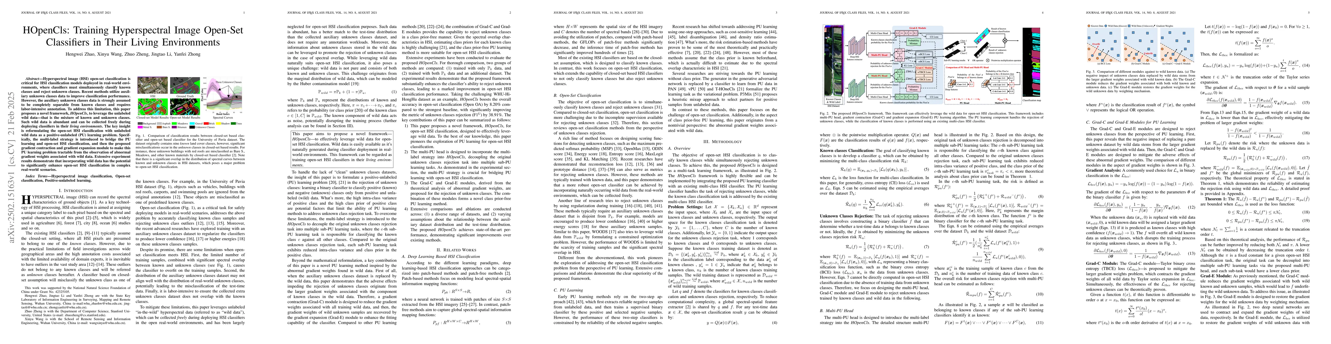
Hyperspectral image (HSI) open-set classification is critical for HSI classification models deployed in real-world environments, where classifiers must simultaneously classify known classes and reject...
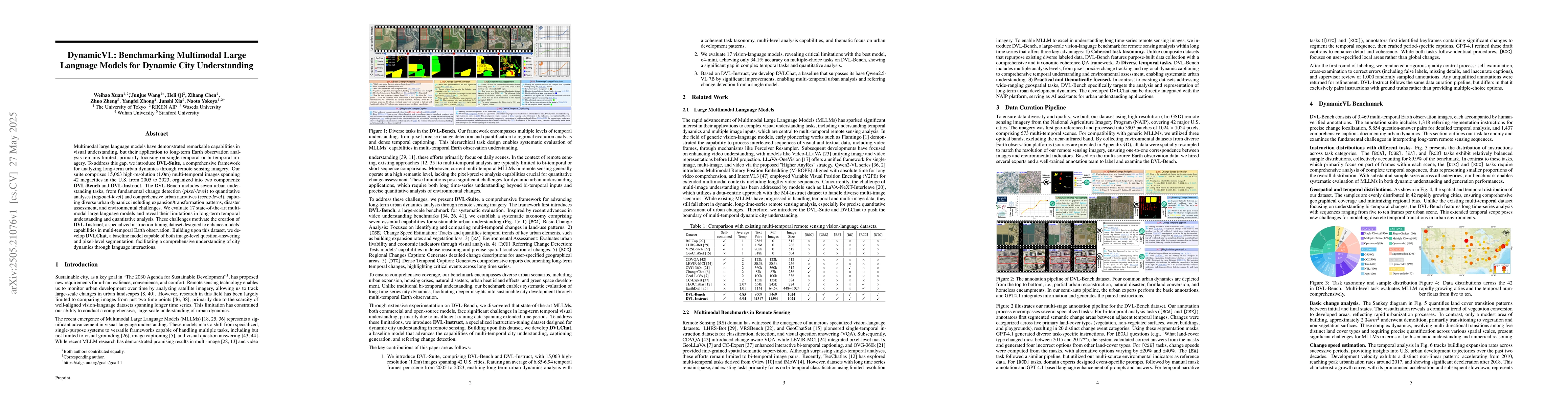
Multimodal large language models have demonstrated remarkable capabilities in visual understanding, but their application to long-term Earth observation analysis remains limited, primarily focusing on...
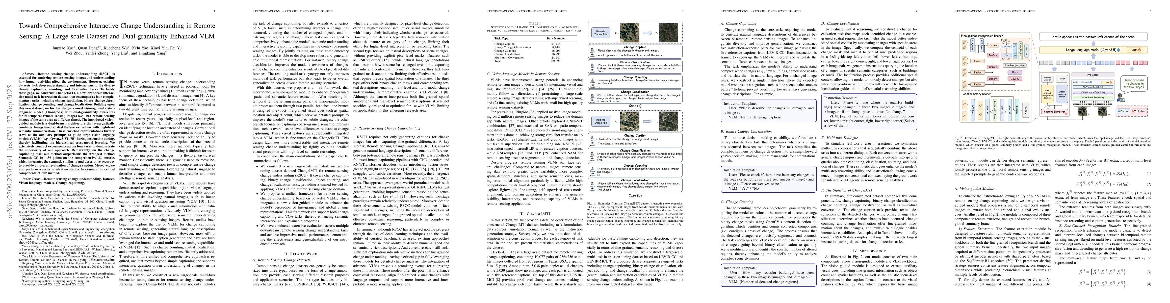
Remote sensing change understanding (RSCU) is essential for analyzing remote sensing images and understanding how human activities affect the environment. However, existing datasets lack deep understa...
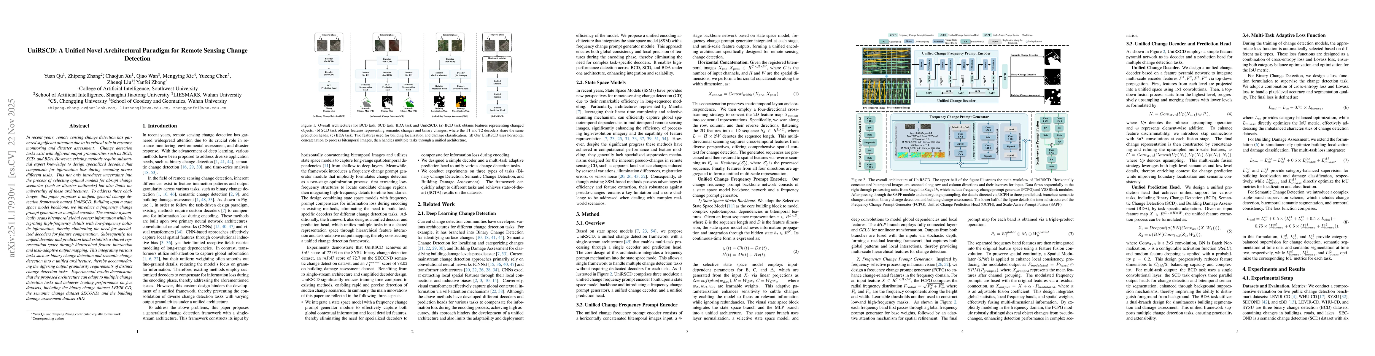
In recent years, remote sensing change detection has garnered significant attention due to its critical role in resource monitoring and disaster assessment. Change detection tasks exist with different...
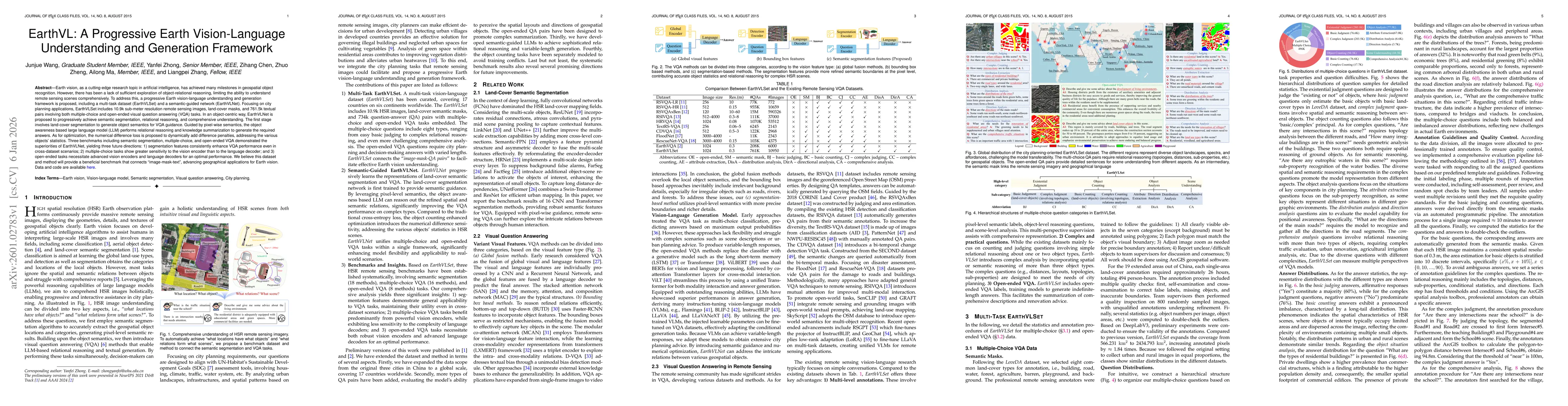
Earth vision has achieved milestones in geospatial object recognition but lacks exploration in object-relational reasoning, limiting comprehensive scene understanding. To address this, a progressive E...
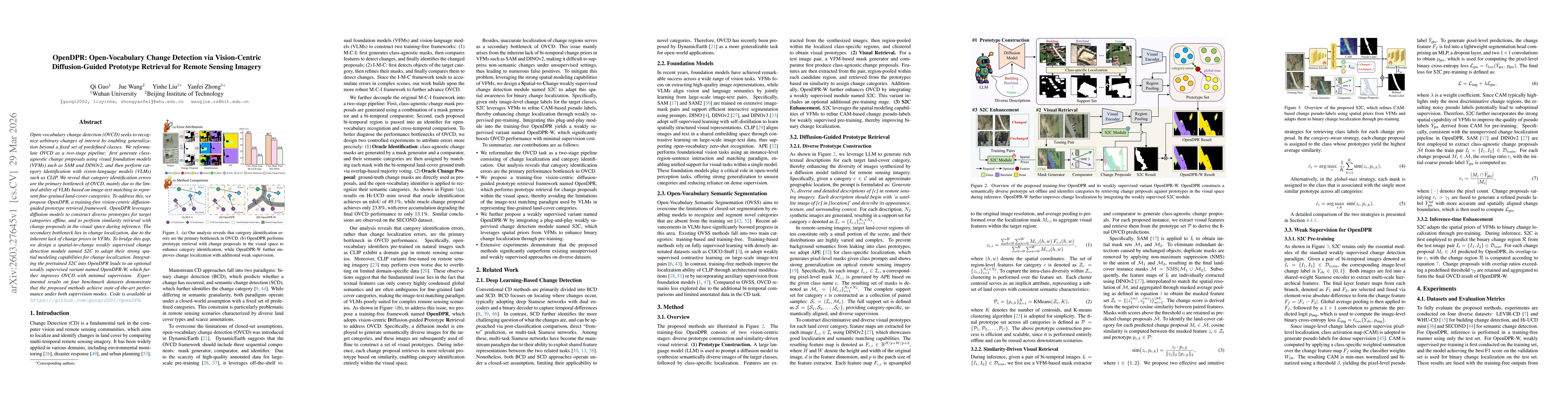
Open-vocabulary change detection (OVCD) seeks to recognize arbitrary changes of interest by enabling generalization beyond a fixed set of predefined classes. We reformulate OVCD as a two-stage pipelin...
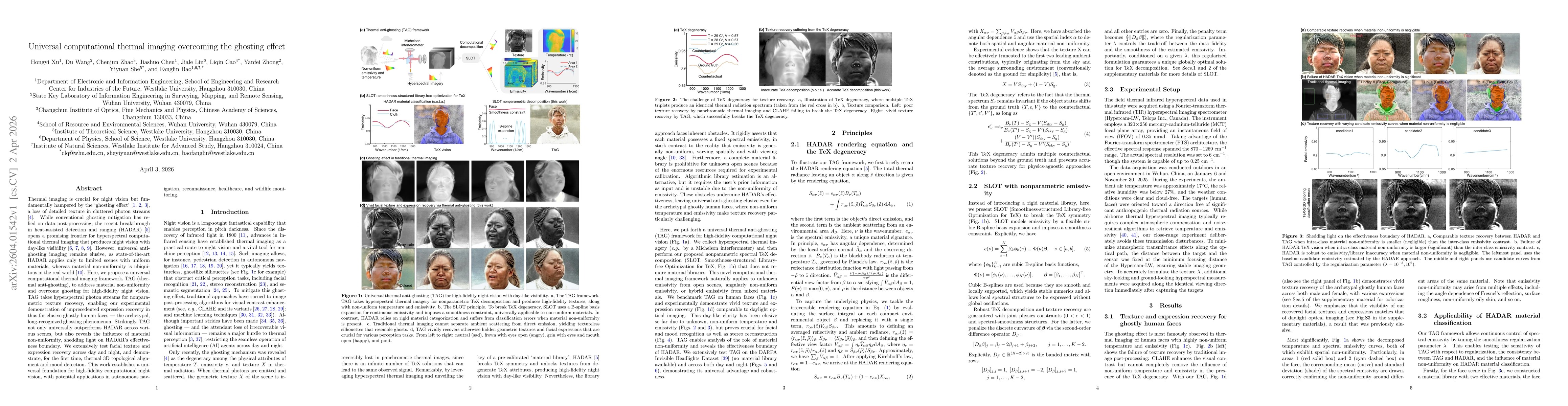
Thermal imaging is crucial for night vision but fundamentally hampered by the ghosting effect, a loss of detailed texture in cluttered photon streams. While conventional ghosting mitigation has relied...