Academic Profile
Statistics
Similar Authors
Papers on arXiv
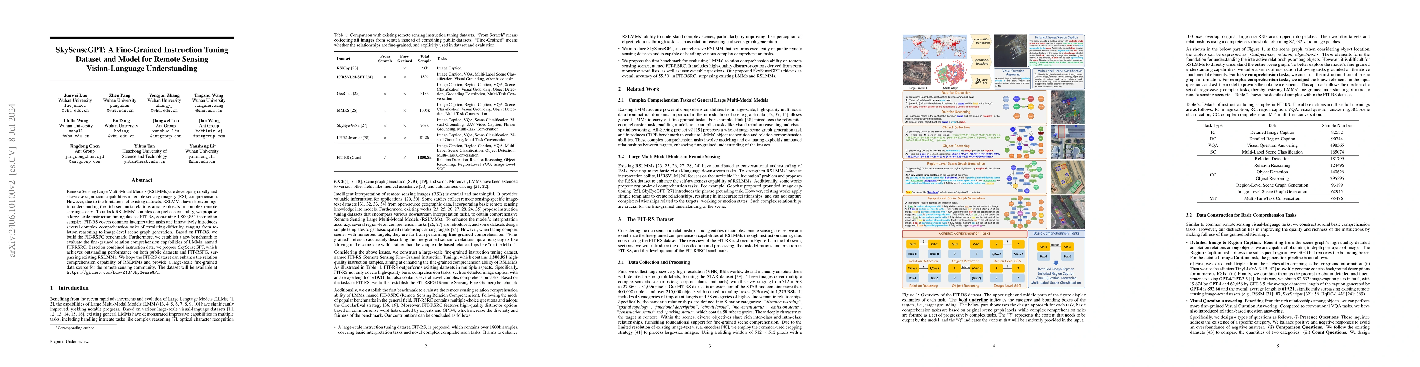
Remote Sensing Large Multi-Modal Models (RSLMMs) are developing rapidly and showcase significant capabilities in remote sensing imagery (RSI) comprehension. However, due to the limitations of existing...
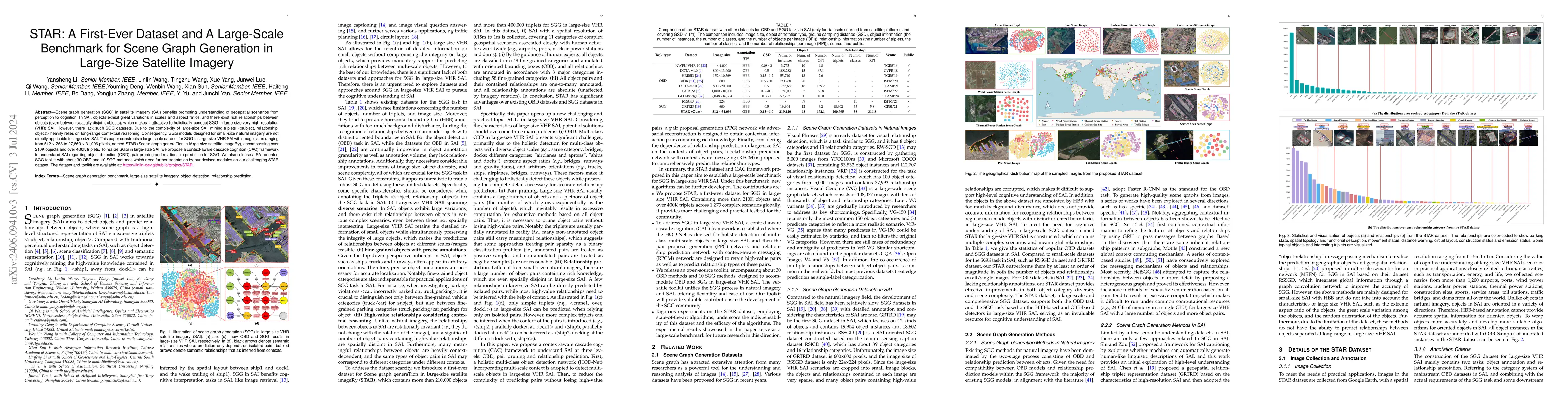
Scene graph generation (SGG) in satellite imagery (SAI) benefits promoting understanding of geospatial scenarios from perception to cognition. In SAI, objects exhibit great variations in scales and ...
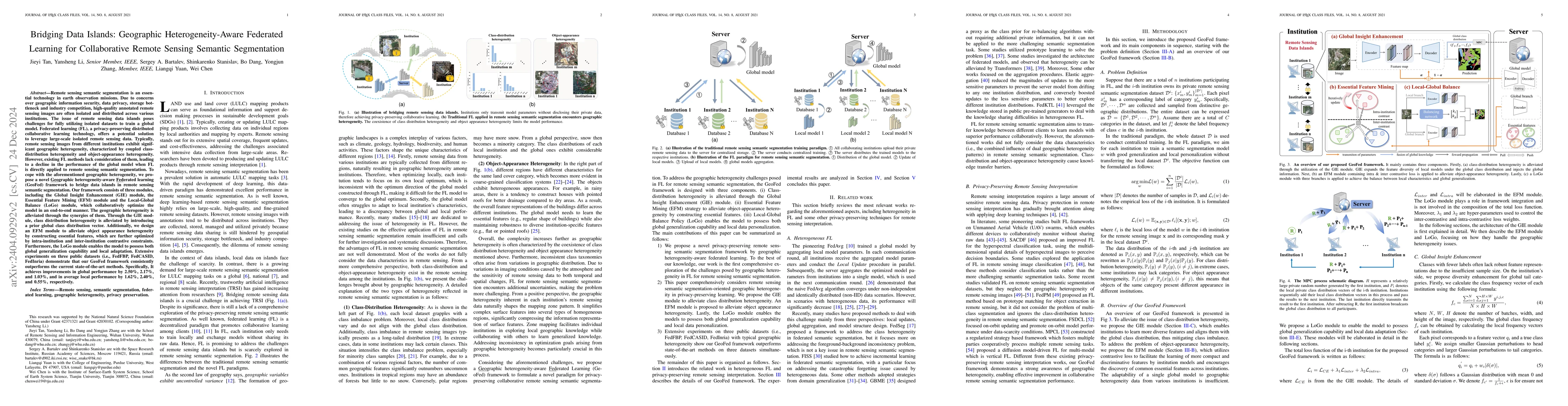
Remote sensing semantic segmentation (RSS) is an essential task in Earth Observation missions. Due to data privacy concerns, high-quality remote sensing images with annotations cannot be well shared...
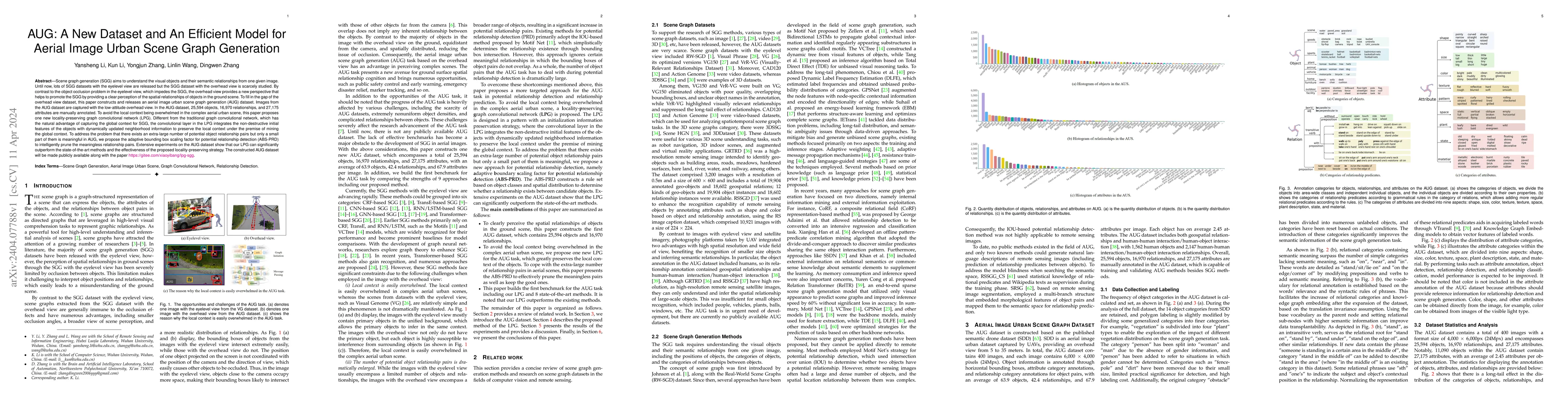
Scene graph generation (SGG) aims to understand the visual objects and their semantic relationships from one given image. Until now, lots of SGG datasets with the eyelevel view are released but the ...
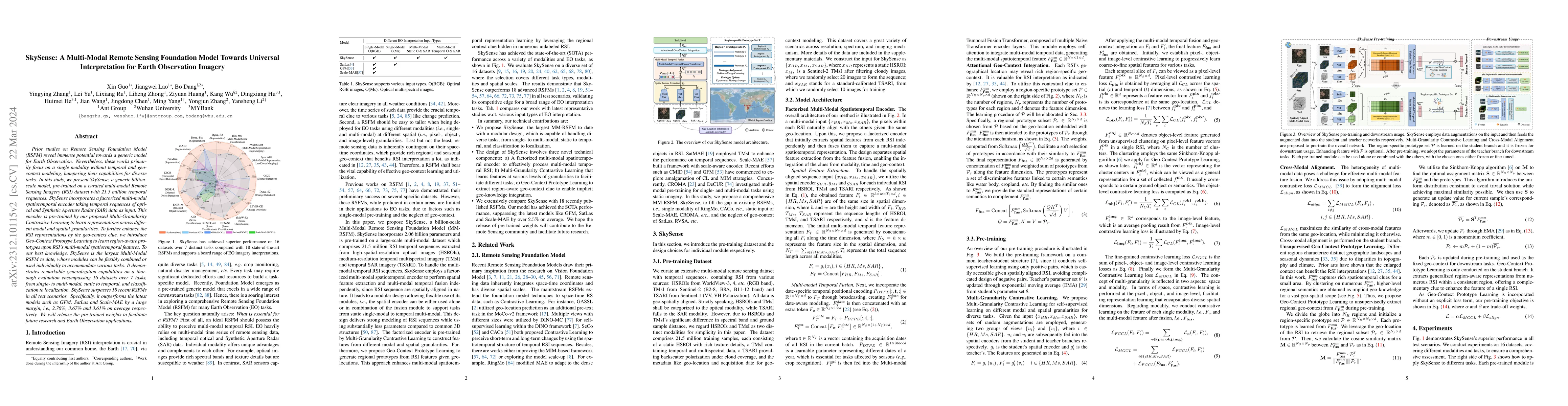
Prior studies on Remote Sensing Foundation Model (RSFM) reveal immense potential towards a generic model for Earth Observation. Nevertheless, these works primarily focus on a single modality without...
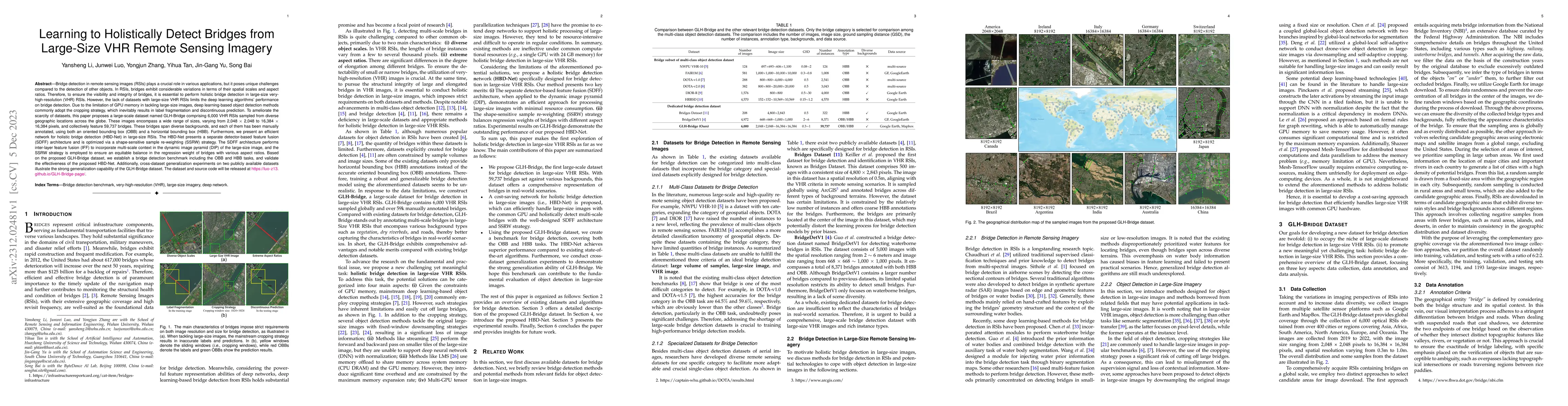
Bridge detection in remote sensing images (RSIs) plays a crucial role in various applications, but it poses unique challenges compared to the detection of other objects. In RSIs, bridges exhibit con...
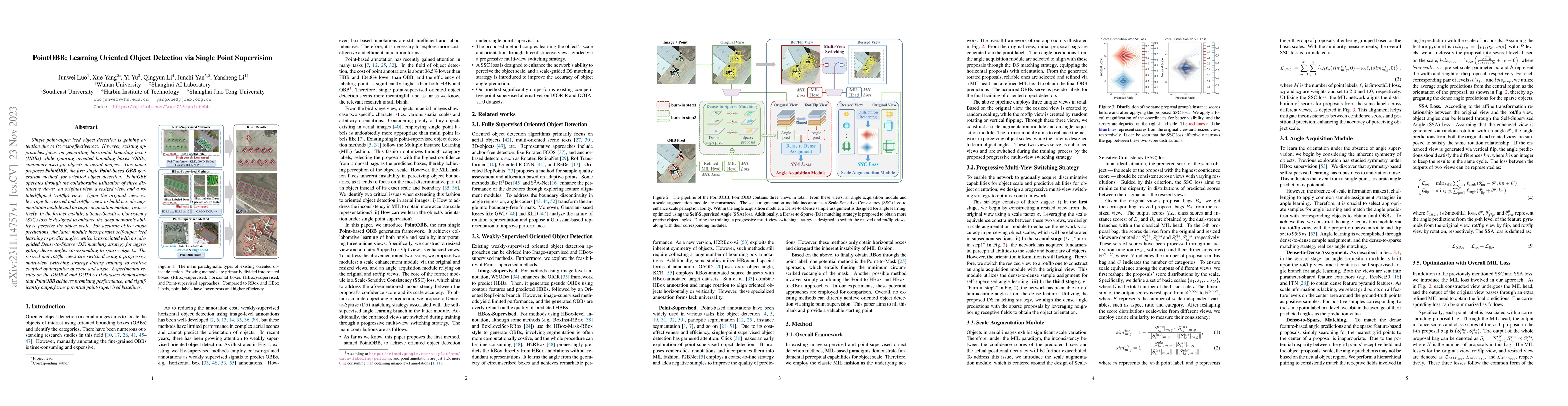
Single point-supervised object detection is gaining attention due to its cost-effectiveness. However, existing approaches focus on generating horizontal bounding boxes (HBBs) while ignoring oriented...
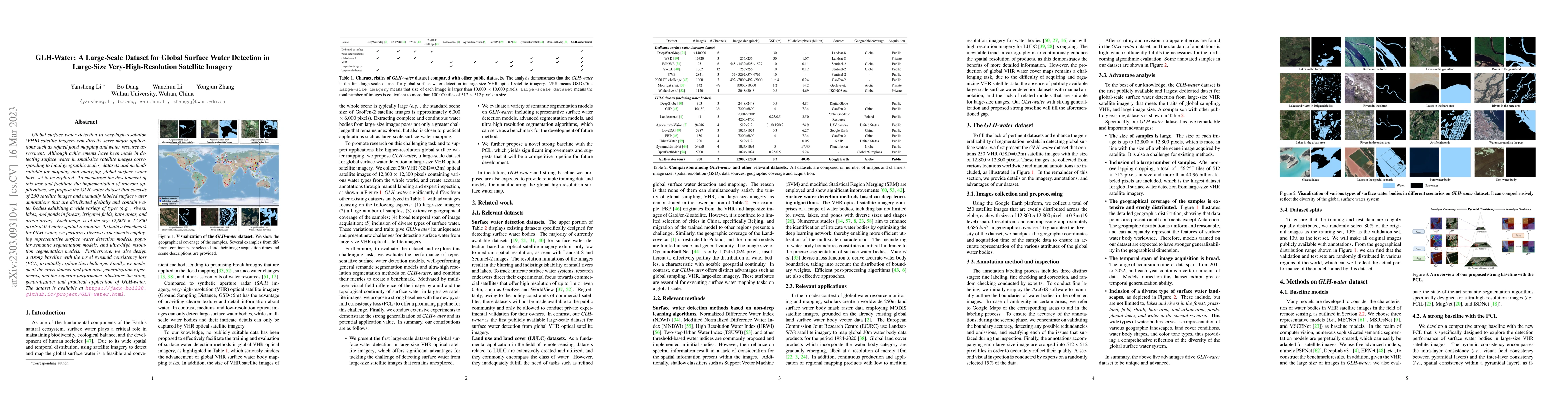
Global surface water detection in very-high-resolution (VHR) satellite imagery can directly serve major applications such as refined flood mapping and water resource assessment. Although achievement...
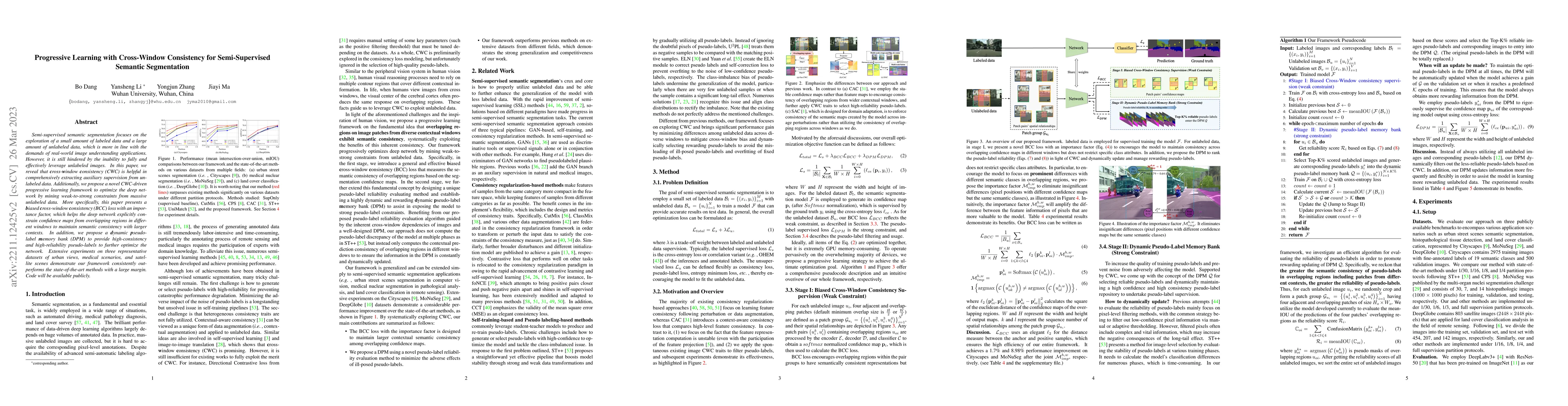
Semi-supervised semantic segmentation focuses on the exploration of a small amount of labeled data and a large amount of unlabeled data, which is more in line with the demands of real-world image un...
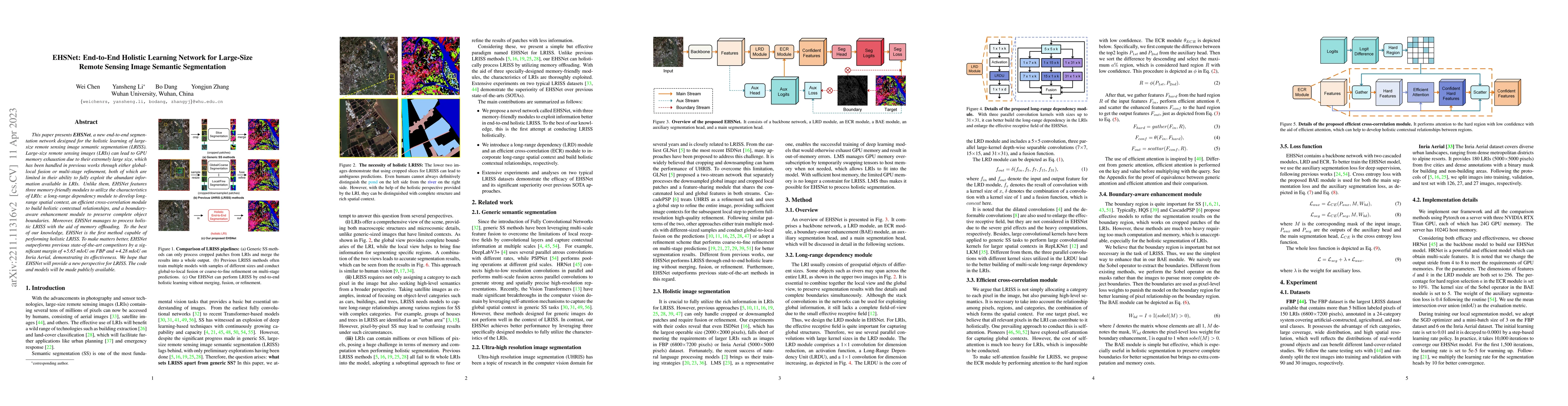
This paper presents EHSNet, a new end-to-end segmentation network designed for the holistic learning of large-size remote sensing image semantic segmentation (LRISS). Large-size remote sensing image...
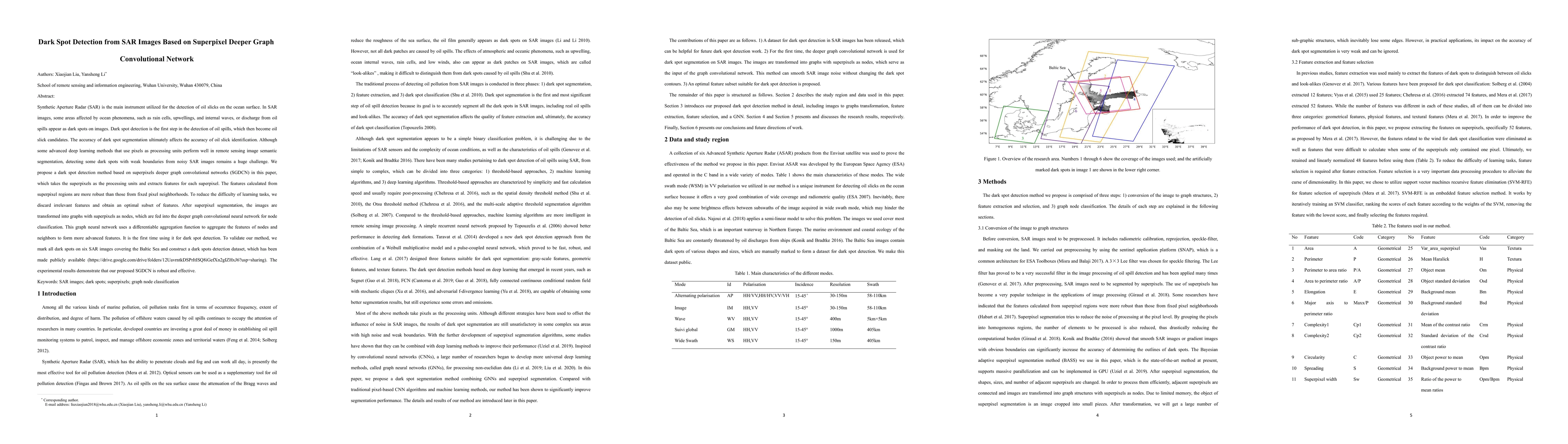
Synthetic Aperture Radar (SAR) is the main instrument utilized for the detection of oil slicks on the ocean surface. In SAR images, some areas affected by ocean phenomena, such as rain cells, upwell...
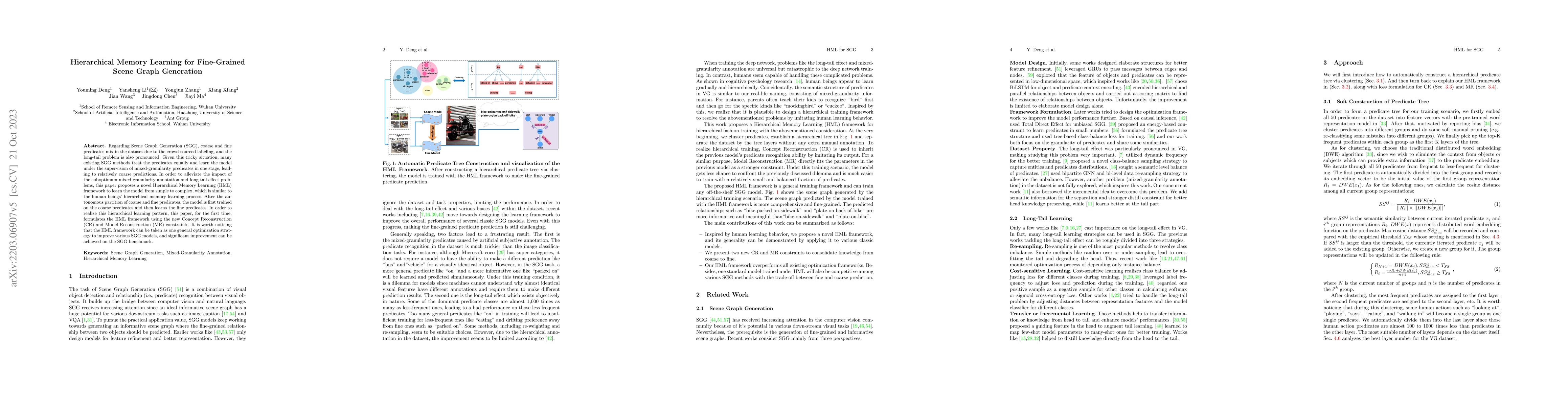
As far as Scene Graph Generation (SGG), coarse and fine predicates mix in the dataset due to the crowd-sourced labeling, and the long-tail problem is also pronounced. Given this tricky situation, ma...
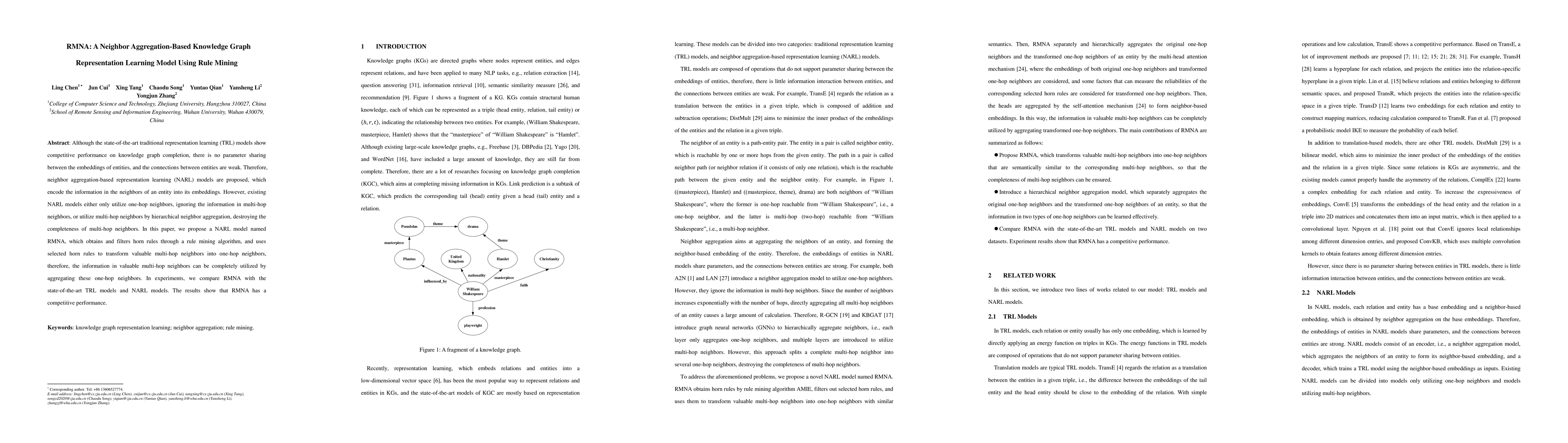
Although the state-of-the-art traditional representation learning (TRL) models show competitive performance on knowledge graph completion, there is no parameter sharing between the embeddings of ent...
The problem of air pollution threatens public health. Air quality forecasting can provide the air quality index hours or even days later, which can help the public to prevent air pollution in advanc...
As one kind of architecture from the deep learning family, deep semantic segmentation network (DSSN) achieves a certain degree of success on the semantic segmentation task and obviously outperforms ...
Scene Graph Generation (SGG) aims to explore the relationships between objects in images and obtain scene summary graphs, thereby better serving downstream tasks. However, the long-tailed problem has ...
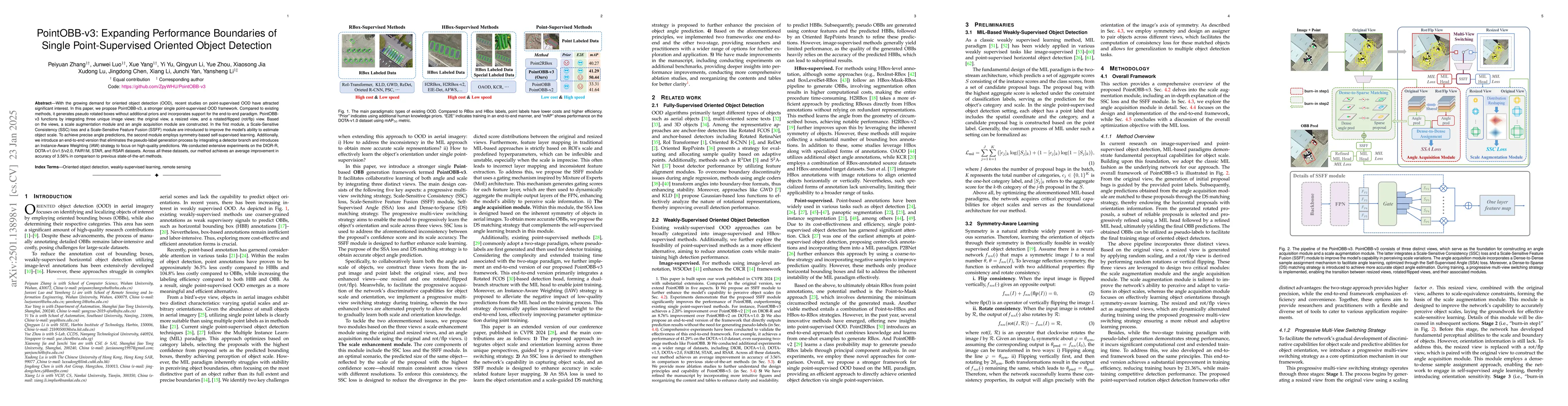
With the growing demand for oriented object detection (OOD), recent studies on point-supervised OOD have attracted significant interest. In this paper, we propose PointOBB-v3, a stronger single point-...
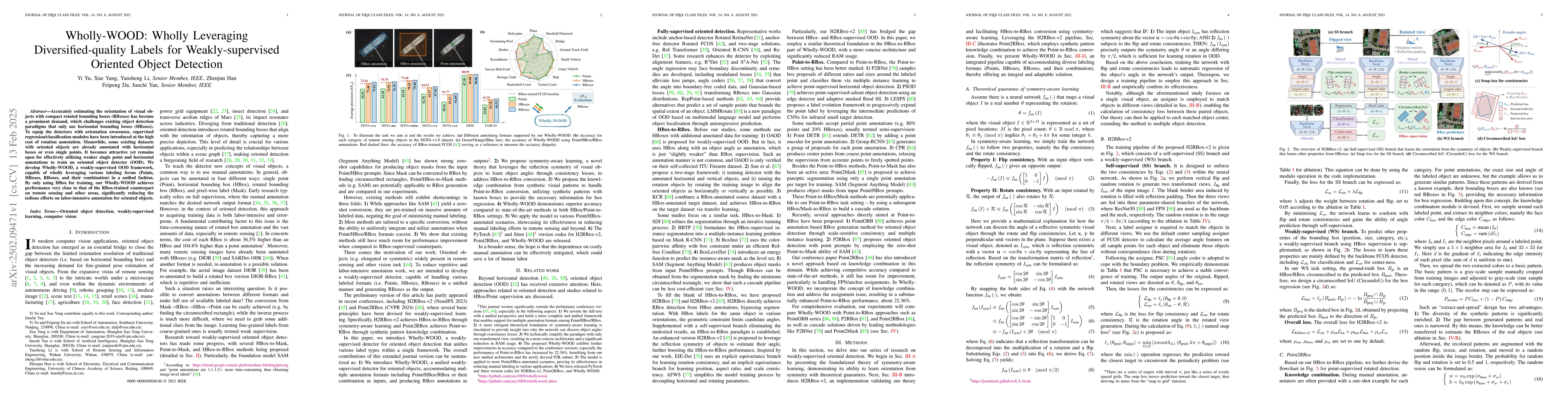
Accurately estimating the orientation of visual objects with compact rotated bounding boxes (RBoxes) has become a prominent demand, which challenges existing object detection paradigms that only use h...
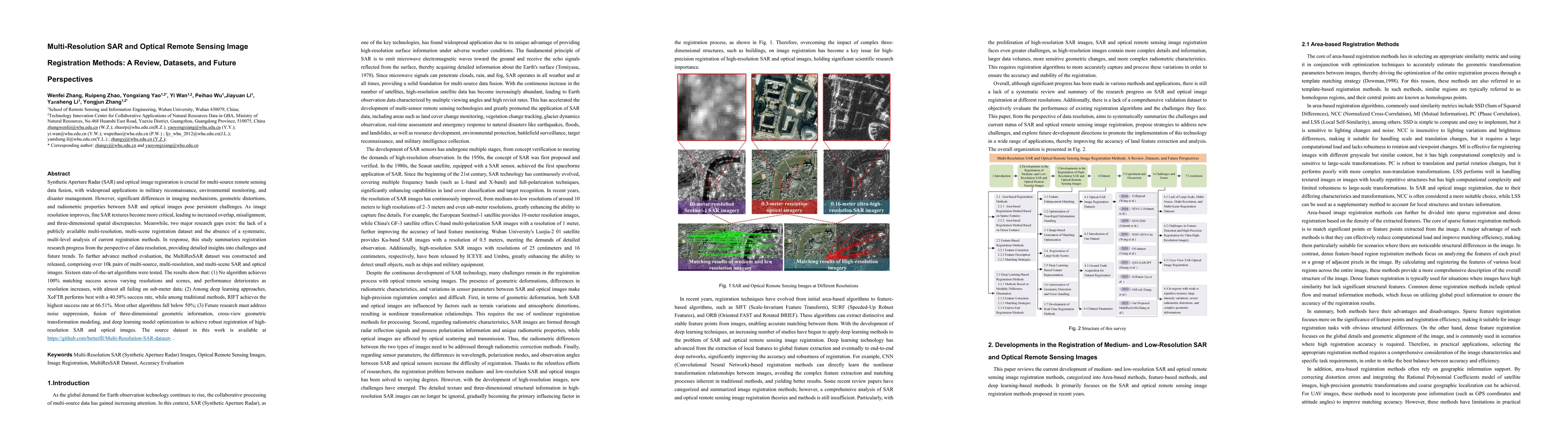
Synthetic Aperture Radar (SAR) and optical image registration is essential for remote sensing data fusion, with applications in military reconnaissance, environmental monitoring, and disaster manageme...
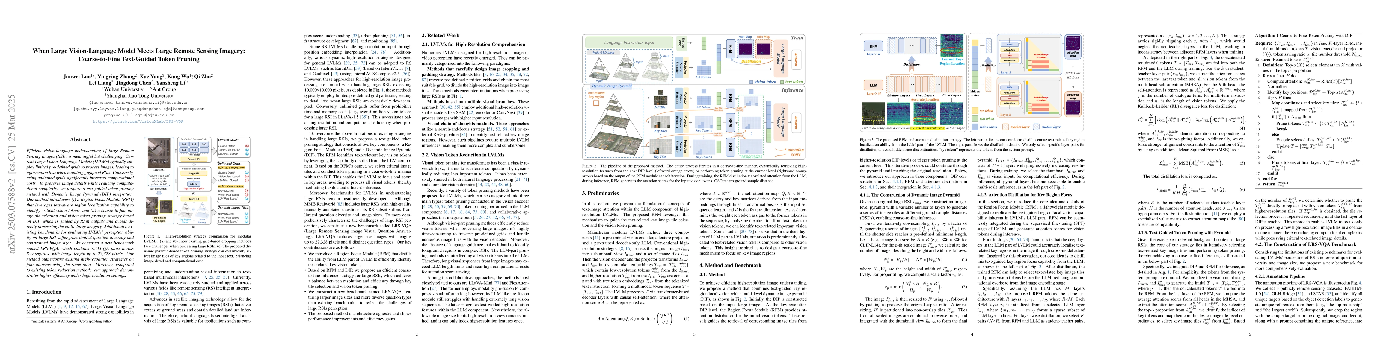
Efficient vision-language understanding of large Remote Sensing Images (RSIs) is meaningful but challenging. Current Large Vision-Language Models (LVLMs) typically employ limited pre-defined grids to ...
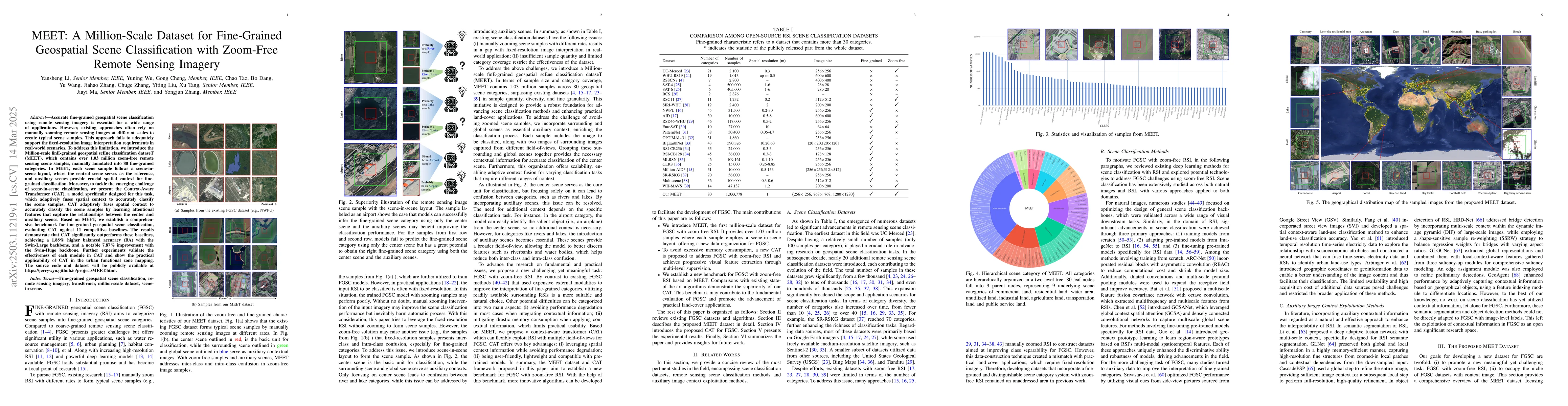
Accurate fine-grained geospatial scene classification using remote sensing imagery is essential for a wide range of applications. However, existing approaches often rely on manually zooming remote sen...
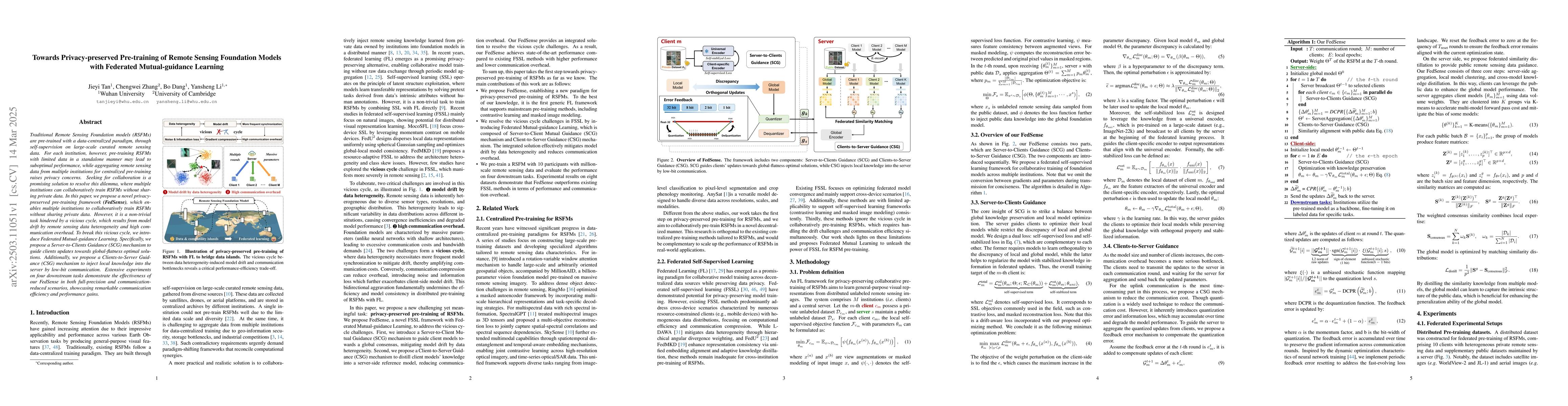
Traditional Remote Sensing Foundation models (RSFMs) are pre-trained with a data-centralized paradigm, through self-supervision on large-scale curated remote sensing data. For each institution, howeve...
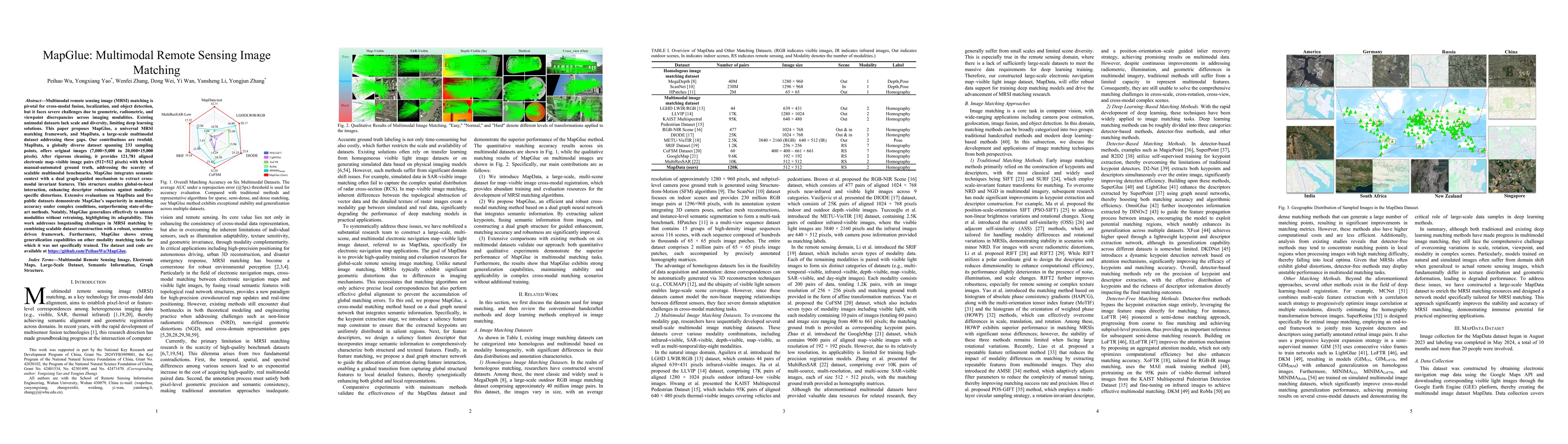
Multimodal remote sensing image (MRSI) matching is pivotal for cross-modal fusion, localization, and object detection, but it faces severe challenges due to geometric, radiometric, and viewpoint discr...
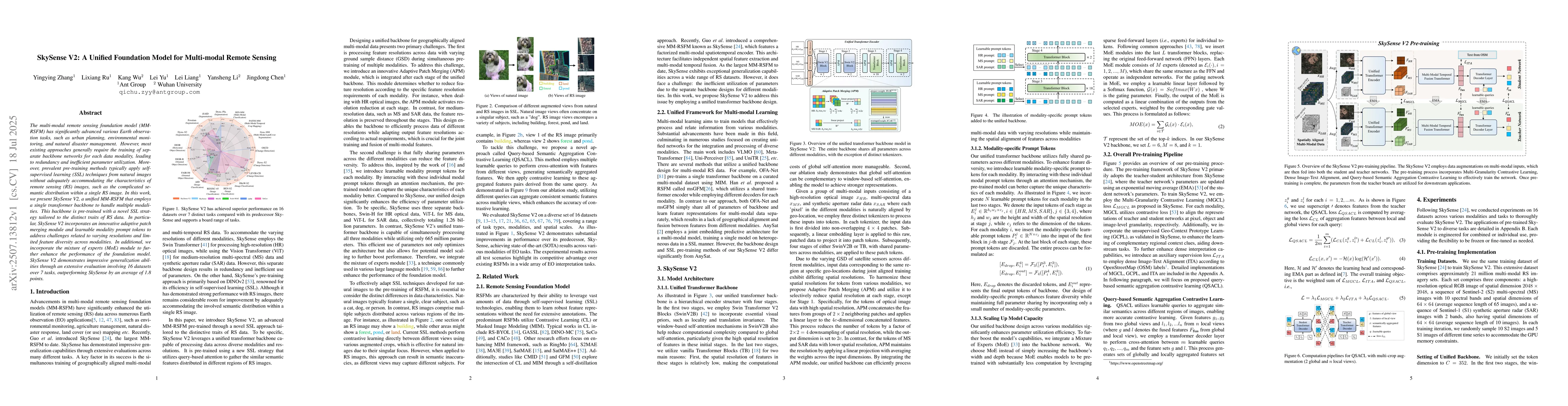
The multi-modal remote sensing foundation model (MM-RSFM) has significantly advanced various Earth observation tasks, such as urban planning, environmental monitoring, and natural disaster management....
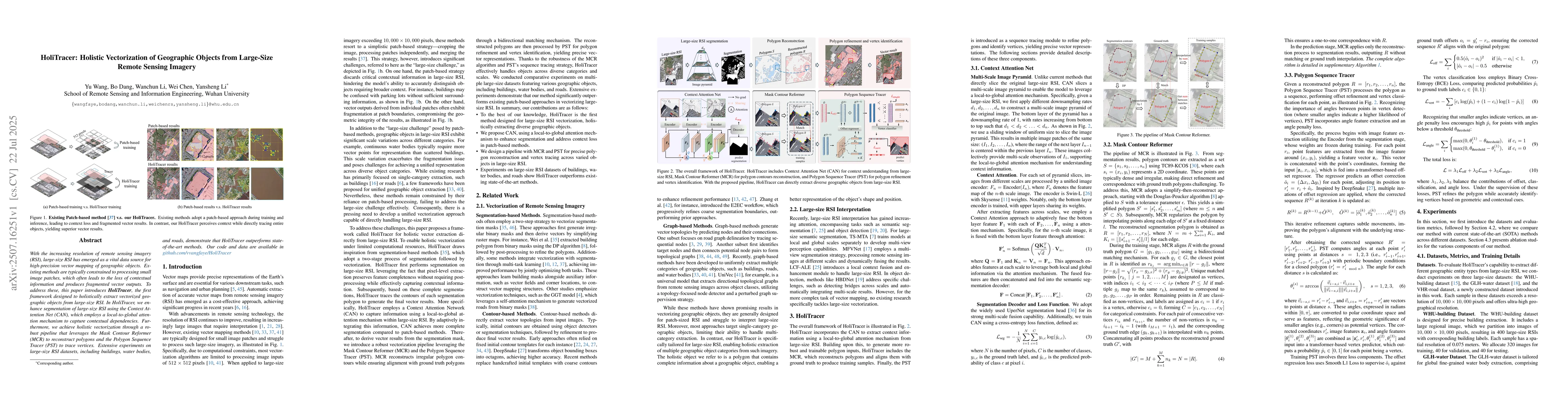
With the increasing resolution of remote sensing imagery (RSI), large-size RSI has emerged as a vital data source for high-precision vector mapping of geographic objects. Existing methods are typicall...
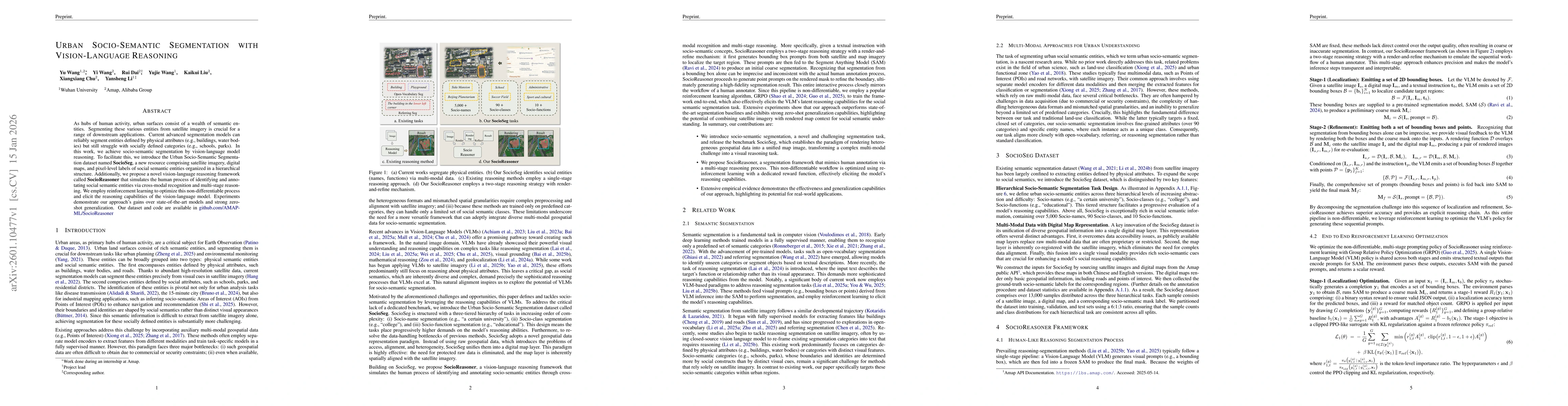
As hubs of human activity, urban surfaces consist of a wealth of semantic entities. Segmenting these various entities from satellite imagery is crucial for a range of downstream applications. Current ...

Earth Observation (EO) forecasting aims to predict future Earth surface dynamics from satellite observations under changing meteorological conditions. In this paper, we view this task as a partially o...
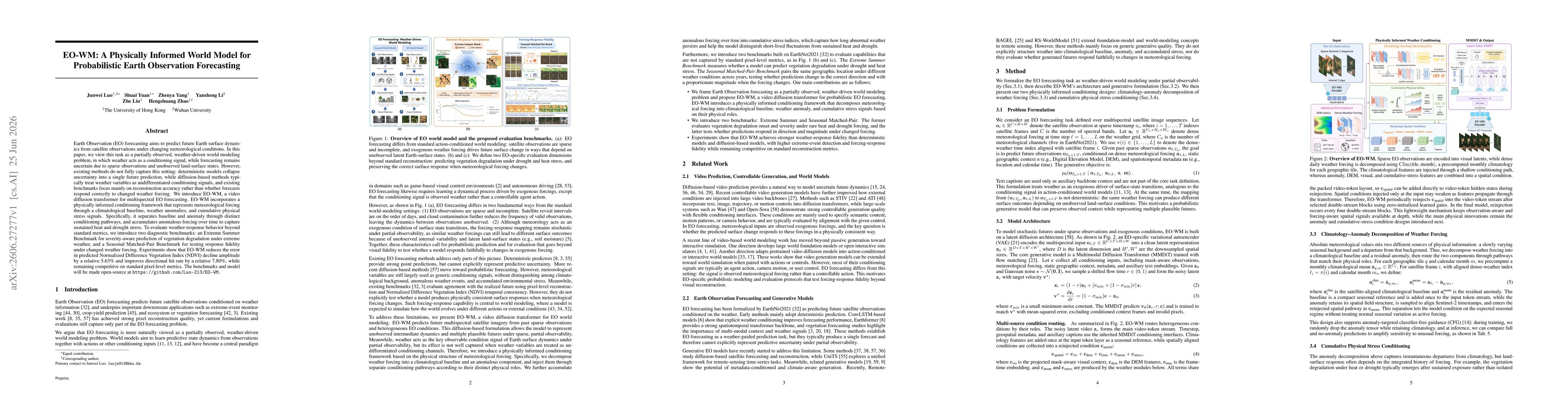
Earth Observation (EO) forecasting aims to predict future Earth surface dynamics from satellite observations under changing meteorological conditions. In this paper, we view this task as a partially o...