Academic Profile
Statistics
Similar Authors
Papers on arXiv
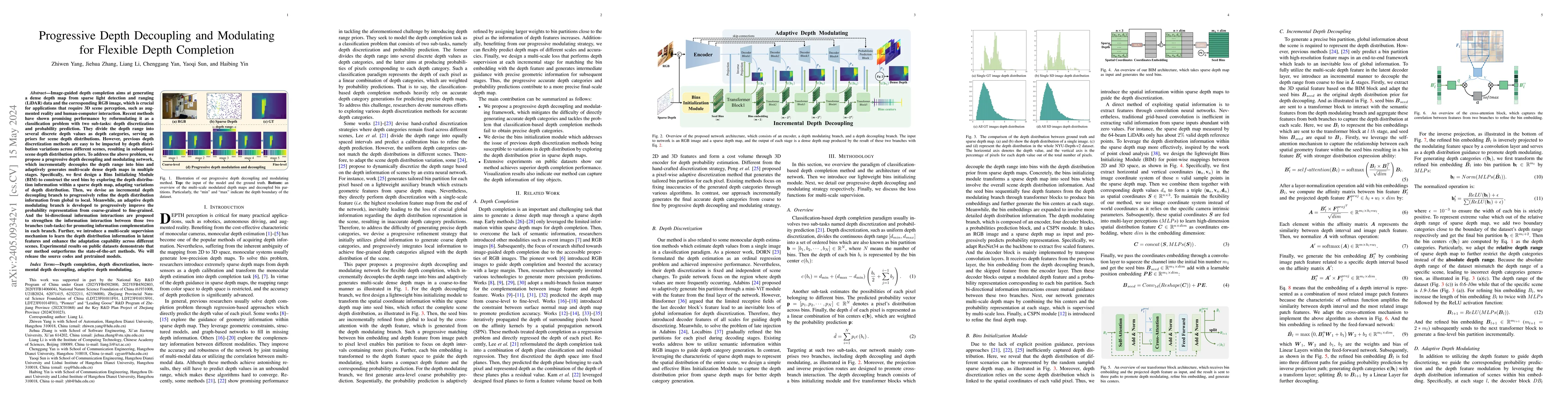
Image-guided depth completion aims at generating a dense depth map from sparse LiDAR data and RGB image. Recent methods have shown promising performance by reformulating it as a classification probl...
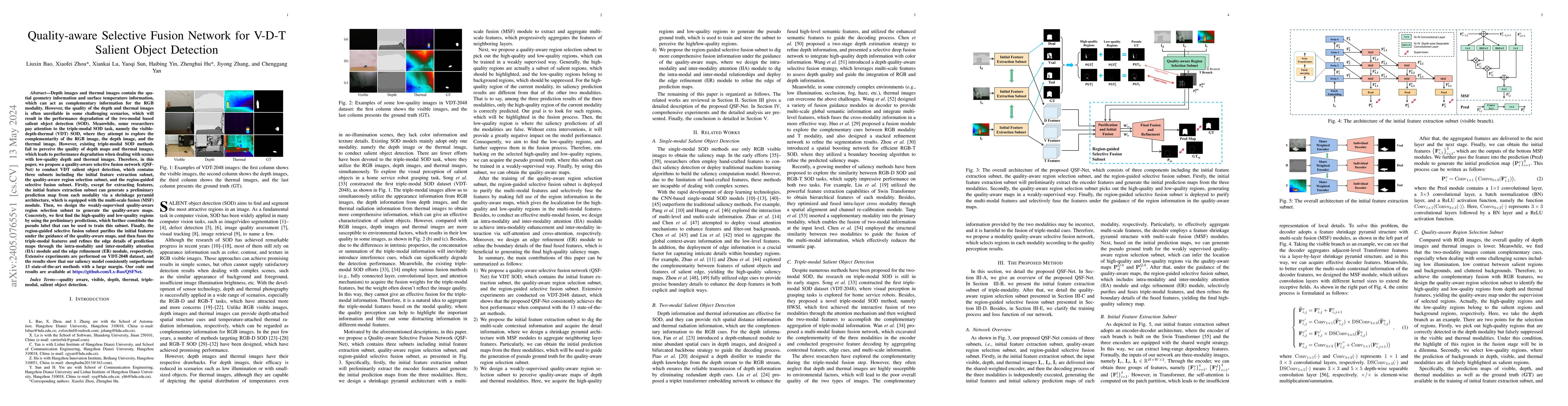
Depth images and thermal images contain the spatial geometry information and surface temperature information, which can act as complementary information for the RGB modality. However, the quality of...
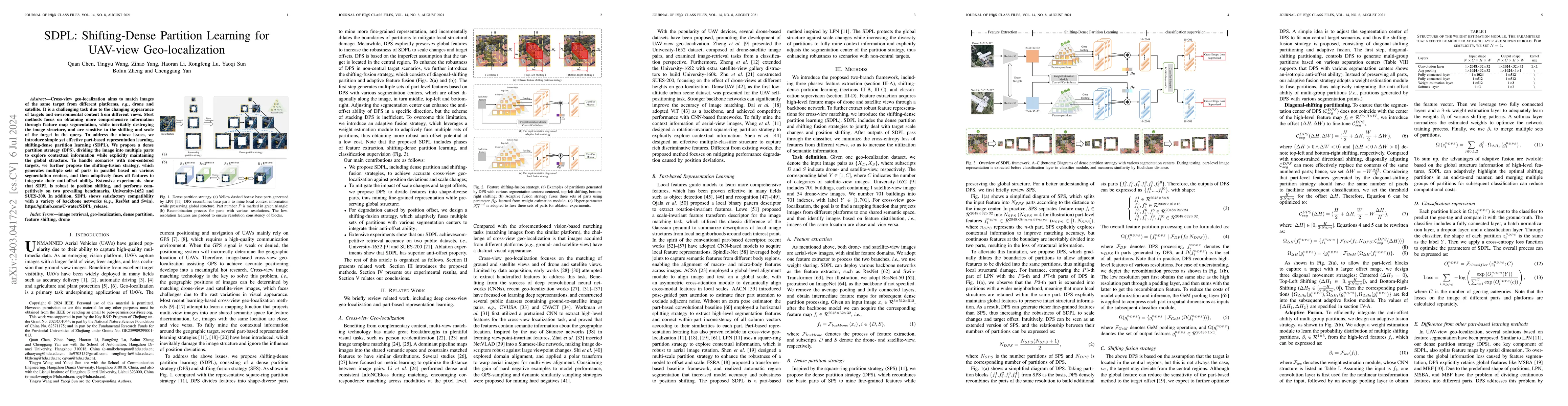
Cross-view geo-localization aims to match images of the same target from different platforms, e.g., drone and satellite. It is a challenging task due to the changing both appearance of targets and e...
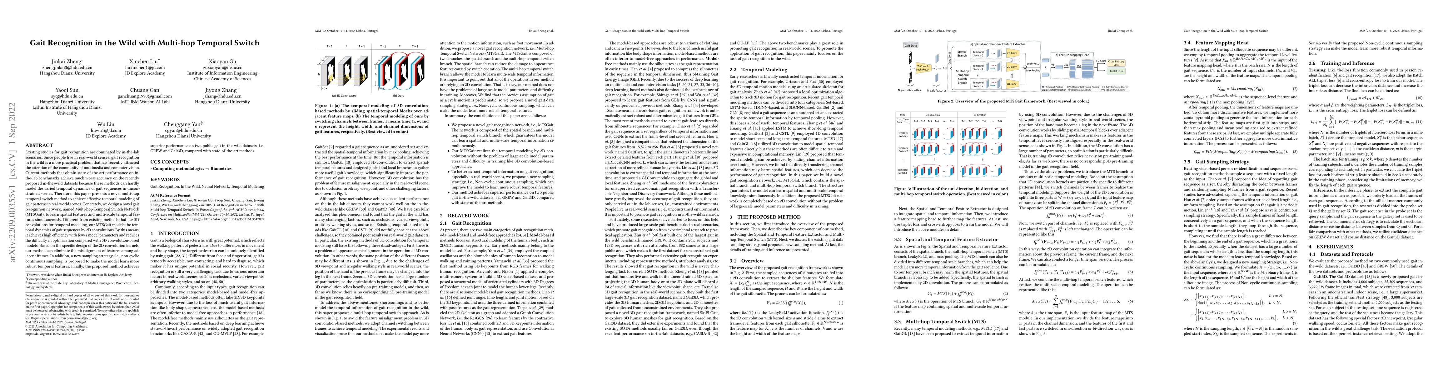
Existing studies for gait recognition are dominated by in-the-lab scenarios. Since people live in real-world senses, gait recognition in the wild is a more practical problem that has recently attrac...
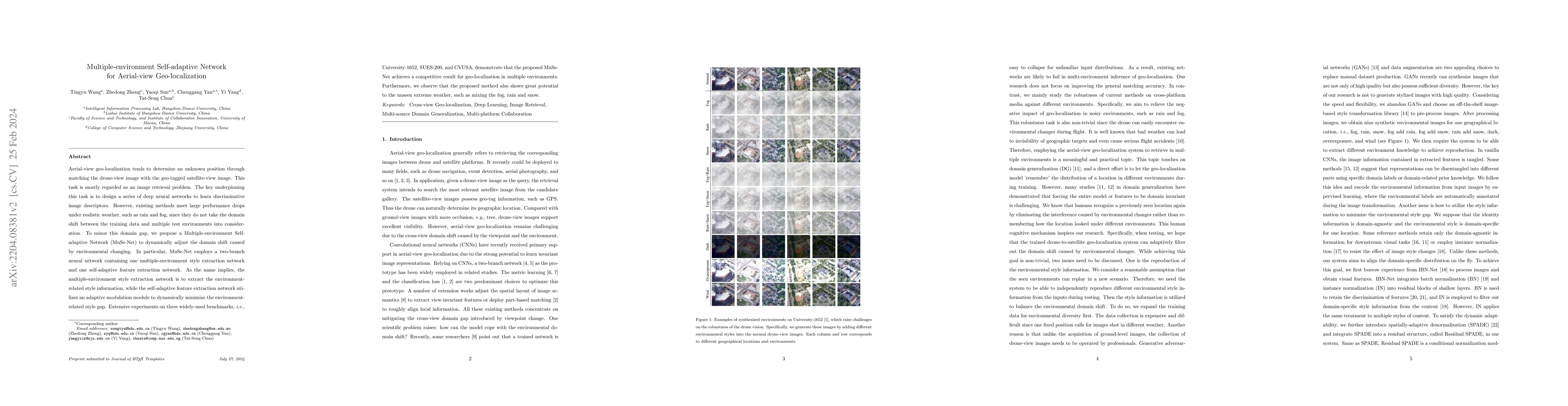
Aerial-view geo-localization tends to determine an unknown position through matching the drone-view image with the geo-tagged satellite-view image. This task is mostly regarded as an image retrieval...
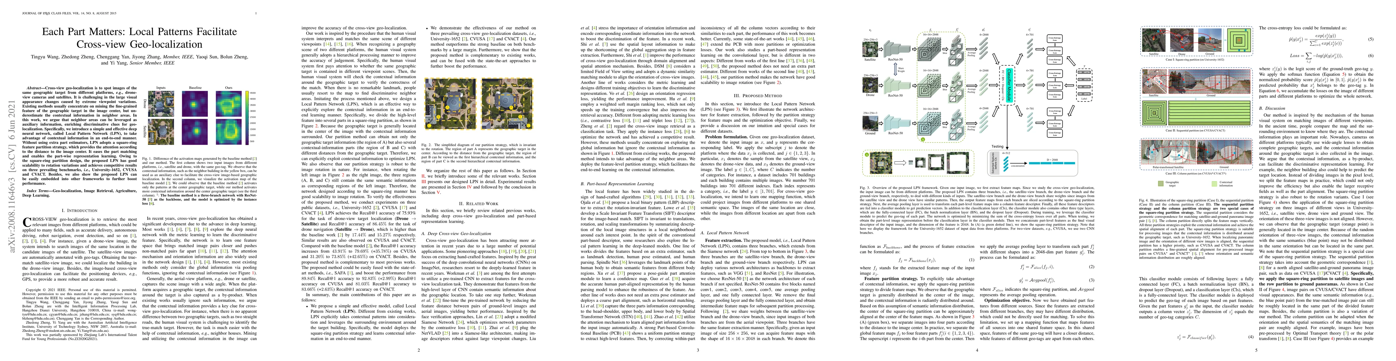
Cross-view geo-localization is to spot images of the same geographic target from different platforms, e.g., drone-view cameras and satellites. It is challenging in the large visual appearance change...
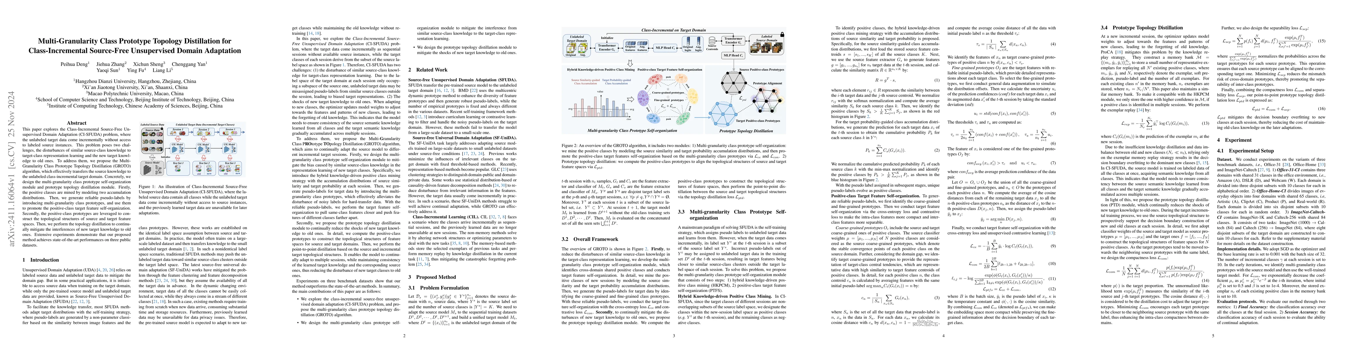
This paper explores the Class-Incremental Source-Free Unsupervised Domain Adaptation (CI-SFUDA) problem, where the unlabeled target data come incrementally without access to labeled source instances. ...
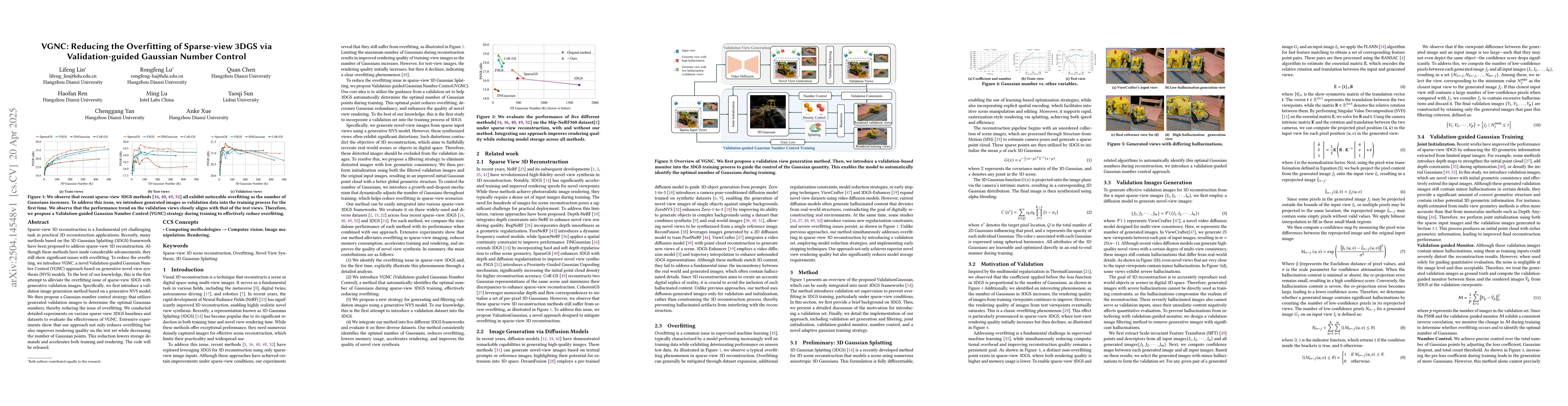
Sparse-view 3D reconstruction is a fundamental yet challenging task in practical 3D reconstruction applications. Recently, many methods based on the 3D Gaussian Splatting (3DGS) framework have been pr...
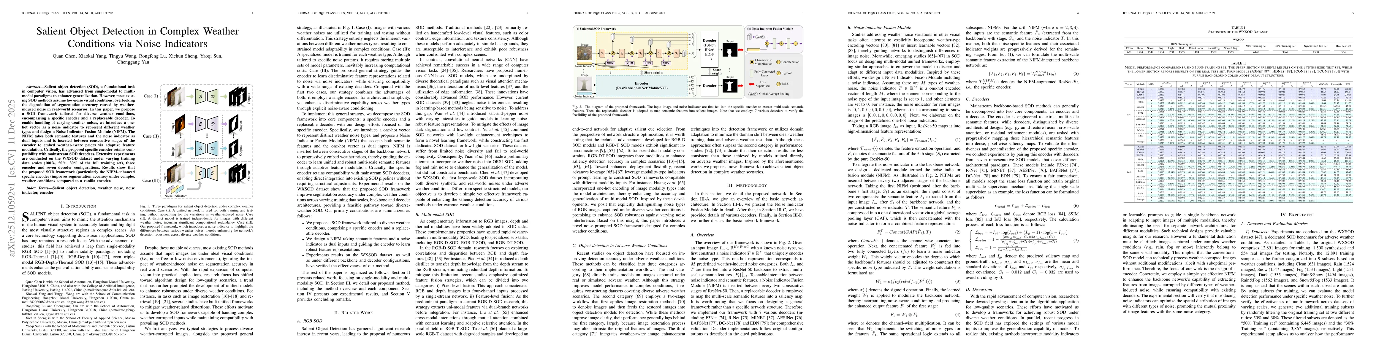
Salient object detection (SOD), a foundational task in computer vision, has advanced from single-modal to multi-modal paradigms to enhance generalization. However, most existing SOD methods assume low...
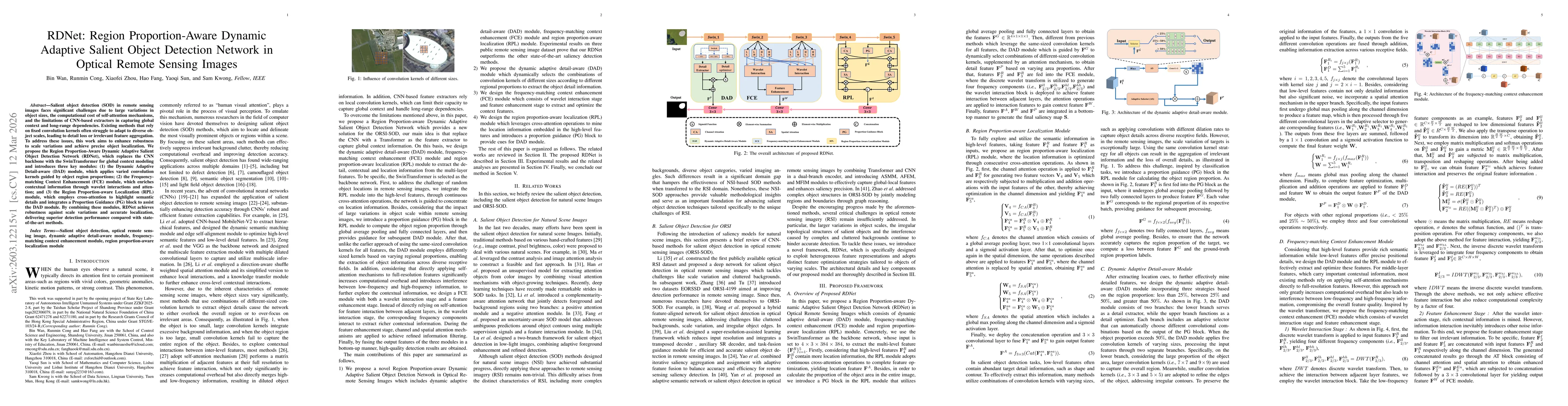
Salient object detection (SOD) in remote sensing images faces significant challenges due to large variations in object sizes, the computational cost of self-attention mechanisms, and the limitations o...
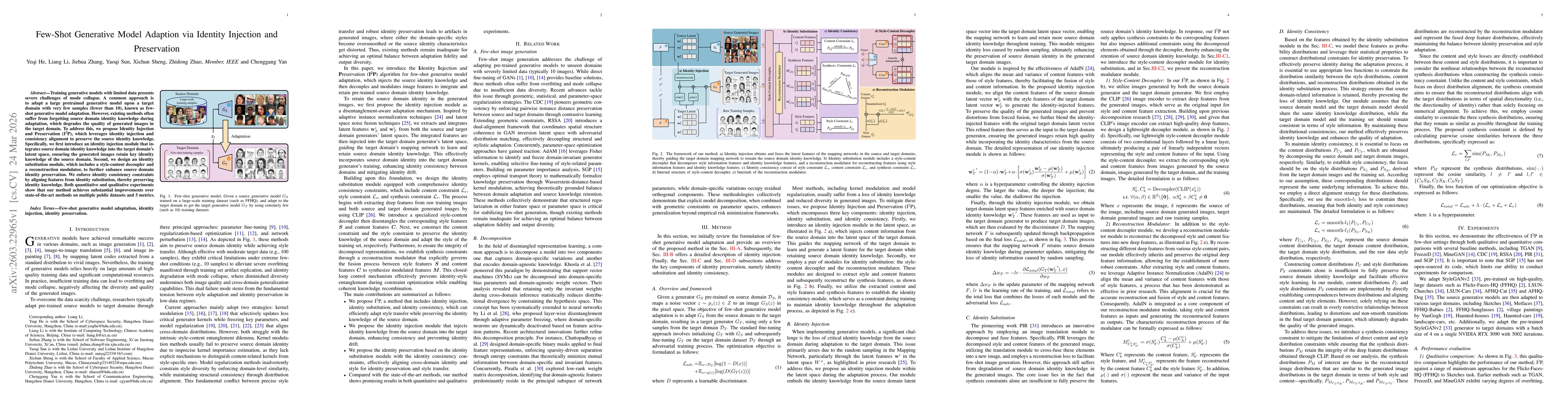
Training generative models with limited data presents severe challenges of mode collapse. A common approach is to adapt a large pretrained generative model upon a target domain with very few samples (...