Academic Profile
Statistics
Similar Authors
Papers on arXiv

Tree defect detection is crucial for the structural health screening of trees. Existing nondestructive testing (NDT) techniques for tree defect detection require time-consuming and labor-intensive m...
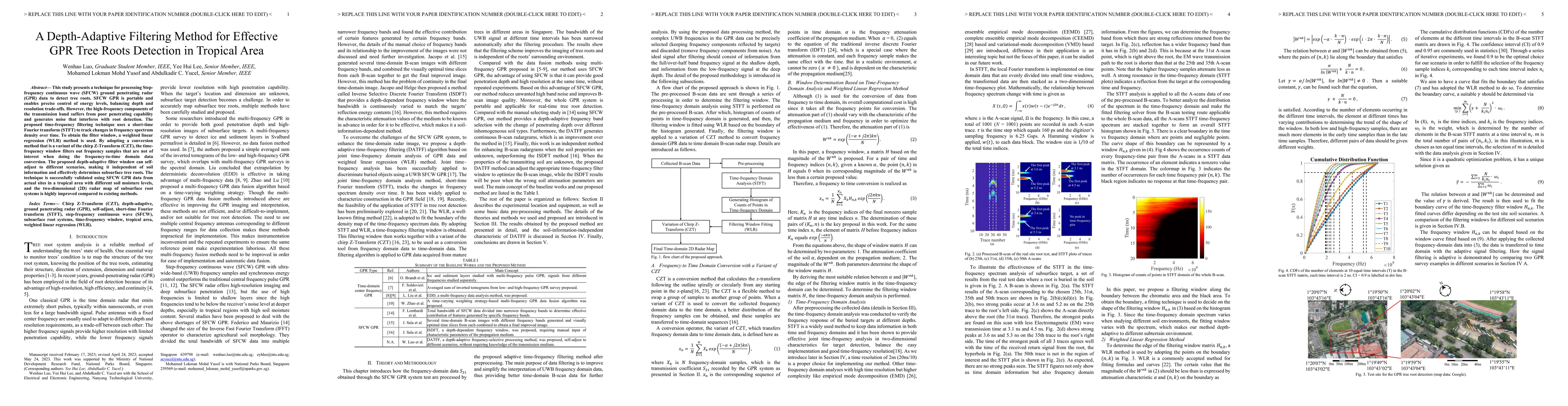
This study presents a technique for processing Stepfrequency continuous wave (SFCW) ground penetrating radar (GPR) data to detect tree roots. SFCW GPR is portable and enables precise control of ener...
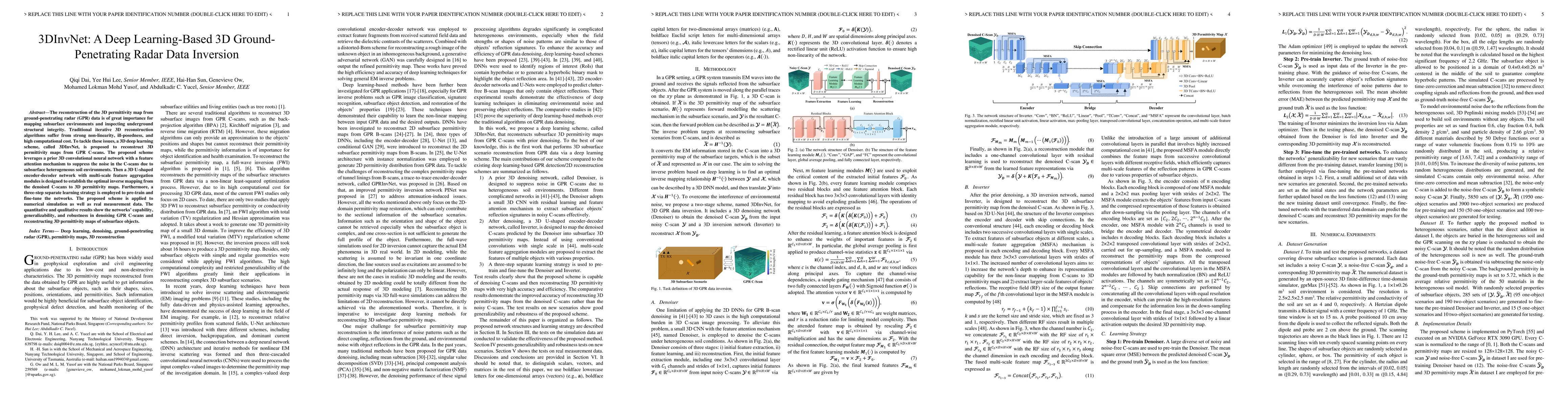
The reconstruction of the 3D permittivity map from ground-penetrating radar (GPR) data is of great importance for mapping subsurface environments and inspecting underground structural integrity. Tra...
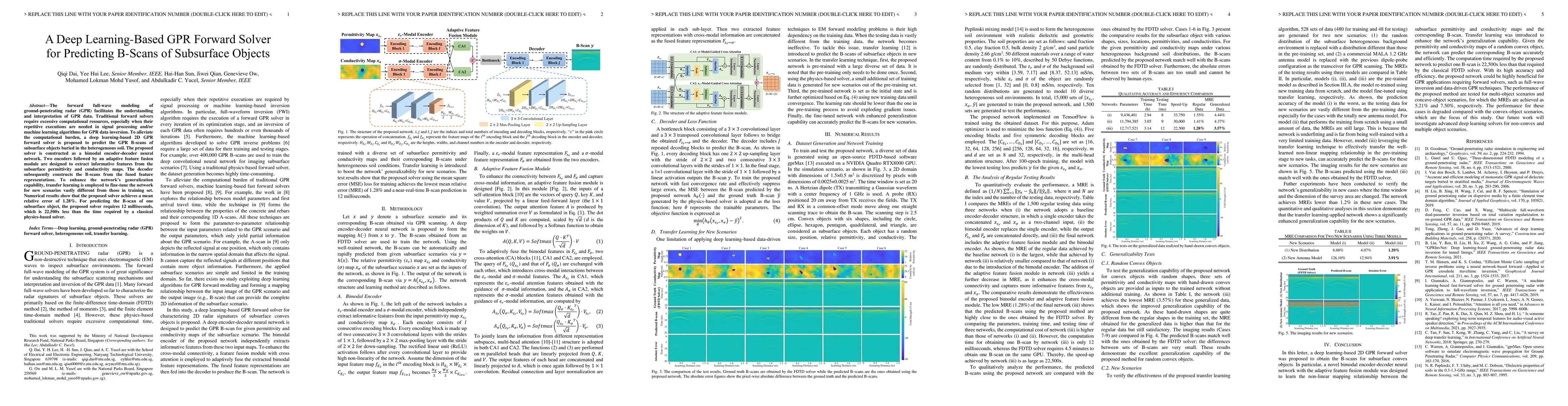
The forward full-wave modeling of ground-penetrating radar (GPR) facilitates the understanding and interpretation of GPR data. Traditional forward solvers require excessive computational resources, ...
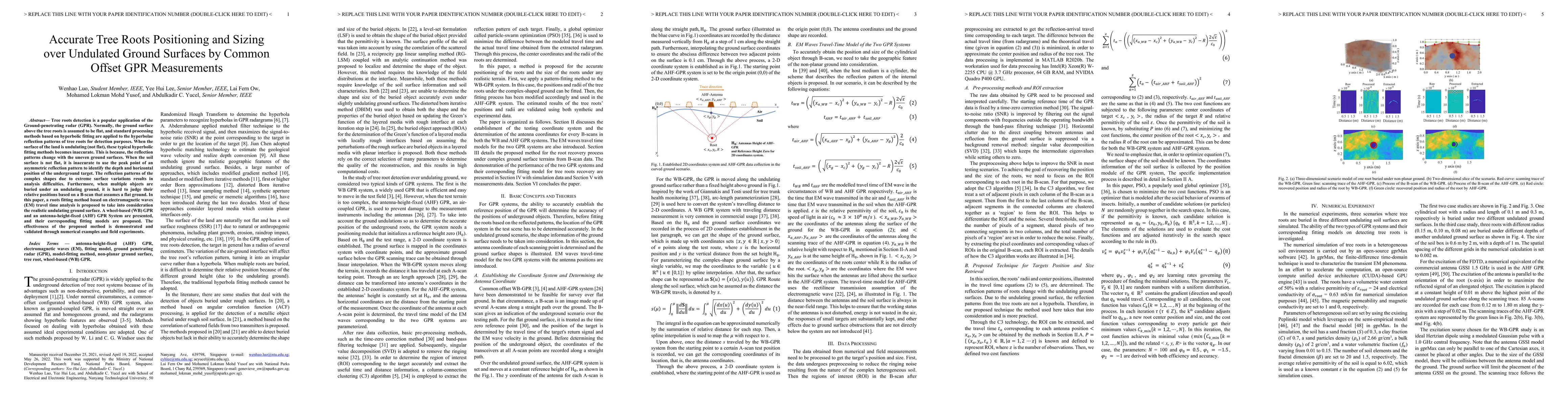
Tree roots detection is a popular application of the Ground-penetrating radar (GPR). Normally, the ground surface above the tree roots is assumed to be flat, and standard processing methods based on...

Detecting a shallowly buried and elongated object and estimating its orientation using a commonly adopted co-polarized GPR system is challenging due to the presence of strong ground clutter that mas...

Traditional ground-penetrating radar (GPR) data inversion leverages iterative algorithms which suffer from high computation costs and low accuracy when applied to complex subsurface scenarios. Exist...
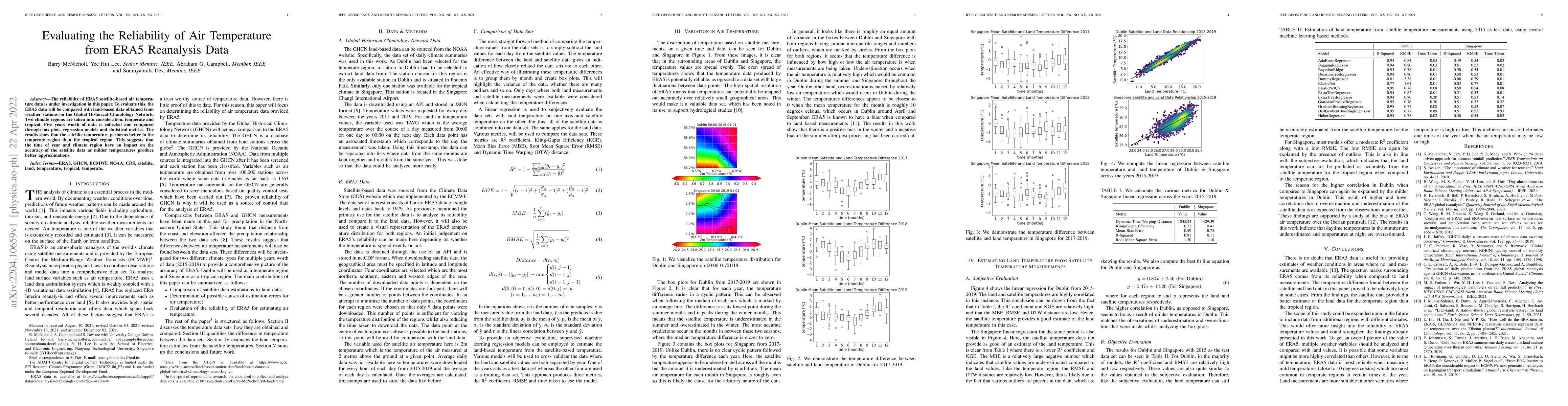
The reliability of ERA5 satellite-based air temperature data is under investigation in this paper. To evaluate this, the ERA5 data will be compared with land-based data obtained from weather station...

Accurate monitoring of tree roots using ground penetrating radar (GPR) is very useful in assessing the trees health. In high moisture tropical areas such as Singapore, tree fall due to root rot can ...
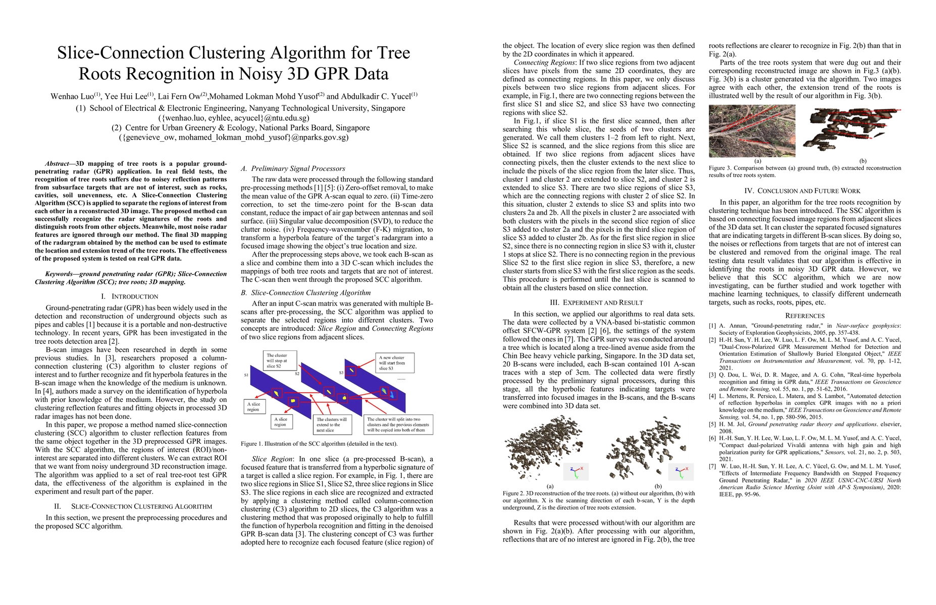
3D mapping of tree roots is a popular ground-penetrating radar (GPR) application. In real field tests, the recognition of tree roots suffers due to noisey reflection patterns from subsurface targets...
Air pollution has been on continuous rise with increase in industrialization in metropolitan cities of the world. Several measures including strict climate laws and reduction in the number of vehicl...
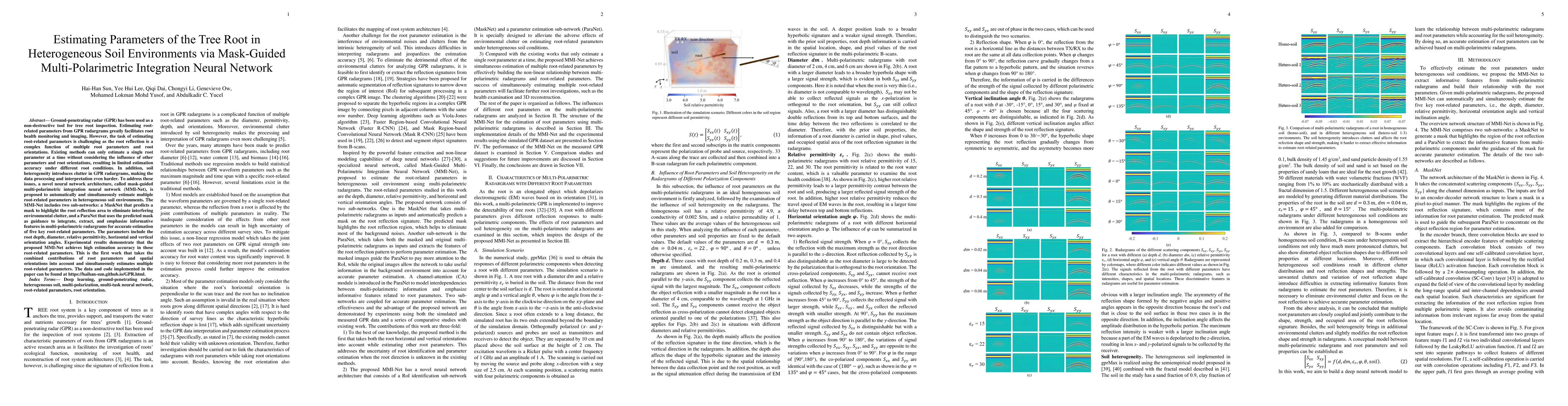
Ground-penetrating radar (GPR) has been used as a non-destructive tool for tree root inspection. Estimating root-related parameters from GPR radargrams greatly facilitates root health monitoring and...
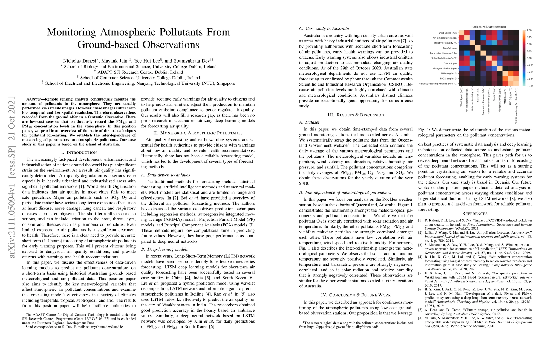
Remote sensing analysts continuously monitor the amount of pollutants in the atmosphere. They are usually performed via satellite images. However, these images suffer from low temporal and low spati...
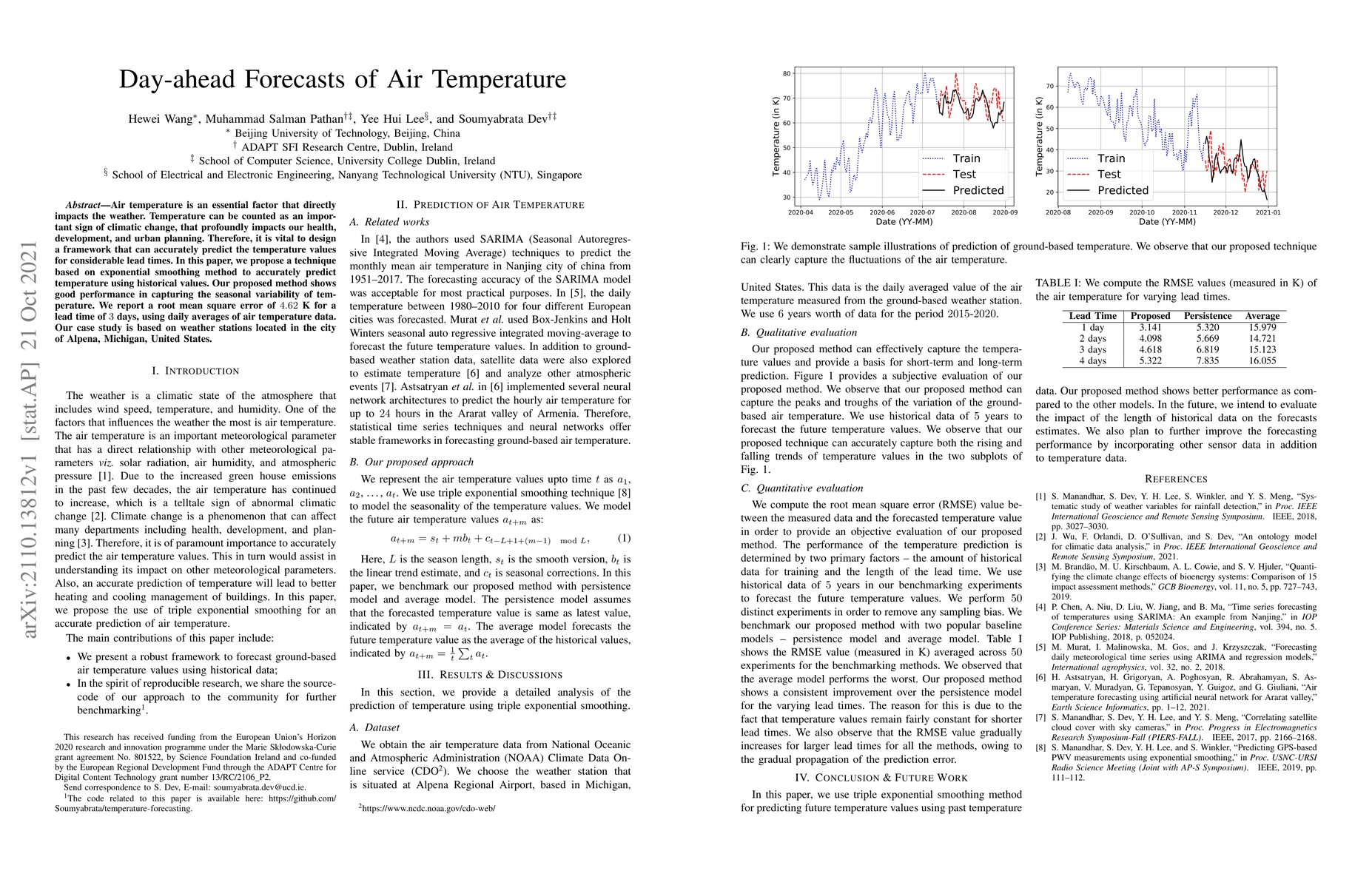
Air temperature is an essential factor that directly impacts the weather. Temperature can be counted as an important sign of climatic change, that profoundly impacts our health, development, and urb...
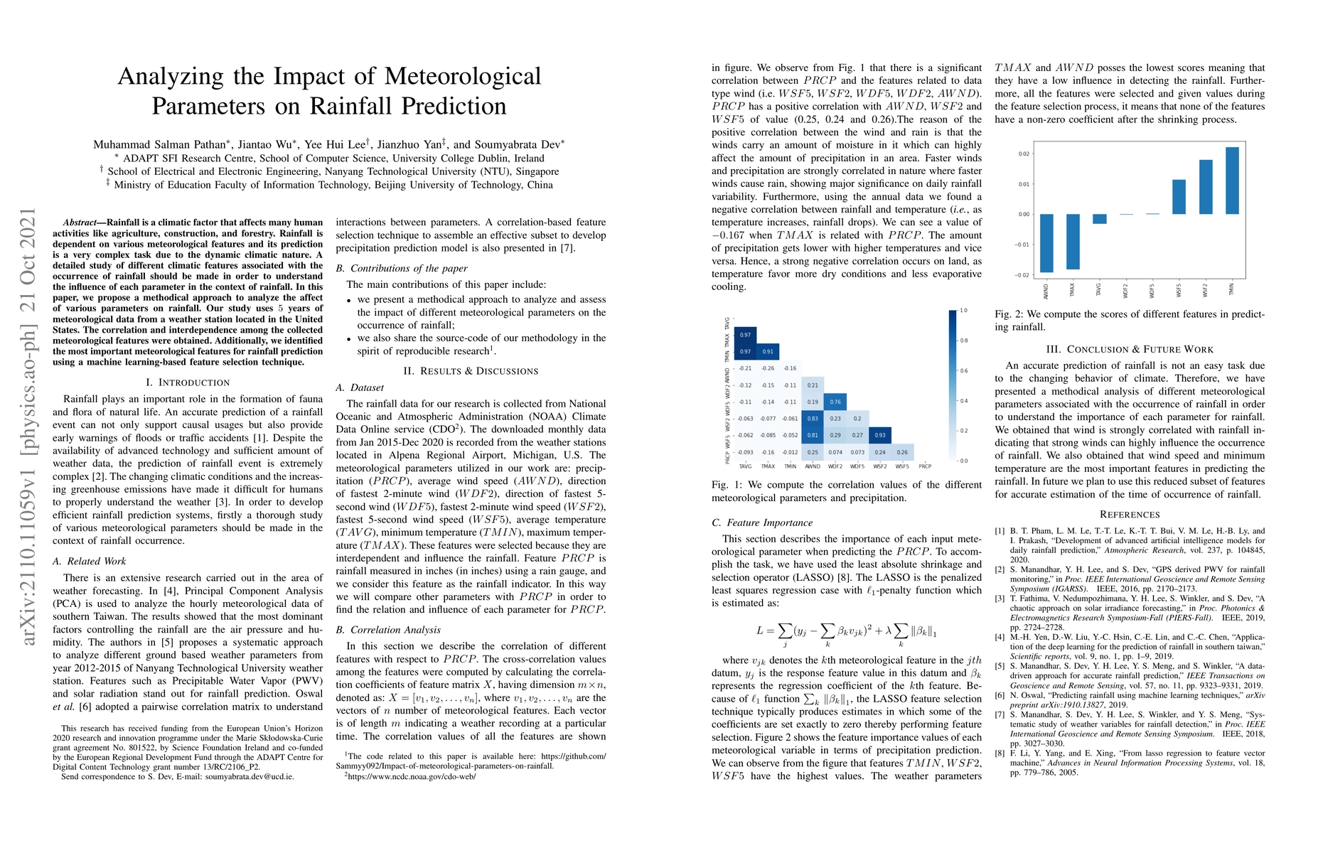
Rainfall is a climatic factor that affects many human activities like agriculture, construction, and forestry. Rainfall is dependent on various meteorological features and its prediction is a very c...
The FAIR (Findable, Accessible, Interoperable, Reusable) data principles are fundamental for climate researchers and all stakeholders in the current digital ecosystem. In this paper, we demonstrate ...
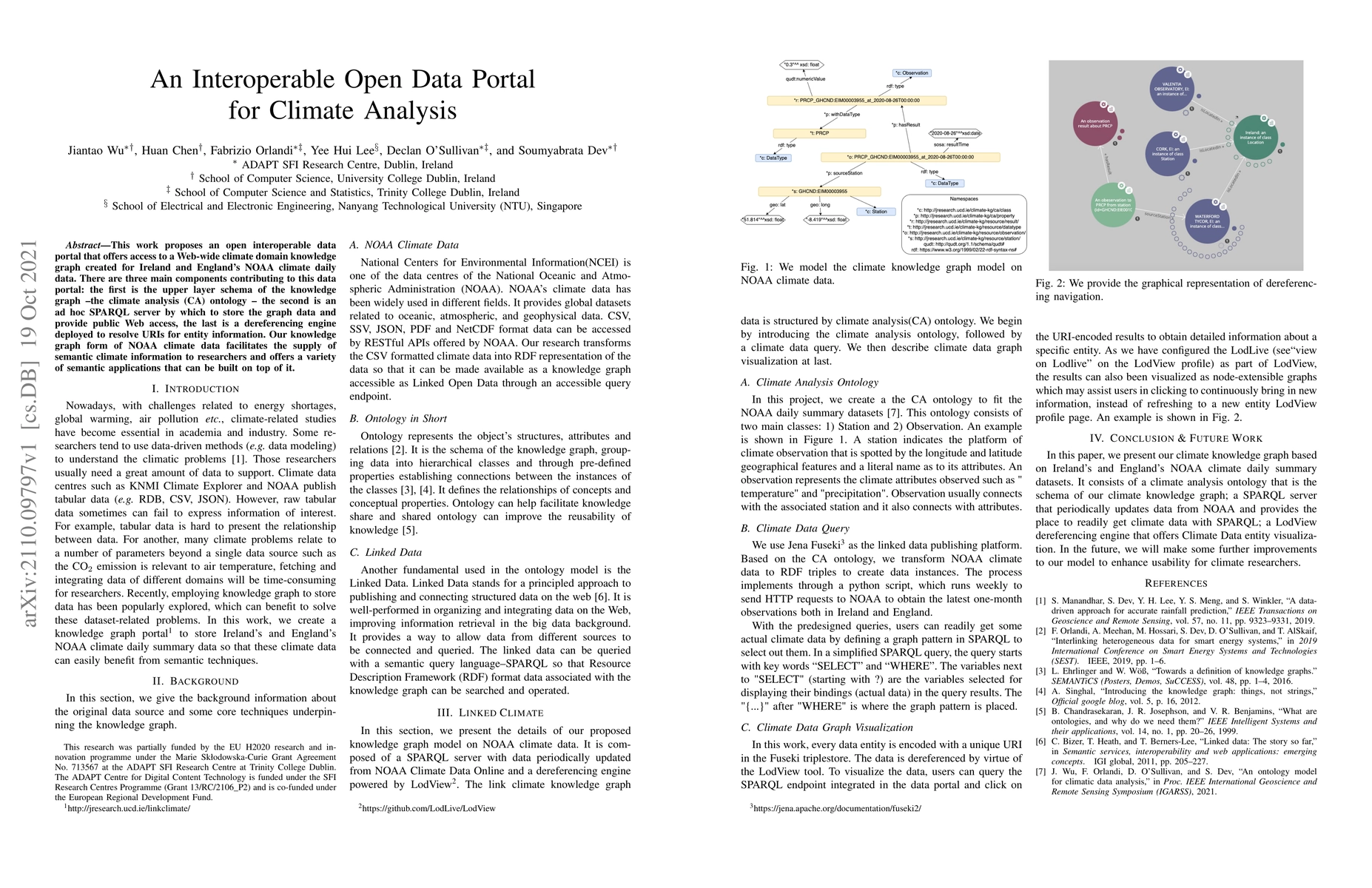
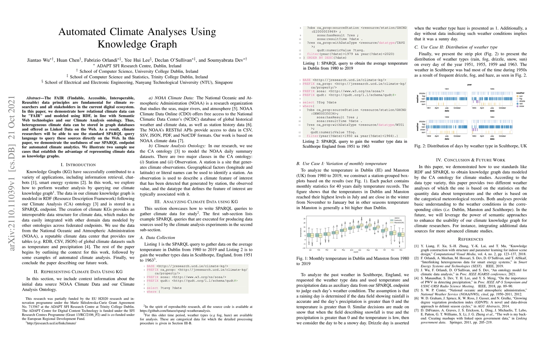
This work proposes an open interoperable data portal that offers access to a Web-wide climate domain knowledge graph created for Ireland and England's NOAA climate daily data. There are three main c...
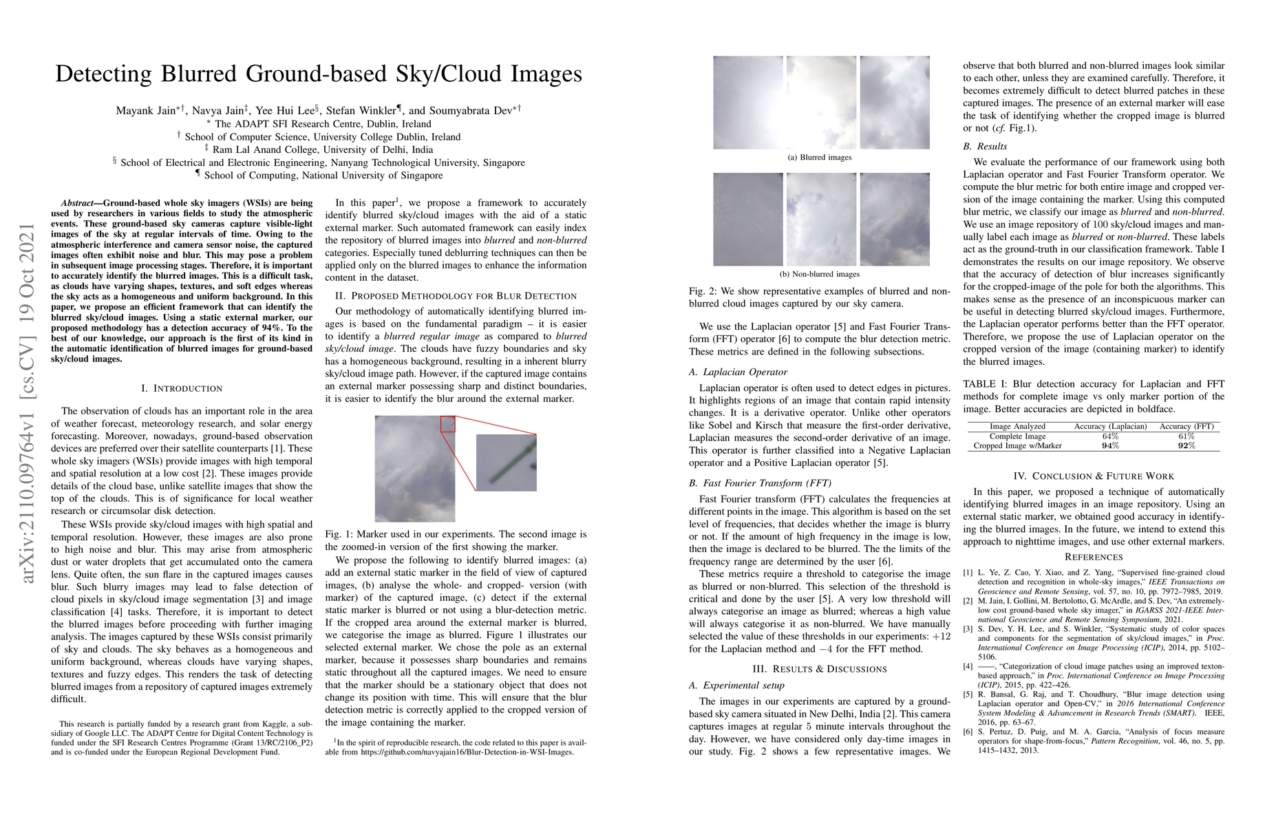
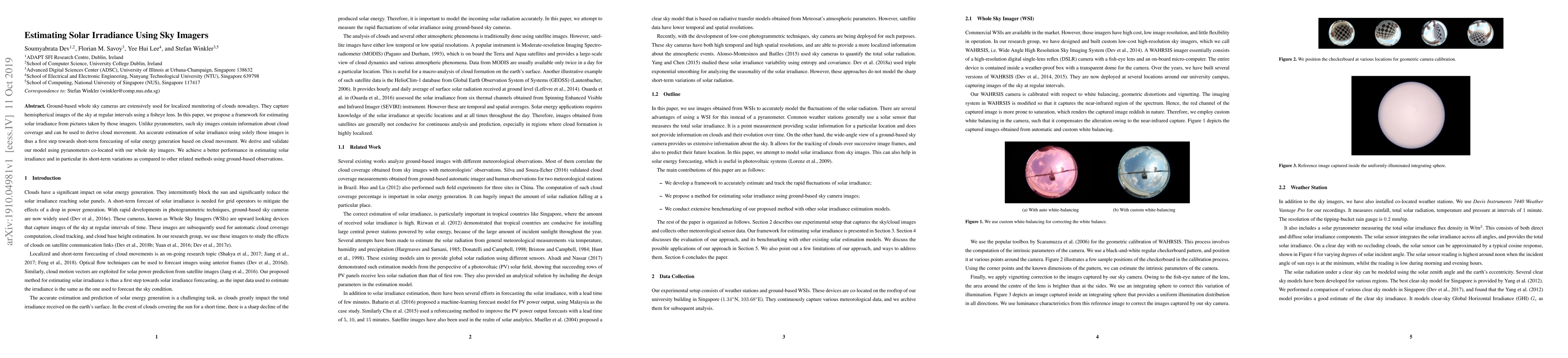
Ground-based whole sky imagers (WSIs) are being used by researchers in various fields to study the atmospheric events. These ground-based sky cameras capture visible-light images of the sky at regul...
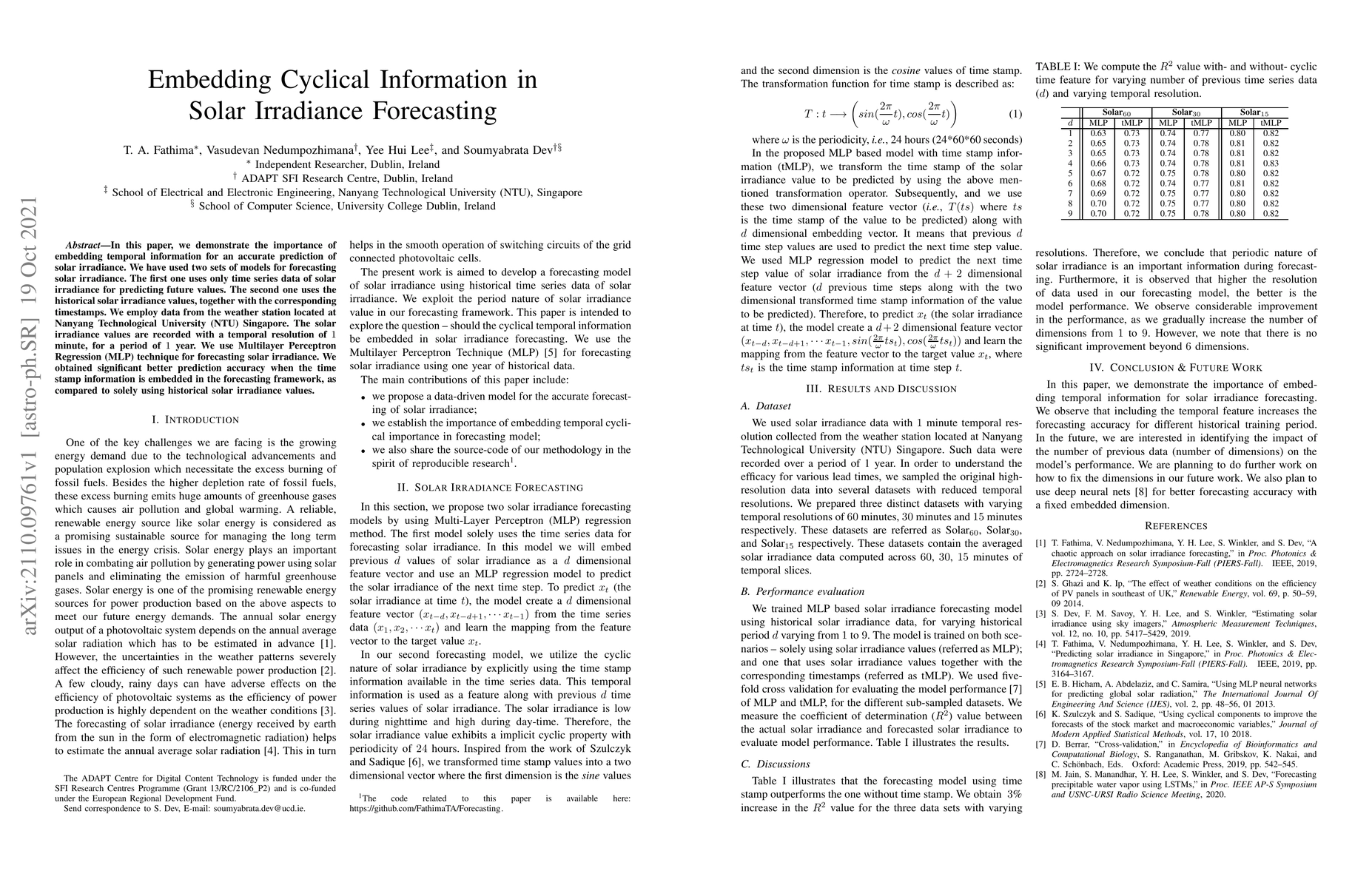
In this paper, we demonstrate the importance of embedding temporal information for an accurate prediction of solar irradiance. We have used two sets of models for forecasting solar irradiance. The f...
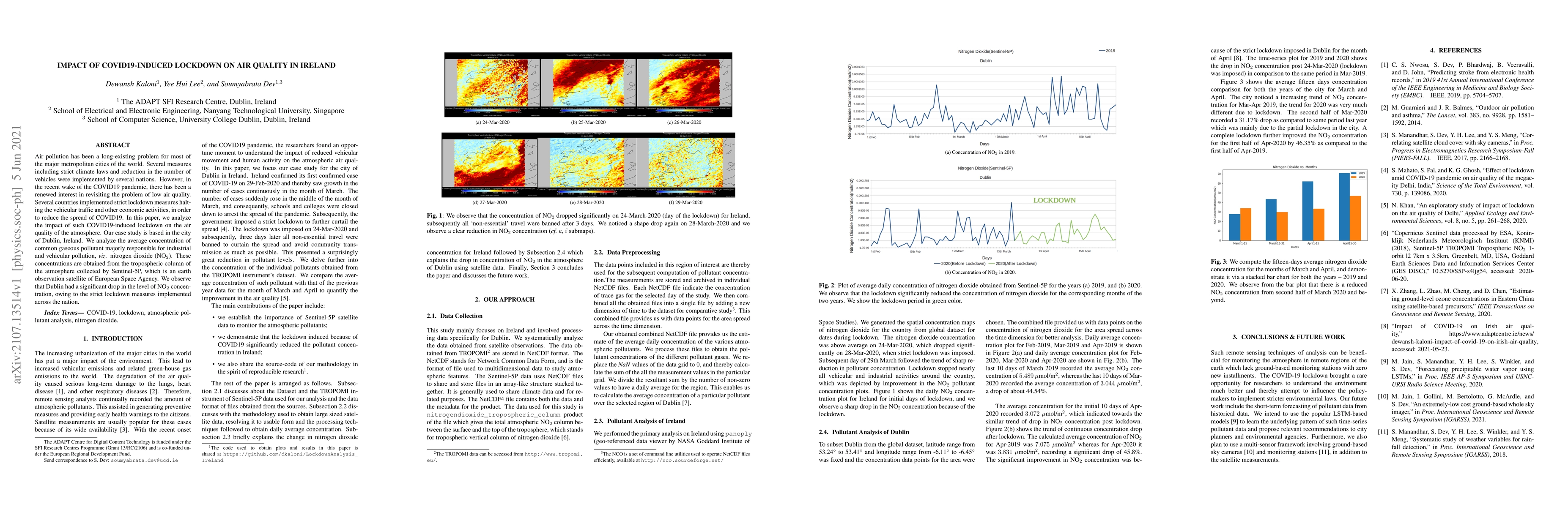
Air pollution has been a long-existing problem for most of the major metropolitan cities of the world. Several measures including strict climate laws and reduction in the number of vehicles were imp...
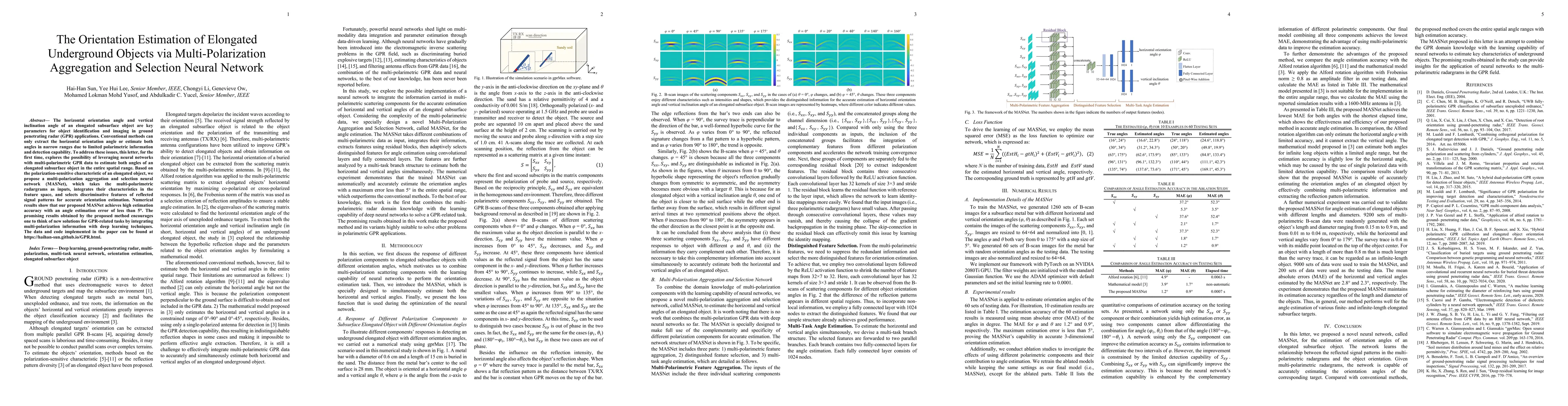
The horizontal orientation angle and vertical inclination angle of an elongated subsurface object are key parameters for object identification and imaging in ground penetrating radar (GPR) applicati...
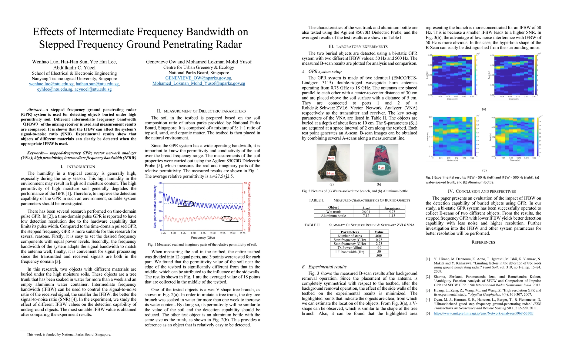
A stepped frequency ground penetrating radar (GPR) system is used for detecting objects buried under high permittivity soil. Different intermediate frequency bandwidth (IFBW) of the mixing receiver ...
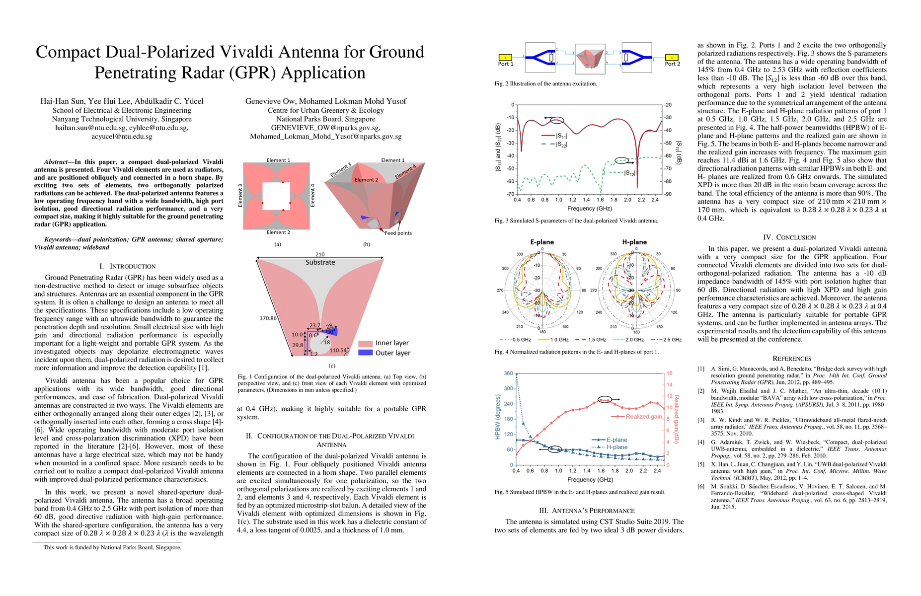
In this paper, a compact dual-polarized Vivaldi antenna is presented. Four Vivaldi elements are used as radiators, and are positioned obliquely and connected in a horn shape. By exciting two sets of...
Long-Short-Term-Memory (LSTM) networks have been used extensively for time series forecasting in recent years due to their ability of learning patterns over different periods of time. In this paper,...
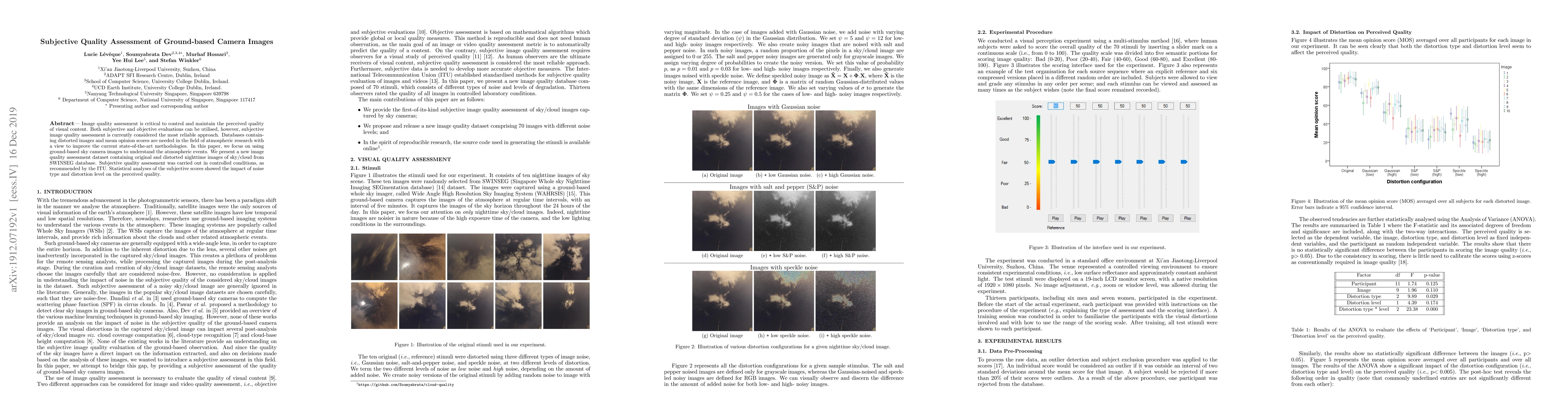
Image quality assessment is critical to control and maintain the perceived quality of visual content. Both subjective and objective evaluations can be utilised, however, subjective image quality ass...
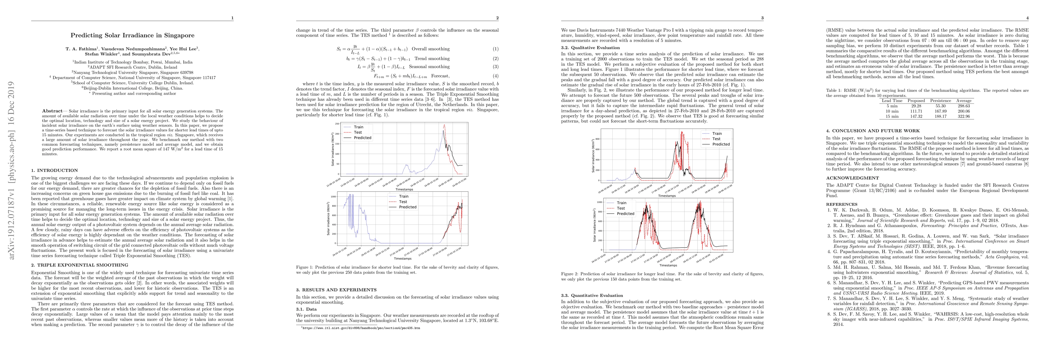
Solar irradiance is the primary input for all solar energy generation systems. The amount of available solar radiation over time under the local weather conditions helps to decide the optimal locati...
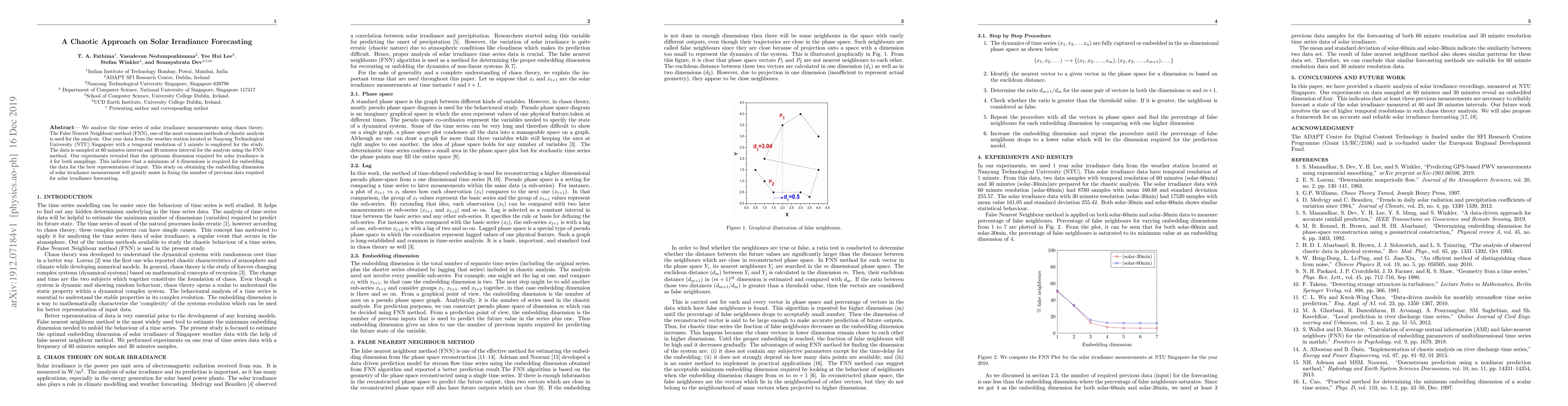
We analyse the time series of solar irradiance measurements using chaos theory. The False Nearest Neighbour method (FNN), one of the most common methods of chaotic analysis is used for the analysis....
Ground-based whole sky cameras are extensively used for localized monitoring of clouds nowadays. They capture hemispherical images of the sky at regular intervals using a fisheye lens. In this paper...
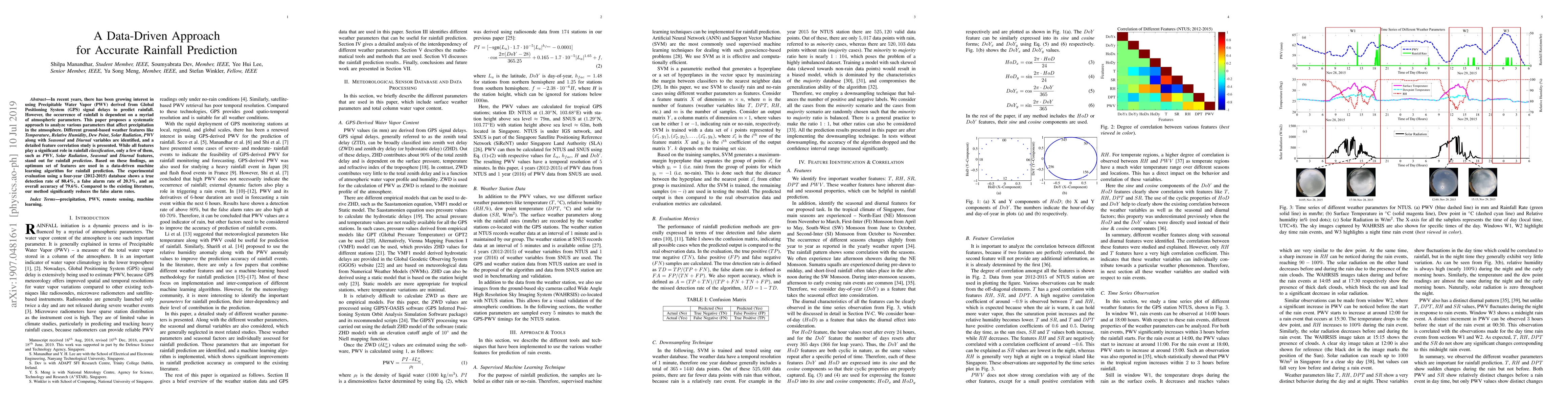
In recent years, there has been growing interest in using Precipitable Water Vapor (PWV) derived from Global Positioning System (GPS) signal delays to predict rainfall. However, the occurrence of ra...
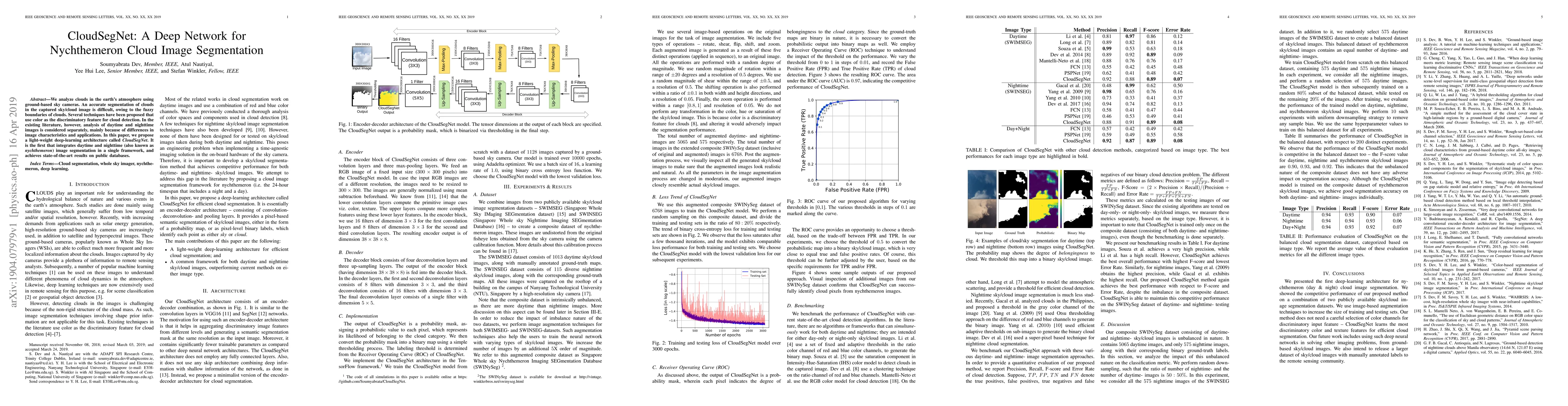
We analyze clouds in the earth's atmosphere using ground-based sky cameras. An accurate segmentation of clouds in the captured sky/cloud image is difficult, owing to the fuzzy boundaries of clouds. ...
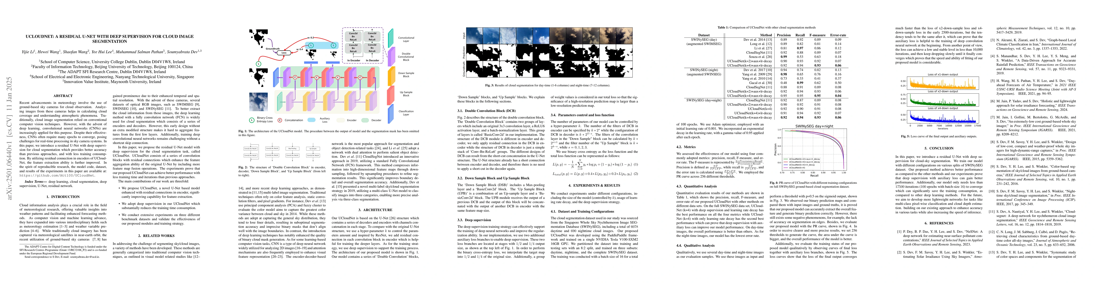
Recent advancements in meteorology involve the use of ground-based sky cameras for cloud observation. Analyzing images from these cameras helps in calculating cloud coverage and understanding atmosphe...
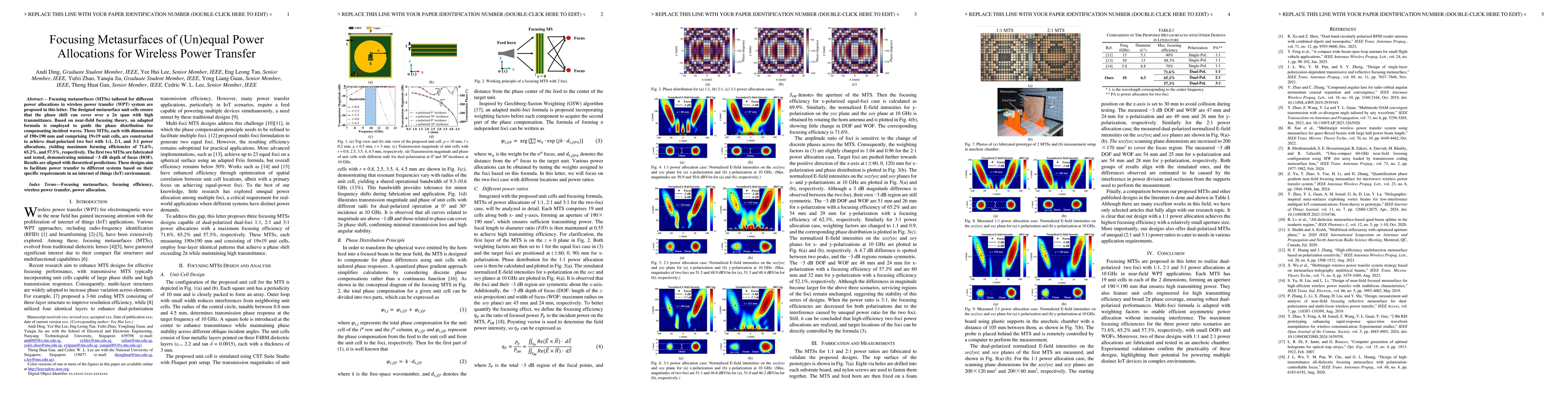
Focusing metasurfaces (MTSs) tailored for different power allocations in wireless power transfer (WPT) system are proposed in this letter. The designed metasurface unit cells ensure that the phase shi...
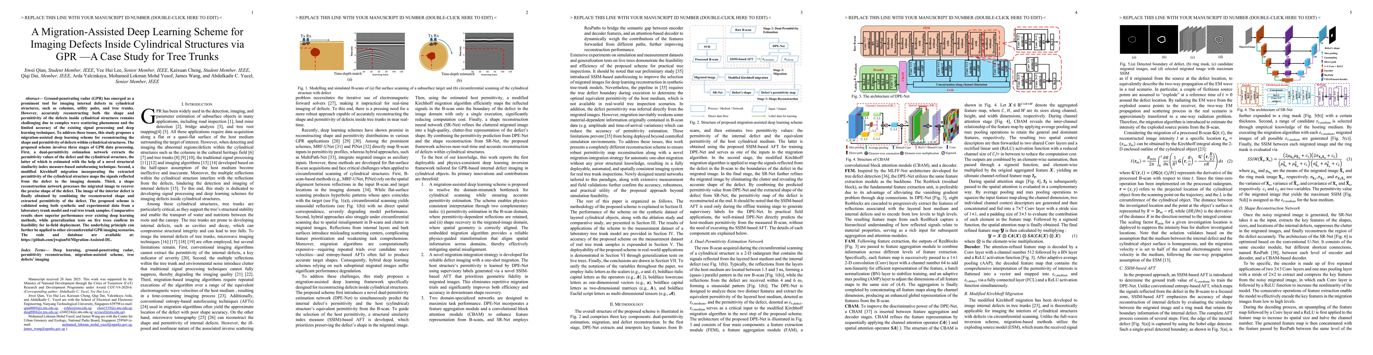
Ground-penetrating radar (GPR) has emerged as a prominent tool for imaging internal defects in cylindrical structures, such as columns, utility poles, and tree trunks. However, accurately reconstructi...

Most data-driven ionospheric forecasting models operate on gridded products, which do not preserve the time-varying sampling structure of satellite-based sensing. We instead model the ionosphere as a ...