Academic Profile
Statistics
Similar Authors
Papers on arXiv
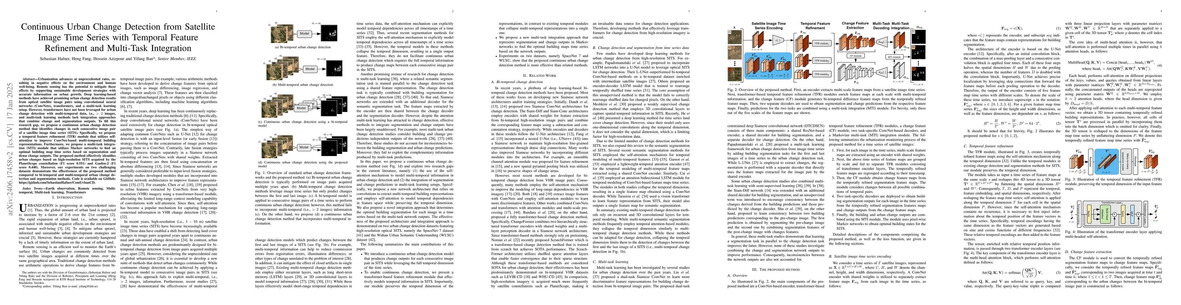
Urbanization advances at unprecedented rates, resulting in negative effects on the environment and human well-being. Remote sensing has the potential to mitigate these effects by supporting sustainabl...
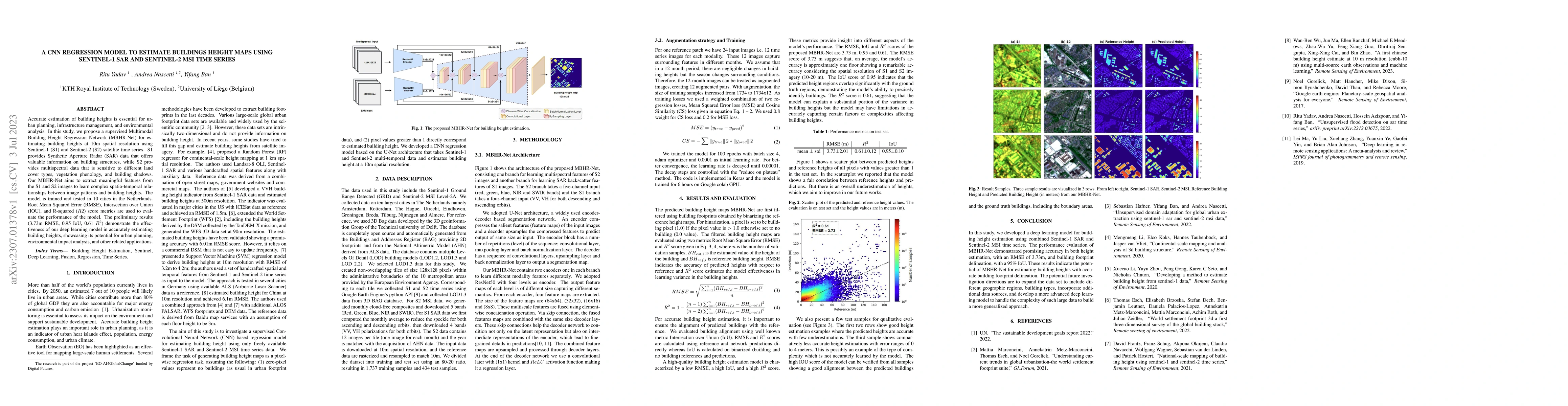
Accurate estimation of building heights is essential for urban planning, infrastructure management, and environmental analysis. In this study, we propose a supervised Multimodal Building Height Regr...
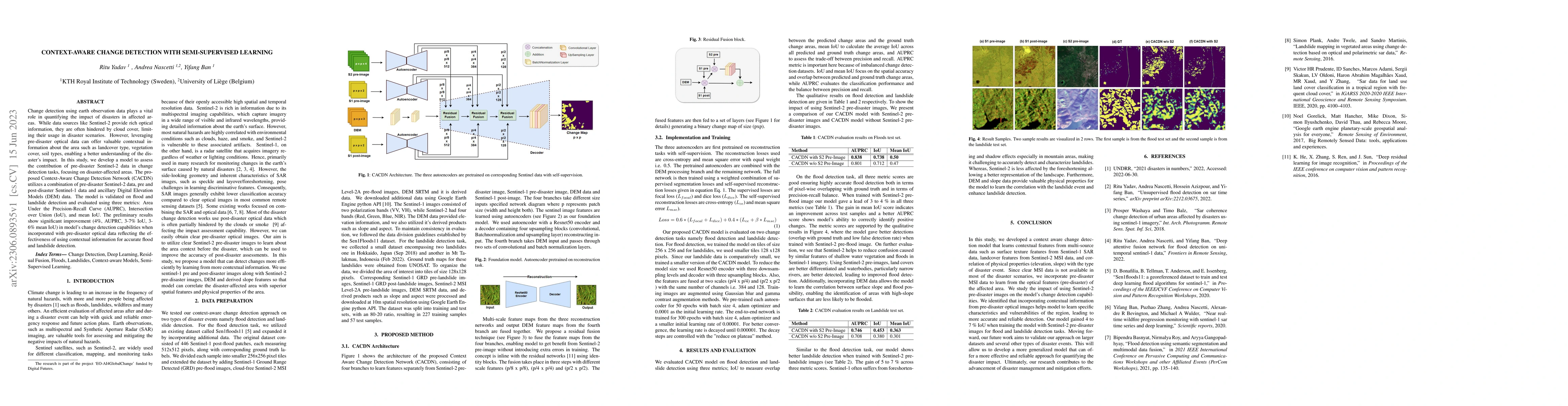
Change detection using earth observation data plays a vital role in quantifying the impact of disasters in affected areas. While data sources like Sentinel-2 provide rich optical information, they a...
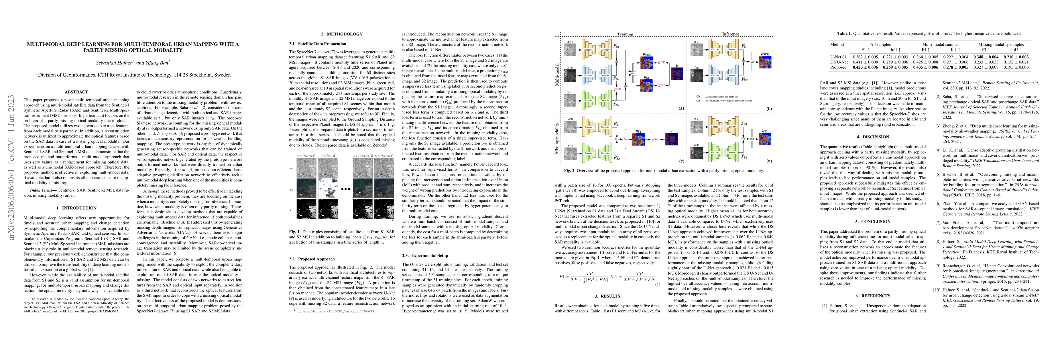
This paper proposes a novel multi-temporal urban mapping approach using multi-modal satellite data from the Sentinel-1 Synthetic Aperture Radar (SAR) and Sentinel-2 MultiSpectral Instrument (MSI) mi...
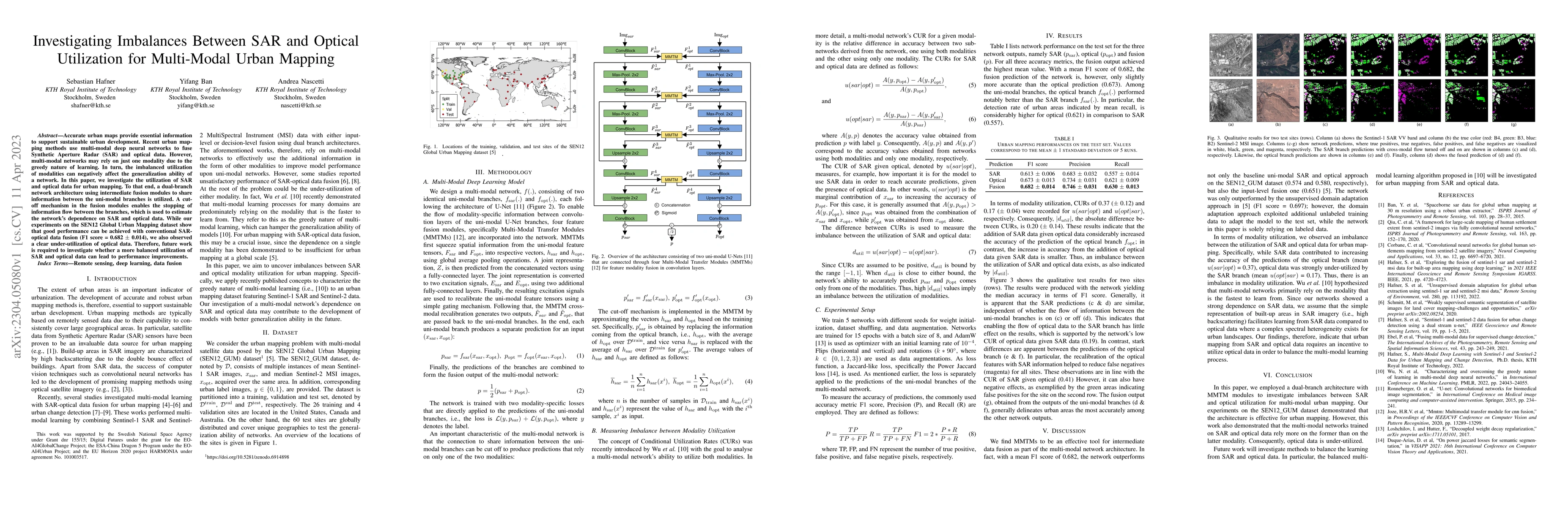
Accurate urban maps provide essential information to support sustainable urban development. Recent urban mapping methods use multi-modal deep neural networks to fuse Synthetic Aperture Radar (SAR) a...
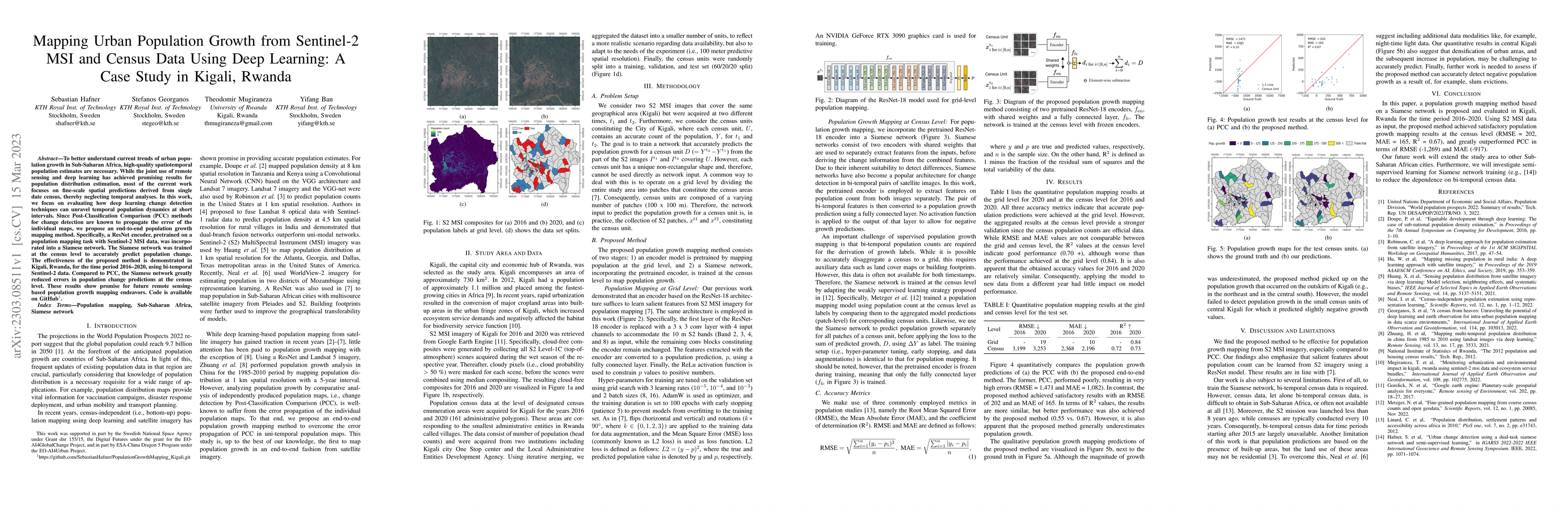
To better understand current trends of urban population growth in Sub-Saharan Africa, high-quality spatiotemporal population estimates are necessary. While the joint use of remote sensing and deep l...
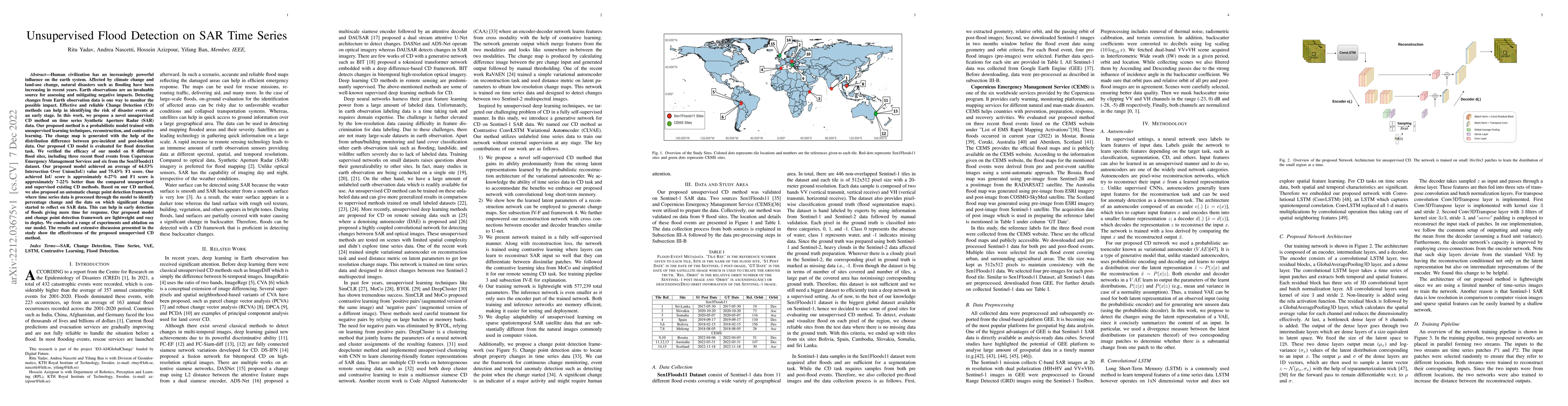
Human civilization has an increasingly powerful influence on the earth system. Affected by climate change and land-use change, natural disasters such as flooding have been increasing in recent years...
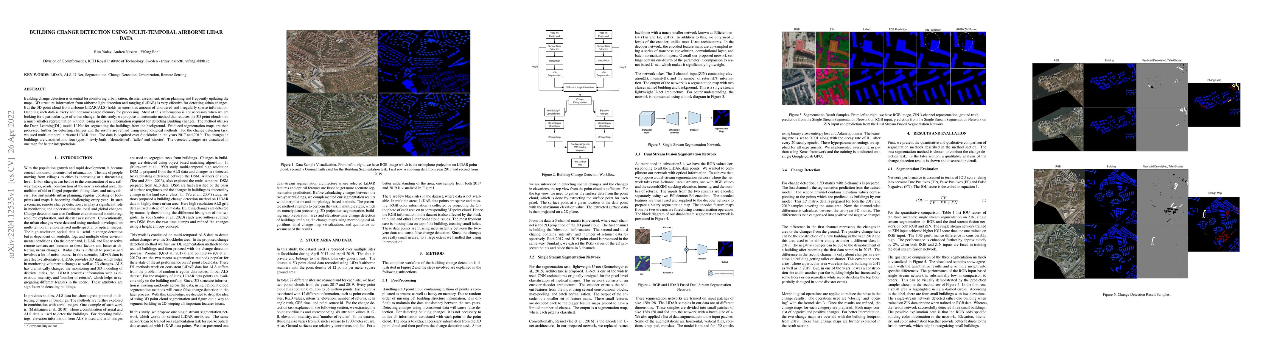
Building change detection is essential for monitoring urbanization, disaster assessment, urban planning and frequently updating the maps. 3D structure information from airborne light detection and r...
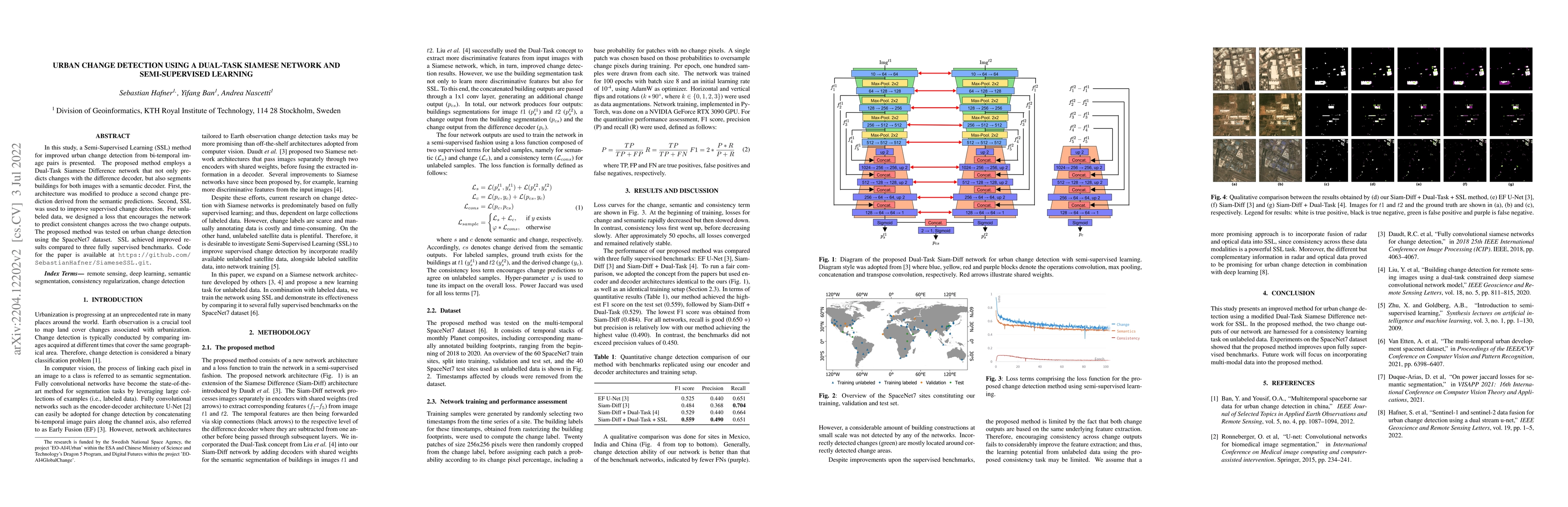
In this study, a Semi-Supervised Learning (SSL) method for improving urban change detection from bi-temporal image pairs was presented. The proposed method adapted a Dual-Task Siamese Difference net...
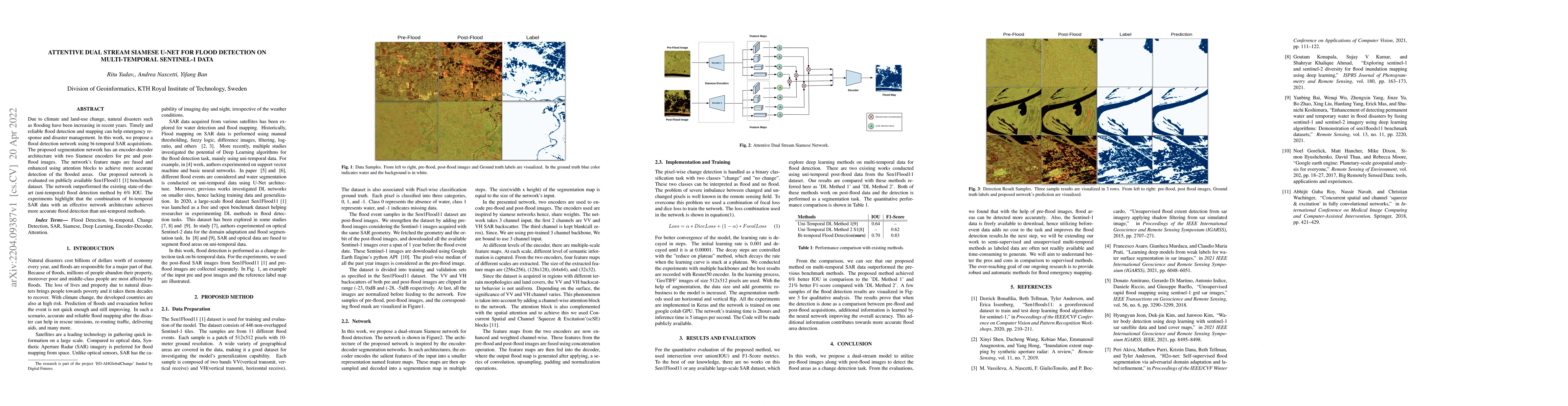
Due to climate and land-use change, natural disasters such as flooding have been increasing in recent years. Timely and reliable flood detection and mapping can help emergency response and disaster ...
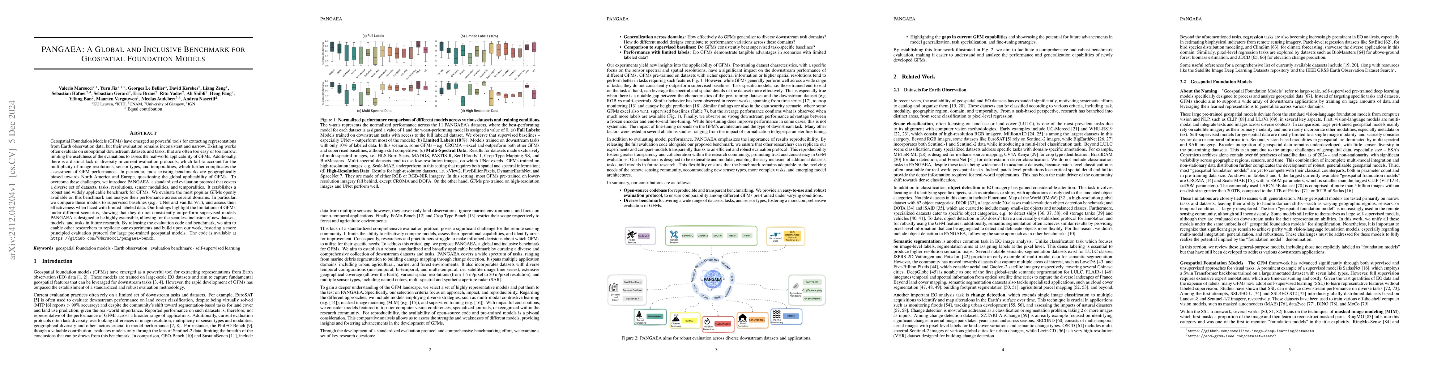
Geospatial Foundation Models (GFMs) have emerged as powerful tools for extracting representations from Earth observation data, but their evaluation remains inconsistent and narrow. Existing works ofte...
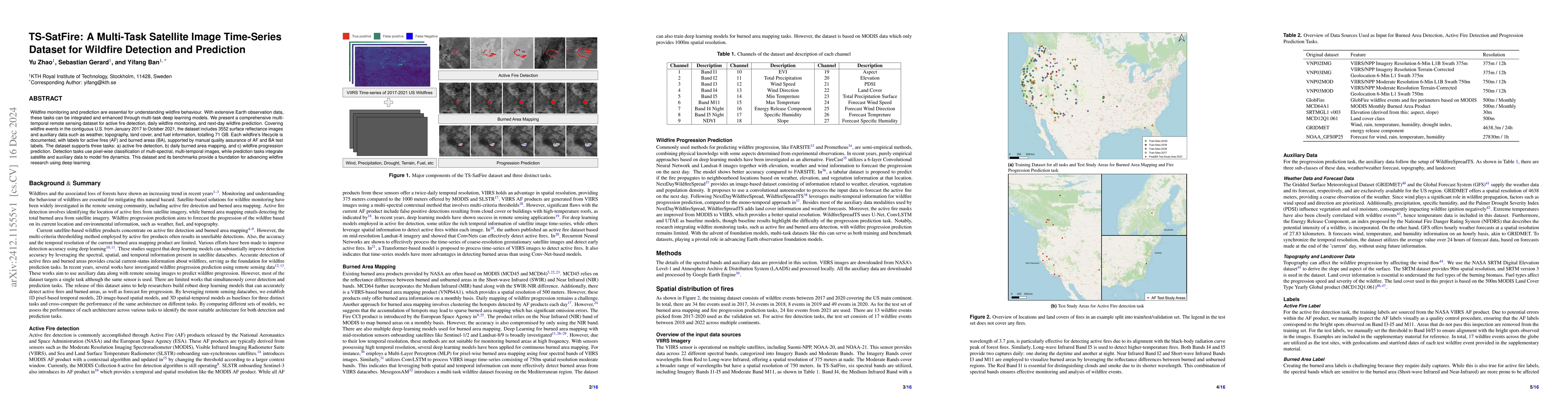
Wildfire monitoring and prediction are essential for understanding wildfire behaviour. With extensive Earth observation data, these tasks can be integrated and enhanced through multi-task deep learnin...
Monitoring wildfires has become increasingly critical due to the sharp rise in wildfire incidents in recent years. Optical satellites like Sentinel-2 and Landsat are extensively utilized for mapping b...
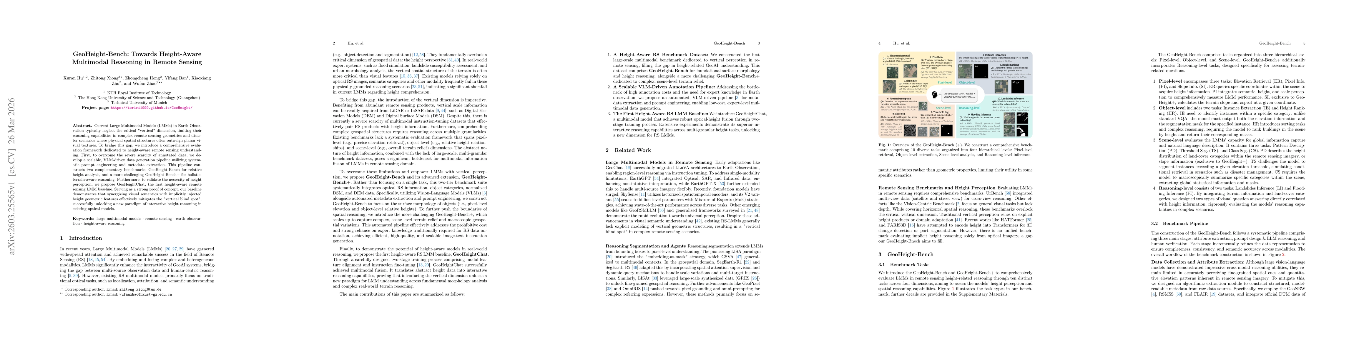
Current Large Multimodal Models (LMMs) in Earth Observation typically neglect the critical "vertical" dimension, limiting their reasoning capabilities in complex remote sensing geometries and disaster...
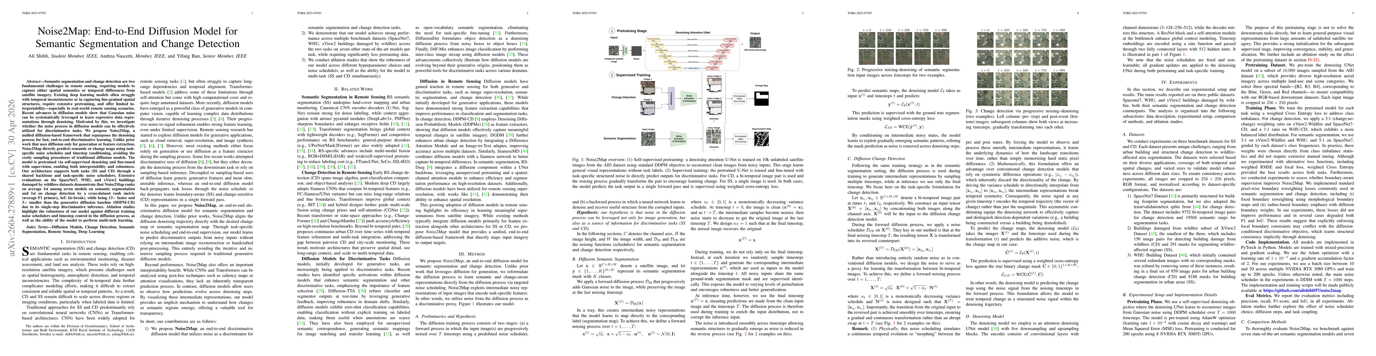
Semantic segmentation and change detection are two fundamental challenges in remote sensing, requiring models to capture either spatial semantics or temporal differences from satellite imagery. Existi...
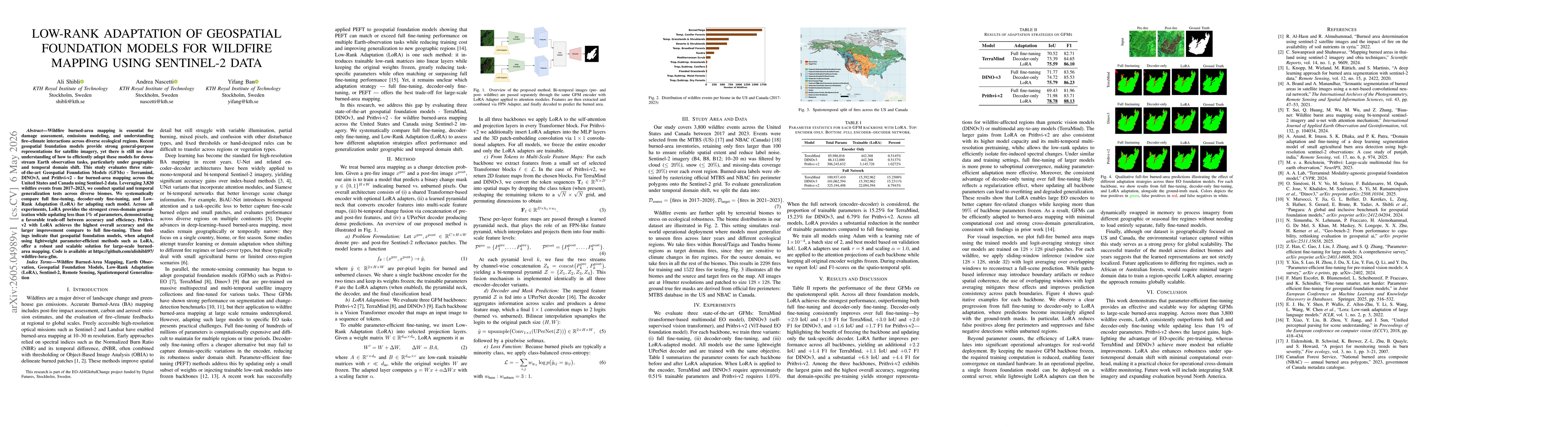
Wildfire burned-area mapping is essential for damage assessment, emissions modeling, and understanding fire-climate interactions across diverse ecological regions. Recent geospatial foundation models ...
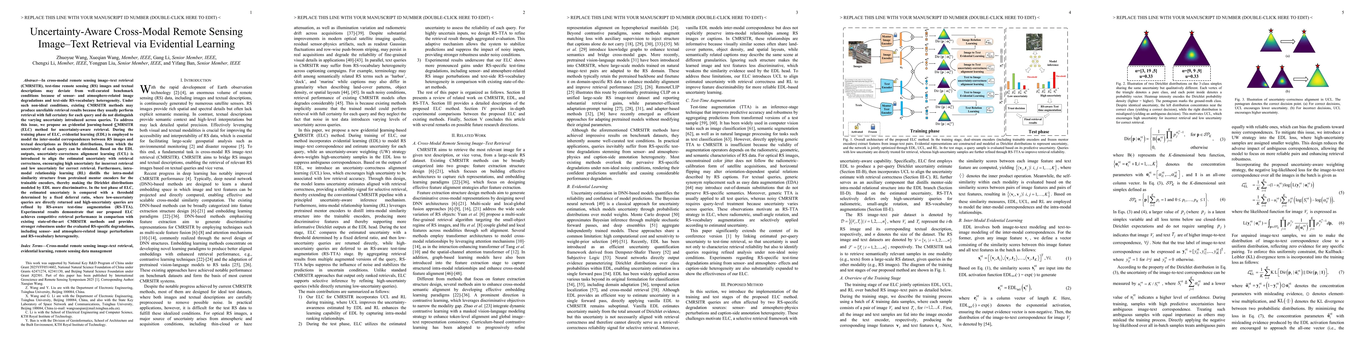
In cross-modal remote sensing image-text retrieval (CMRSITR), test-time remote sensing (RS) images and textual descriptions may deviate from well-curated benchmark conditions due to sensor- and atmosp...