Academic Profile
Statistics
Similar Authors
Papers on arXiv
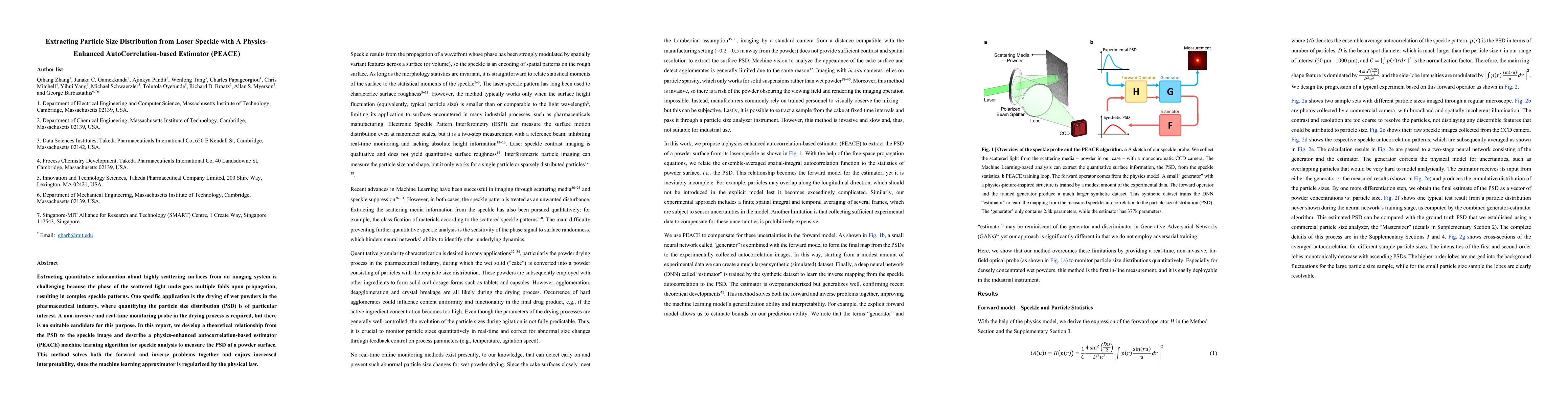
Extracting quantitative information about highly scattering surfaces from an imaging system is challenging because the phase of the scattered light undergoes multiple folds upon propagation, resulti...
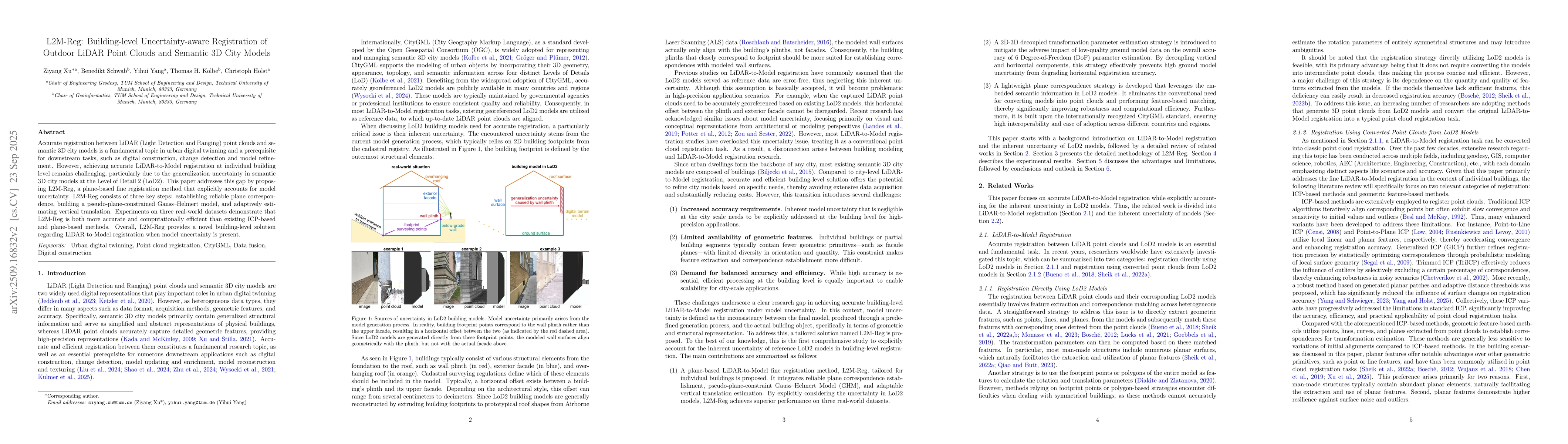
Accurate registration between LiDAR (Light Detection and Ranging) point clouds and semantic 3D city models is a fundamental topic in urban digital twinning and a prerequisite for downstream tasks, suc...
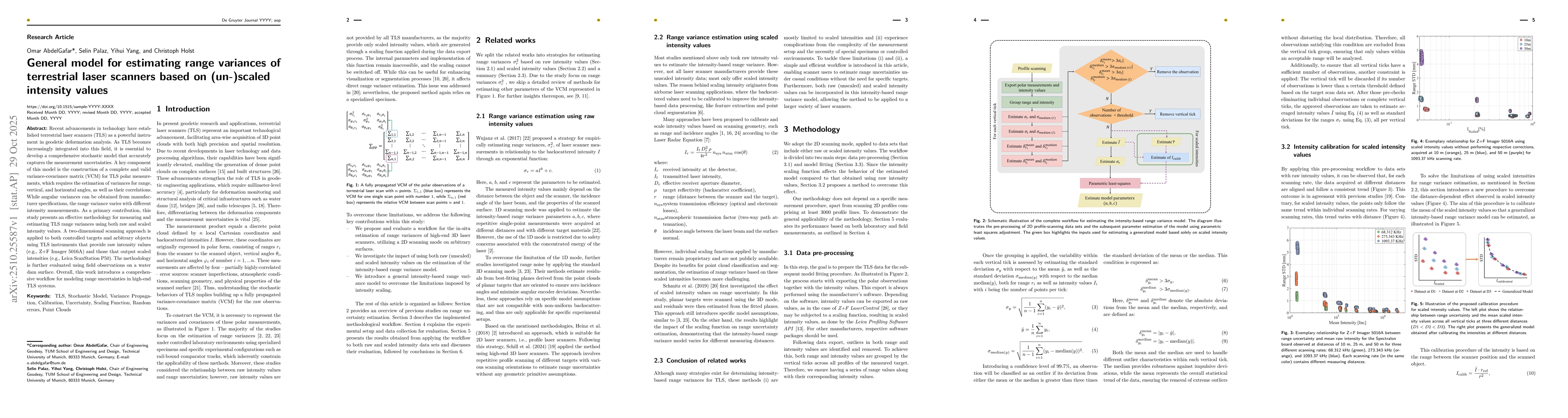
Recent advancements in technology have established terrestrial laser scanners (TLS) as a powerful instrument in geodetic deformation analysis. As TLS becomes increasingly integrated into this field, i...
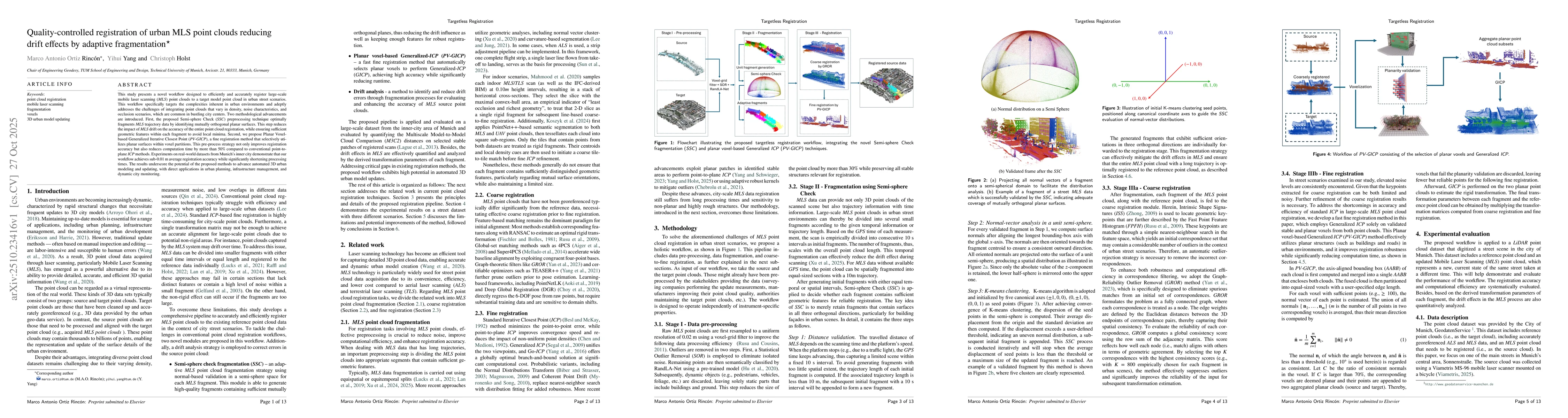
This study presents a novel workflow designed to efficiently and accurately register large-scale mobile laser scanning (MLS) point clouds to a target model point cloud in urban street scenarios. This ...
This paper addresses the problem of decomposed 4D scene reconstruction from multi-view videos. Recent methods achieve this by lifting video segmentation results to a 4D representation through differen...