Academic Profile
Statistics
Similar Authors
Papers on arXiv
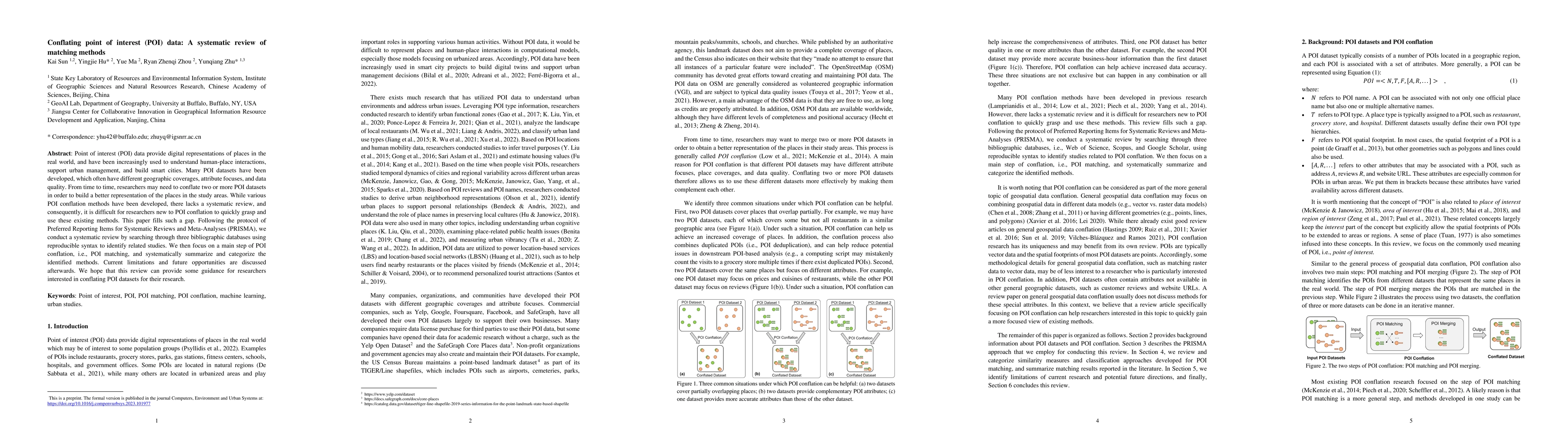
Point of interest (POI) data provide digital representations of places in the real world, and have been increasingly used to understand human-place interactions, support urban management, and build ...
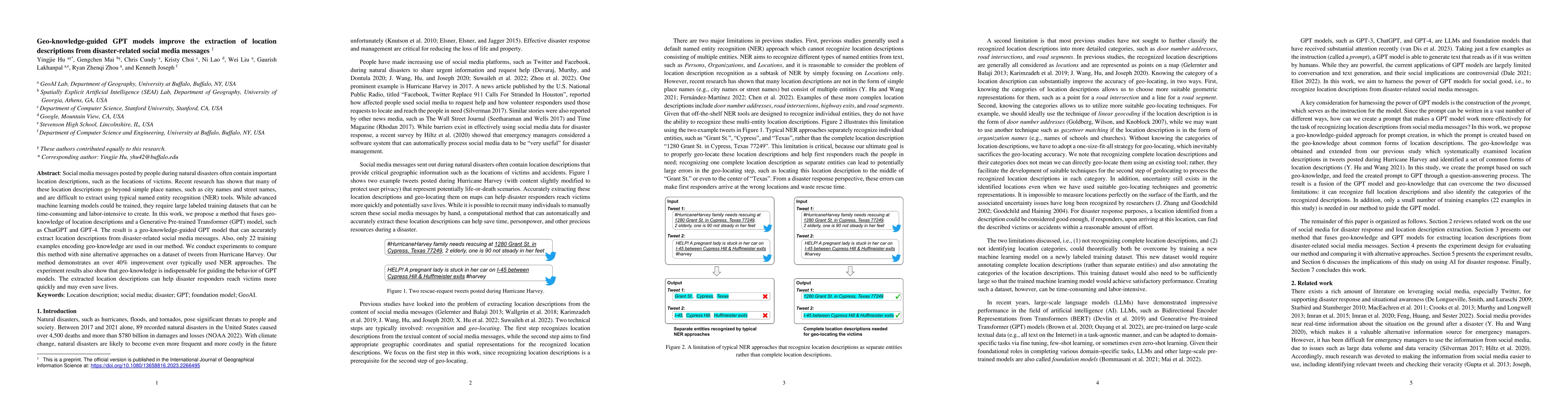
Social media messages posted by people during natural disasters often contain important location descriptions, such as the locations of victims. Recent research has shown that many of these location...
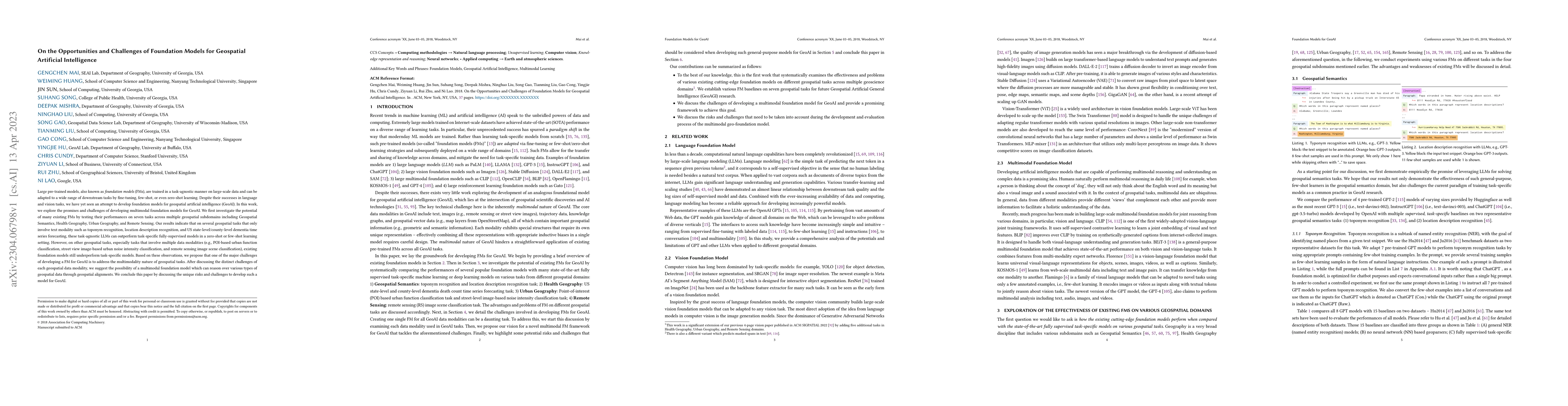
Large pre-trained models, also known as foundation models (FMs), are trained in a task-agnostic manner on large-scale data and can be adapted to a wide range of downstream tasks by fine-tuning, few-...
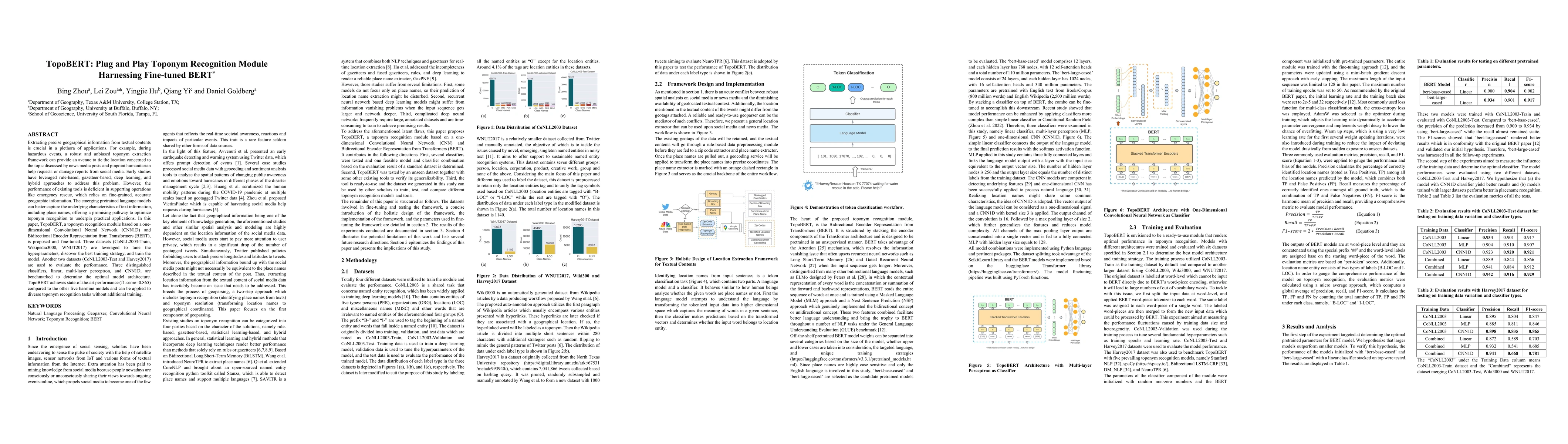
Extracting precise geographical information from textual contents is crucial in a plethora of applications. For example, during hazardous events, a robust and unbiased toponym extraction framework c...
Geospatial Artificial Intelligence (GeoAI) is an interdisciplinary field enjoying tremendous adoption. However, the efficient design and implementation of GeoAI systems face many open challenges. Th...
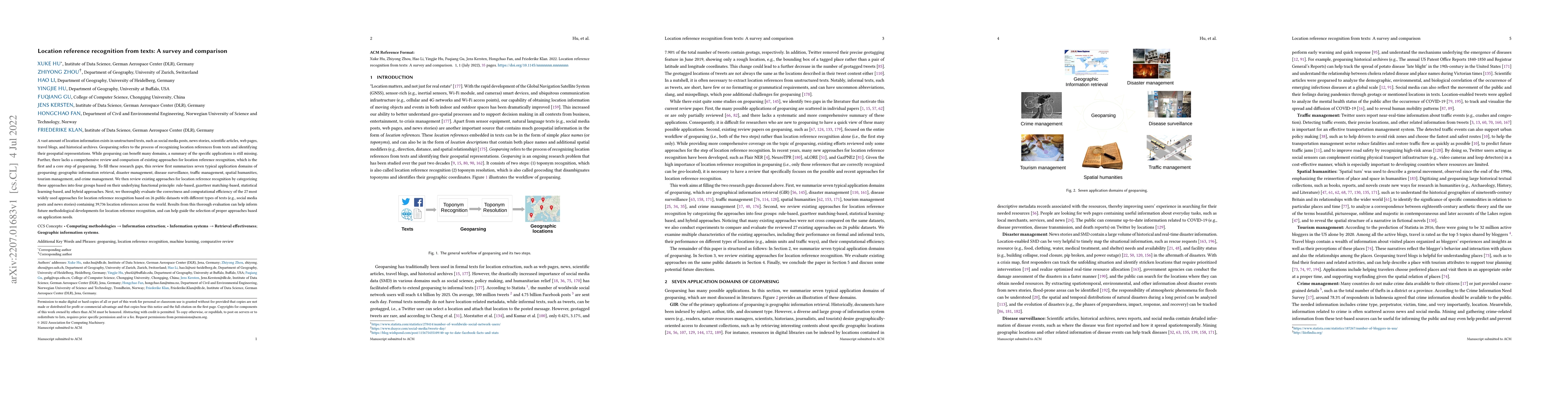
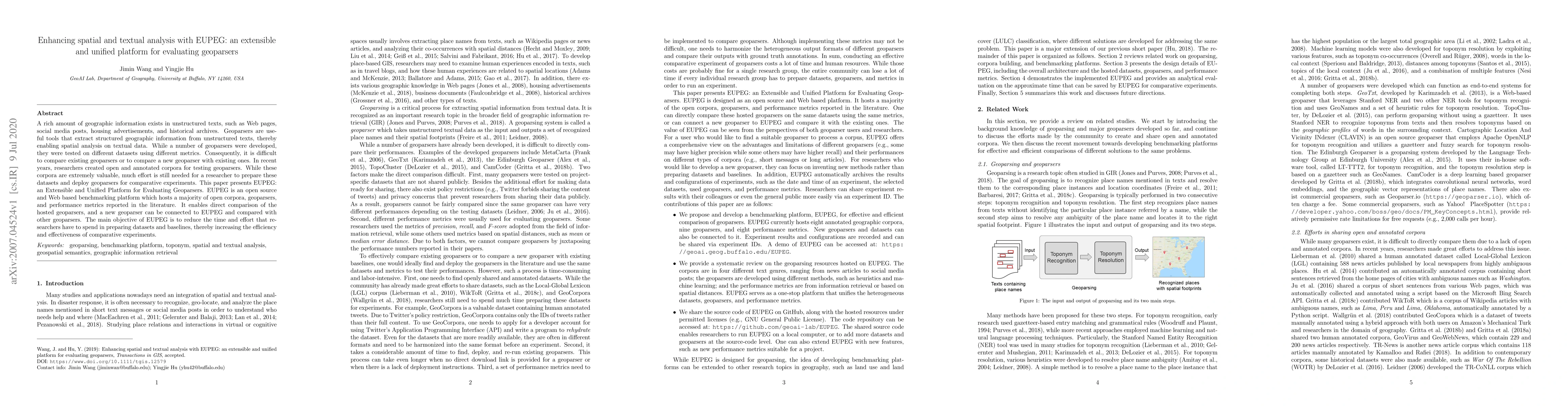
A vast amount of location information exists in unstructured texts, such as social media posts, news stories, scientific articles, web pages, travel blogs, and historical archives. Geoparsing refers...
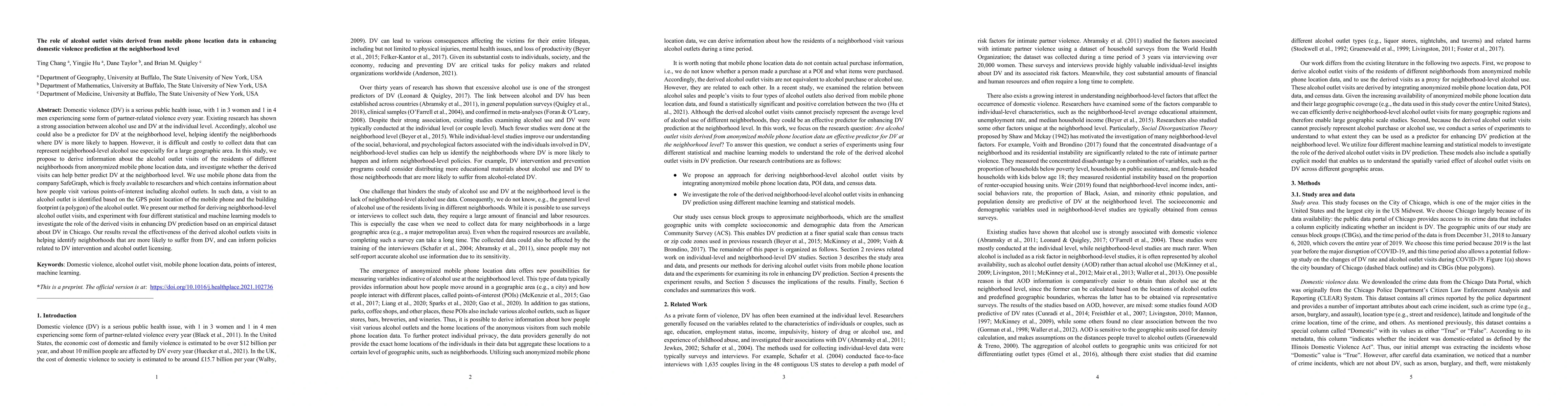
Domestic violence (DV) is a serious public health issue, with 1 in 3 women and 1 in 4 men experiencing some form of partner-related violence every year. Existing research has shown a strong associat...
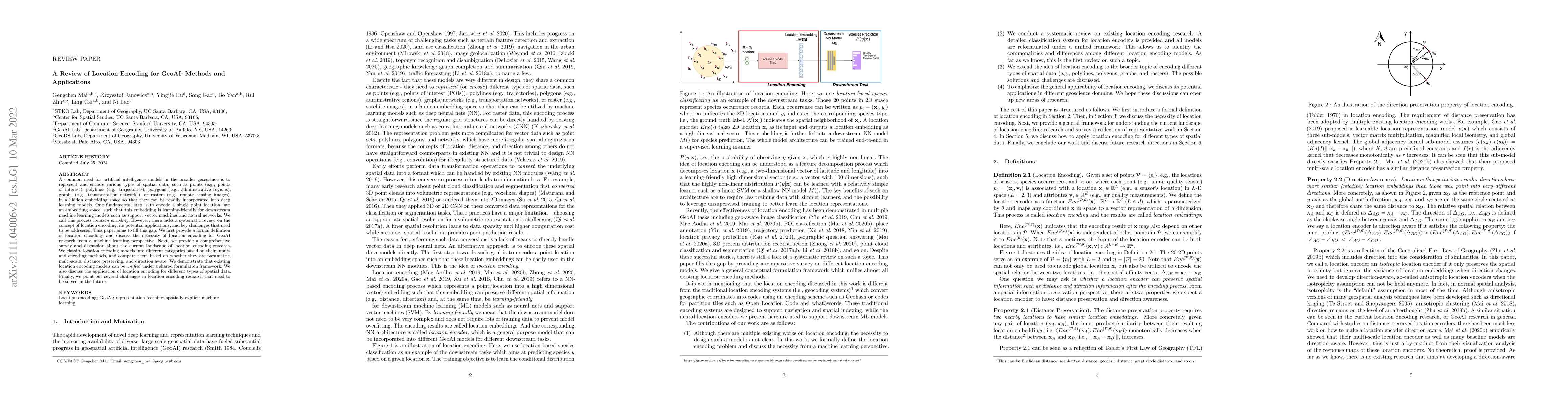
A common need for artificial intelligence models in the broader geoscience is to represent and encode various types of spatial data, such as points (e.g., points of interest), polylines (e.g., traje...
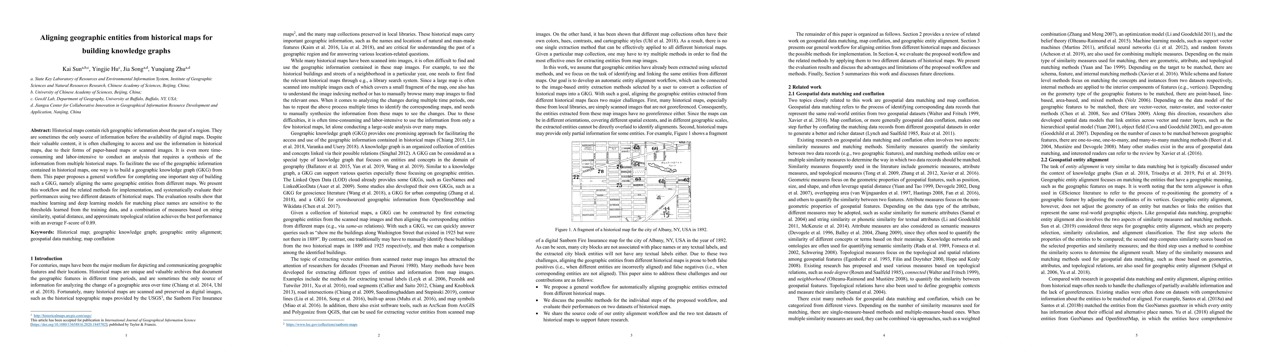
Historical maps contain rich geographic information about the past of a region. They are sometimes the only source of information before the availability of digital maps. Despite their valuable cont...
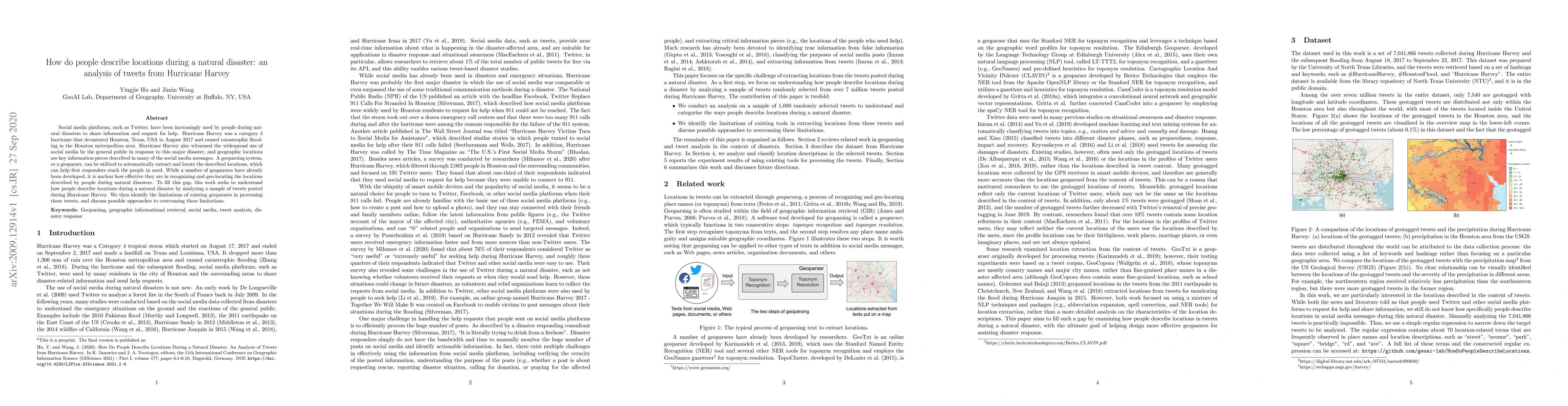
Social media platforms, such as Twitter, have been increasingly used by people during natural disasters to share information and request for help. Hurricane Harvey was a category 4 hurricane that de...
Spatial data science has emerged in recent years as an interdisciplinary field. This position paper discusses the importance of building and sharing high-quality datasets for spatial data science.
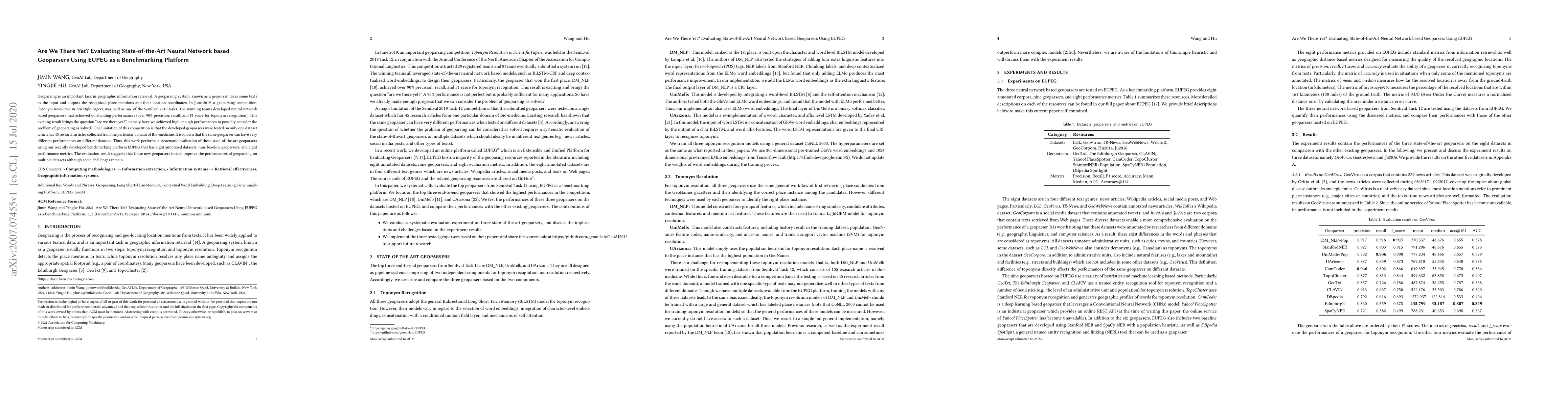
Geoparsing is an important task in geographic information retrieval. A geoparsing system, known as a geoparser, takes some texts as the input and outputs the recognized place mentions and their loca...
A rich amount of geographic information exists in unstructured texts, such as Web pages, social media posts, housing advertisements, and historical archives. Geoparsers are useful tools that extract...
Replicability and reproducibility (R&R) are critical for the long-term prosperity of a scientific discipline. In GIScience, researchers have discussed R&R related to different research topics and pr...
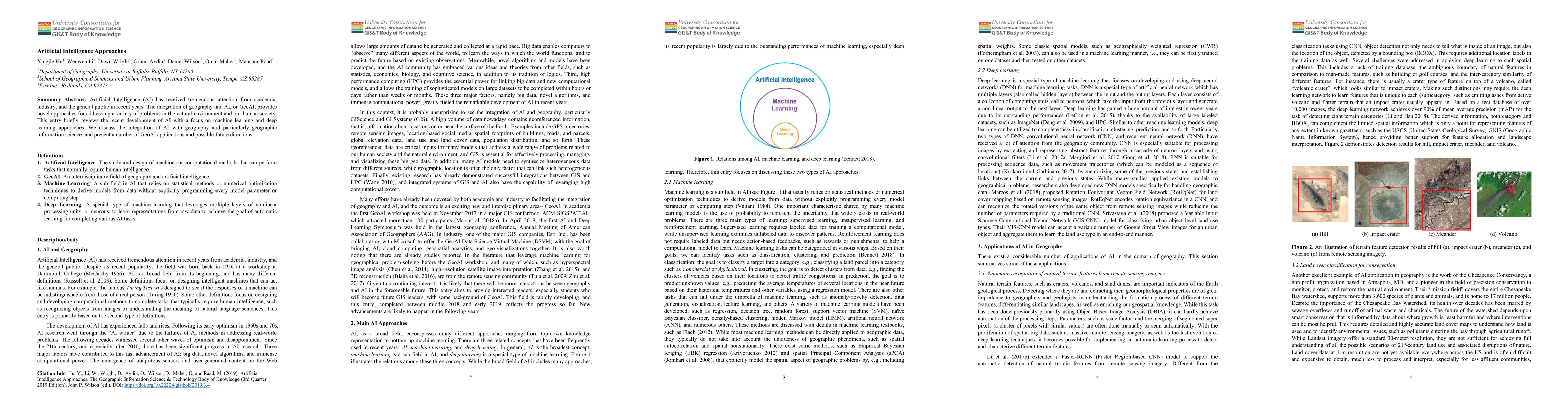
Artificial Intelligence (AI) has received tremendous attention from academia, industry, and the general public in recent years. The integration of geography and AI, or GeoAI, provides novel approach...
Geographical random forest (GRF) is a recently developed and spatially explicit machine learning model. With the ability to provide more accurate predictions and local interpretations, GRF has already...
Global Navigation Satellite Systems (GNSS) aided Inertial Navigation System (INS) is a fundamental approach for attaining continuously available absolute vehicle position and full state estimates at h...
This paper presents preliminary work on computing upper bounds on the estimation error covariance in the framework of the extended Kalman filter. The approach taken is using quadratic constraints to b...
This paper presents a novel constrained Factor Graph Optimization (FGO)-based approach for networked inertial navigation in pedestrian localization. To effectively mitigate the drift inherent in inert...
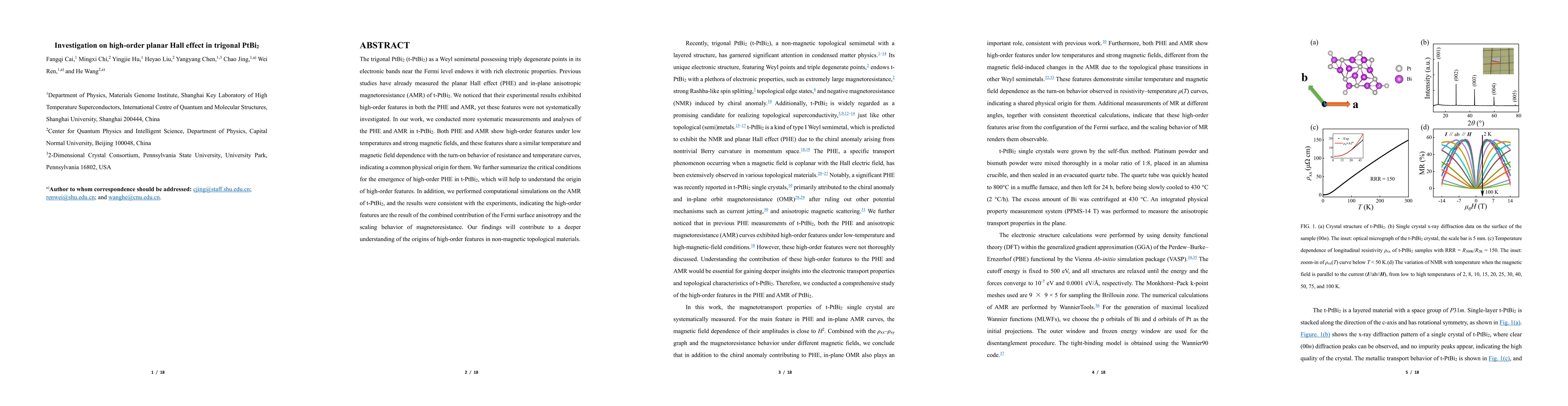
The trigonal PtBi$_2$ (t-PtBi$_2$) as a Weyl semimetal possessing triply degenerate points in its electronic bands near the Fermi level endows it with rich electronic properties. Previous studies have...
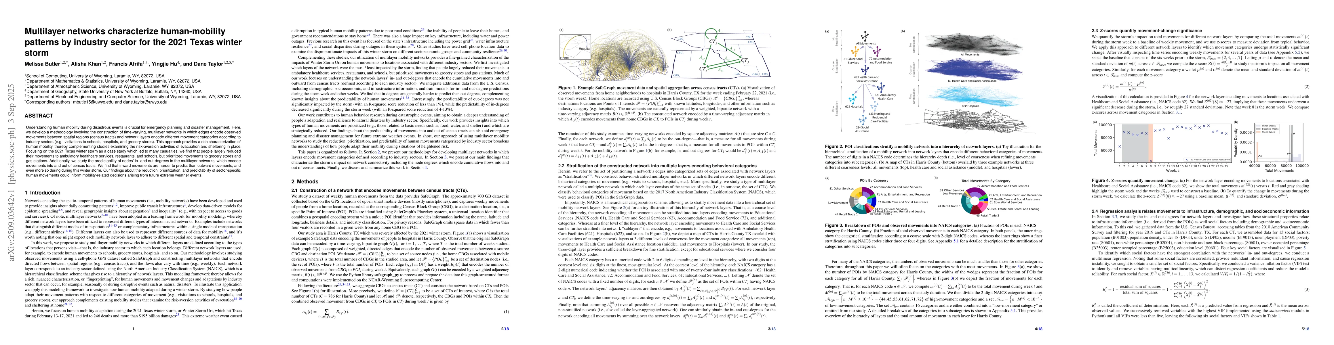
Understanding human mobility during disastrous events is crucial for emergency planning and disaster management. Here, we develop a methodology involving the construction of time-varying, multilayer n...
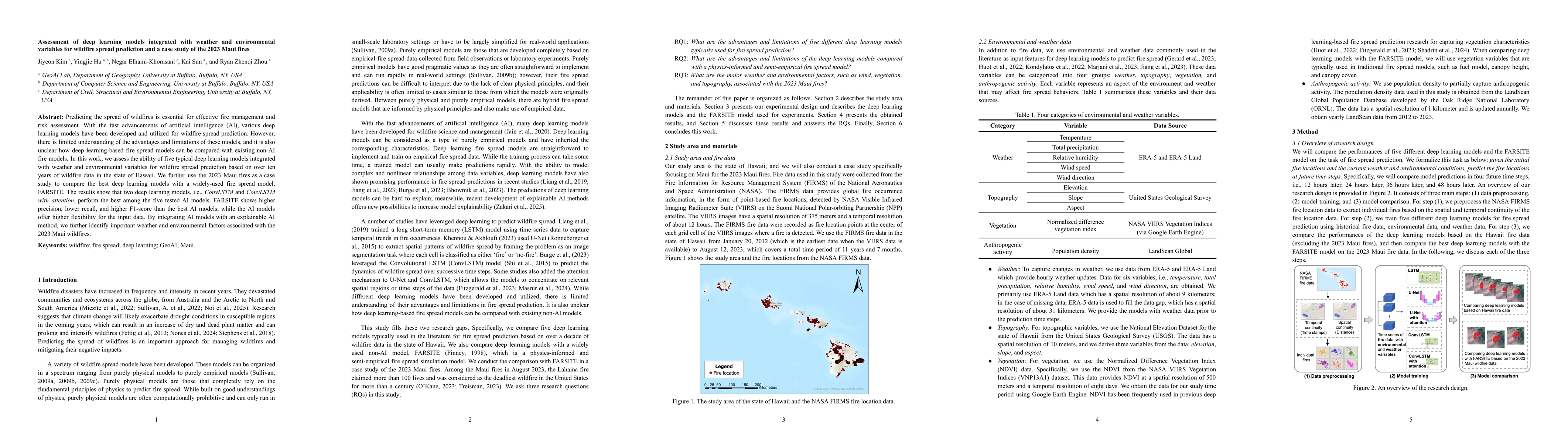
Predicting the spread of wildfires is essential for effective fire management and risk assessment. With the fast advancements of artificial intelligence (AI), various deep learning models have been de...
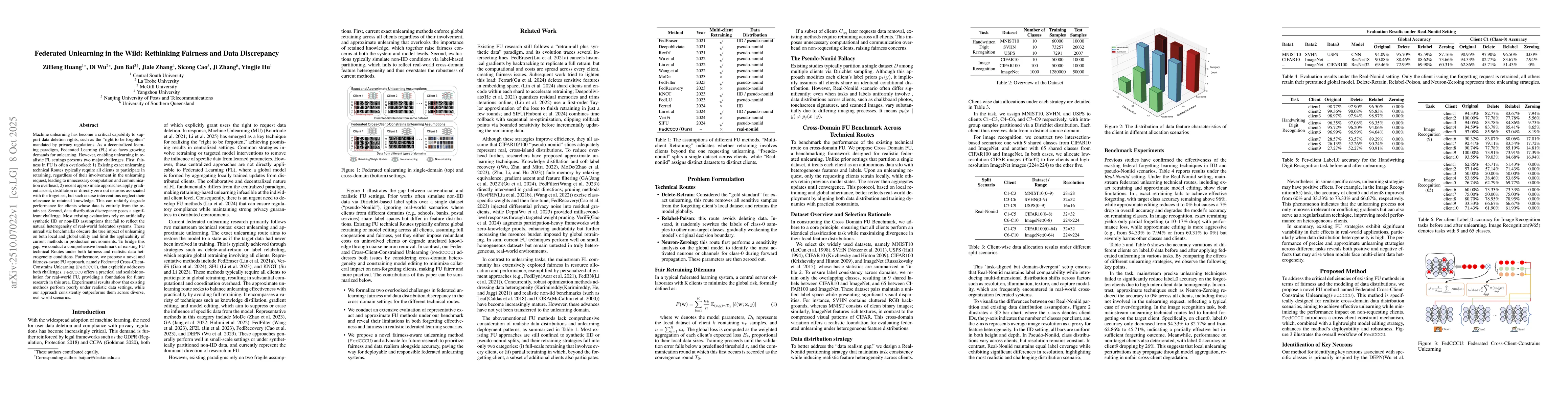
Machine unlearning is critical for enforcing data deletion rights like the "right to be forgotten." As a decentralized paradigm, Federated Learning (FL) also requires unlearning, but realistic impleme...
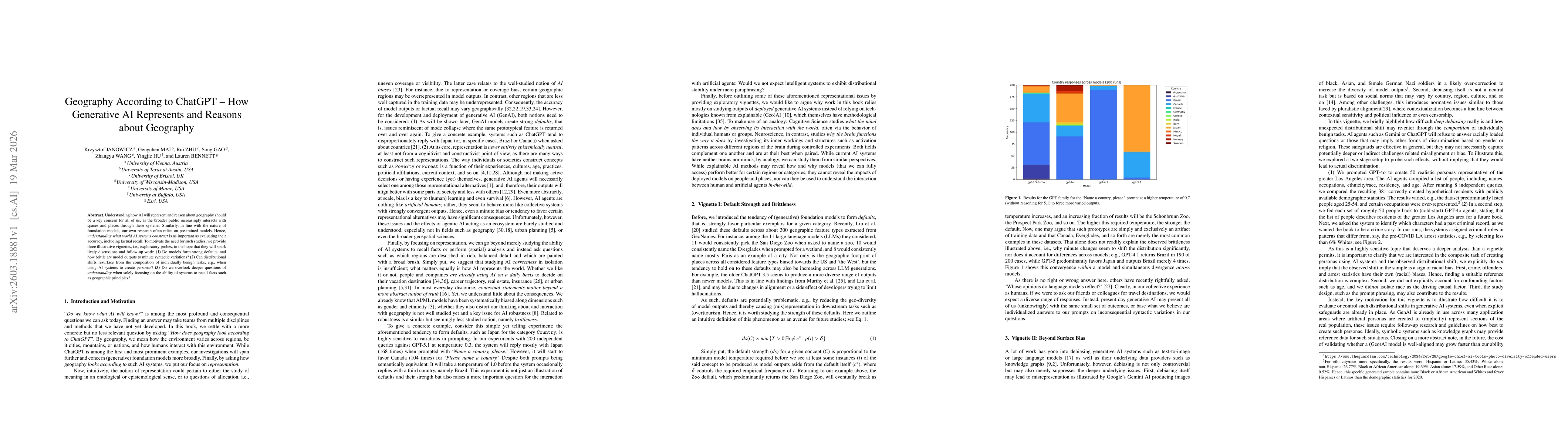
Understanding how AI will represent and reason about geography should be a key concern for all of us, as the broader public increasingly interacts with spaces and places through these systems. Similar...
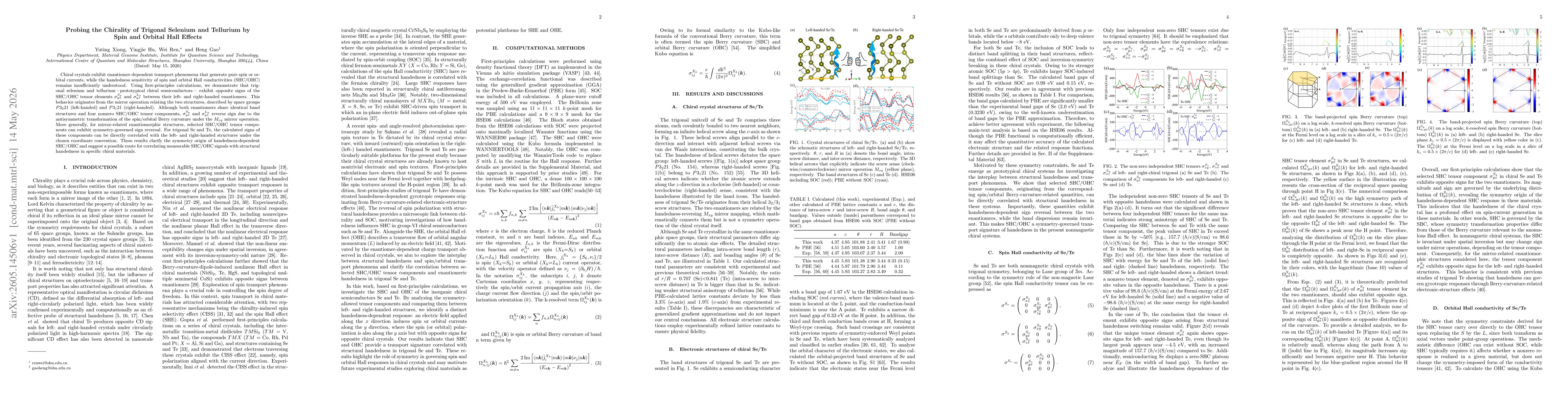
Chiral crystals exhibit enantiomer-dependent transport phenomena that generate pure spin or orbital currents, while the handedness sensitivity of spin and orbital Hall conductivities (SHC/OHC) remains...
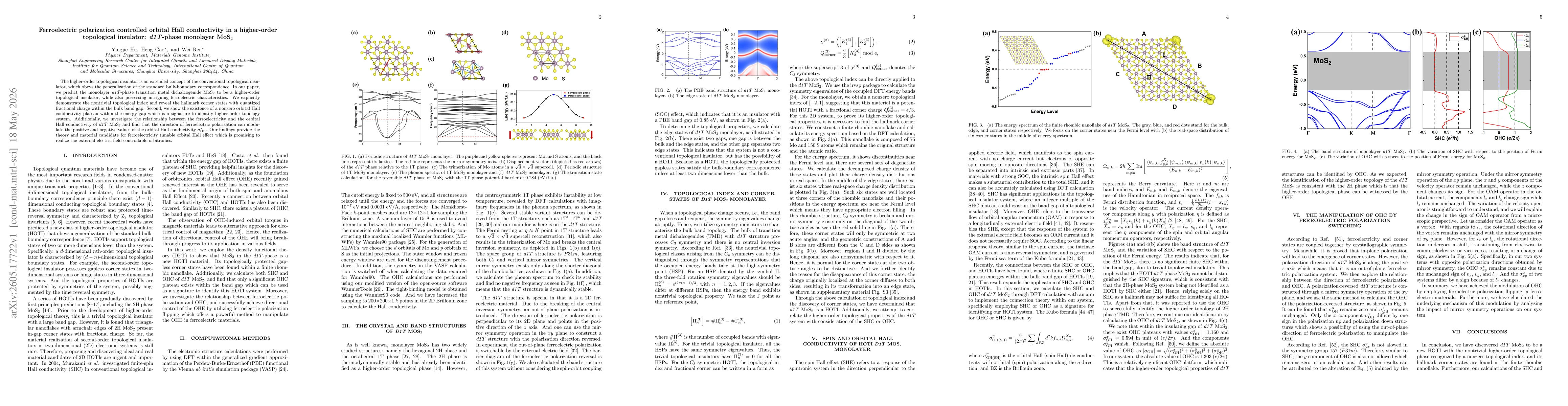
The higher-order topological insulator is an extended concept of the conventional topological insulator, which obeys the generalization of the standard bulk-boundary correspondence. In our paper, we p...
Elliptic quantum algebra is the algebraic structure characterized by the elliptic solution of the Yang-Baxter equation. In this paper, we construct a family of central elements \( \mathfrak{z}(z) \) f...