Academic Profile
Statistics
Similar Authors
Papers on arXiv
Large-scale high-resolution land cover classification is a prerequisite for constructing Earth system models and addressing ecological and resource issues. Advancements in satellite sensor technolog...
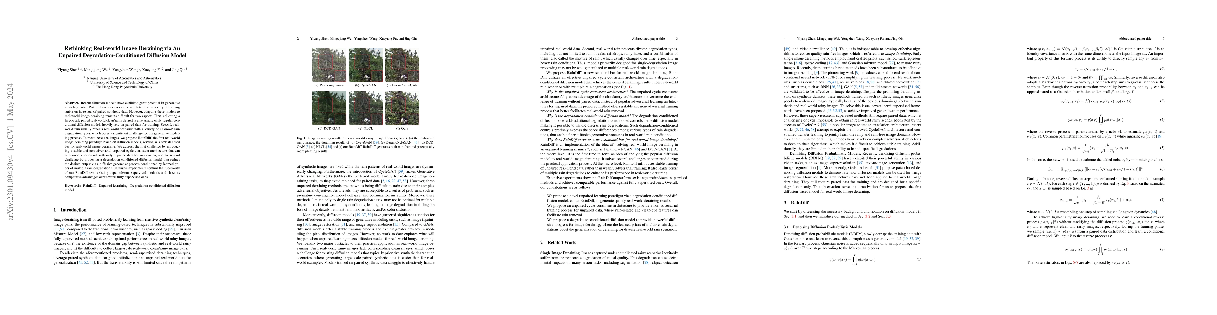
Recent diffusion models have exhibited great potential in generative modeling tasks. Part of their success can be attributed to the ability of training stable on huge sets of paired synthetic data. ...
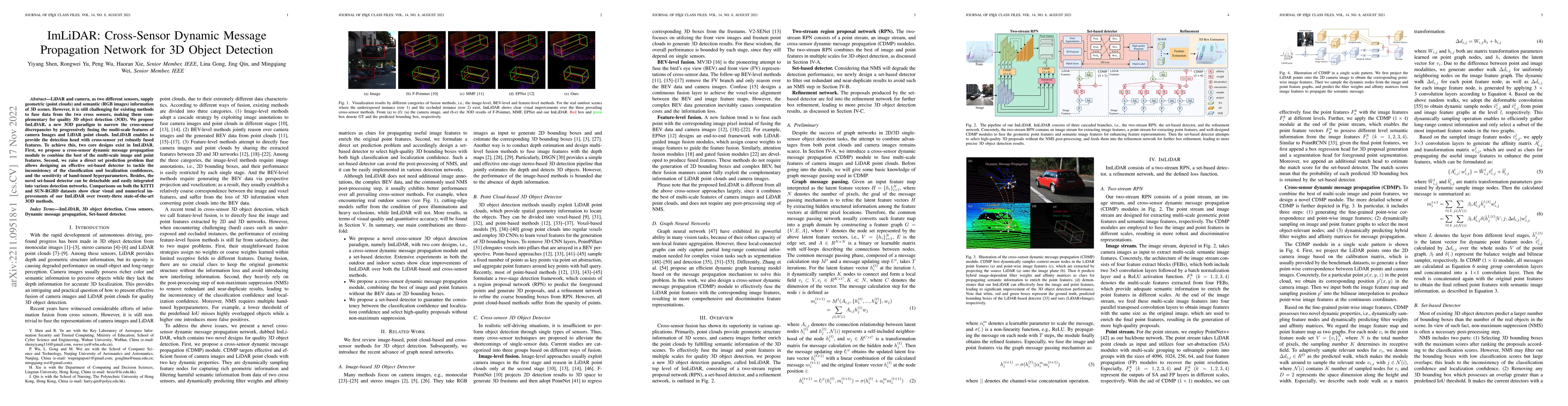
LiDAR and camera, as two different sensors, supply geometric (point clouds) and semantic (RGB images) information of 3D scenes. However, it is still challenging for existing methods to fuse data fro...
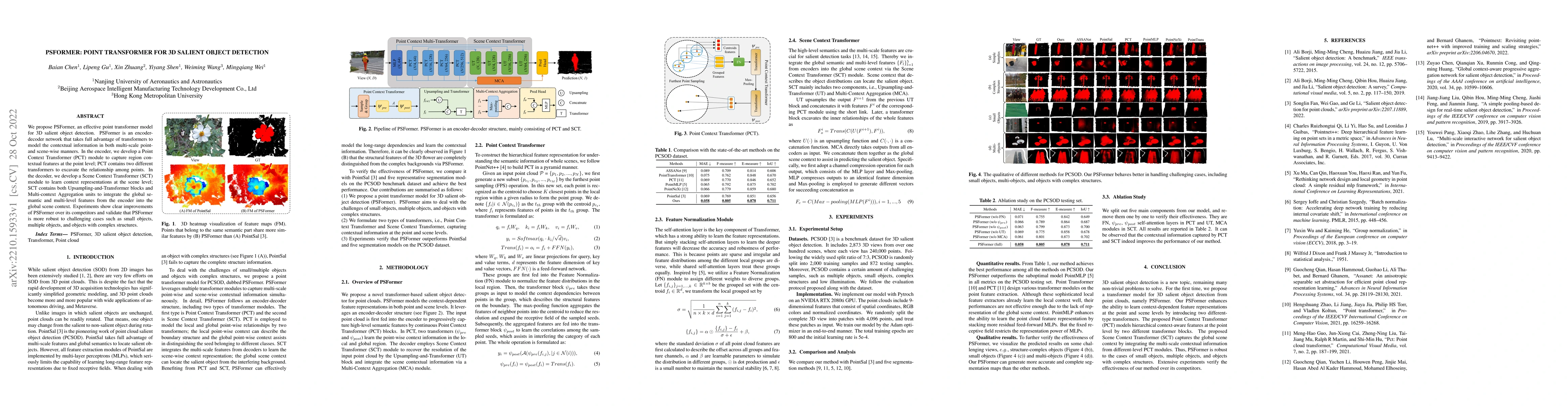
We propose PSFormer, an effective point transformer model for 3D salient object detection. PSFormer is an encoder-decoder network that takes full advantage of transformers to model the contextual in...
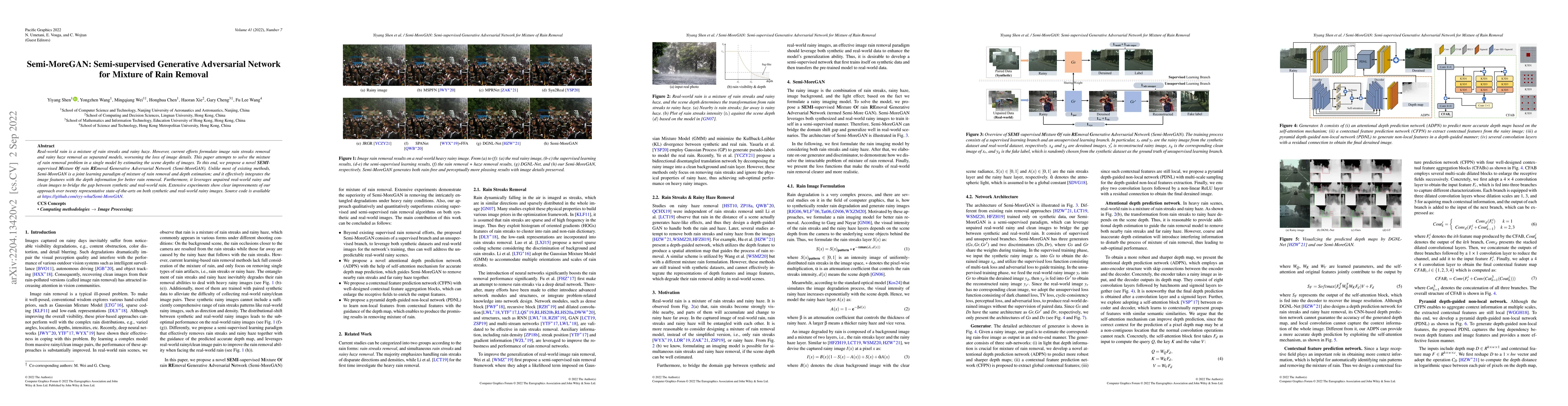
Rain is one of the most common weather which can completely degrade the image quality and interfere with the performance of many computer vision tasks, especially under heavy rain conditions. We obs...
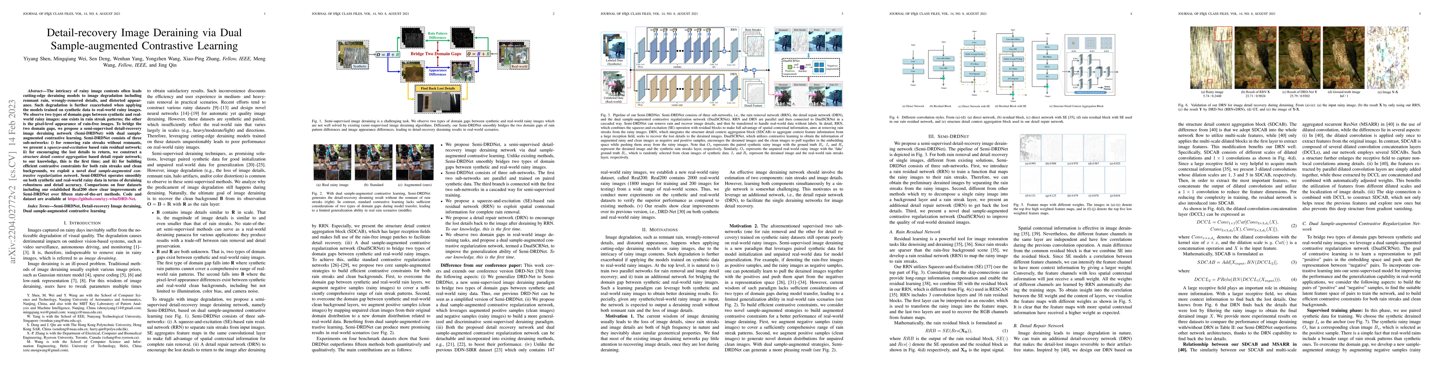
The intricacy of rainy image contents often leads cutting-edge deraining models to image degradation including remnant rain, wrongly-removed details, and distorted appearance. Such degradation is fu...
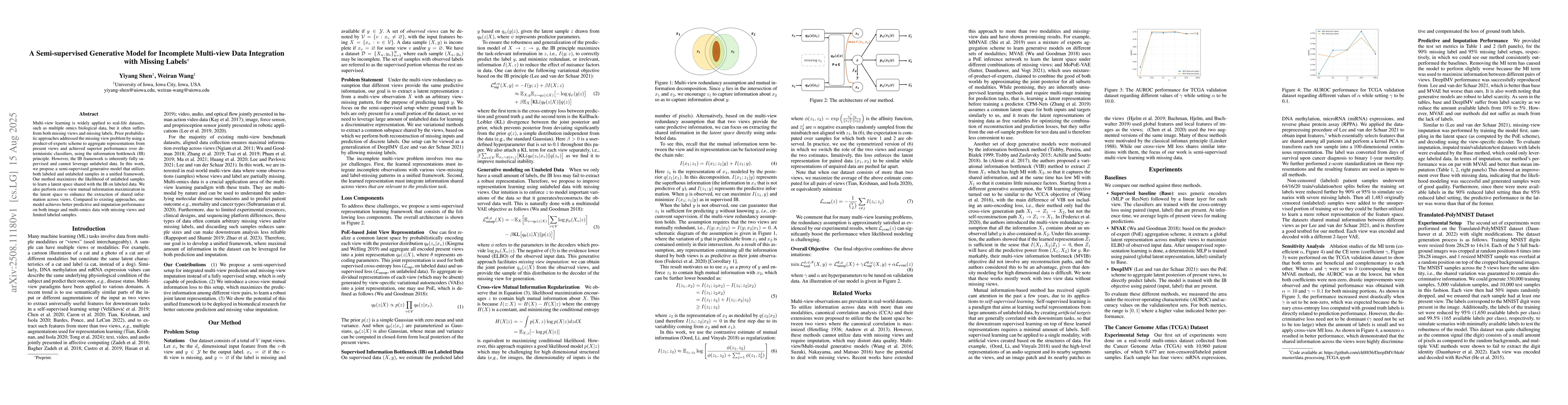
Multi-view learning is widely applied to real-life datasets, such as multiple omics biological data, but it often suffers from both missing views and missing labels. Prior probabilistic approaches add...
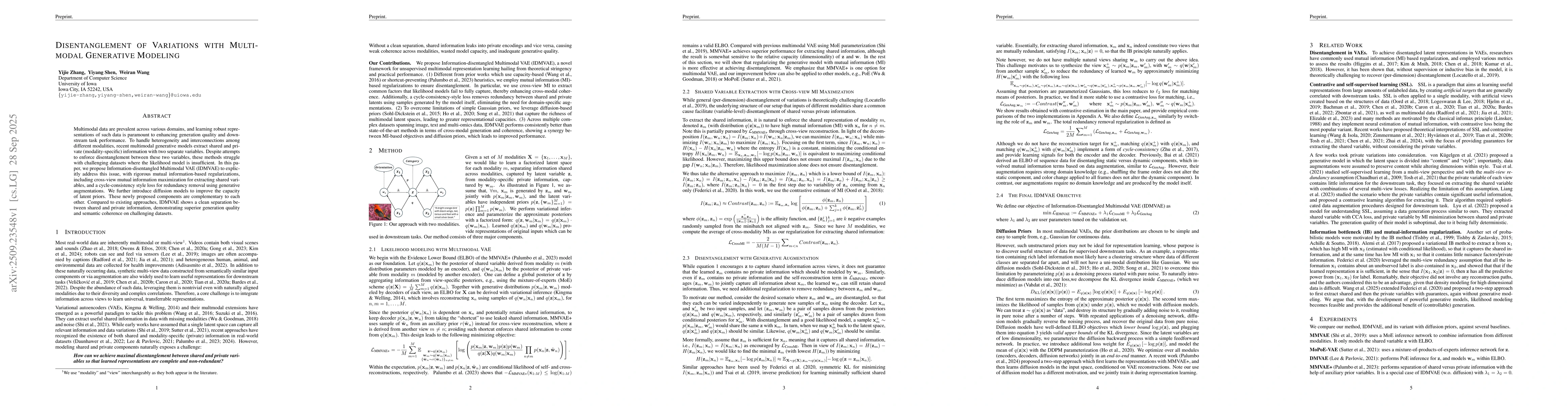
Multimodal data are prevalent across various domains, and learning robust representations of such data is paramount to enhancing generation quality and downstream task performance. To handle heterogen...
Reinforcement Learning (RL) has been shown to substantially improve the reasoning capability of small and large language models (LLMs), but existing approaches typically rely on verifiable rewards, he...
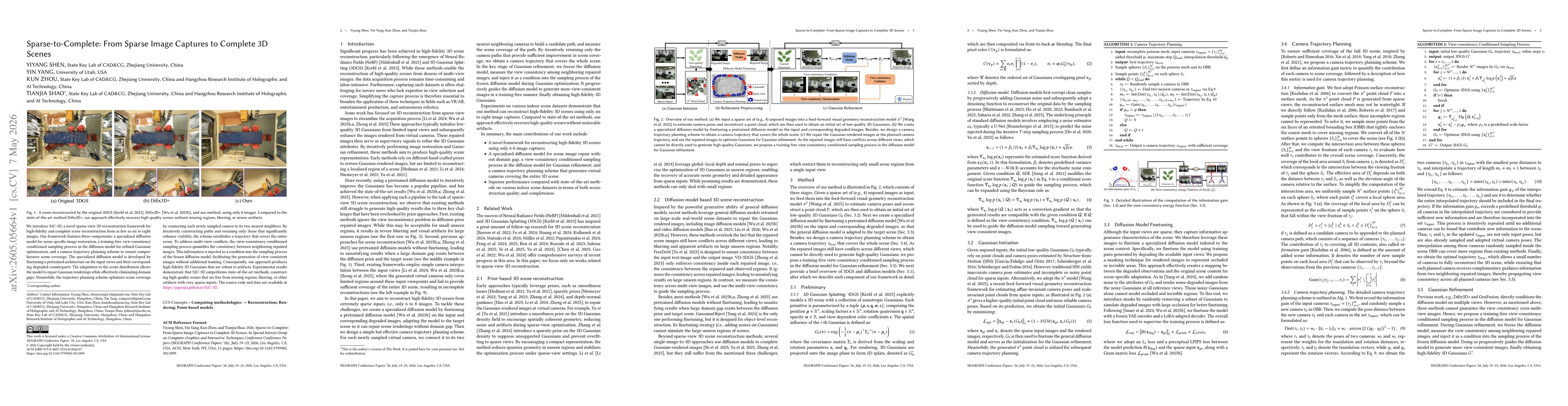
We introduce S2C-3D, a novel sparse-view 3D reconstruction framework for high-fidelity and complete scene reconstruction from as few as six to eight images. Our framework features three components: a ...
We study a class of bilevel optimization problems in which both the upper- and lower-level problems have minimax structures. This setting captures a broad range of emerging applications. Despite the e...