Academic Profile
Statistics
Similar Authors
Papers on arXiv
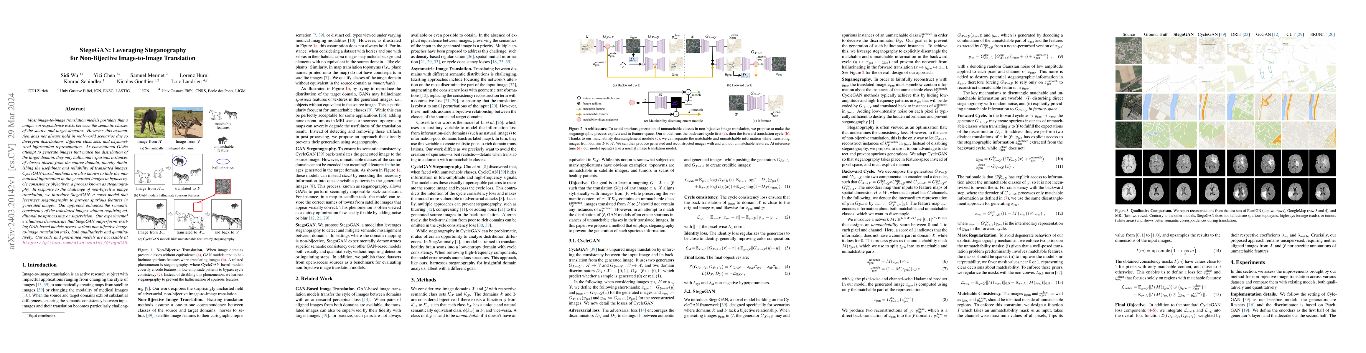
Most image-to-image translation models postulate that a unique correspondence exists between the semantic classes of the source and target domains. However, this assumption does not always hold in r...
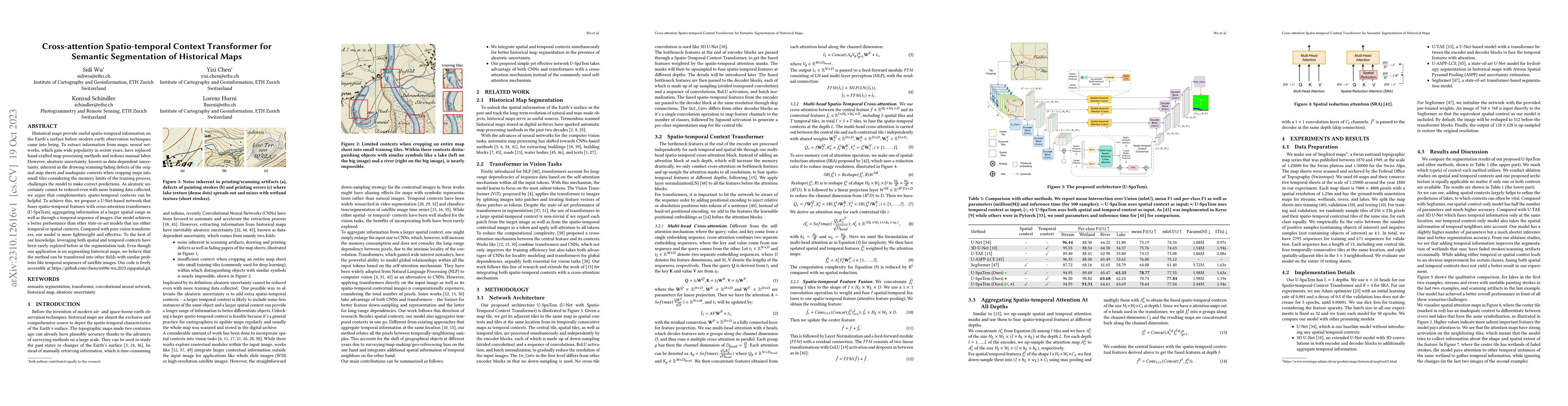
Historical maps provide useful spatio-temporal information on the Earth's surface before modern earth observation techniques came into being. To extract information from maps, neural networks, which...
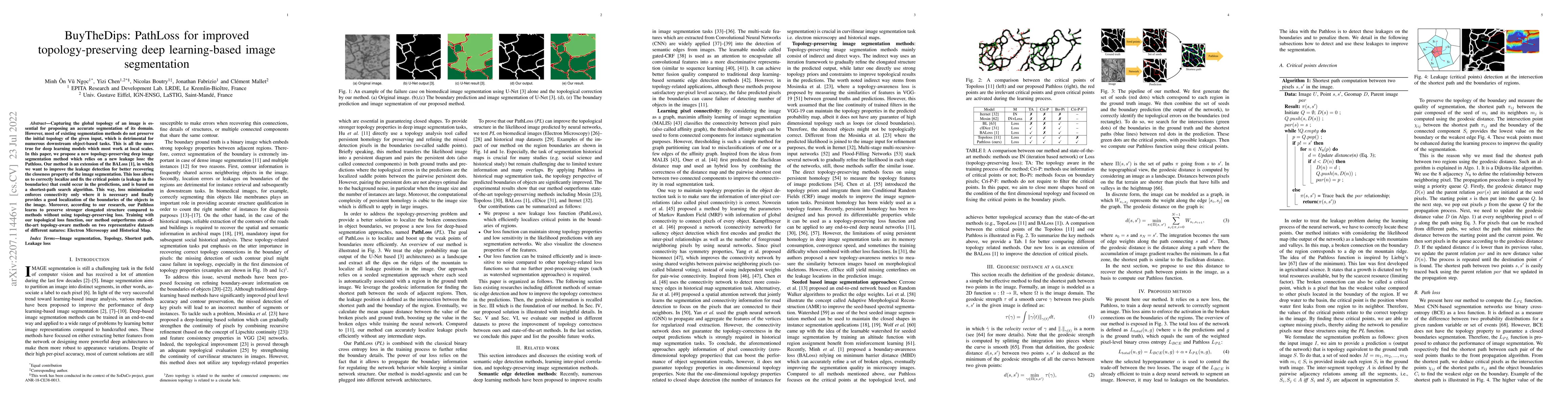
Capturing the global topology of an image is essential for proposing an accurate segmentation of its domain. However, most of existing segmentation methods do not preserve the initial topology of th...
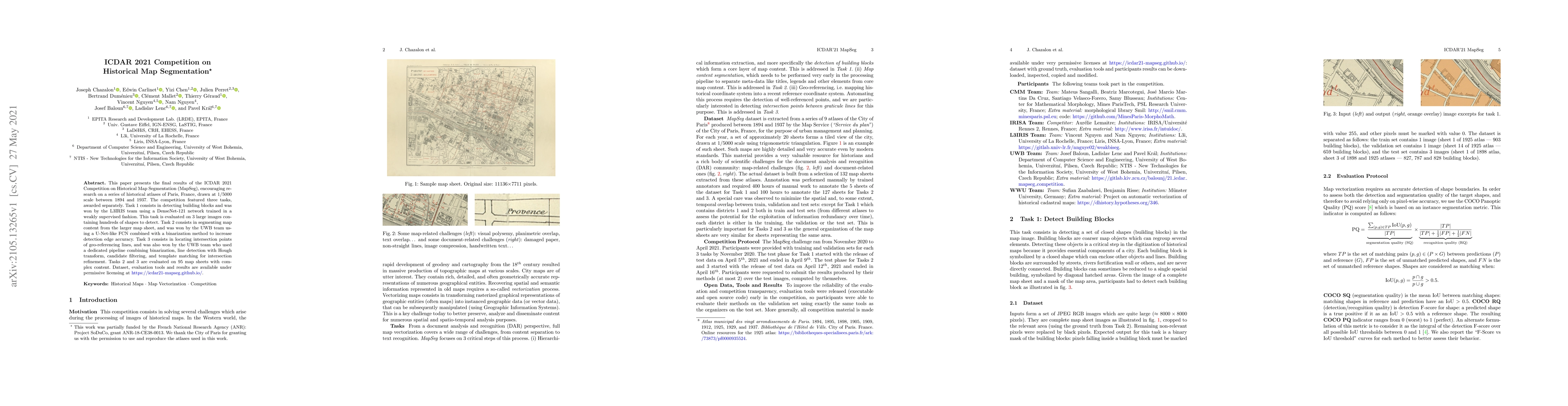
This paper presents the final results of the ICDAR 2021 Competition on Historical Map Segmentation (MapSeg), encouraging research on a series of historical atlases of Paris, France, drawn at 1/5000 ...
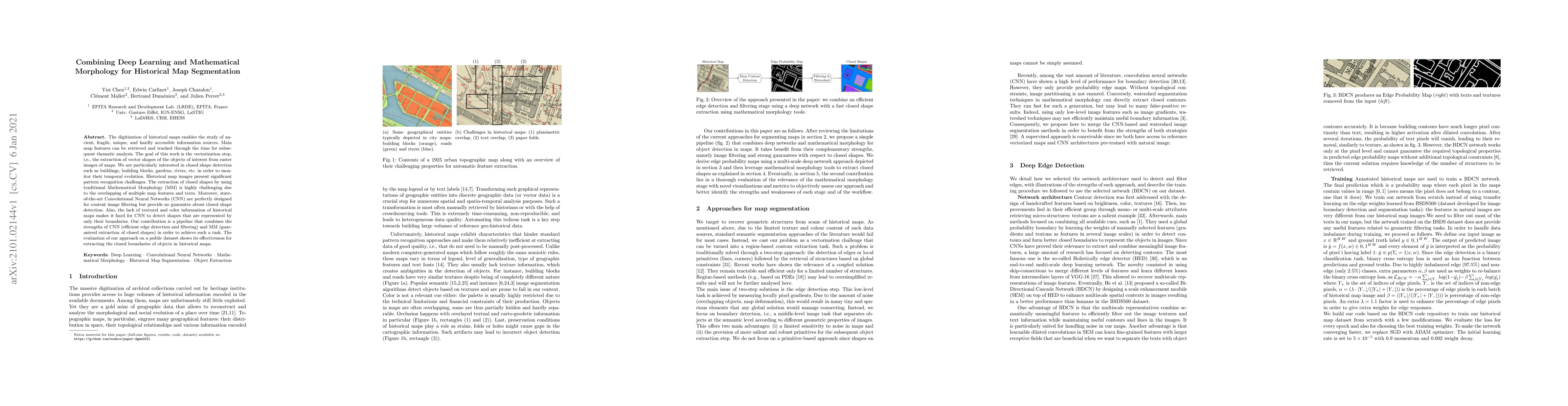
The digitization of historical maps enables the study of ancient, fragile, unique, and hardly accessible information sources. Main map features can be retrieved and tracked through the time for subs...
Historical maps provide valuable information and knowledge about the past. However, as they often feature non-standard projections, hand-drawn styles, and artistic elements, it is challenging for non-...
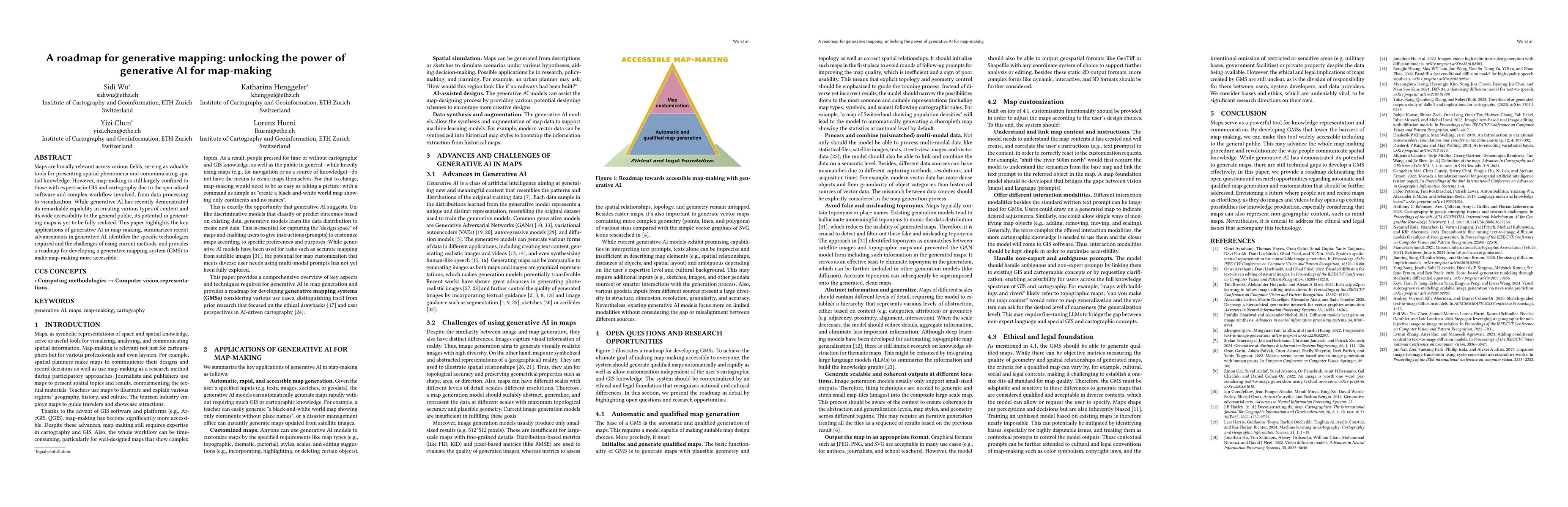
Maps are broadly relevant across various fields, serving as valuable tools for presenting spatial phenomena and communicating spatial knowledge. However, map-making is still largely confined to those ...
We develop an algorithm for computing the motivic Hilbert zeta function for curve singularities with a monomial local ring. It is well known that the Hilbert scheme of points on a smooth curve is isom...
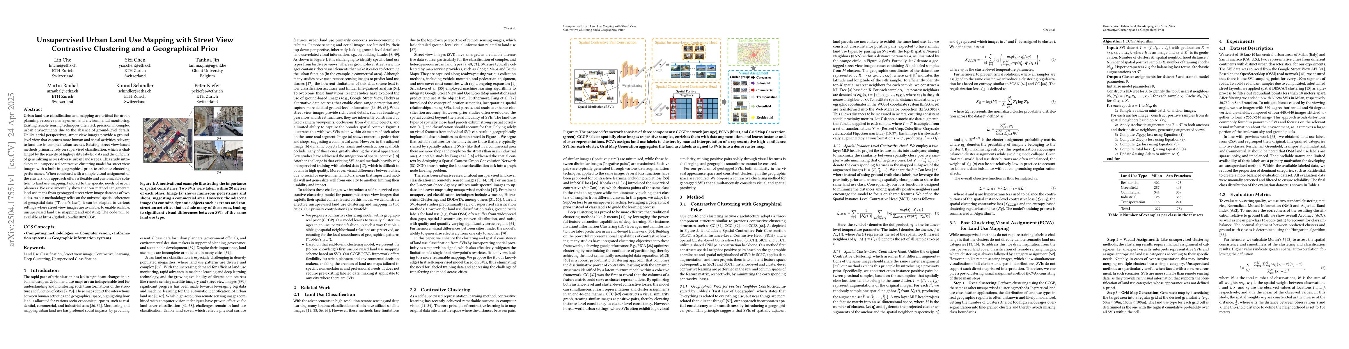
Urban land use classification and mapping are critical for urban planning, resource management, and environmental monitoring. Existing remote sensing techniques often lack precision in complex urban e...
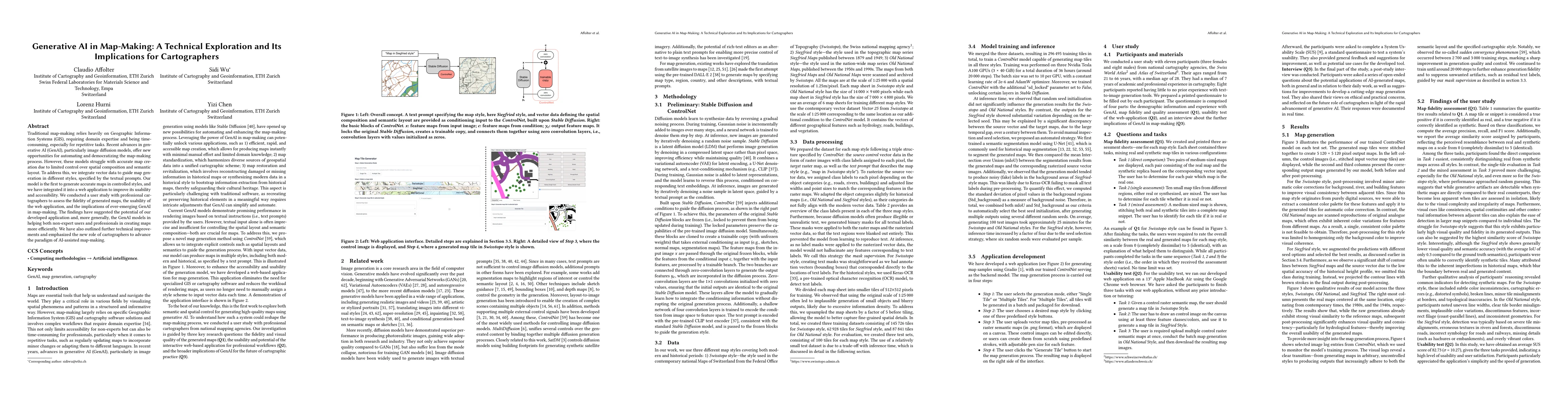
Traditional map-making relies heavily on Geographic Information Systems (GIS), requiring domain expertise and being time-consuming, especially for repetitive tasks. Recent advances in generative AI (G...
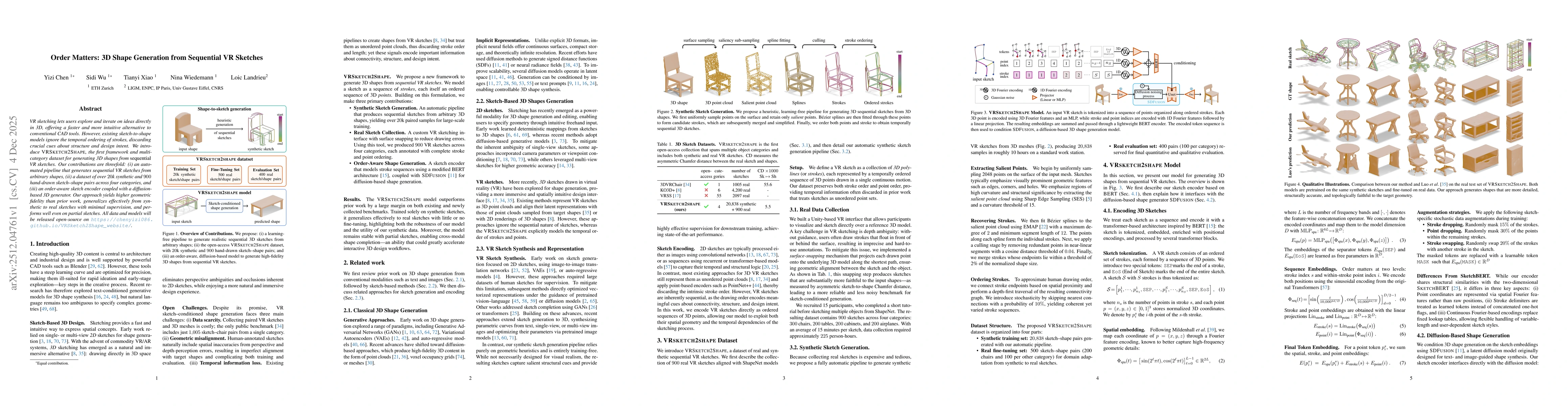
VR sketching lets users explore and iterate on ideas directly in 3D, offering a faster and more intuitive alternative to conventional CAD tools. However, existing sketch-to-shape models ignore the tem...
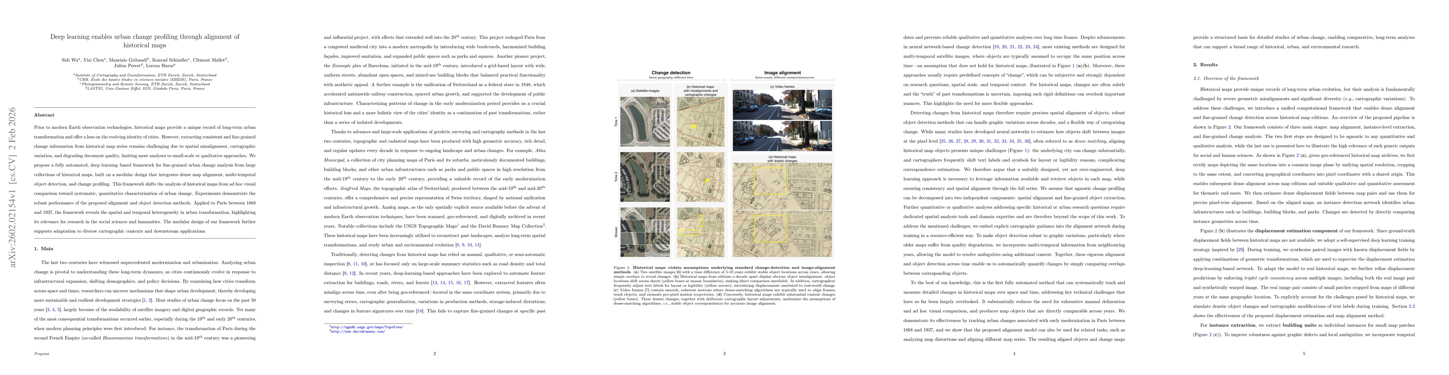
Prior to modern Earth observation technologies, historical maps provide a unique record of long-term urban transformation and offer a lens on the evolving identity of cities. However, extracting consi...
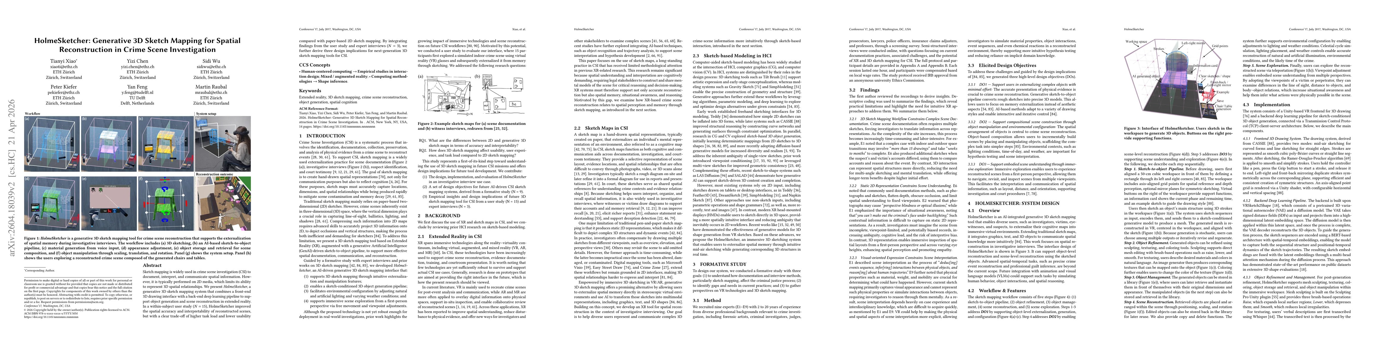
Sketch mapping is widely used in crime scene investigation (CSI) to document, interpret, and communicate spatial information. However, it is typically performed on 2D media, which limits its ability t...