Academic Profile
Statistics
Similar Authors
Papers on arXiv
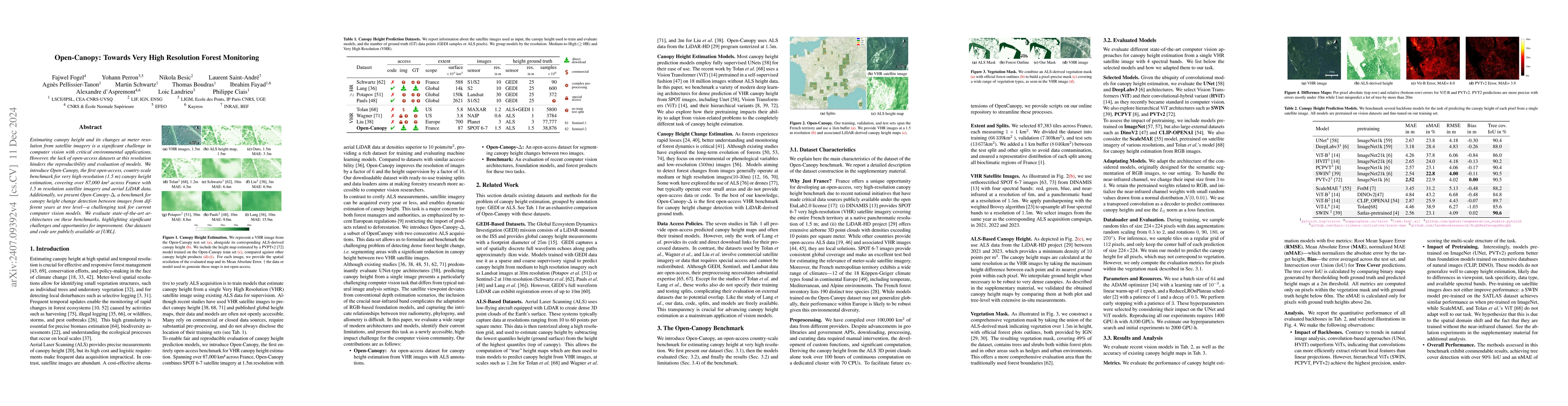
Estimating canopy height and canopy height change at meter resolution from satellite imagery has numerous applications, such as monitoring forest health, logging activities, wood resources, and carbon...
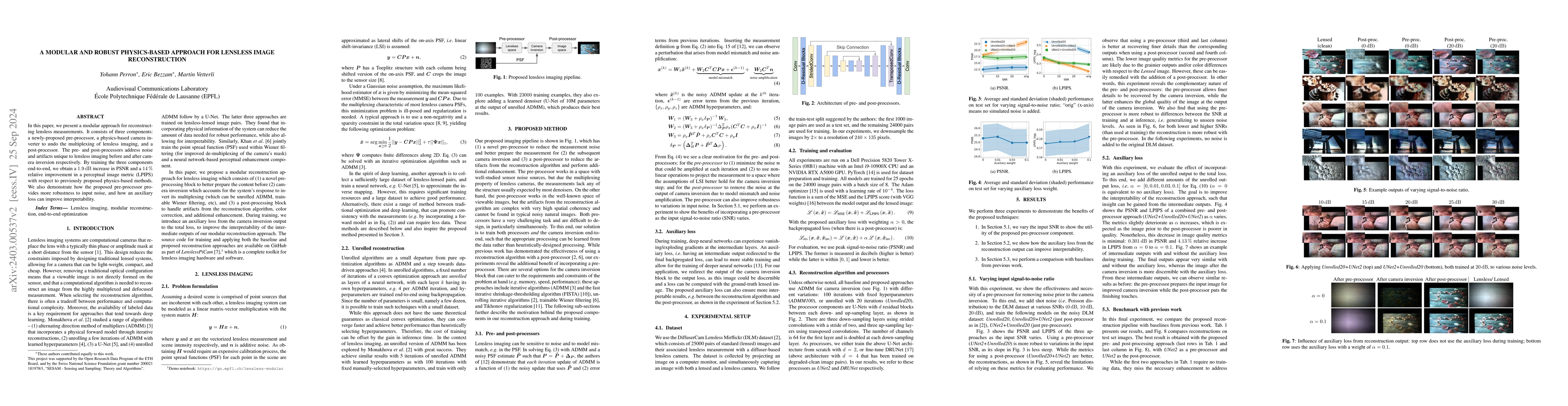
In this paper, we present a modular approach for reconstructing lensless measurements. It consists of three components: a newly-proposed pre-processor, a physics-based camera inverter to undo the mu...
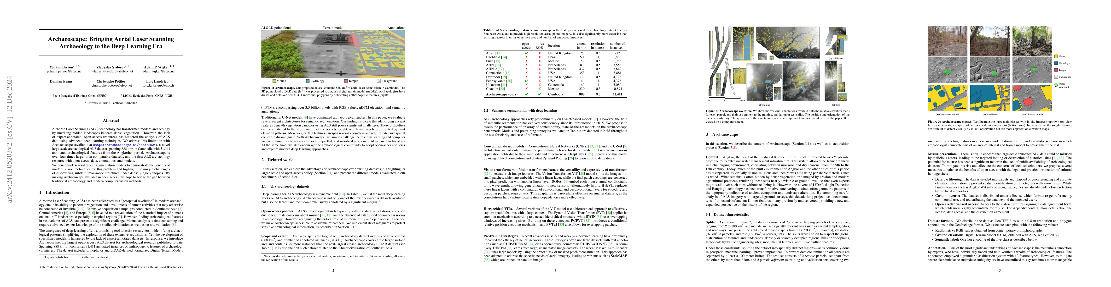
Airborne Laser Scanning (ALS) technology has transformed modern archaeology by unveiling hidden landscapes beneath dense vegetation. However, the lack of expert-annotated, open-access resources has hi...
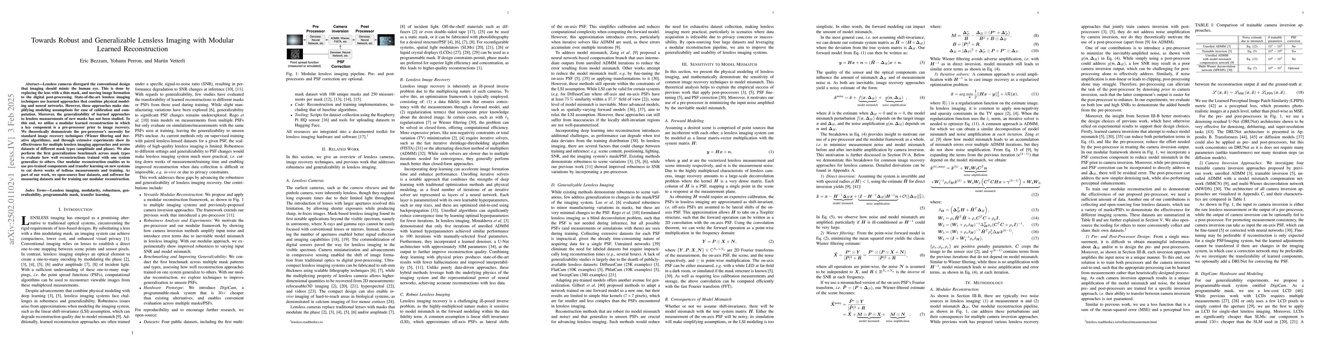
Lensless cameras disregard the conventional design that imaging should mimic the human eye. This is done by replacing the lens with a thin mask, and moving image formation to the digital post-processi...
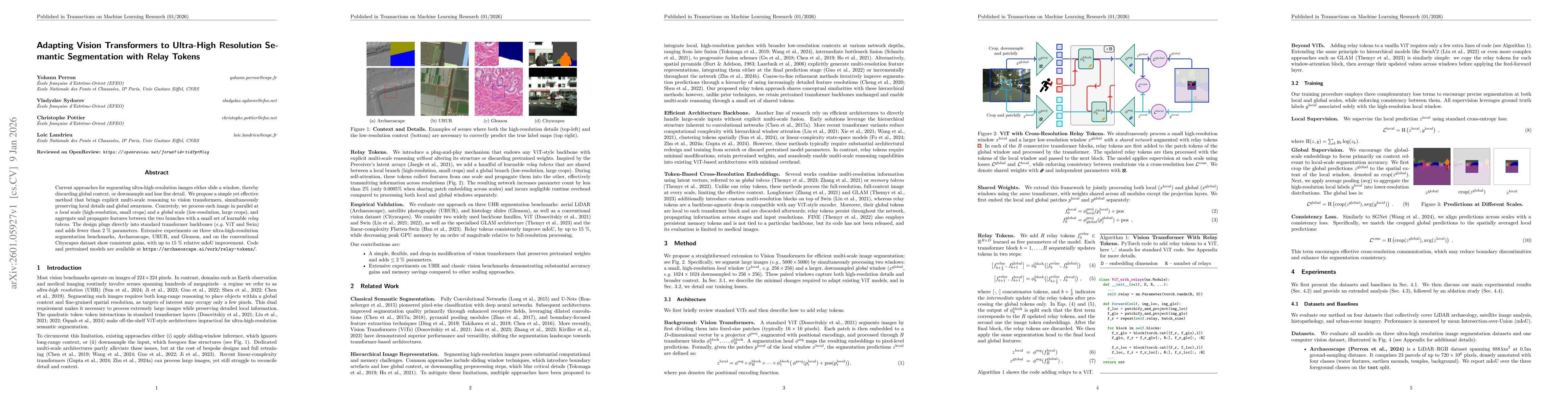
Current approaches for segmenting ultra high resolution images either slide a window, thereby discarding global context, or downsample and lose fine detail. We propose a simple yet effective method th...
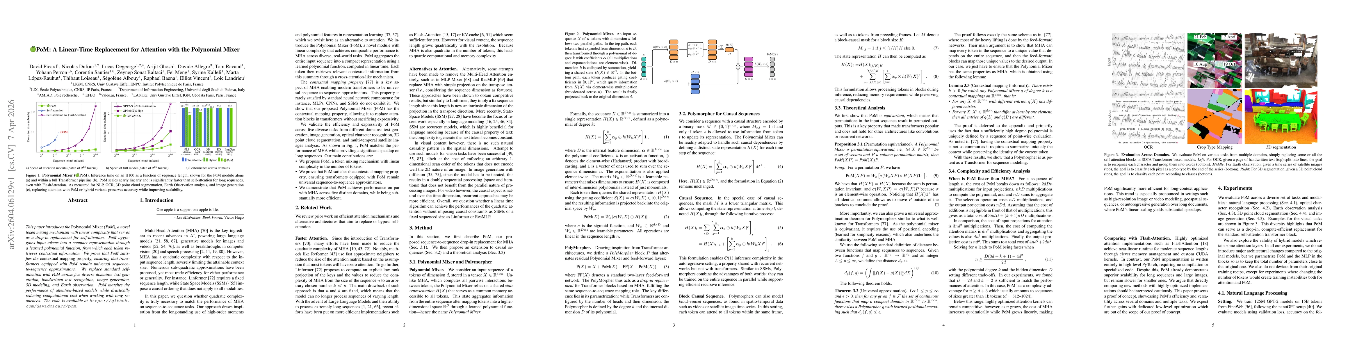
This paper introduces the Polynomial Mixer (PoM), a novel token mixing mechanism with linear complexity that serves as a drop-in replacement for self-attention. PoM aggregates input tokens into a comp...

Vision Transformers (ViT) dominate computer vision. However, their reliance on rigid patch projectors hinders transfer to Earth Observation (EO), where input modalities, scales, and resolutions vary w...
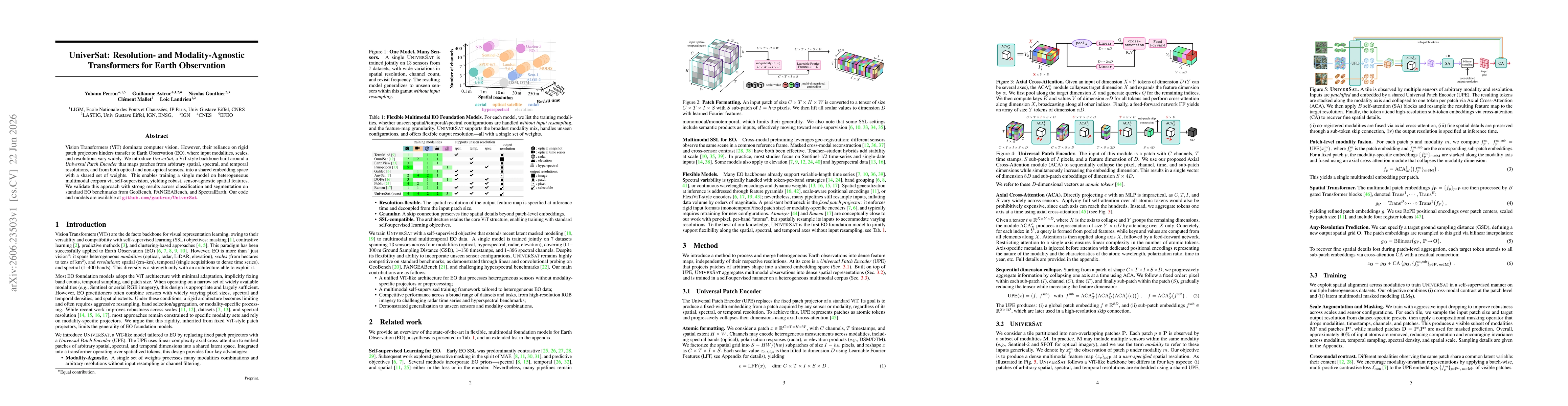
Vision Transformers (ViT) dominate computer vision. However, their reliance on rigid patch projectors hinders transfer to Earth Observation (EO), where input modalities, scales, and resolutions vary w...