Academic Profile
Statistics
Similar Authors
Papers on arXiv
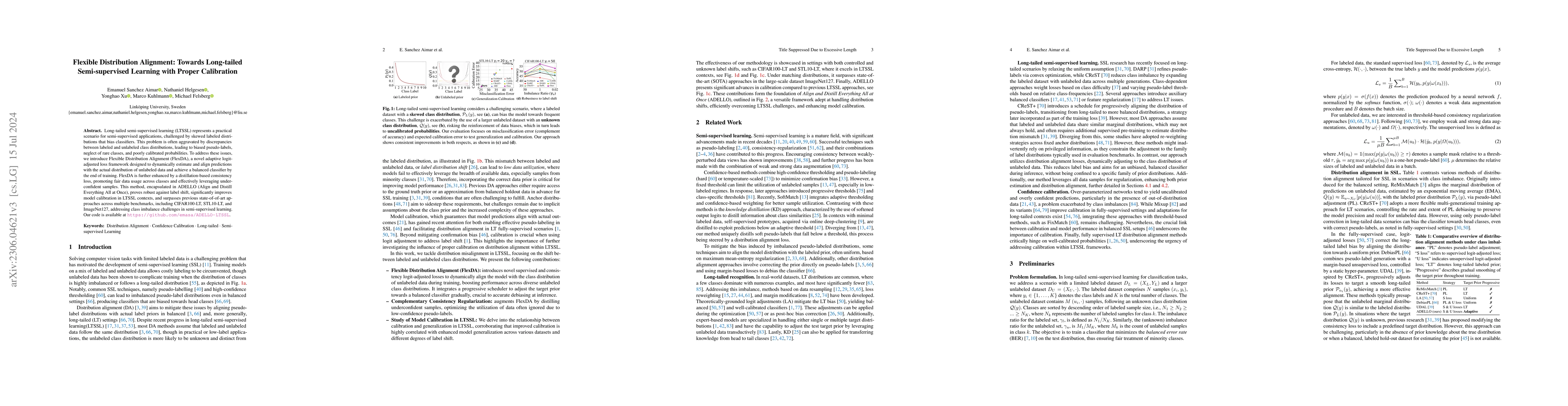
Long-tailed semi-supervised learning (LTSSL) represents a practical scenario for semi-supervised applications, challenged by skewed labeled distributions that bias classifiers. This problem is often a...
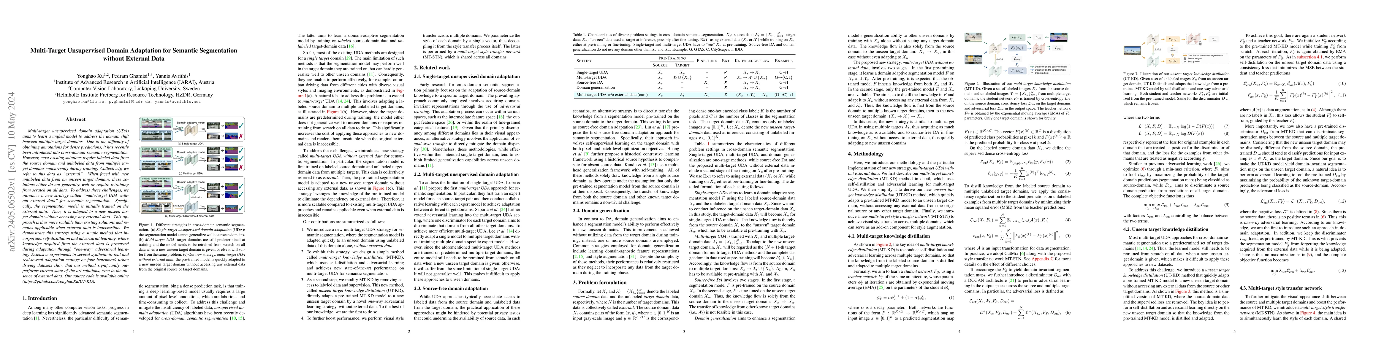
Multi-target unsupervised domain adaptation (UDA) aims to learn a unified model to address the domain shift between multiple target domains. Due to the difficulty of obtaining annotations for dense ...
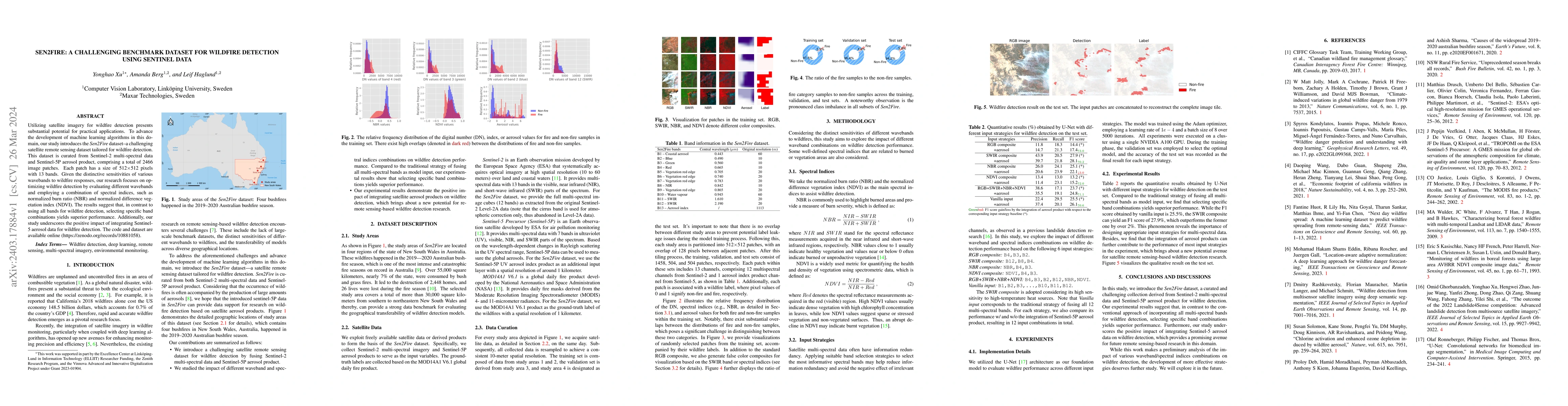
Utilizing satellite imagery for wildfire detection presents substantial potential for practical applications. To advance the development of machine learning algorithms in this domain, our study intr...
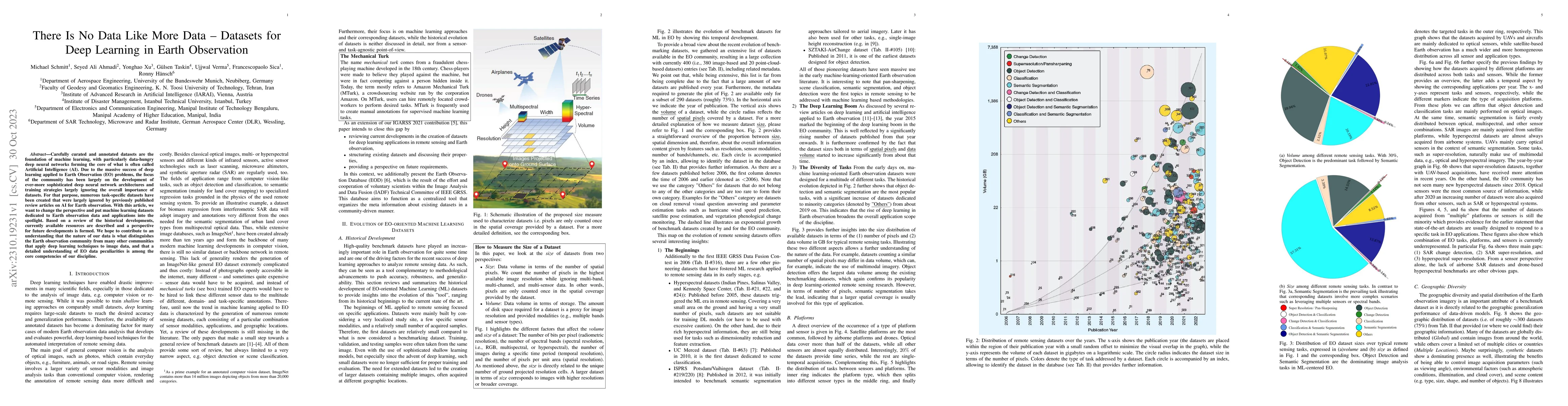
Carefully curated and annotated datasets are the foundation of machine learning, with particularly data-hungry deep neural networks forming the core of what is often called Artificial Intelligence (...
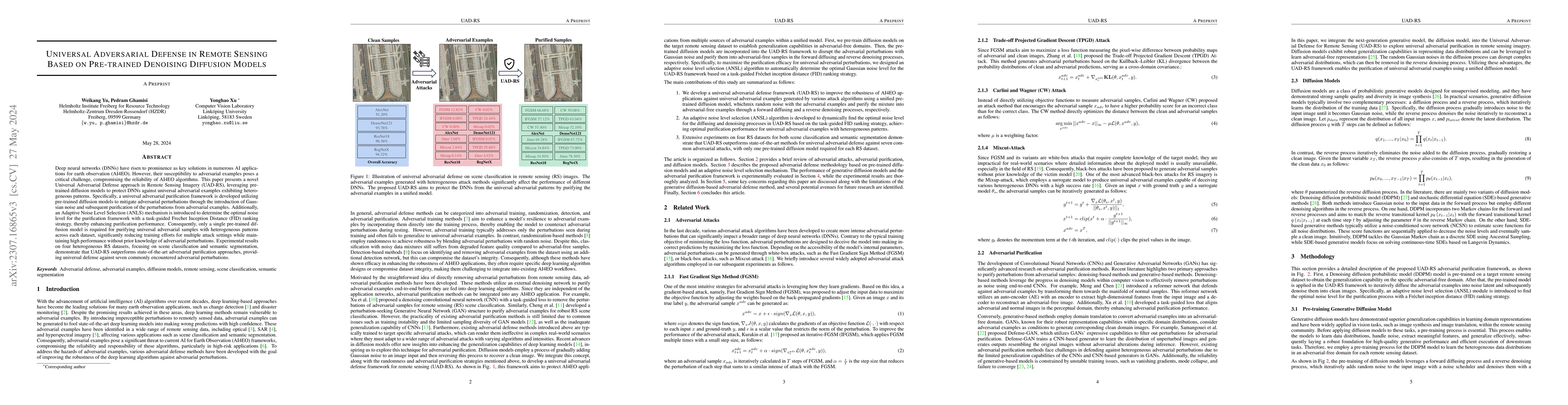
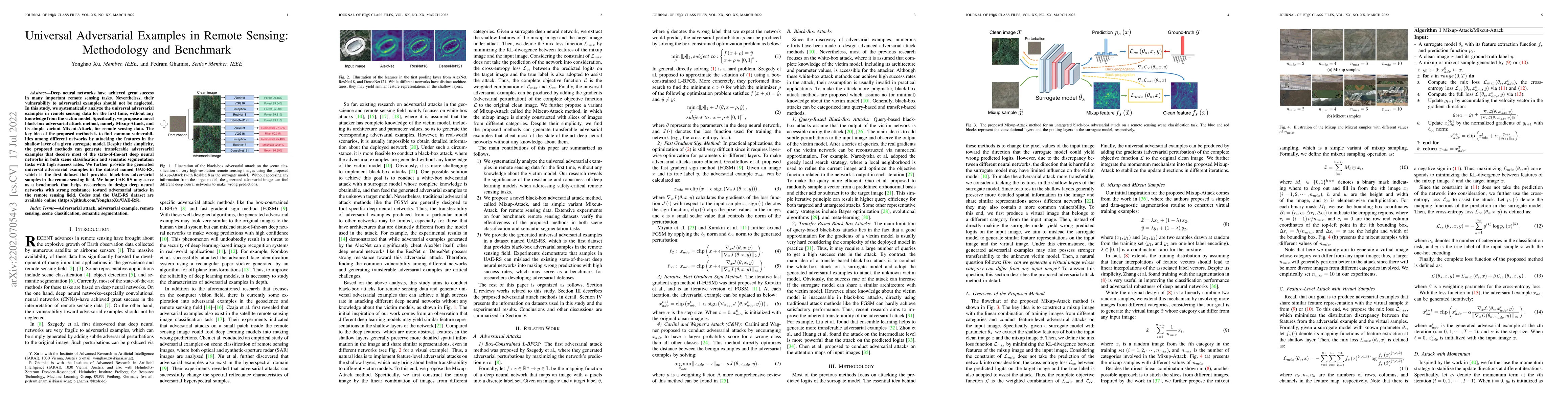
Deep neural networks (DNNs) have risen to prominence as key solutions in numerous AI applications for earth observation (AI4EO). However, their susceptibility to adversarial examples poses a critica...
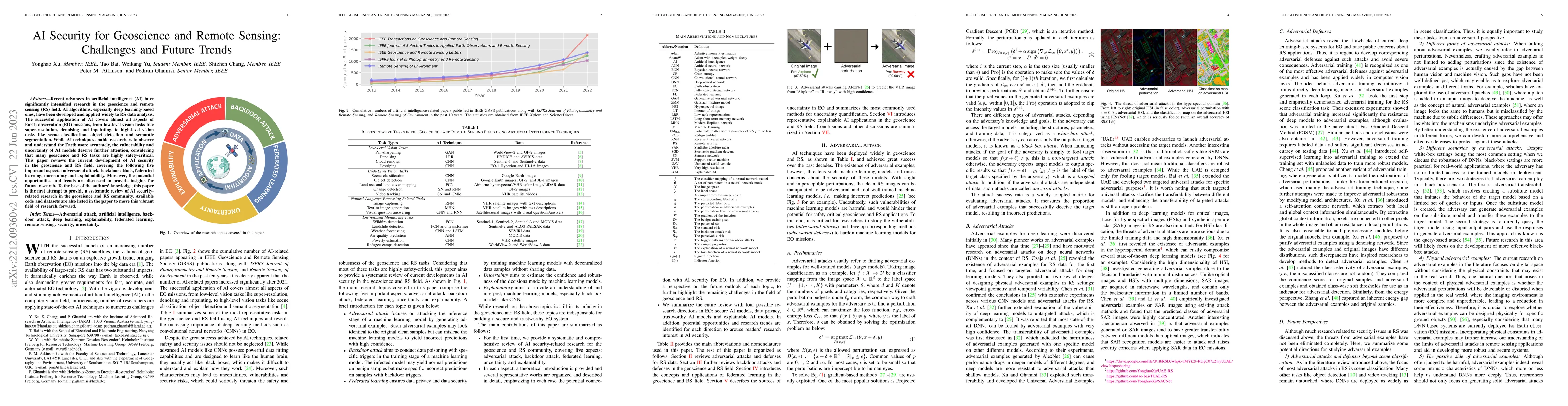
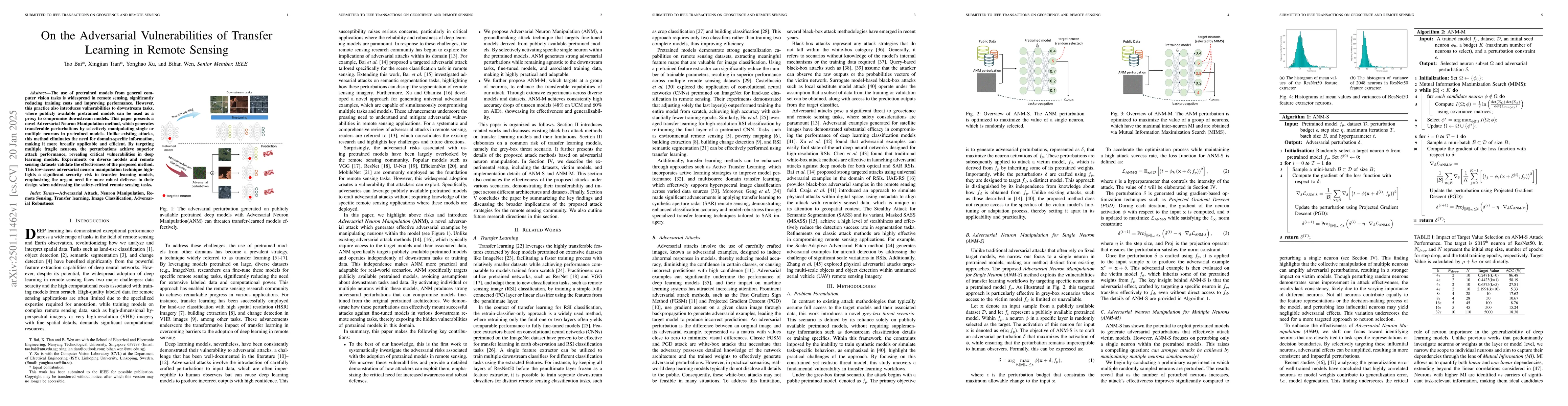
Recent advances in artificial intelligence (AI) have significantly intensified research in the geoscience and remote sensing (RS) field. AI algorithms, especially deep learning-based ones, have been...
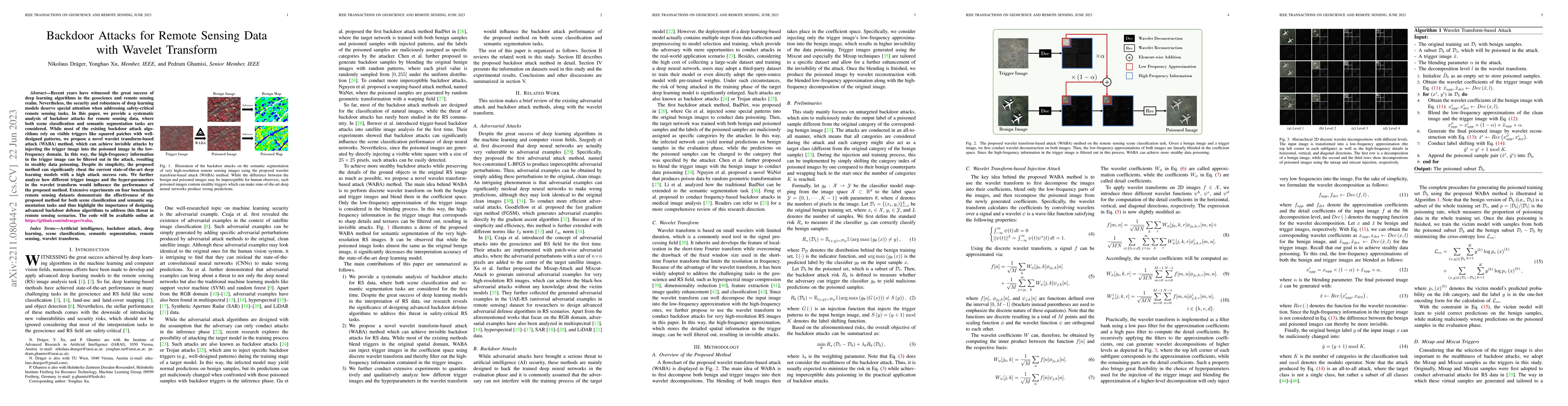
Recent years have witnessed the great success of deep learning algorithms in the geoscience and remote sensing realm. Nevertheless, the security and robustness of deep learning models deserve specia...
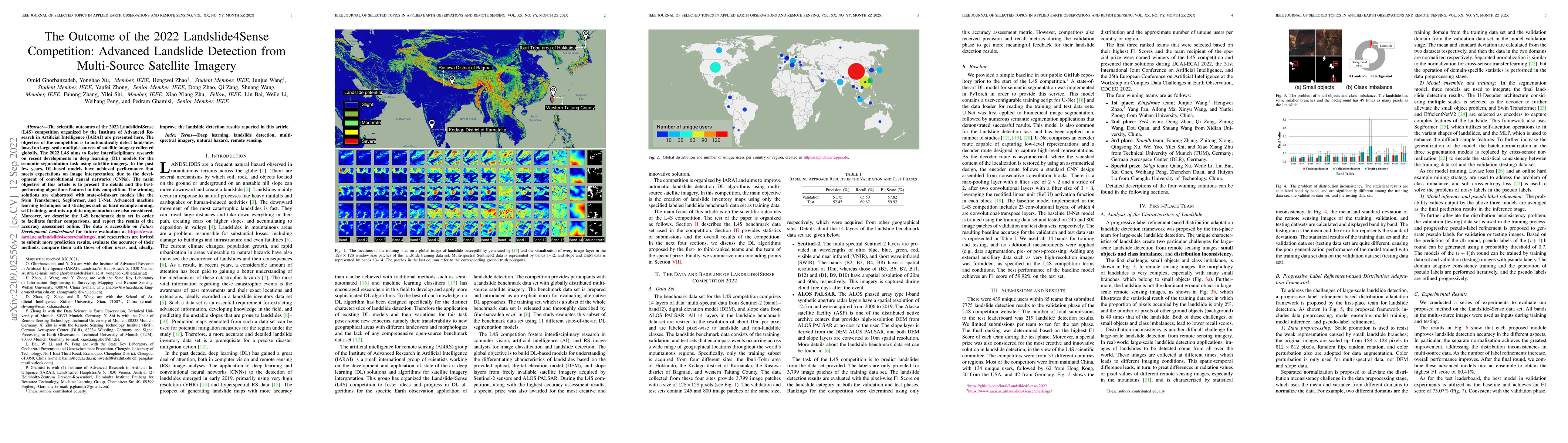
The scientific outcomes of the 2022 Landslide4Sense (L4S) competition organized by the Institute of Advanced Research in Artificial Intelligence (IARAI) are presented here. The objective of the comp...
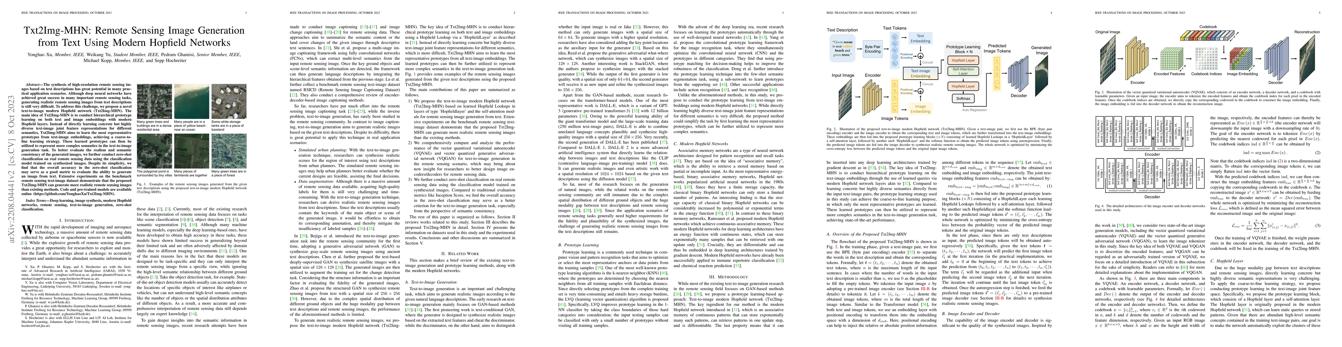
The synthesis of high-resolution remote sensing images based on text descriptions has great potential in many practical application scenarios. Although deep neural networks have achieved great succe...
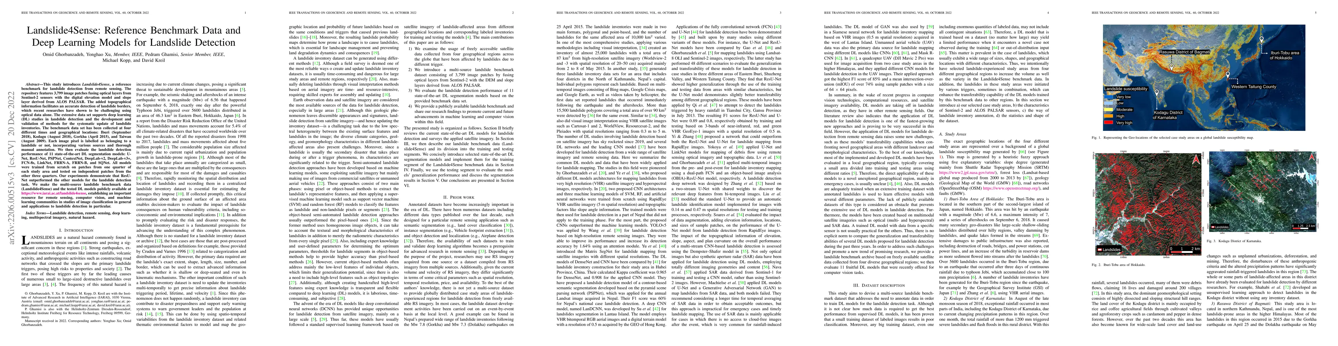
This study introduces \textit{Landslide4Sense}, a reference benchmark for landslide detection from remote sensing. The repository features 3,799 image patches fusing optical layers from Sentinel-2 s...
Deep neural networks have achieved great success in many important remote sensing tasks. Nevertheless, their vulnerability to adversarial examples should not be neglected. In this study, we systemat...
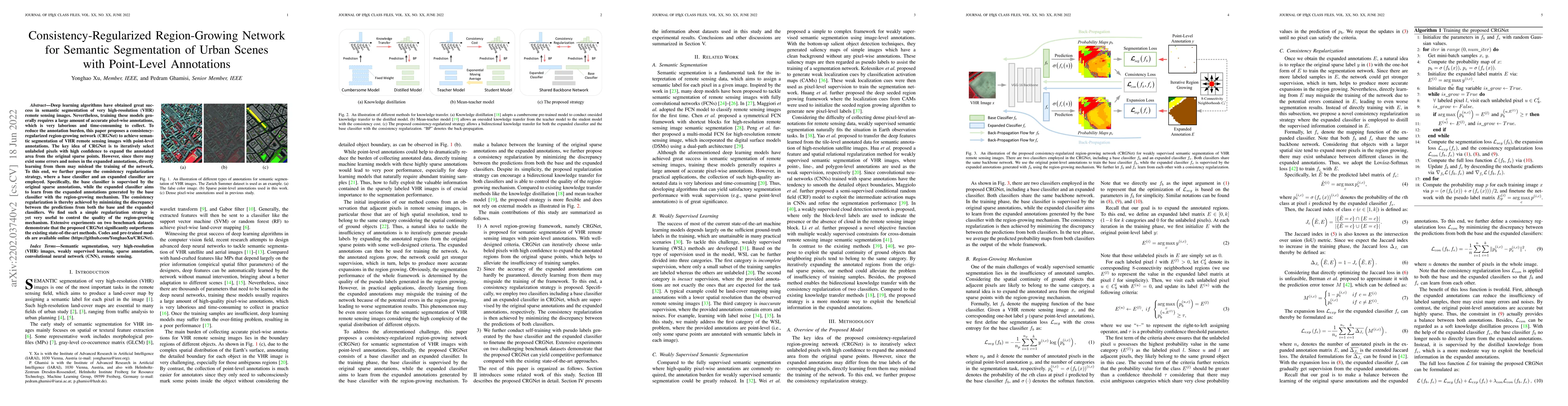
Deep learning algorithms have obtained great success in semantic segmentation of very high-resolution (VHR) images. Nevertheless, training these models generally requires a large amount of accurate ...
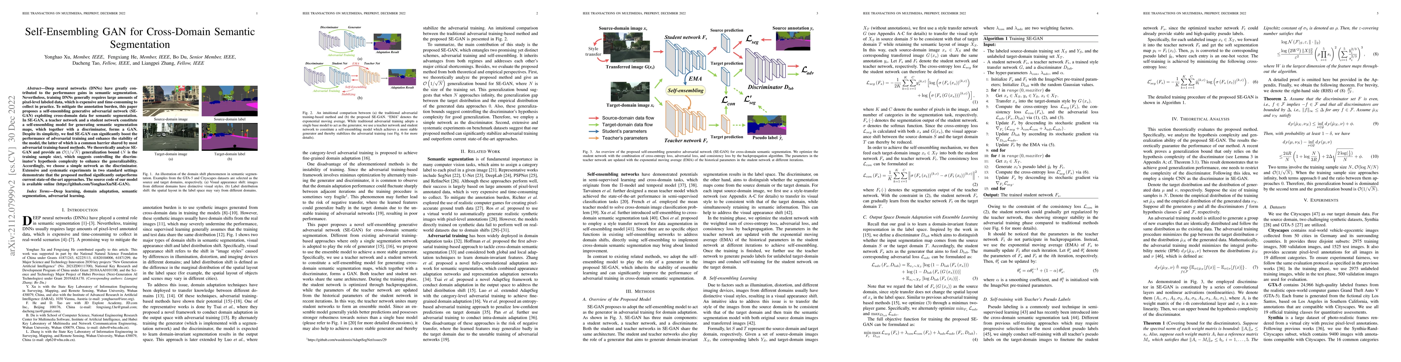
Deep neural networks (DNNs) have greatly contributed to the performance gains in semantic segmentation. Nevertheless, training DNNs generally requires large amounts of pixel-level labeled data, whic...
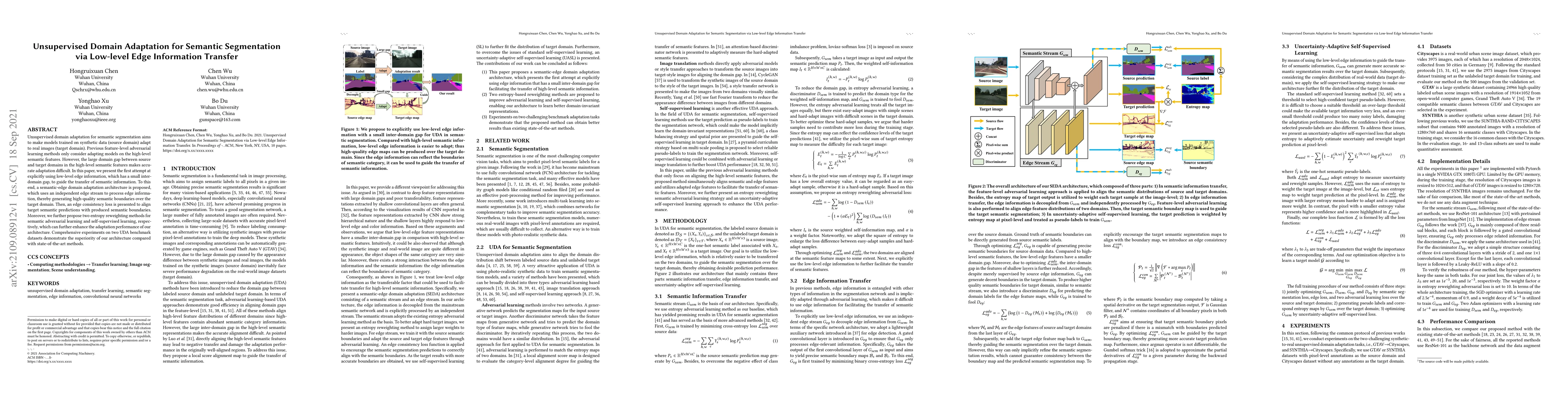
Unsupervised domain adaptation for semantic segmentation aims to make models trained on synthetic data (source domain) adapt to real images (target domain). Previous feature-level adversarial learni...
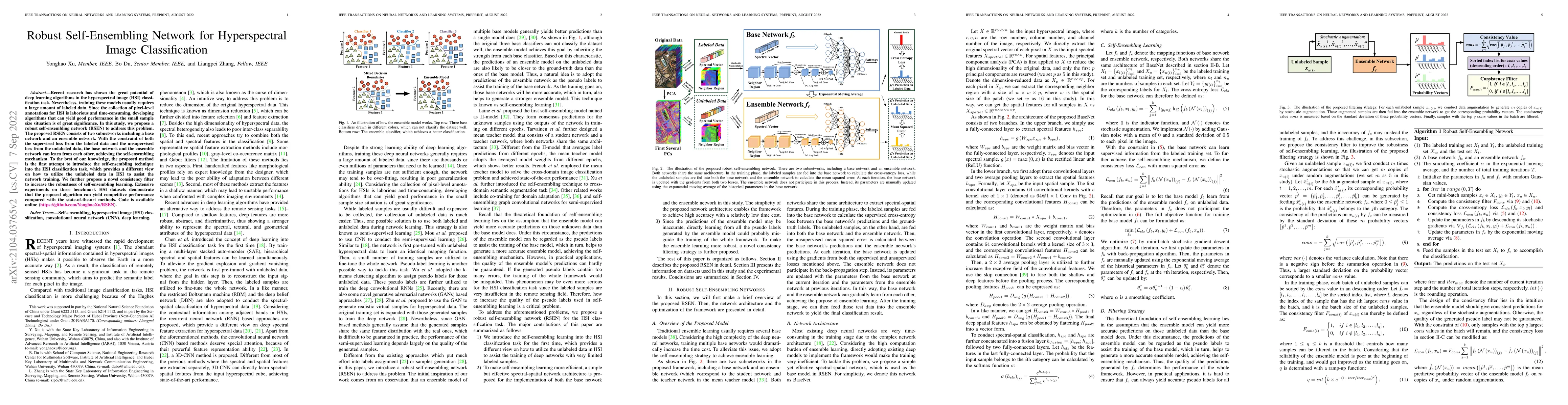
Recent research has shown the great potential of deep learning algorithms in the hyperspectral image (HSI) classification task. Nevertheless, training these models usually requires a large amount of...
The use of pretrained models from general computer vision tasks is widespread in remote sensing, significantly reducing training costs and improving performance. However, this practice also introduces...
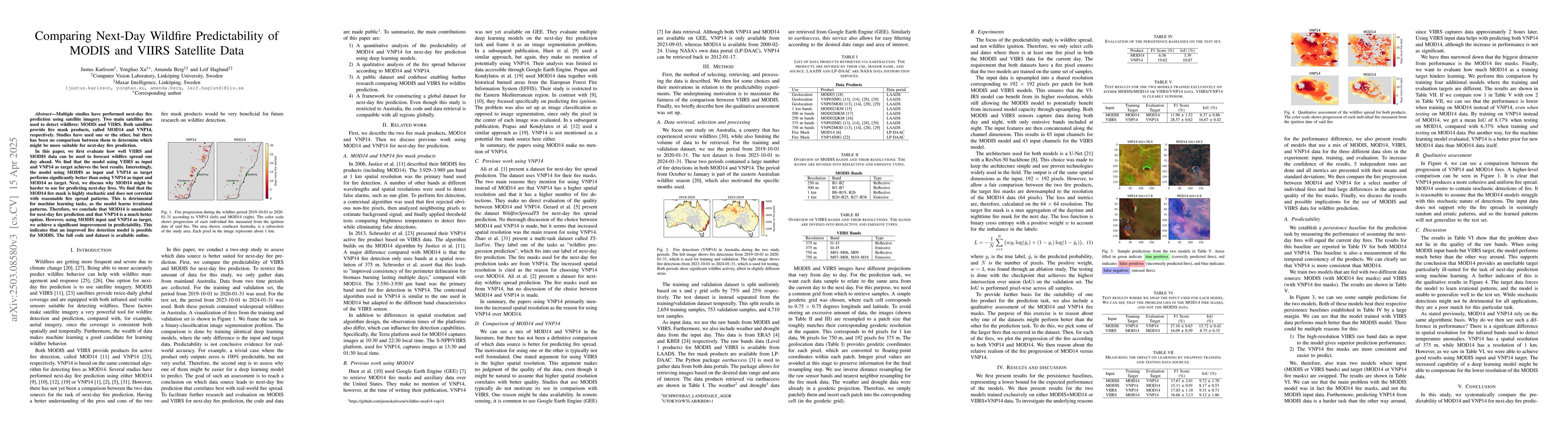
Multiple studies have performed next-day fire prediction using satellite imagery. Two main satellites are used to detect wildfires: MODIS and VIIRS. Both satellites provide fire mask products, called ...
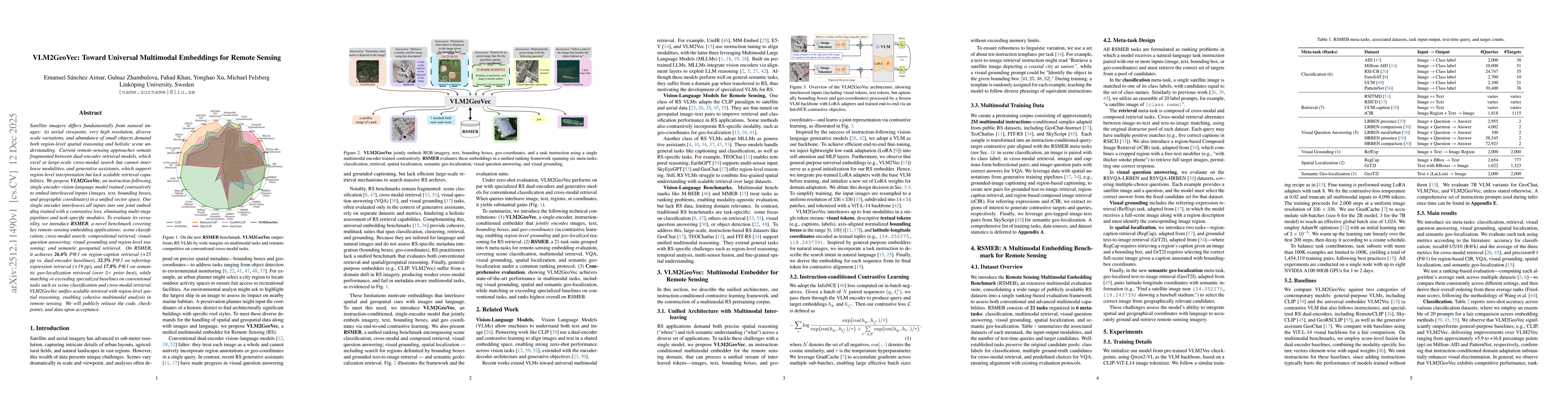
Satellite imagery differs fundamentally from natural images: its aerial viewpoint, very high resolution, diverse scale variations, and abundance of small objects demand both region-level spatial reaso...
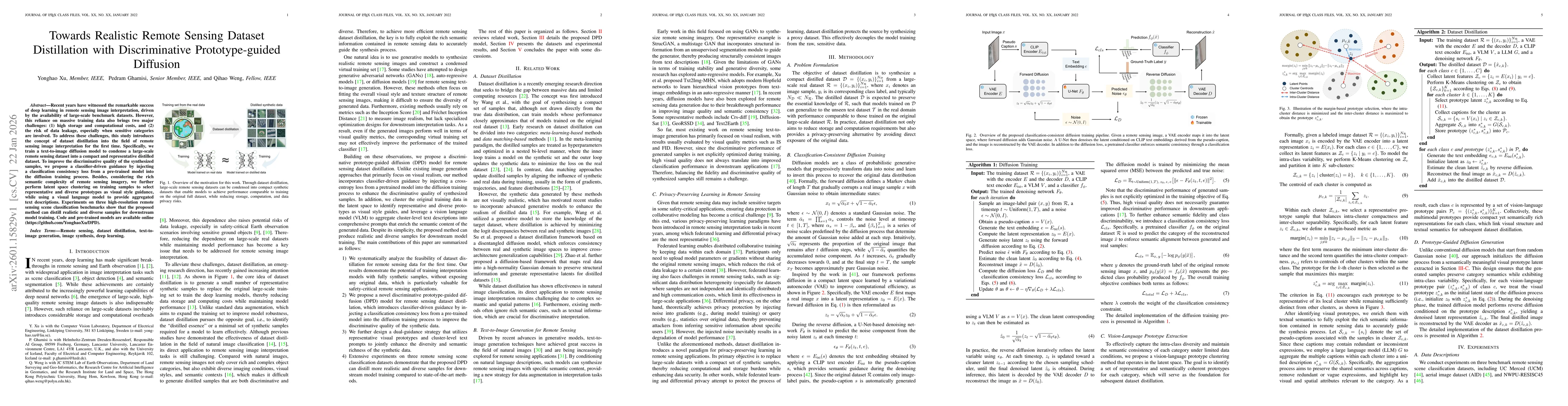
Recent years have witnessed the remarkable success of deep learning in remote sensing image interpretation, driven by the availability of large-scale benchmark datasets. However, this reliance on mass...
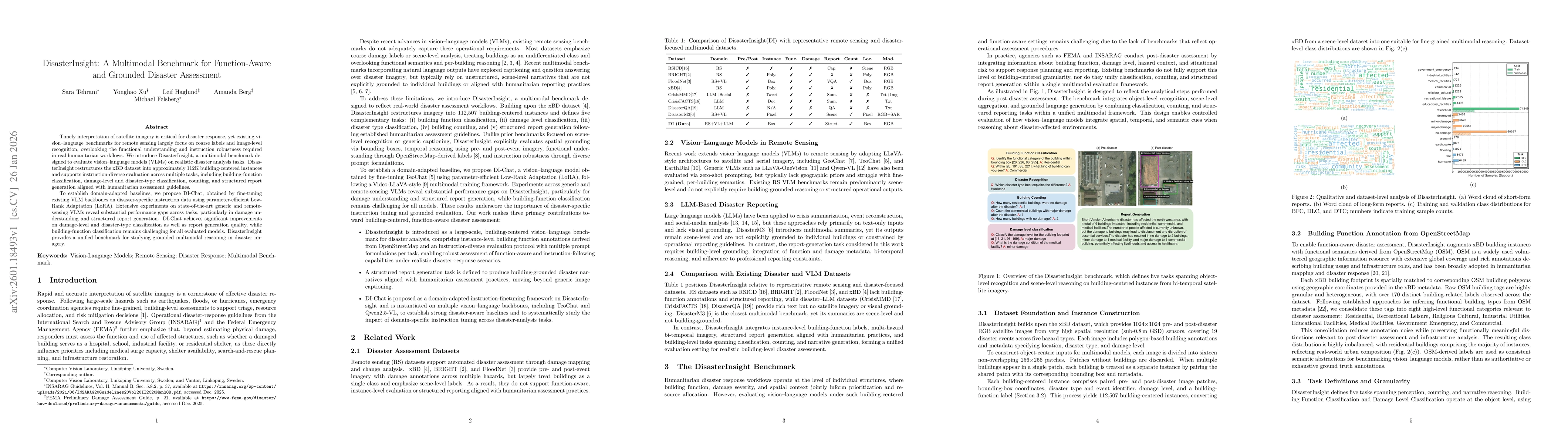
Timely interpretation of satellite imagery is critical for disaster response, yet existing vision-language benchmarks for remote sensing largely focus on coarse labels and image-level recognition, ove...
Recent advances in multimodal large language models (MLLMs) have accelerated progress in domain-oriented AI, yet their development in geoscience and remote sensing (RS) remains constrained by distinct...