Academic Profile
Statistics
Similar Authors
Papers on arXiv
The complementary fusion of light detection and ranging (LiDAR) data and image data is a promising but challenging task for generating high-precision and high-density point clouds. This study propos...
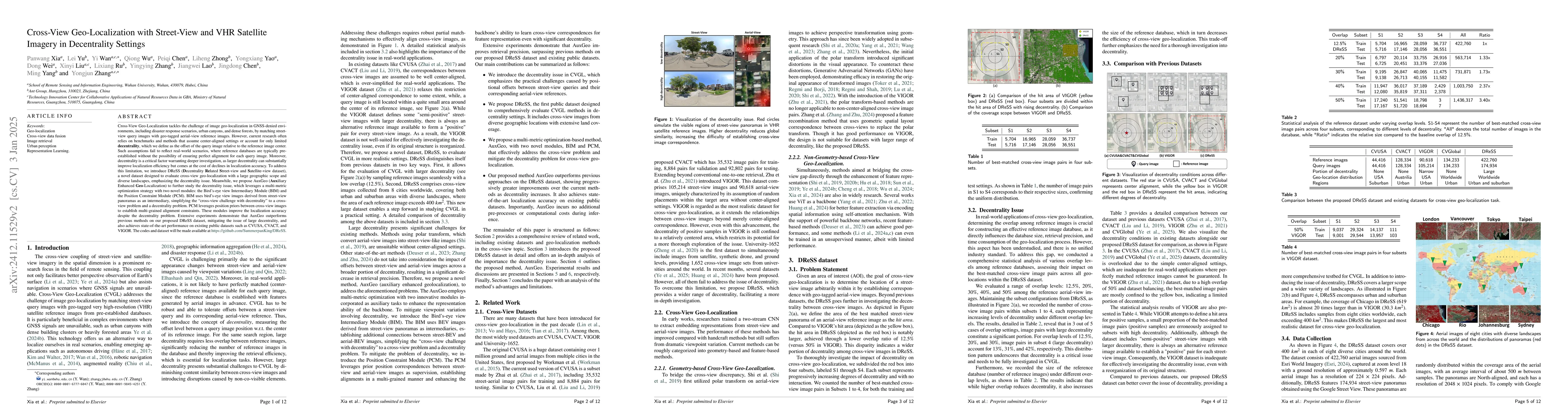
Cross-View Geo-Localization tackles the problem of image geo-localization in GNSS-denied environments by matching street-view query images with geo-tagged aerial-view reference images. However, existi...
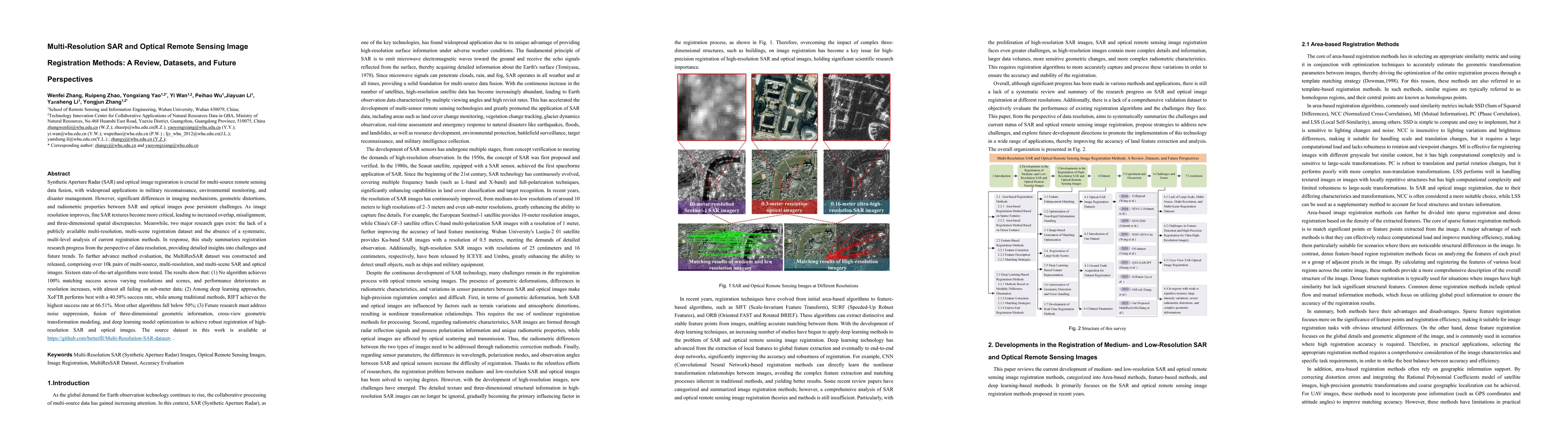
Synthetic Aperture Radar (SAR) and optical image registration is essential for remote sensing data fusion, with applications in military reconnaissance, environmental monitoring, and disaster manageme...
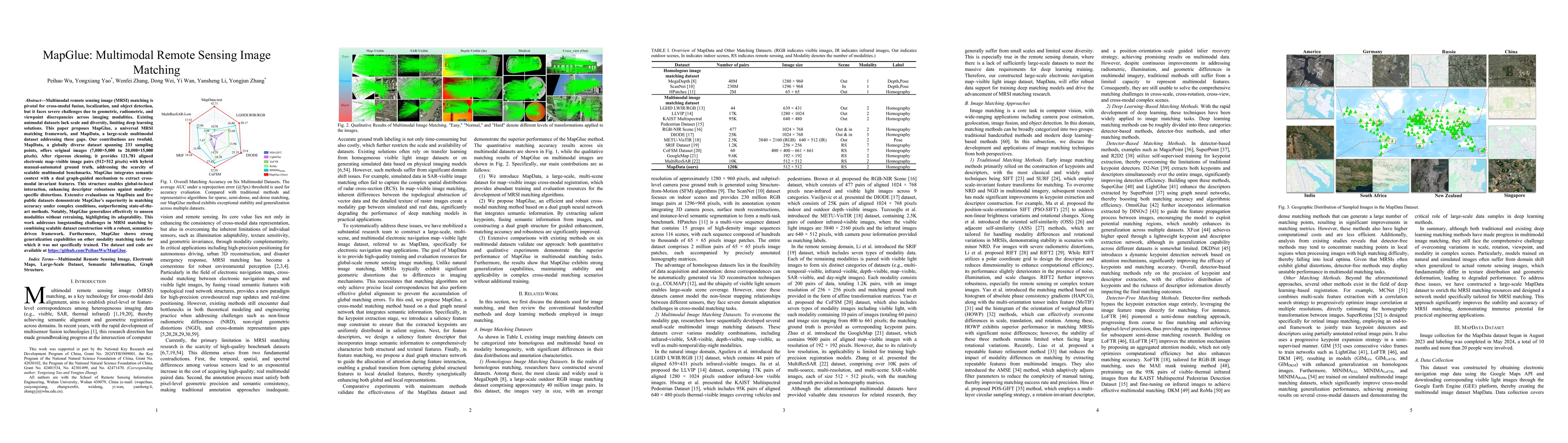
Multimodal remote sensing image (MRSI) matching is pivotal for cross-modal fusion, localization, and object detection, but it faces severe challenges due to geometric, radiometric, and viewpoint discr...
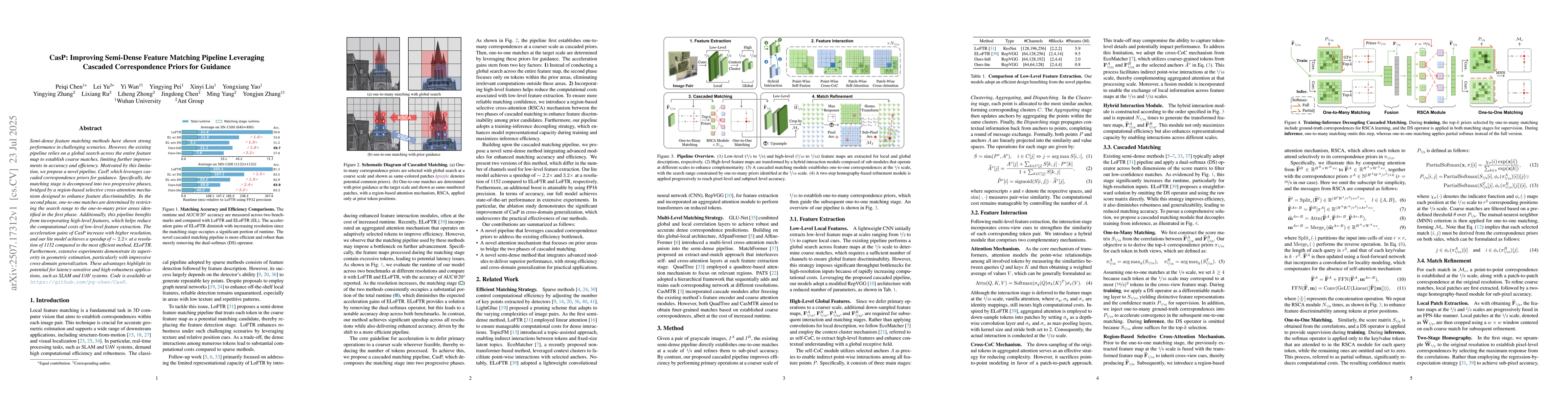
Semi-dense feature matching methods have shown strong performance in challenging scenarios. However, the existing pipeline relies on a global search across the entire feature map to establish coarse m...
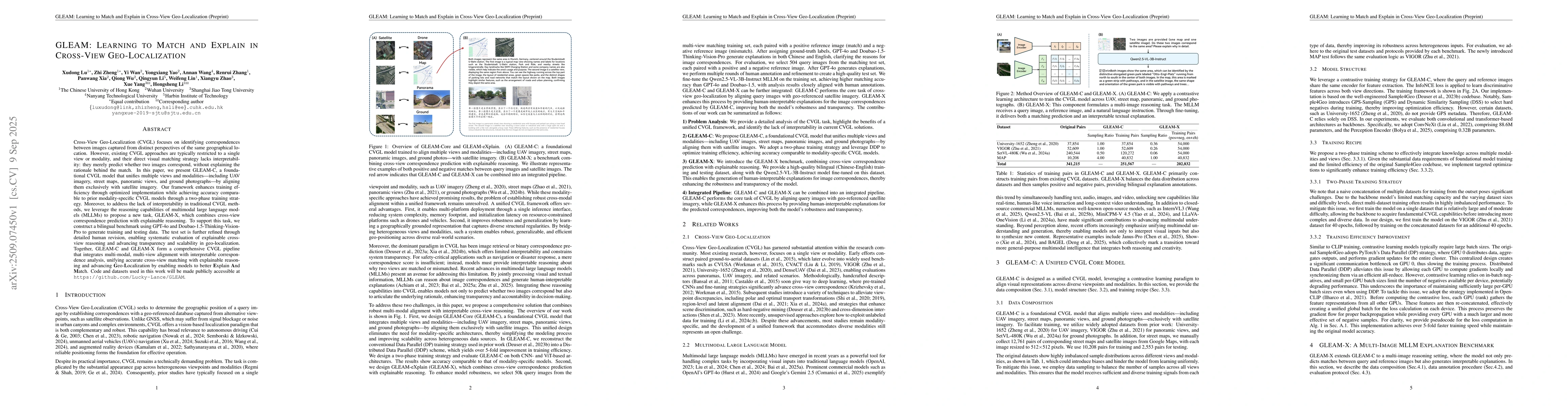
Cross-View Geo-Localization (CVGL) focuses on identifying correspondences between images captured from distinct perspectives of the same geographical location. However, existing CVGL approaches are ty...
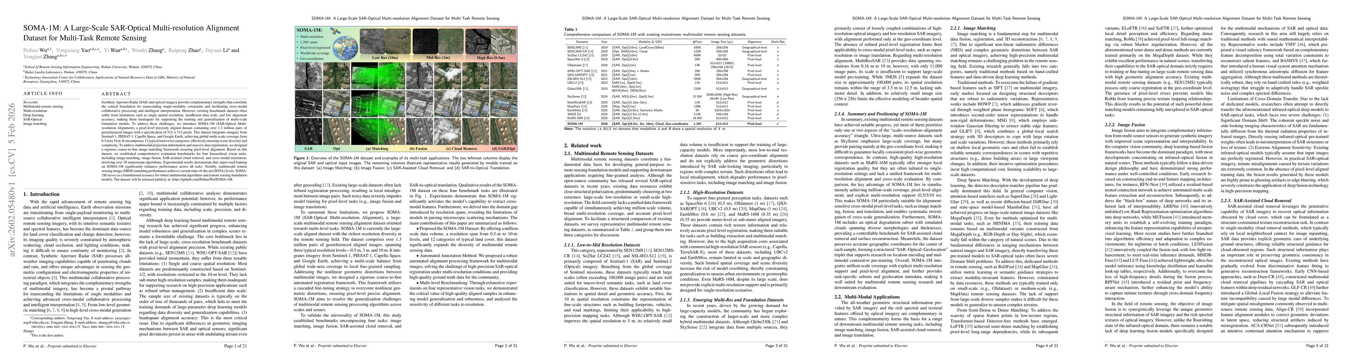
Synthetic Aperture Radar (SAR) and optical imagery provide complementary strengths that constitute the critical foundation for transcending single-modality constraints and facilitating cross-modal col...