Yotam Gigi

6 papers on arXiv

Academic Profile

Name: Yotam Gigi
Total Papers: 6

Statistics

arXiv Papers 6
Total Publications 6

Papers on arXiv

Thumbnail for Flood forecasting with machine learning models in an operational
  framework

Flood forecasting with machine learning models in an operational framework

The operational flood forecasting system by Google was developed to provide accurate real-time flood warnings to agencies and the public, with a focus on riverine floods in large, gauged rivers. It ...

Thumbnail for Spectral Algorithm for Low-rank Multitask Regression

Spectral Algorithm for Low-rank Multitask Regression

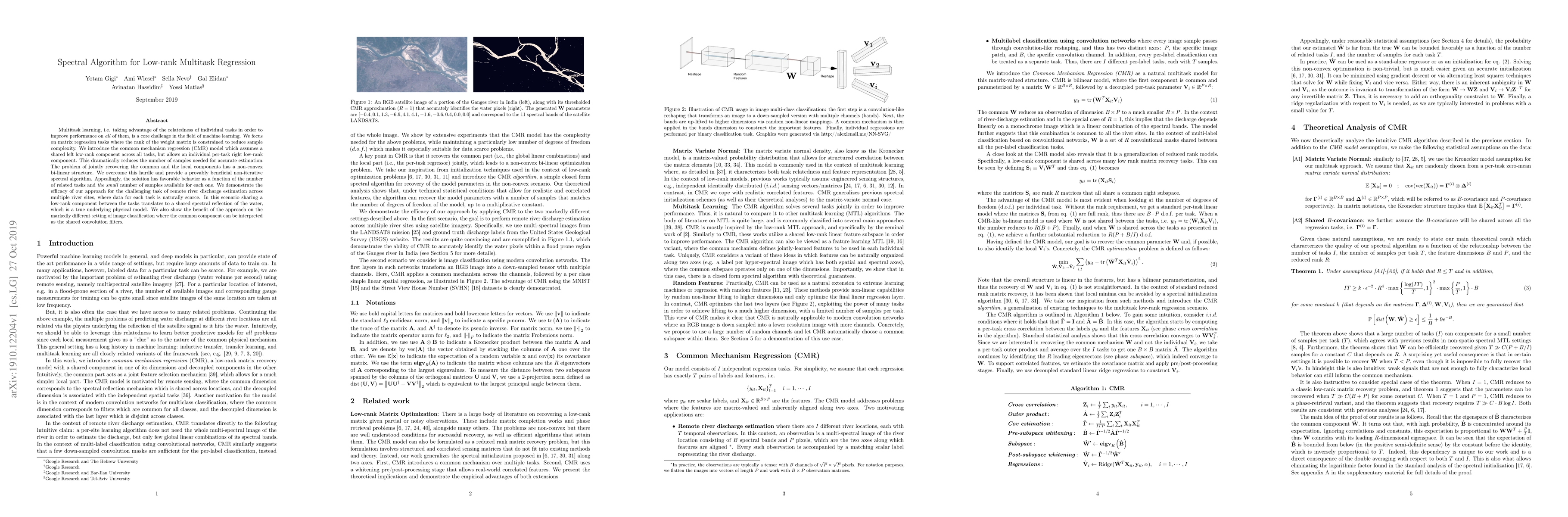
Multitask learning, i.e. taking advantage of the relatedness of individual tasks in order to improve performance on all of them, is a core challenge in the field of machine learning. We focus on mat...

Thumbnail for A Recipe for Improving Remote Sensing VLM Zero Shot Generalization

A Recipe for Improving Remote Sensing VLM Zero Shot Generalization

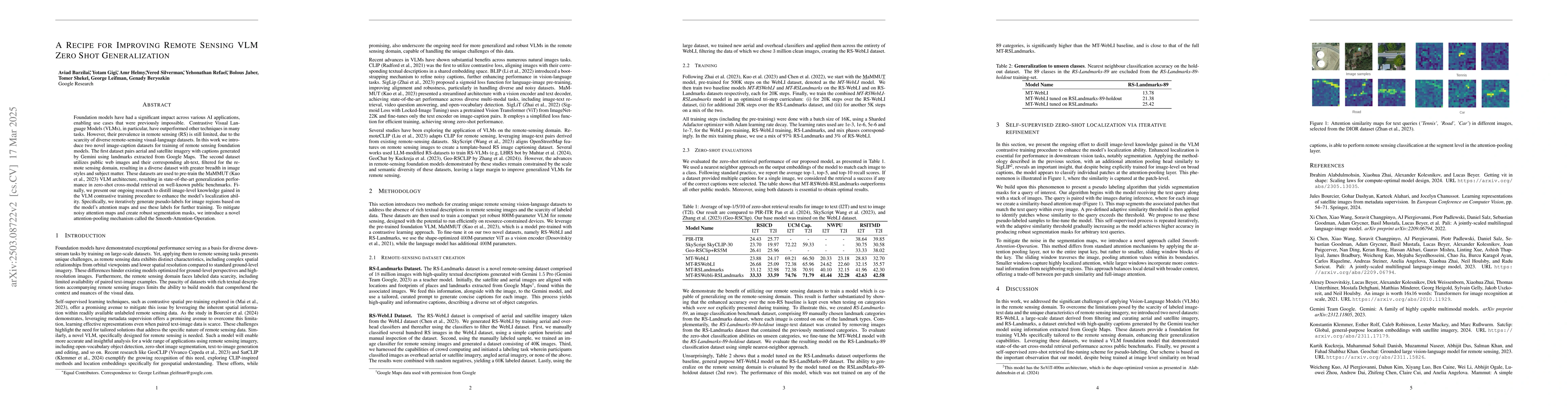
Foundation models have had a significant impact across various AI applications, enabling use cases that were previously impossible. Contrastive Visual Language Models (VLMs), in particular, have outpe...

Thumbnail for Zero-Shot Multi-Spectral Learning: Reimagining a Generalist Multimodal
  Gemini 2.5 Model for Remote Sensing Applications

Zero-Shot Multi-Spectral Learning: Reimagining a Generalist Multimodal Gemini 2.5 Model for Remote Sensing Applications

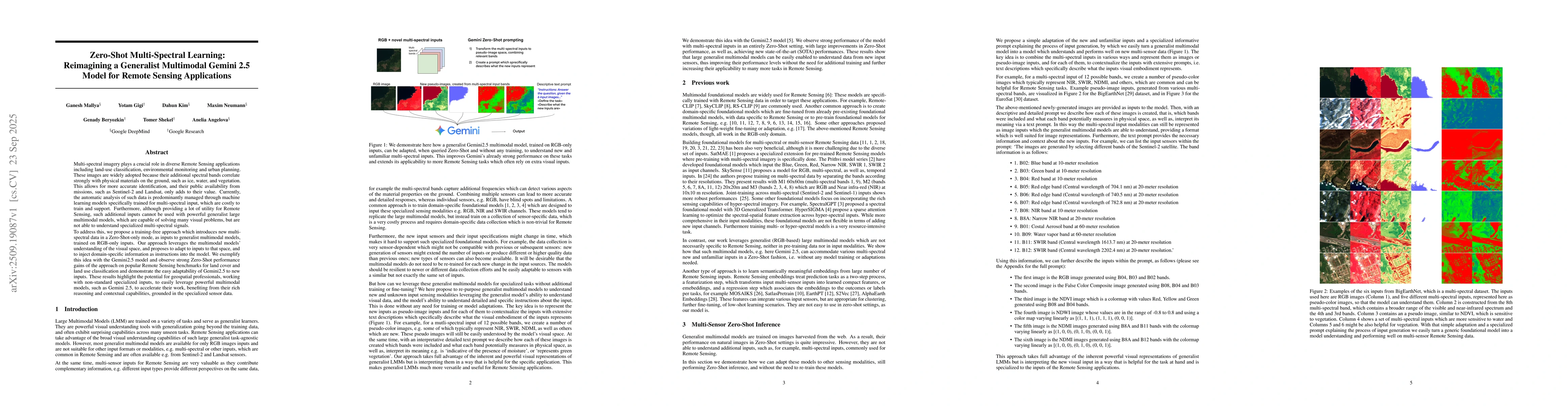
Multi-spectral imagery plays a crucial role in diverse Remote Sensing applications including land-use classification, environmental monitoring and urban planning. These images are widely adopted becau...

Thumbnail for Earth AI: Unlocking Geospatial Insights with Foundation Models and
  Cross-Modal Reasoning

Earth AI: Unlocking Geospatial Insights with Foundation Models and Cross-Modal Reasoning

Geospatial data offers immense potential for understanding our planet. However, the sheer volume and diversity of this data along with its varied resolutions, timescales, and sparsity pose significant...

Thumbnail for RSRCC: A Remote Sensing Regional Change Comprehension Benchmark Constructed via Retrieval-Augmented Best-of-N Ranking

RSRCC: A Remote Sensing Regional Change Comprehension Benchmark Constructed via Retrieval-Augmented Best-of-N Ranking

Traditional change detection identifies where changes occur, but does not explain what changed in natural language. Existing remote sensing change captioning datasets typically describe overall image-...

This website uses cookies to ensure you get the best experience. Learn more