ArxivLens
Y
Researcher

Youqi Liao

6 papers on arXiv

6 arXiv Papers
7 Total Publications
Profile

Academic Profile

Name Youqi Liao
Total Papers 7
Scholar Profile View on Semantic Scholar
Metrics

Statistics

6 arXiv Papers
7 Total Publications
Publications

Papers on arXiv

Thumbnail for Mobile-Seed: Joint Semantic Segmentation and Boundary Detection for
  Mobile Robots
arXiv
Mobile-Seed: Joint Semantic Segmentation and Boundary Detection for Mobile Robots

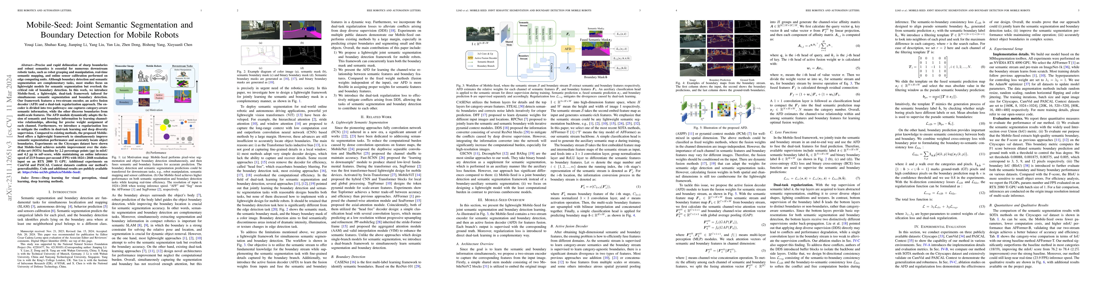
Precise and rapid delineation of sharp boundaries and robust semantics is essential for numerous downstream robotic tasks, such as robot grasping and manipulation, real-time semantic mapping, and on...

Thumbnail for CoFiI2P: Coarse-to-Fine Correspondences for Image-to-Point Cloud
  Registration
arXiv
CoFiI2P: Coarse-to-Fine Correspondences for Image-to-Point Cloud Registration

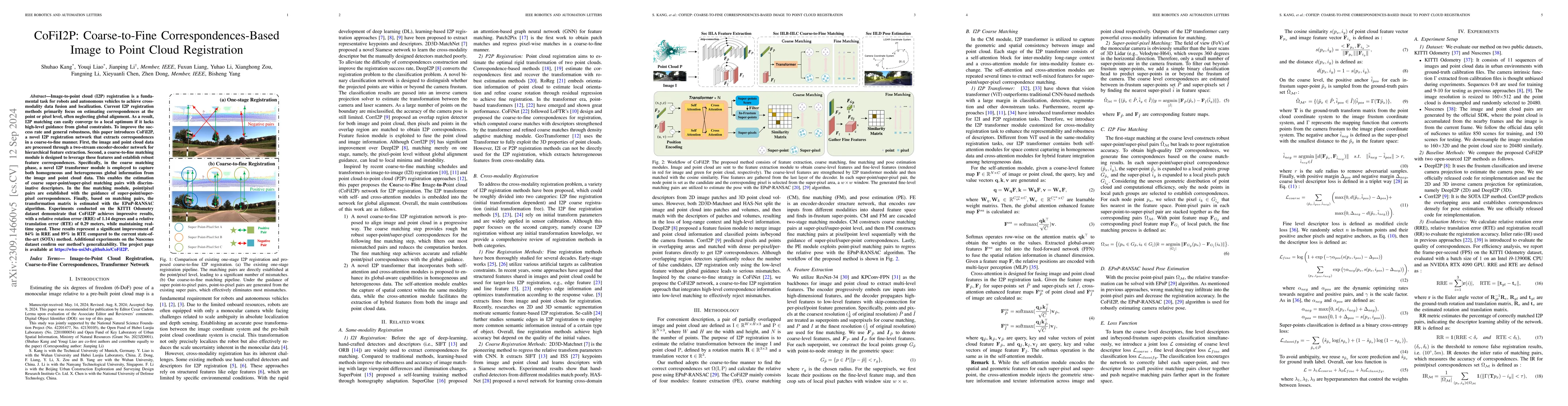
Image-to-point cloud (I2P) registration is a fundamental task for robots and autonomous vehicles to achieve cross-modality data fusion and localization. Existing I2P registration methods estimate co...

Thumbnail for OSMLoc: Single Image-Based Visual Localization in OpenStreetMap with
  Geometric and Semantic Guidances
arXiv
OSMLoc: Single Image-Based Visual Localization in OpenStreetMap with Geometric and Semantic Guidances

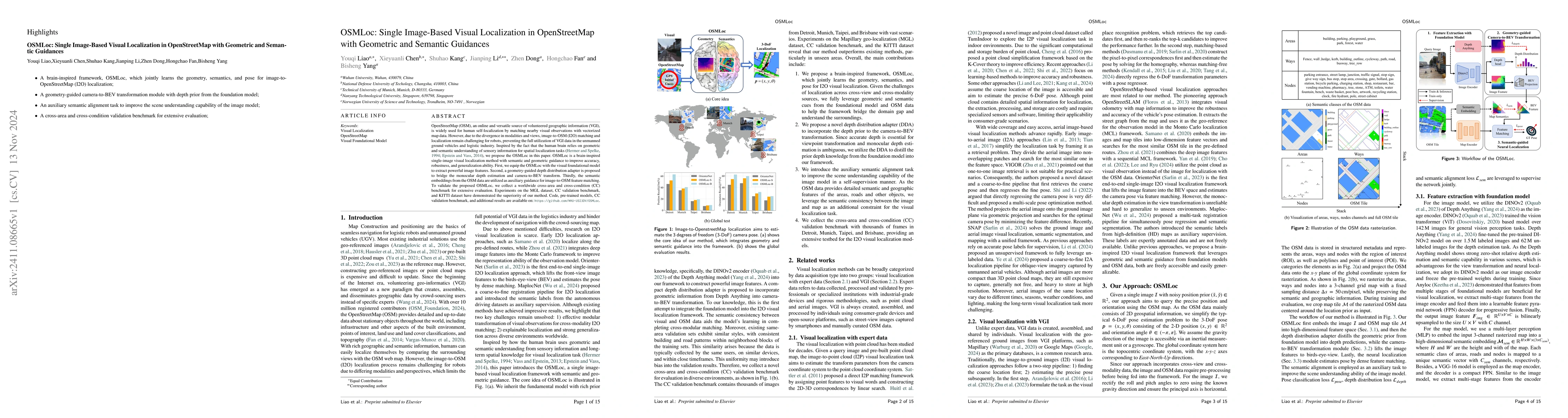
OpenStreetMap (OSM), an online and versatile source of volunteered geographic information (VGI), is widely used for human self-localization by matching nearby visual observations with vectorized map d...

Thumbnail for Aerial-ground Cross-modal Localization: Dataset, Ground-truth, and
  Benchmark
arXiv
Aerial-ground Cross-modal Localization: Dataset, Ground-truth, and Benchmark

Accurate visual localization in dense urban environments poses a fundamental task in photogrammetry, geospatial information science, and robotics. While imagery is a low-cost and widely accessible sen...

Thumbnail for VLM-Loc: Localization in Point Cloud Maps via Vision-Language Models
arXiv
VLM-Loc: Localization in Point Cloud Maps via Vision-Language Models

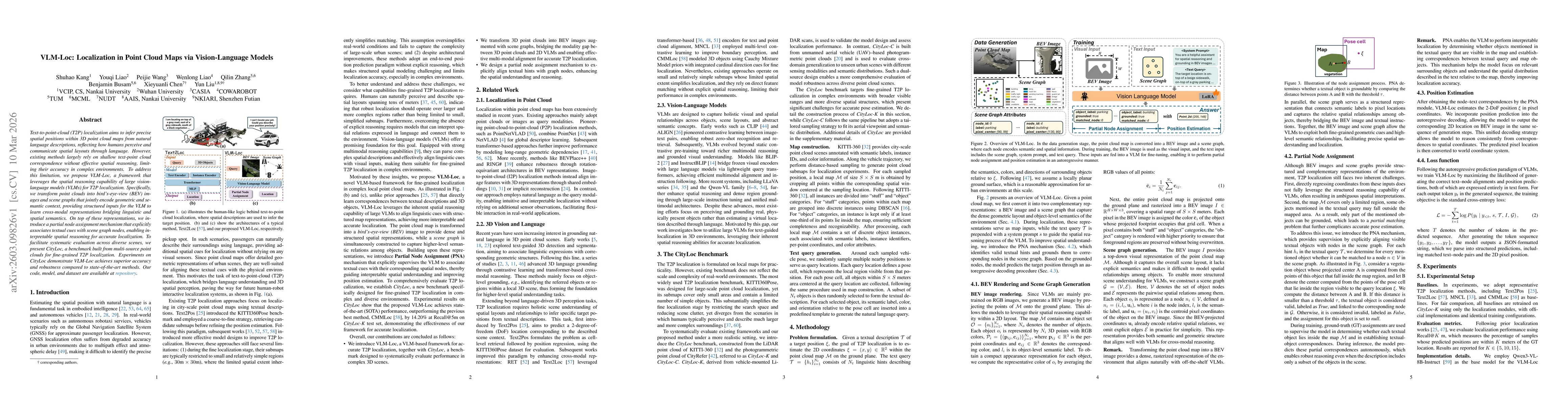
Text-to-point-cloud (T2P) localization aims to infer precise spatial positions within 3D point cloud maps from natural language descriptions, reflecting how humans perceive and communicate spatial lay...

Thumbnail for TOL: Textual Localization with OpenStreetMap
arXiv
TOL: Textual Localization with OpenStreetMap

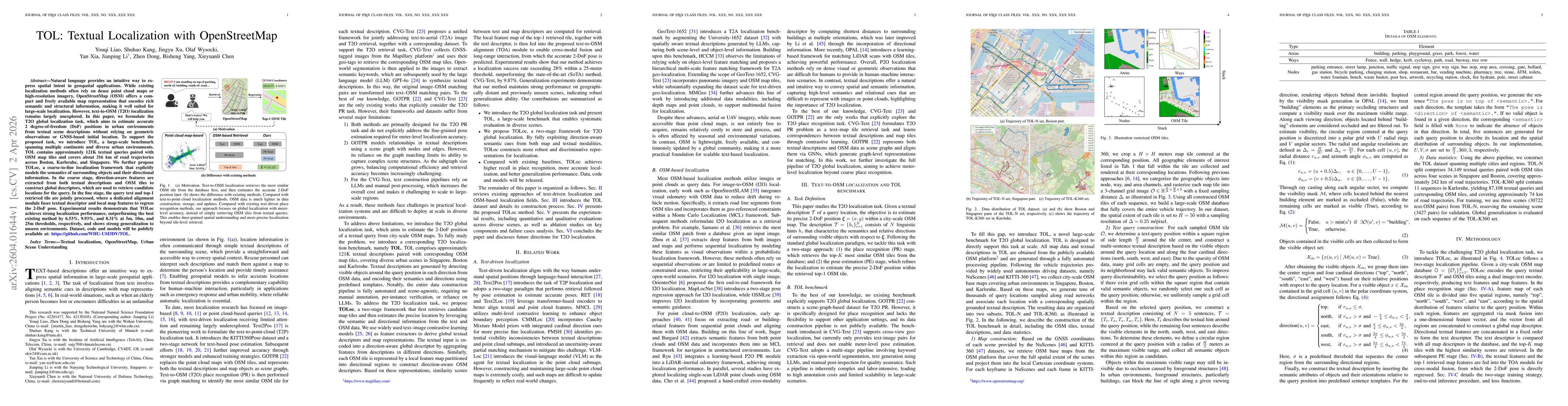
Natural language provides an intuitive way to express spatial intent in geospatial applications. While existing localization methods often rely on dense point cloud maps or high-resolution imagery, Op...

This website uses cookies to ensure you get the best experience. Learn more