Academic Profile
Statistics
Similar Authors
Papers on arXiv
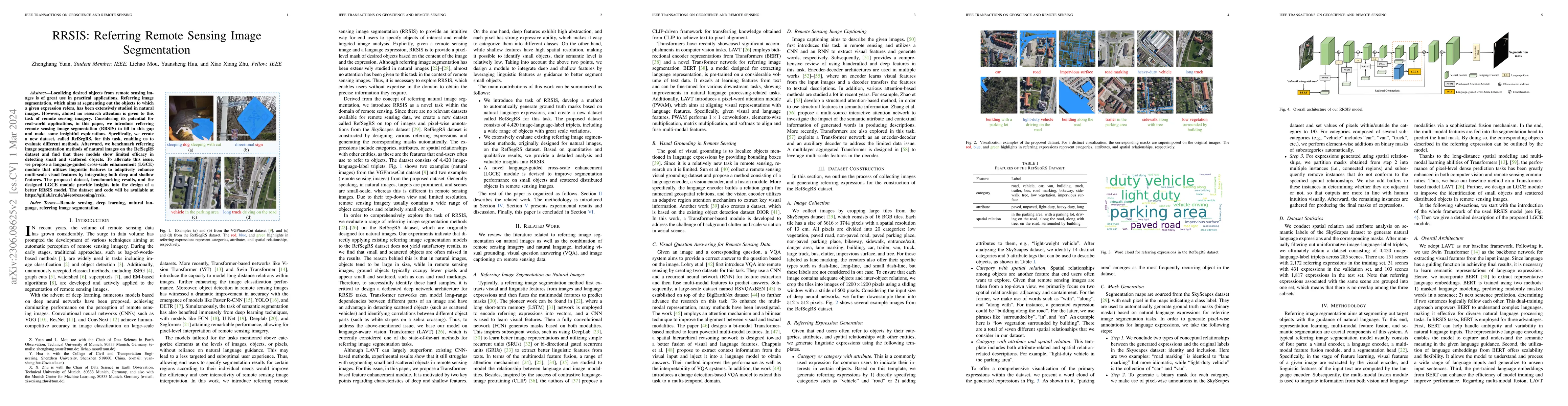
Localizing desired objects from remote sensing images is of great use in practical applications. Referring image segmentation, which aims at segmenting out the objects to which a given expression re...
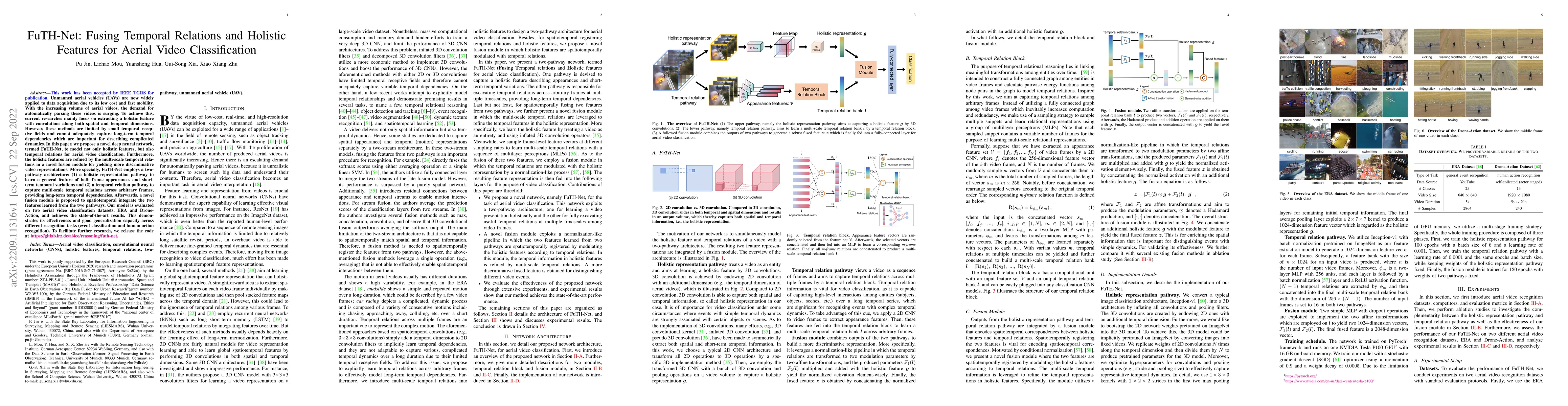
Unmanned aerial vehicles (UAVs) are now widely applied to data acquisition due to its low cost and fast mobility. With the increasing volume of aerial videos, the demand for automatically parsing th...
Most publicly available datasets for image classification are with single labels, while images are inherently multi-labeled in our daily life. Such an annotation gap makes many pre-trained single-la...
Aerial scene recognition is a fundamental visual task and has attracted an increasing research interest in the last few years. Most of current researches mainly deploy efforts to categorize an aeria...
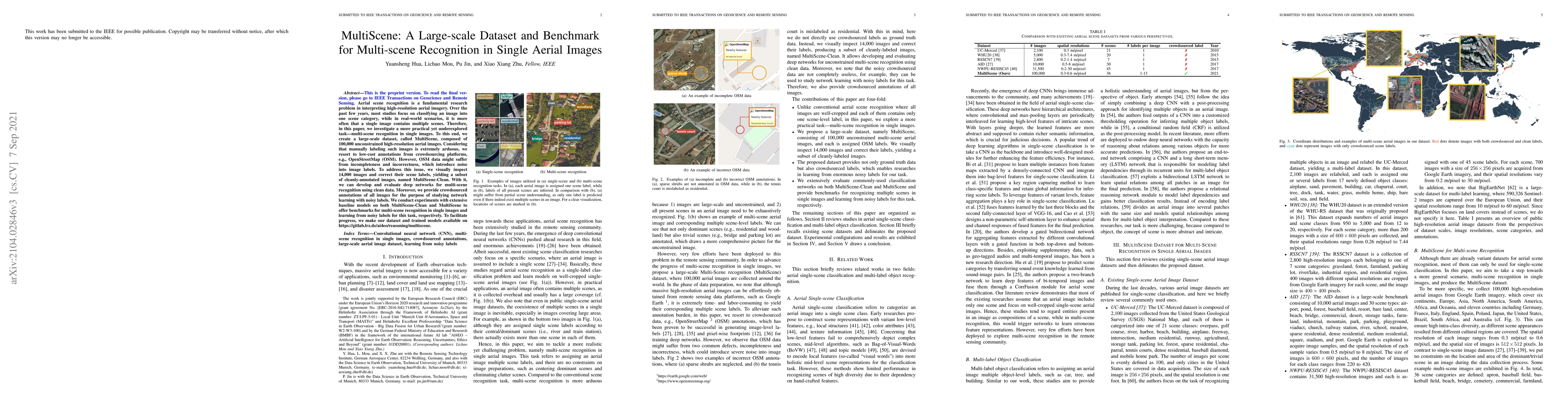
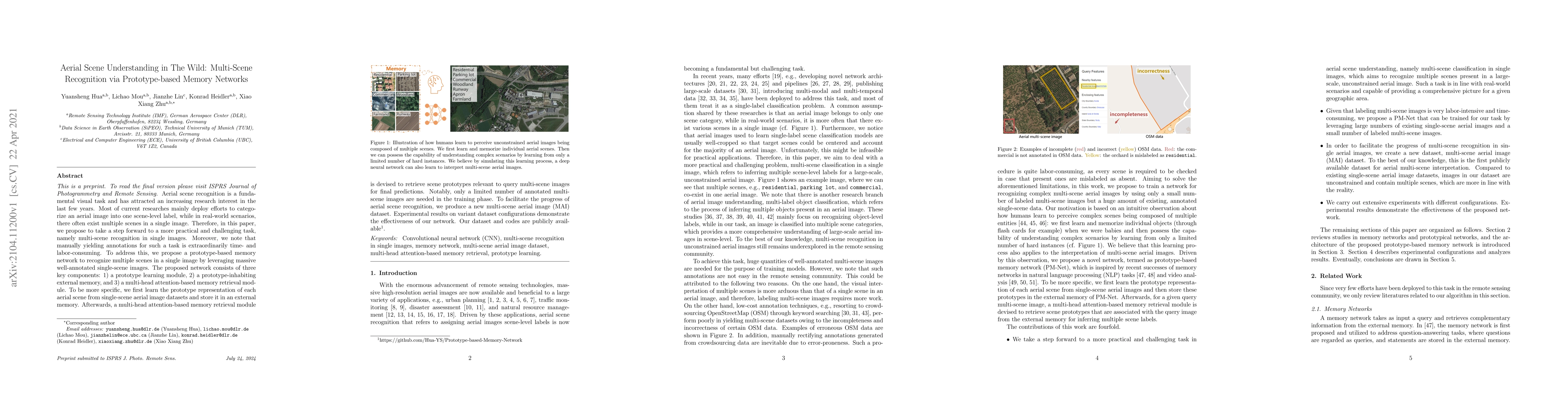
Aerial scene recognition is a fundamental research problem in interpreting high-resolution aerial imagery. Over the past few years, most studies focus on classifying an image into one scene category...
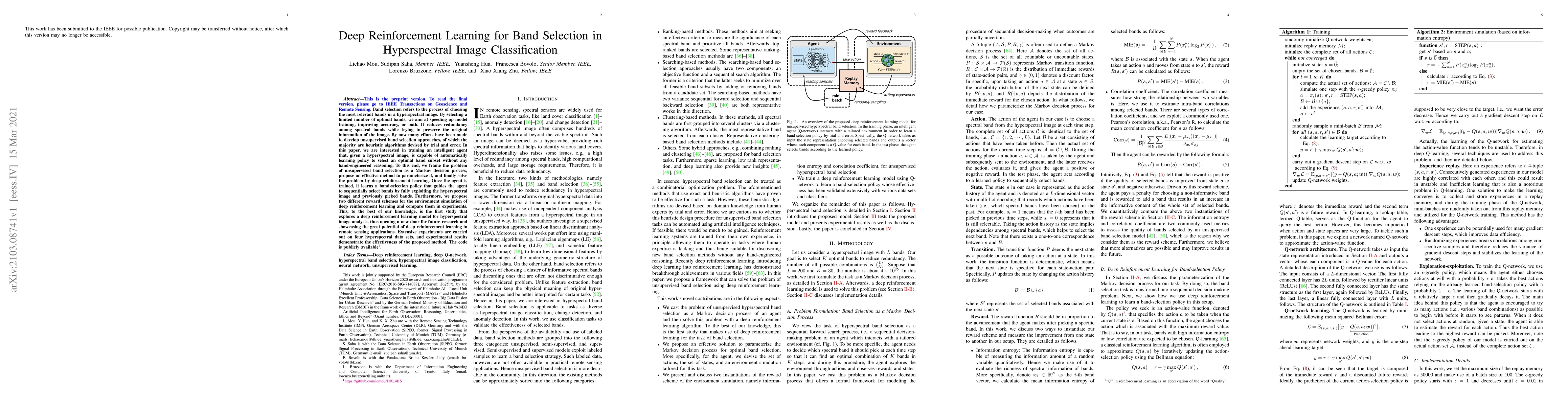
Band selection refers to the process of choosing the most relevant bands in a hyperspectral image. By selecting a limited number of optimal bands, we aim at speeding up model training, improving acc...
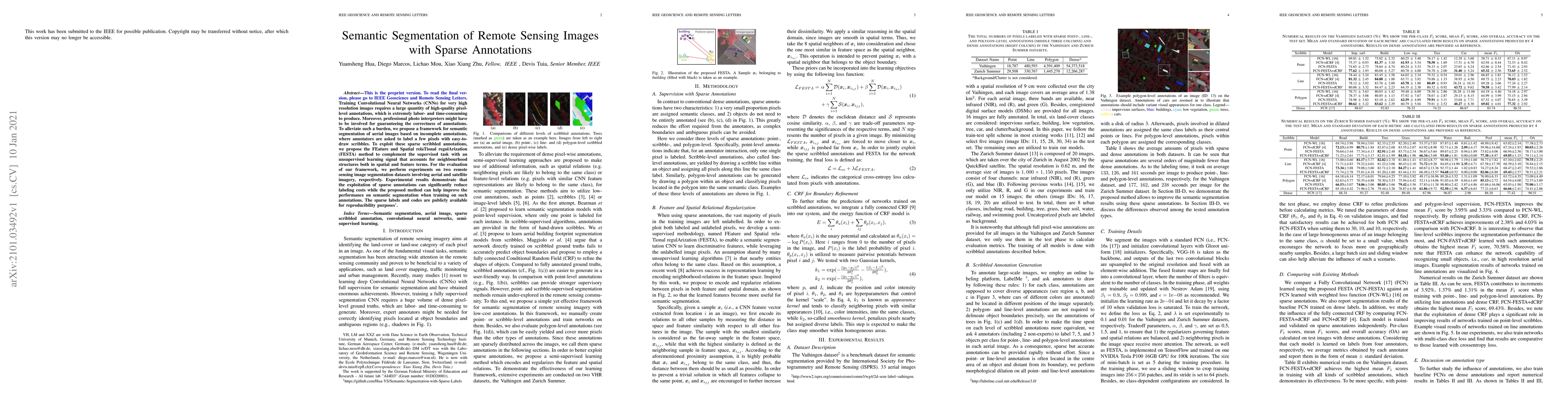
Training Convolutional Neural Networks (CNNs) for very high resolution images requires a large quantity of high-quality pixel-level annotations, which is extremely labor- and time-consuming to produ...
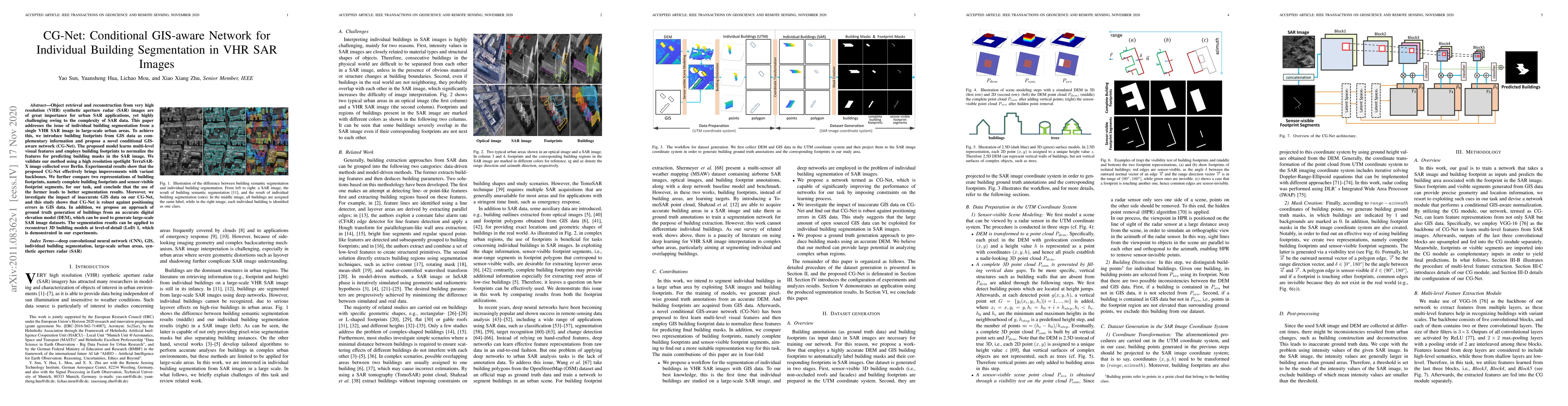
Object retrieval and reconstruction from very high resolution (VHR) synthetic aperture radar (SAR) images are of great importance for urban SAR applications, yet highly challenging owing to the comp...
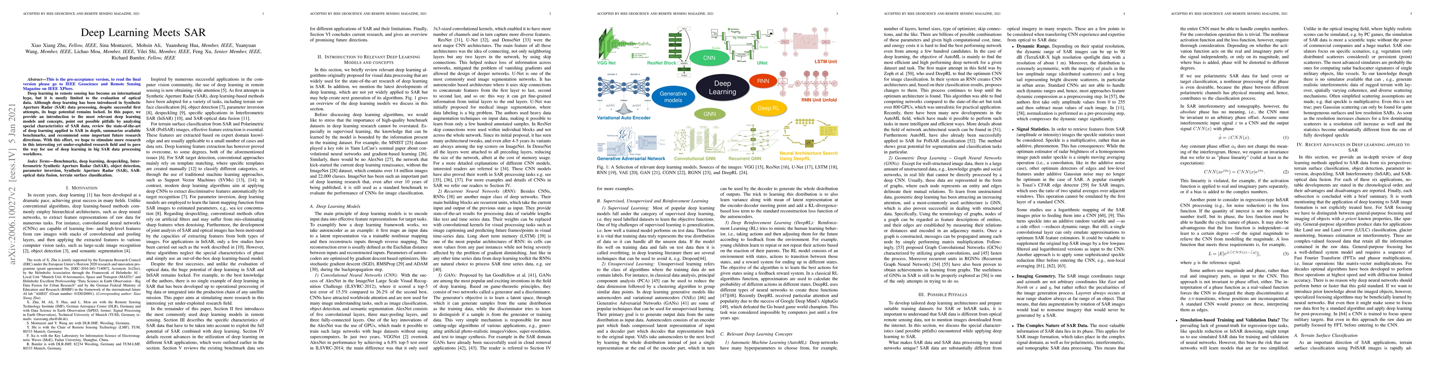
Deep learning in remote sensing has become an international hype, but it is mostly limited to the evaluation of optical data. Although deep learning has been introduced in Synthetic Aperture Radar (...
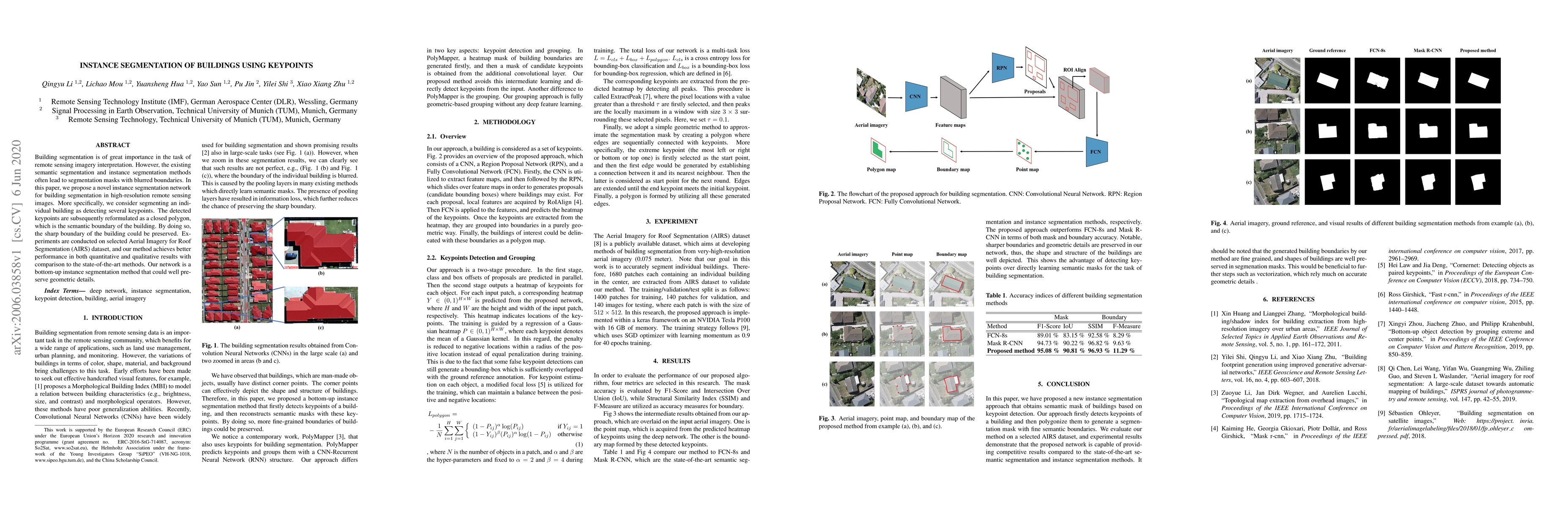
Building segmentation is of great importance in the task of remote sensing imagery interpretation. However, the existing semantic segmentation and instance segmentation methods often lead to segment...
Visual crowd counting has been recently studied as a way to enable people counting in crowd scenes from images. Albeit successful, vision-based crowd counting approaches could fail to capture inform...
Access to labeled reference data is one of the grand challenges in supervised machine learning endeavors. This is especially true for an automated analysis of remote sensing images on a global scale...
Multi-label classification plays a momentous role in perceiving intricate contents of an aerial image and triggers several related studies over the last years. However, most of them deploy few effor...