Academic Profile
Statistics
Similar Authors
Papers on arXiv
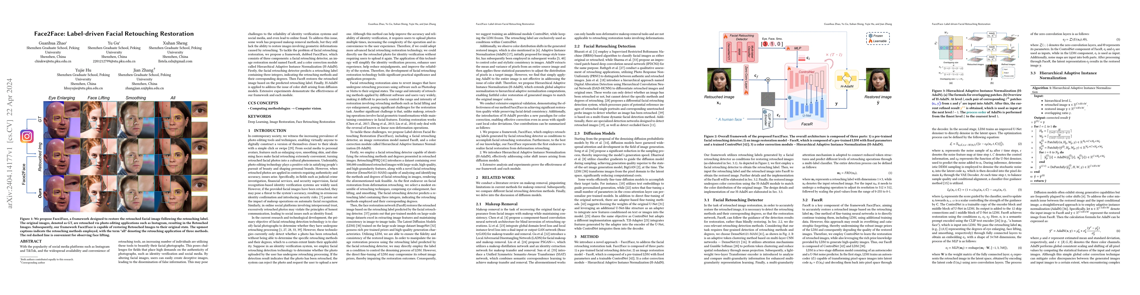
With the popularity of social media platforms such as Instagram and TikTok, and the widespread availability and convenience of retouching tools, an increasing number of individuals are utilizing the...
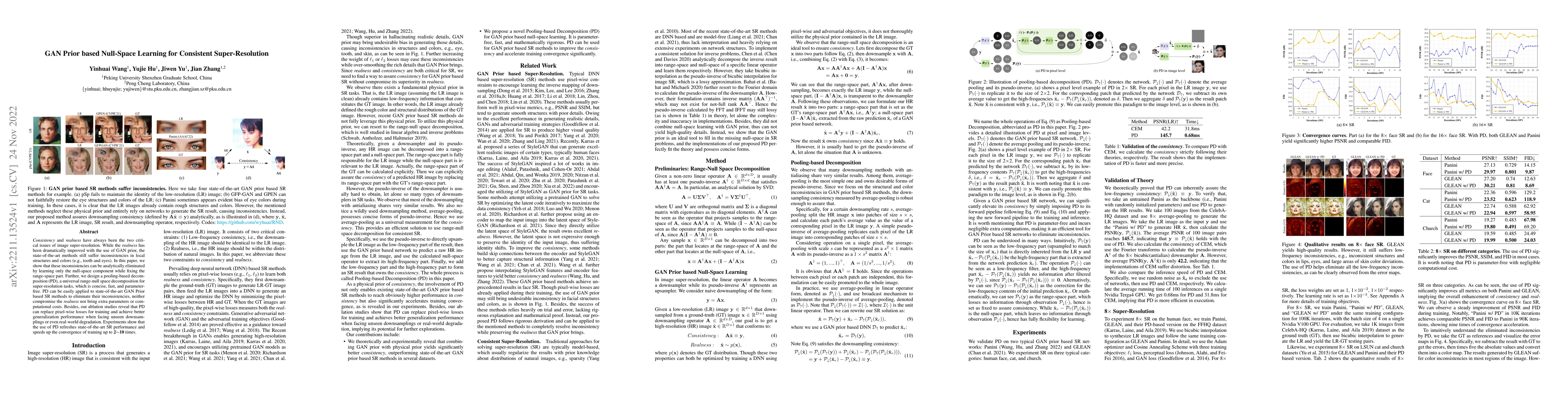
Consistency and realness have always been the two critical issues of image super-resolution. While the realness has been dramatically improved with the use of GAN prior, the state-of-the-art methods...
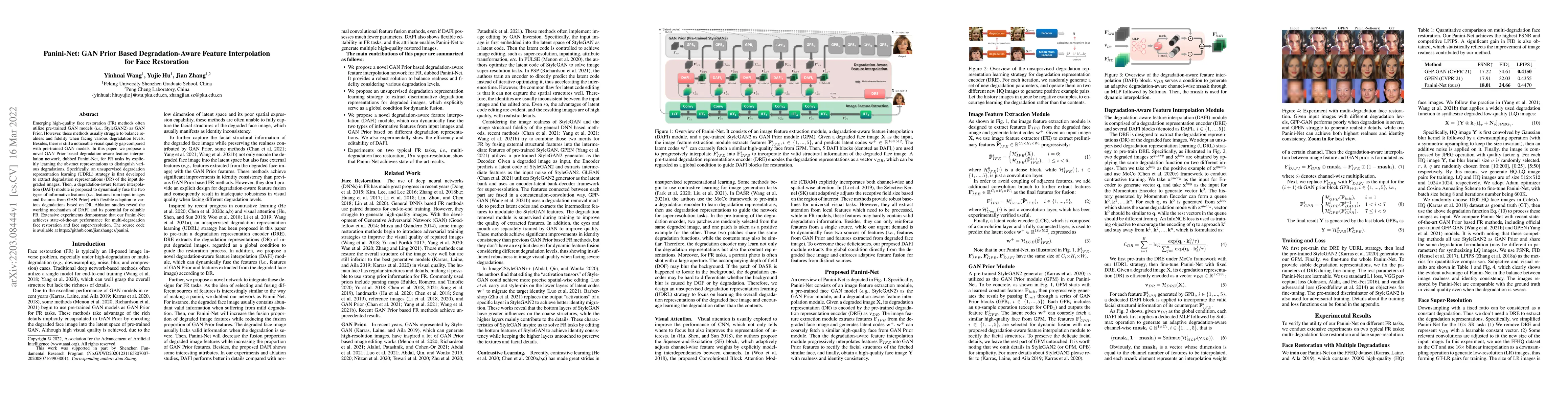
Emerging high-quality face restoration (FR) methods often utilize pre-trained GAN models (\textit{i.e.}, StyleGAN2) as GAN Prior. However, these methods usually struggle to balance realness and fide...
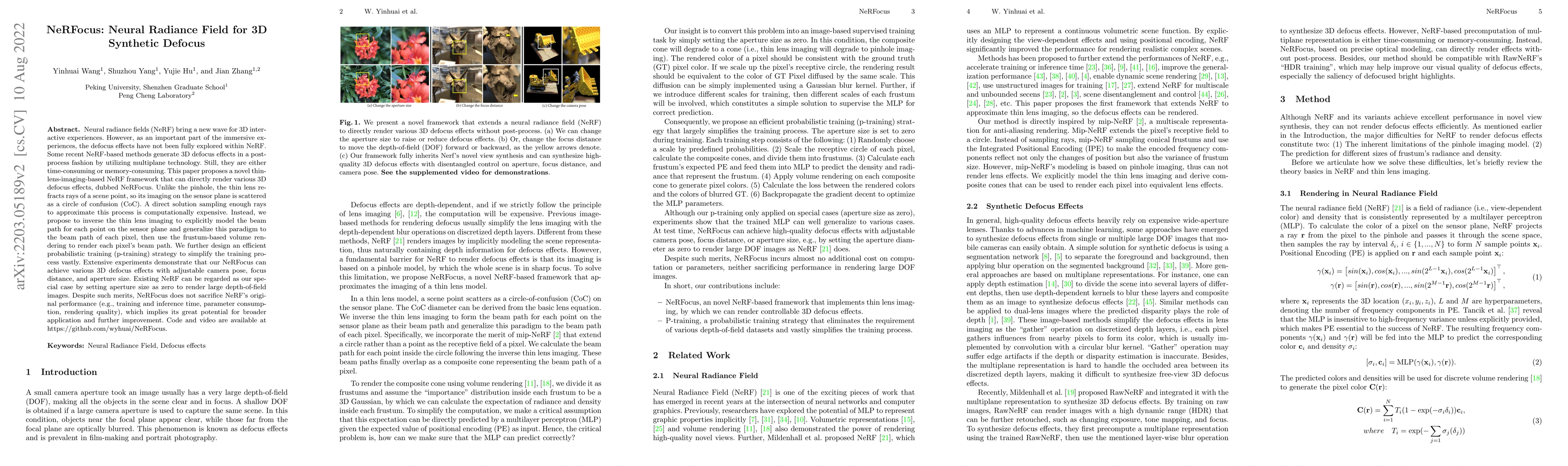
Neural radiance fields (NeRF) bring a new wave for 3D interactive experiences. However, as an important part of the immersive experiences, the defocus effects have not been fully explored within NeR...
In statistical applications, it is common to encounter parameters supported on a varying or unknown dimensional space. Examples include the fused lasso regression, the matrix recovery under an unkno...
Commuting, like other types of human travel, is complex in nature, such as trip-chaining behavior involving making stops of multiple purposes between two anchors. According to the 2001 National Hous...
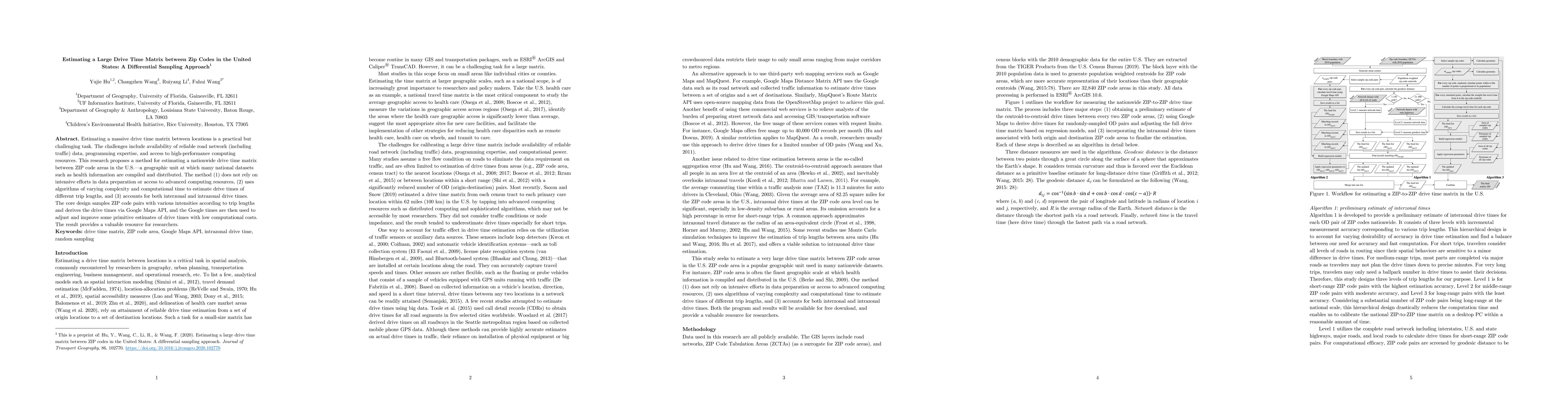
Estimating a massive drive time matrix between locations is a practical but challenging task. The challenges include availability of reliable road network (including traffic) data, programming exper...
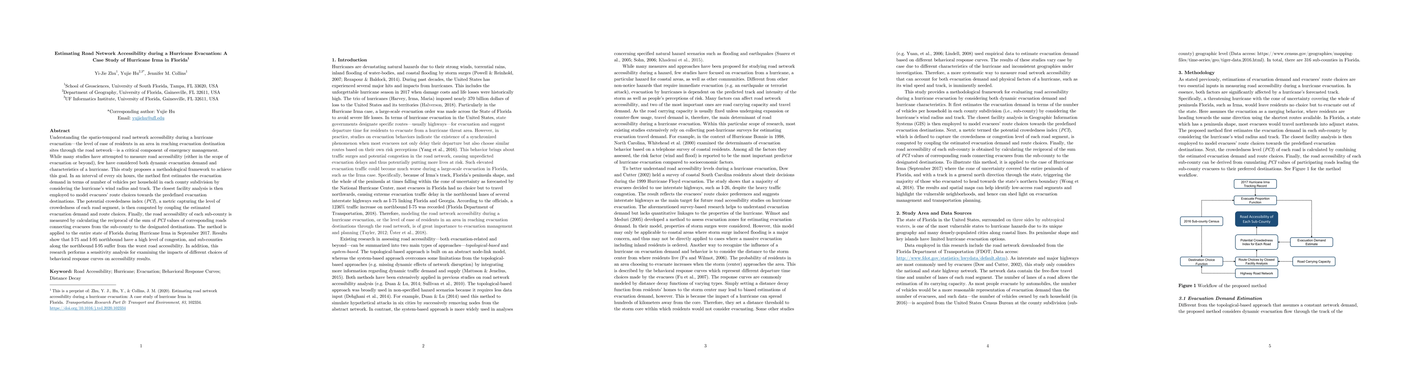
Understanding the spatiotemporal road network accessibility during a hurricane evacuation, the level of ease of residents in an area in reaching evacuation destination sites through the road network...
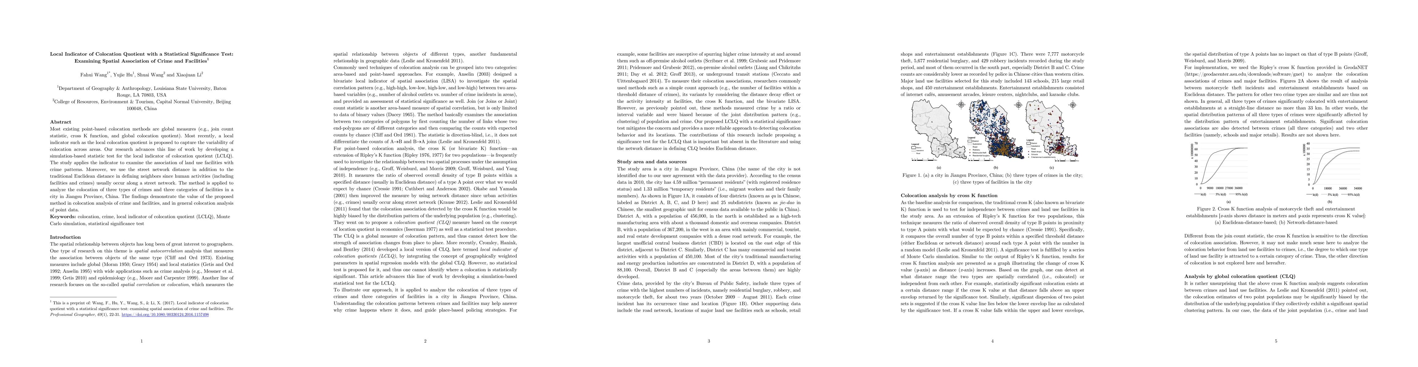
Most existing point-based colocation methods are global measures (e.g., join count statistic, cross K function, and global colocation quotient). Most recently, a local indicator such as the local co...
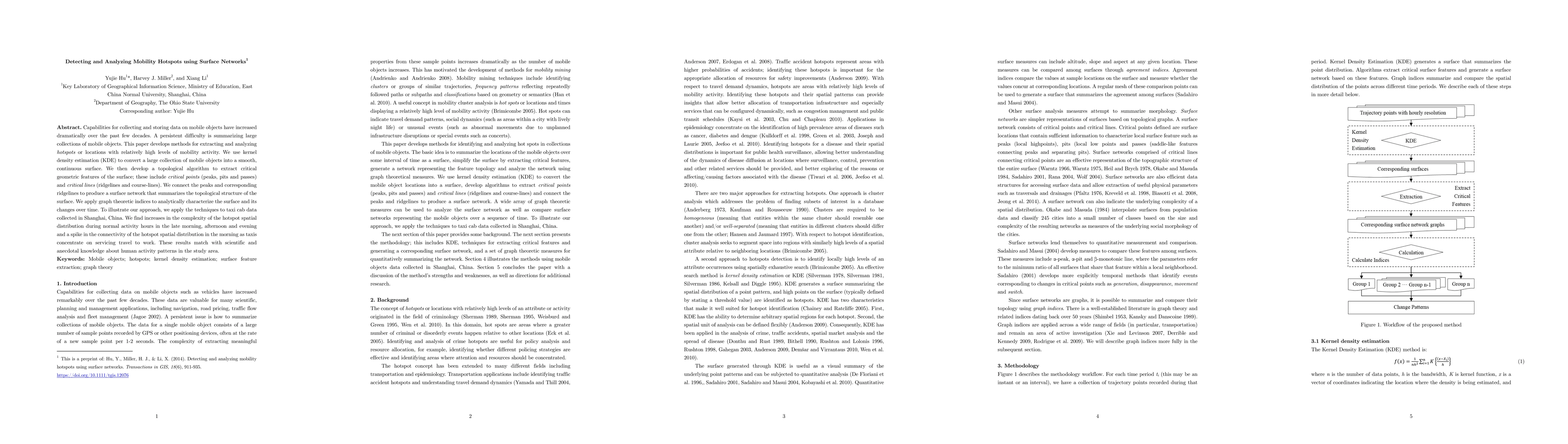
Capabilities for collecting and storing data on mobile objects have increased dramatically over the past few decades. A persistent difficulty is summarizing large collections of mobile objects. This...
Residential segregation recently has shifted to more class or income-based in the United States, and neighborhoods are undergoing significant changes such as commuting patterns over time. To better ...
Pedestrians and cyclists are vulnerable road users. They are at greater risk for being killed in a crash than other road users. The percentage of fatal crashes that involve a pedestrian or cyclist i...
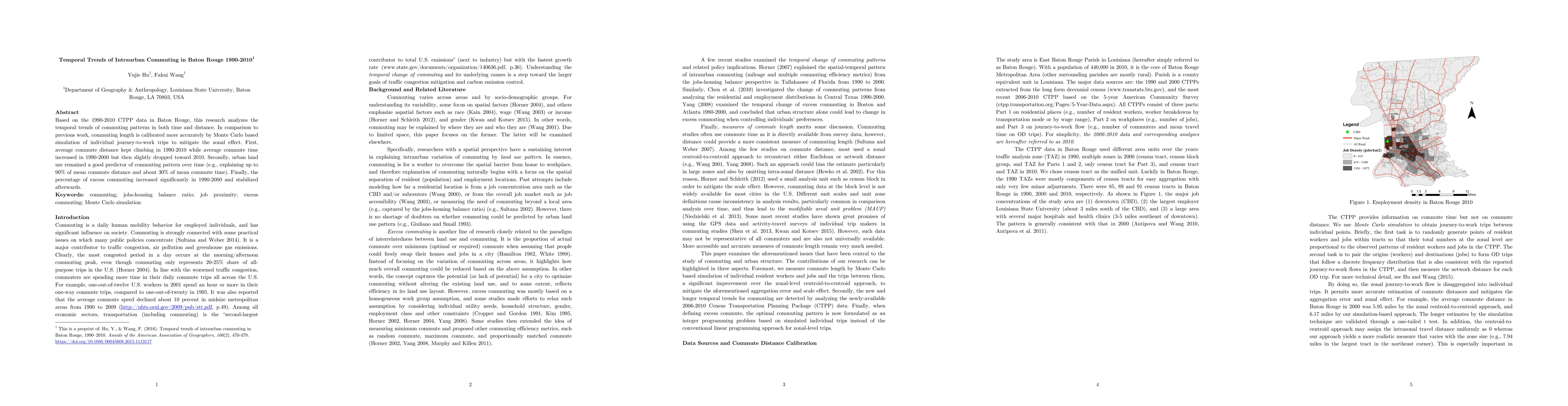
Based on the 1990-2010 CTPP data in Baton Rouge, this research analyzes the temporal trends of commuting patterns in both time and distance. In comparison to previous work, commuting length is calib...
Excess or wasteful commuting is measured as the proportion of actual commute that is over minimum (optimal) commute when assuming that people could freely swap their homes and jobs in a city. Studie...
Objective. To develop an automated, data-driven, and scale-flexible method to delineate HSAs and HRRs that are up-to-date, representative of all patients, and have the optimal localization of hospit...
Predictive hotspot mapping plays a critical role in hotspot policing. Existing methods such as the popular kernel density estimation (KDE) do not consider the temporal dimension of crime. Building u...
The mobility of residents and their access to essential services can be highly affected by transportation network closures that occur during and after coastal hazard events. Few studies have used ge...
Place-based accessibility measures, such as the gravity-based model, are widely applied to study the spatial accessibility of workers to job opportunities in cities. However, gravity-based measures ...
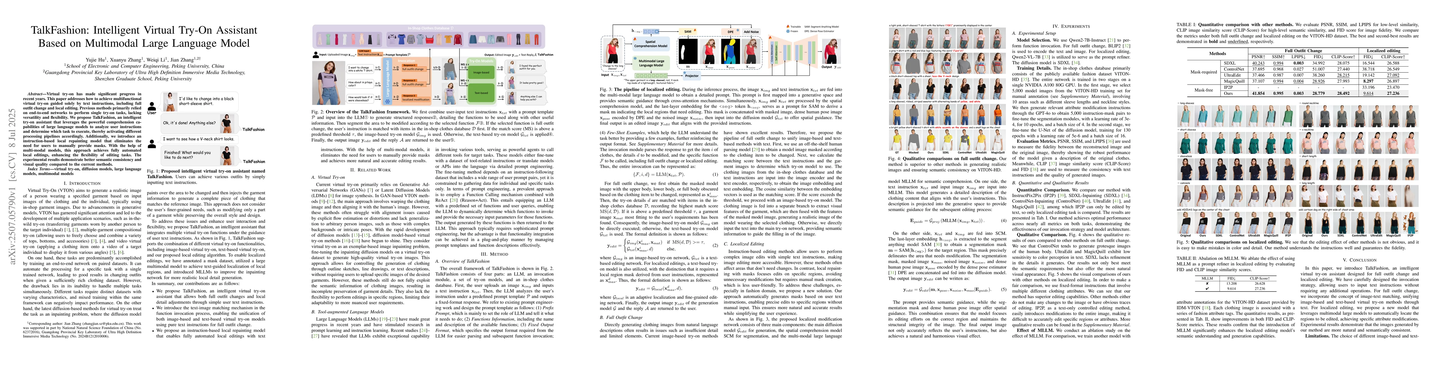
Virtual try-on has made significant progress in recent years. This paper addresses how to achieve multifunctional virtual try-on guided solely by text instructions, including full outfit change and lo...
Thanks to the powerful language comprehension capabilities of Large Language Models (LLMs), existing instruction-based image editing methods have introduced Multimodal Large Language Models (MLLMs) to...