Academic Profile
Statistics
Similar Authors
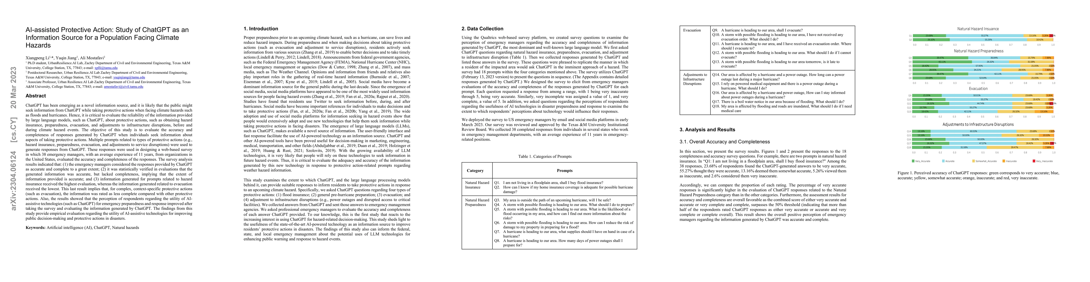
Papers on arXiv
A comprehensive understanding of human mobility patterns in urban areas is essential for urban development and transportation planning. In this study, we create entropy-based measurements to capture...
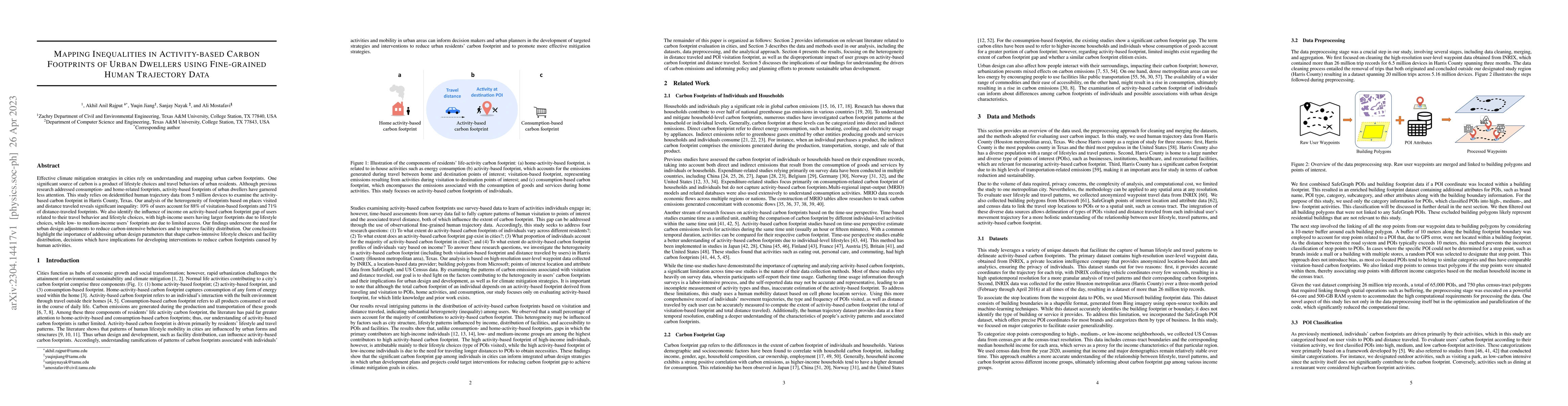
Effective climate mitigation strategies in cities rely on understanding and mapping urban carbon footprints. One significant source of carbon is a product of lifestyle choices and travel behaviors o...
ChatGPT has been emerging as a novel information source, and it is likely that the public might seek information from ChatGPT while taking protective actions when facing climate hazards such as floo...
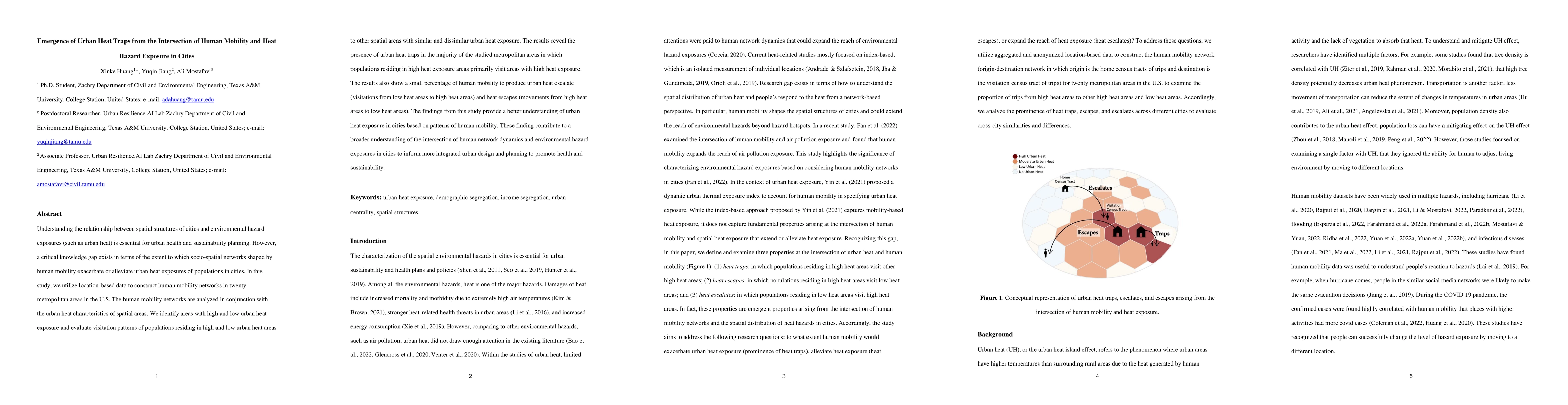
Understanding the relationship between spatial structures of cities and environmental hazard exposures (such as urban heat) is essential for urban health and sustainability planning. However, a crit...
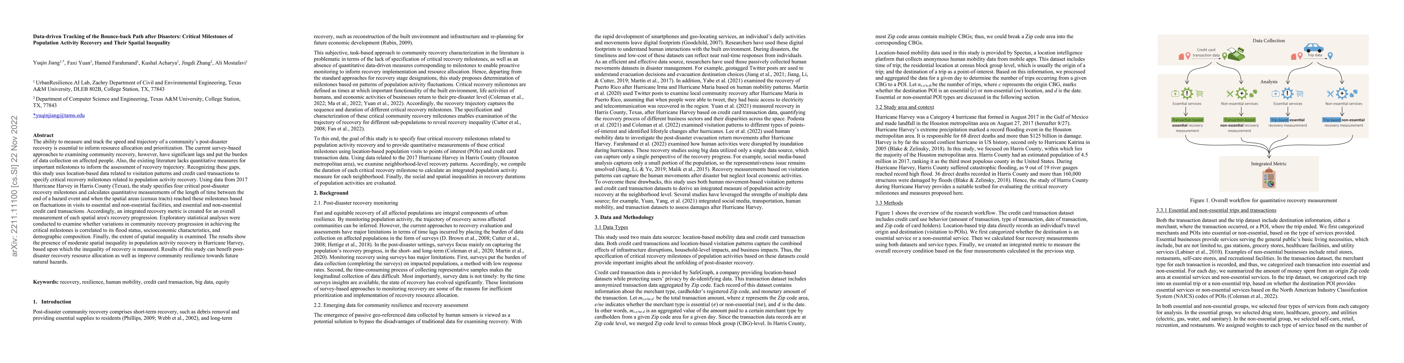
The ability to measure and track the speed and trajectory of a community's post-disaster recovery is essential to inform resource allocation and prioritization. The current survey-based approaches t...
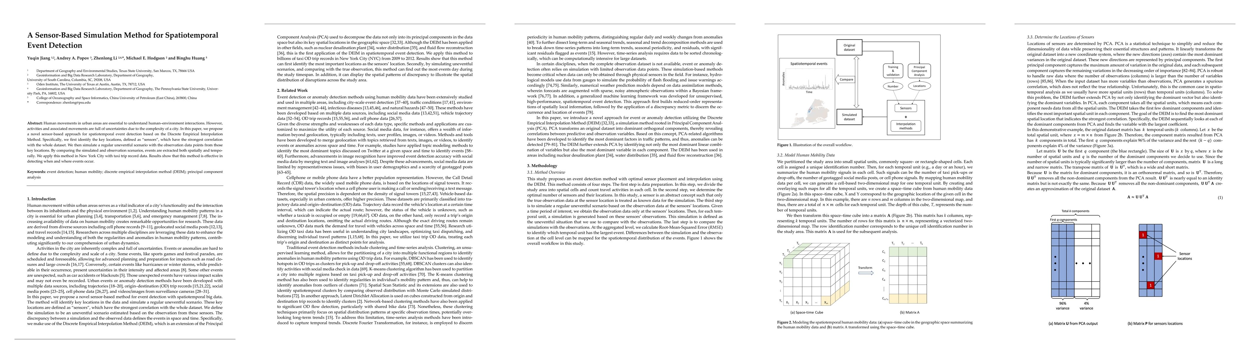
Human movements in urban areas are essential to understand human-environment interactions. However, activities and associated movements are full of uncertainties due to the complexity of a city. In ...
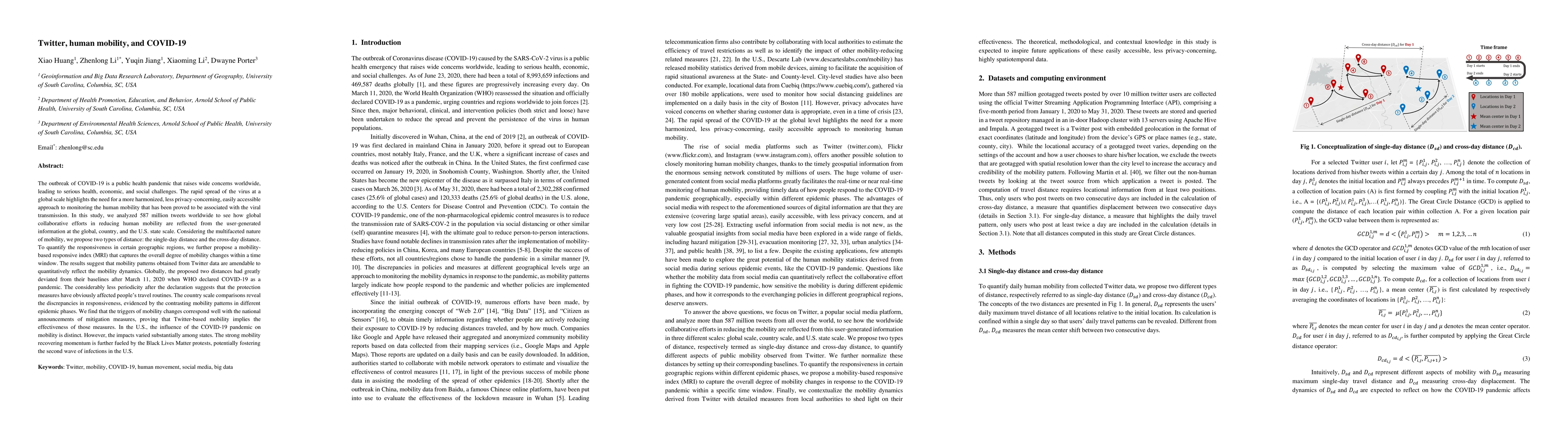
The outbreak of COVID-19 highlights the need for a more harmonized, less privacy-concerning, easily accessible approach to monitoring the human mobility that has been proved to be associated with th...
Numerous researchers have utilized GPS-enabled vehicle data and SafeGraph mobility data to analyze human movements. However, the comparison of their ability to capture human mobility remains unexplore...
Understanding urban human mobility patterns at various spatial levels is essential for social science. This study presents a machine learning framework to downscale origin-destination (OD) taxi trips ...
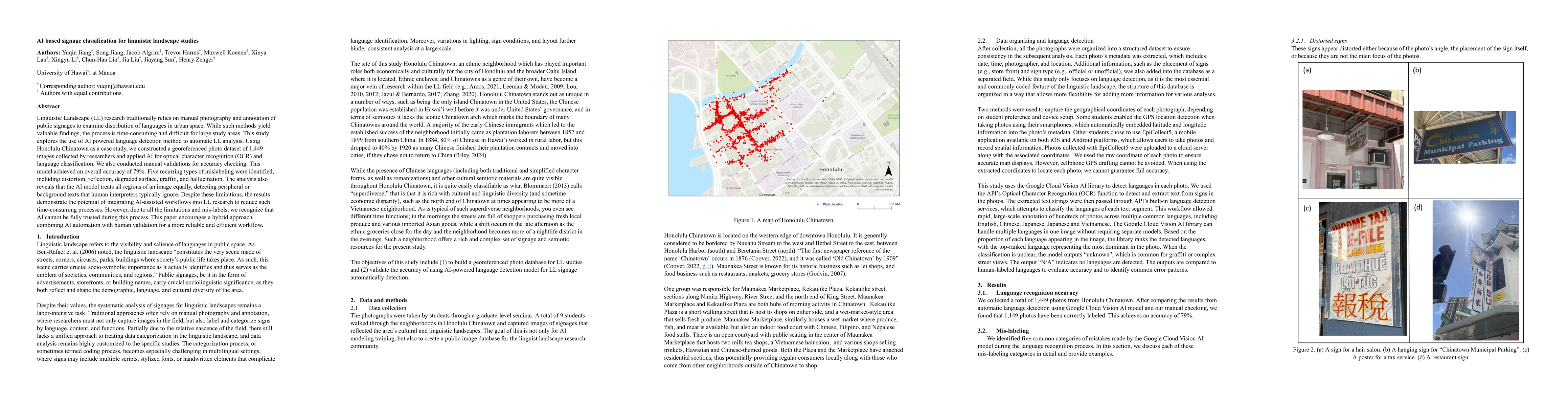
Linguistic Landscape (LL) research traditionally relies on manual photography and annotation of public signages to examine distribution of languages in urban space. While such methods yield valuable f...
The estimation of concentration parameter in Fisher-von Mises-Langevin distribution is the directional statistics analogue of the estimation of the precision matrix for the Gaussian distribution. In t...