Academic Profile
Statistics
Similar Authors
Papers on arXiv
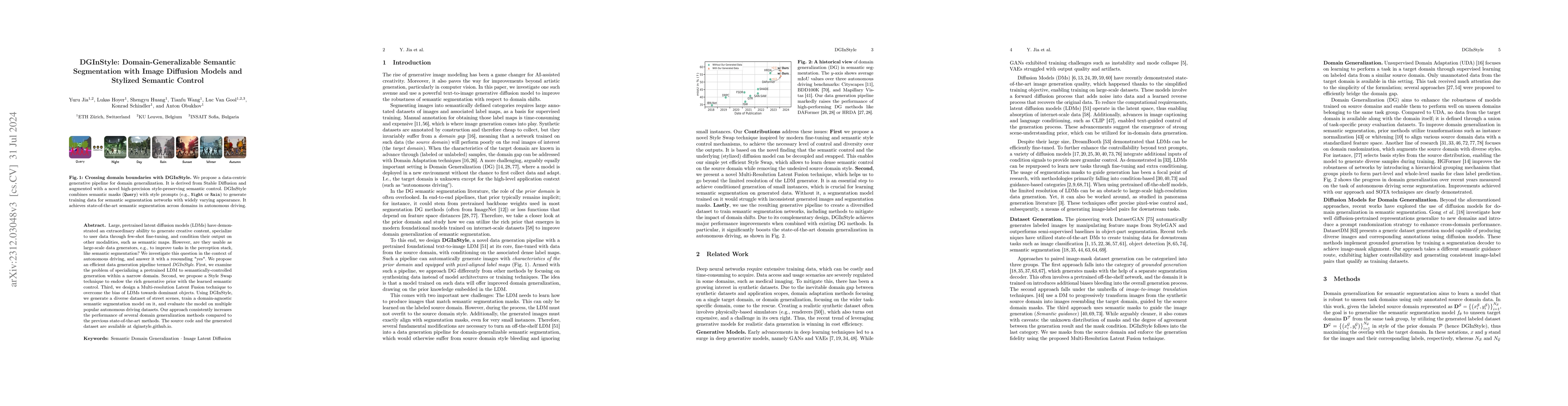
Large, pretrained latent diffusion models (LDMs) have demonstrated an extraordinary ability to generate creative content, specialize to user data through few-shot fine-tuning, and condition their ou...
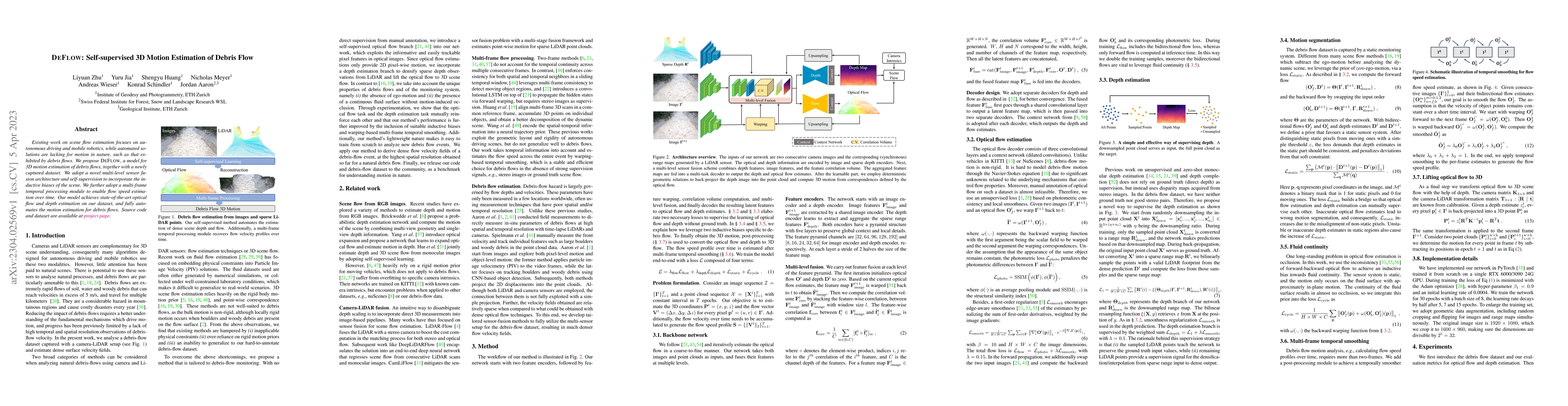
Existing work on scene flow estimation focuses on autonomous driving and mobile robotics, while automated solutions are lacking for motion in nature, such as that exhibited by debris flows. We propo...
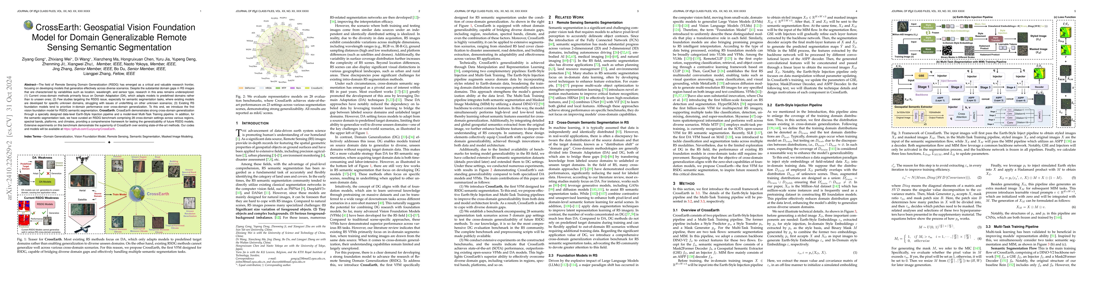
The field of Remote Sensing Domain Generalization (RSDG) has emerged as a critical and valuable research frontier, focusing on developing models that generalize effectively across diverse scenarios. D...
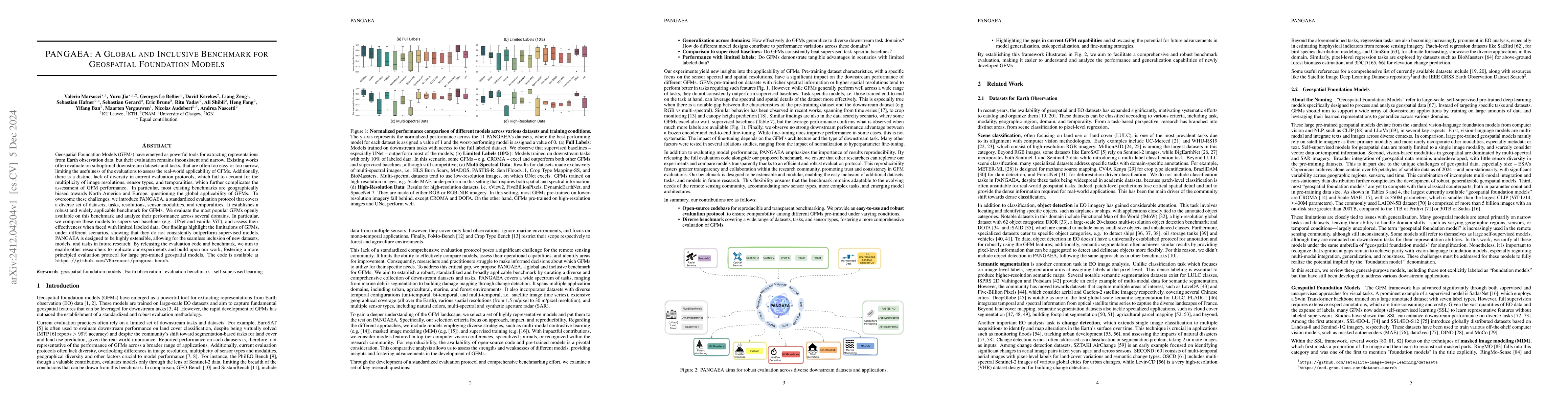
Geospatial Foundation Models (GFMs) have emerged as powerful tools for extracting representations from Earth observation data, but their evaluation remains inconsistent and narrow. Existing works ofte...
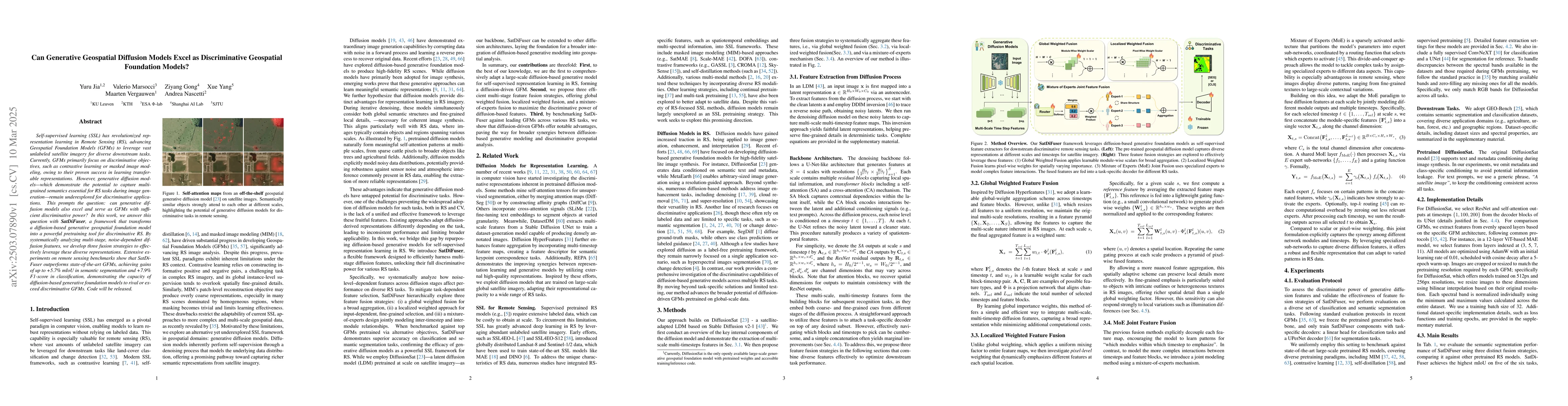
Self-supervised learning (SSL) has revolutionized representation learning in Remote Sensing (RS), advancing Geospatial Foundation Models (GFMs) to leverage vast unlabeled satellite imagery for diverse...
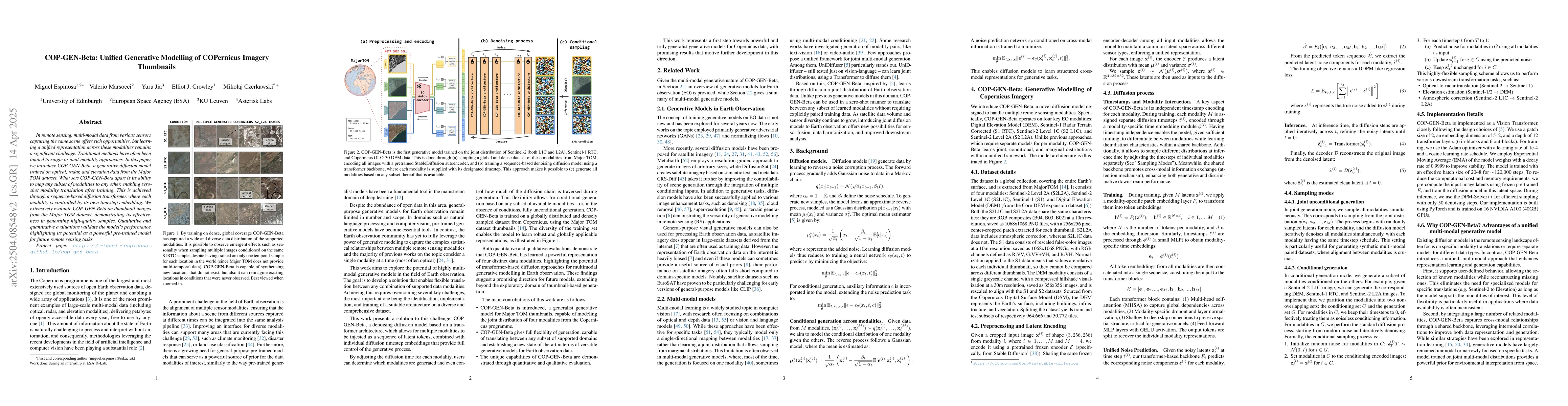
In remote sensing, multi-modal data from various sensors capturing the same scene offers rich opportunities, but learning a unified representation across these modalities remains a significant challen...
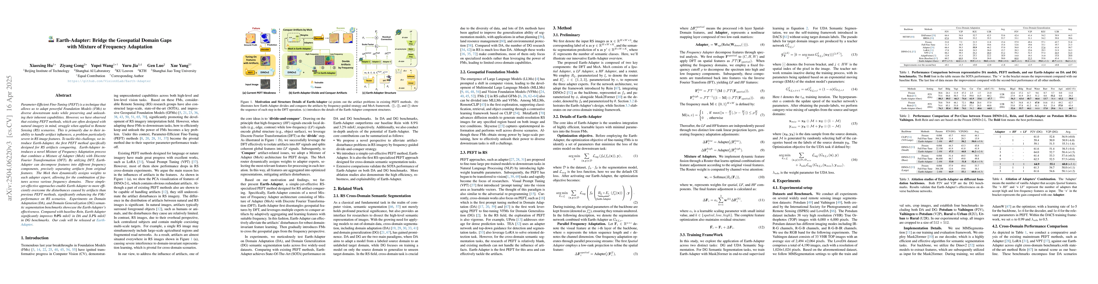
Parameter-Efficient Fine-Tuning (PEFT) is a technique that allows us to adapt powerful Foundation Models (FMs) to diverse downstream tasks while preserving and unleashing their inherent capabilities. ...
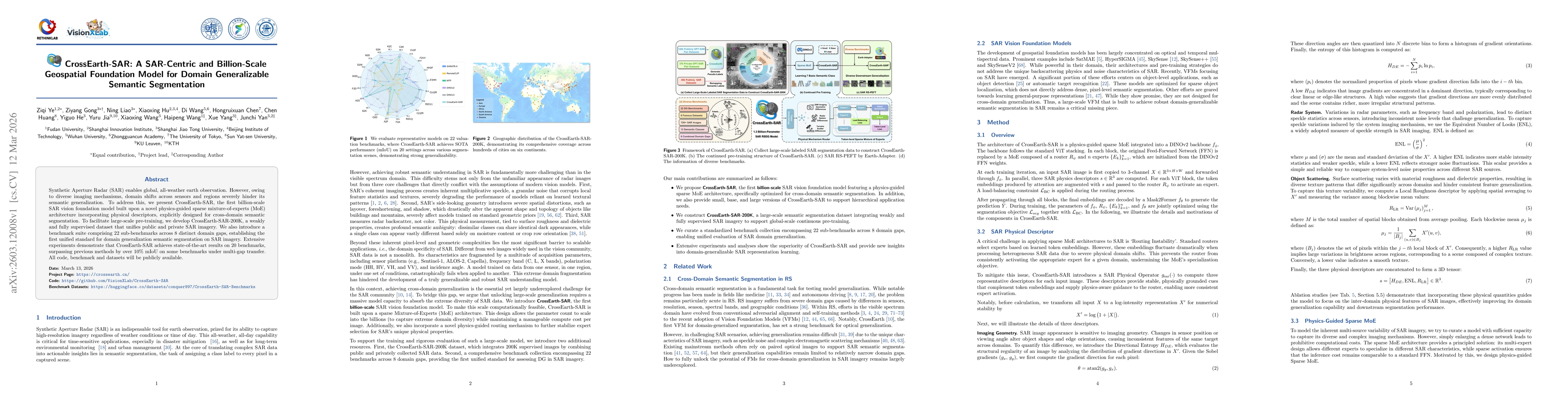
Synthetic Aperture Radar (SAR) enables global, all-weather earth observation. However, owing to diverse imaging mechanisms, domain shifts across sensors and regions severely hinder its semantic genera...