Academic Profile
Statistics
Similar Authors
Papers on arXiv
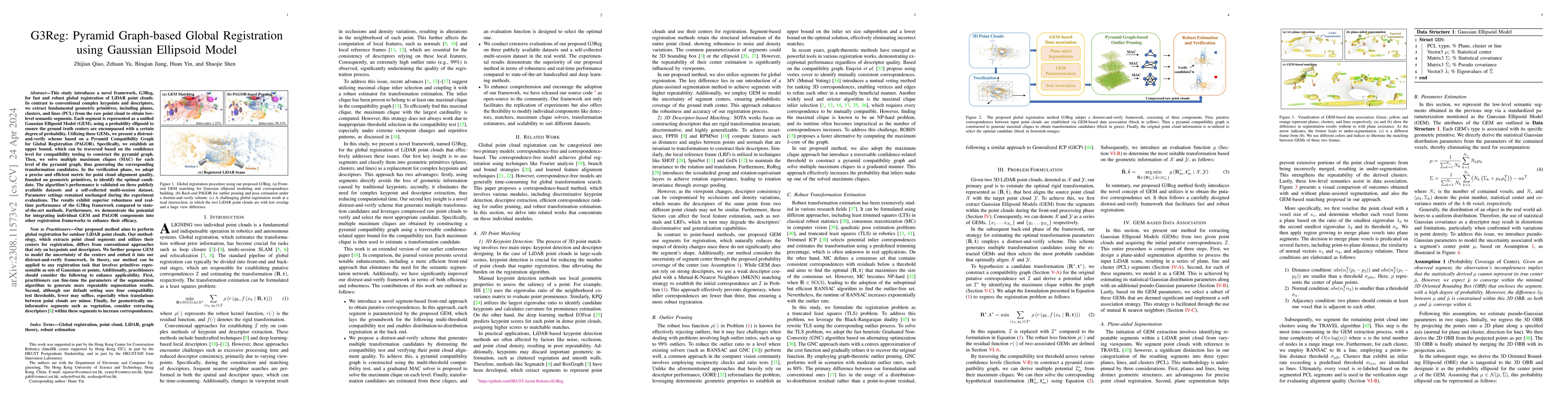
This study introduces a novel framework, G3Reg, for fast and robust global registration of LiDAR point clouds. In contrast to conventional complex keypoints and descriptors, we extract fundamental g...
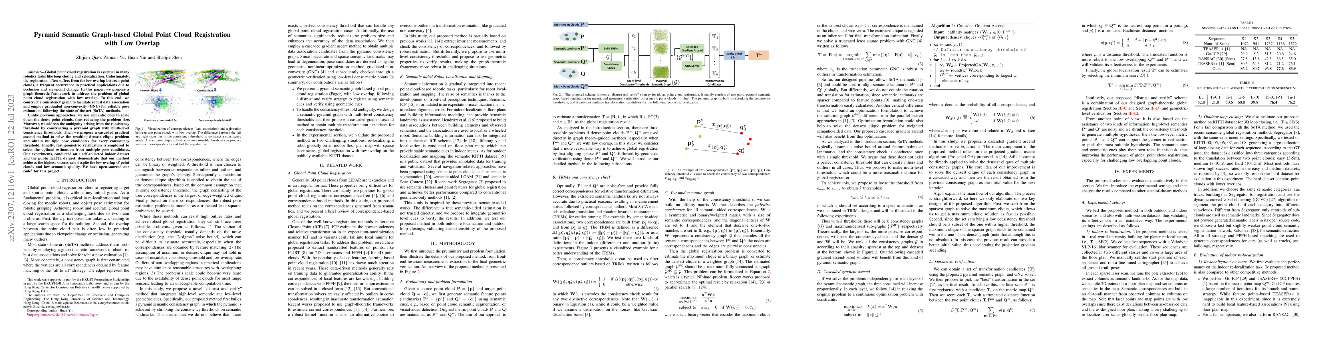
Global point cloud registration is essential in many robotics tasks like loop closing and relocalization. Unfortunately, the registration often suffers from the low overlap between point clouds, a f...
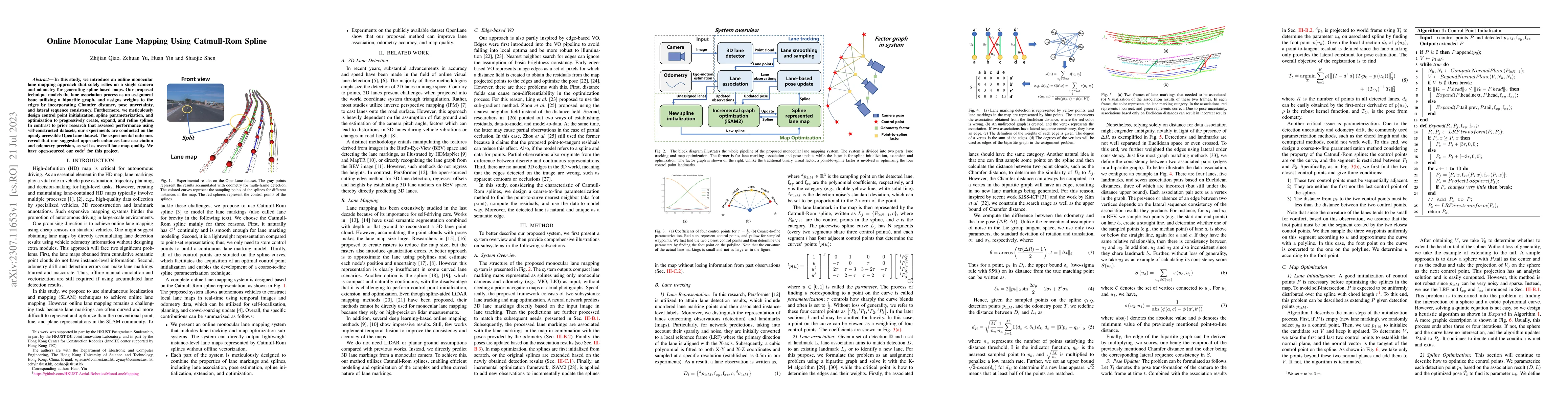
In this study, we introduce an online monocular lane mapping approach that solely relies on a single camera and odometry for generating spline-based maps. Our proposed technique models the lane asso...
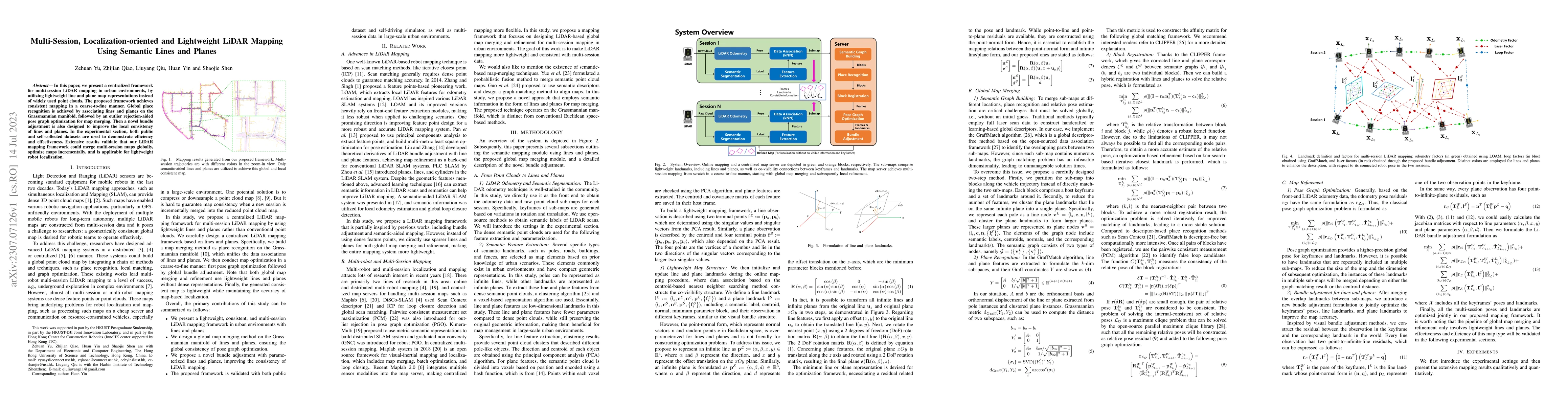
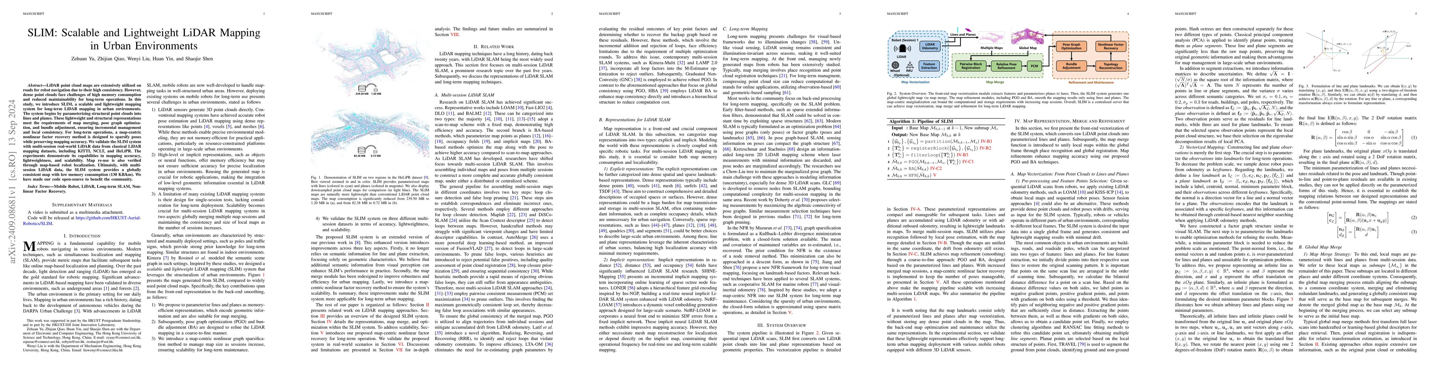
In this paper, we present a centralized framework for multi-session LiDAR mapping in urban environments, by utilizing lightweight line and plane map representations instead of widely used point clou...
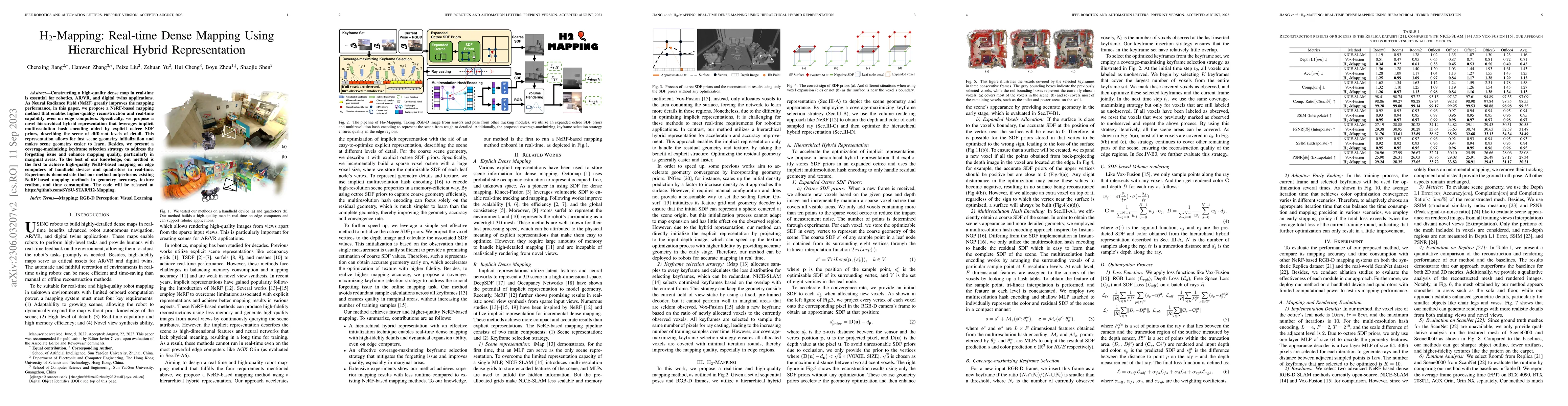
Constructing a high-quality dense map in real-time is essential for robotics, AR/VR, and digital twins applications. As Neural Radiance Field (NeRF) greatly improves the mapping performance, in this...
Visual features, whose description often relies on the local intensity and gradient direction, have found wide applications in robot navigation and localization in recent years. However, the extractio...
LiDAR point cloud maps are extensively utilized on roads for robot navigation due to their high consistency. However, dense point clouds face challenges of high memory consumption and reduced maintain...
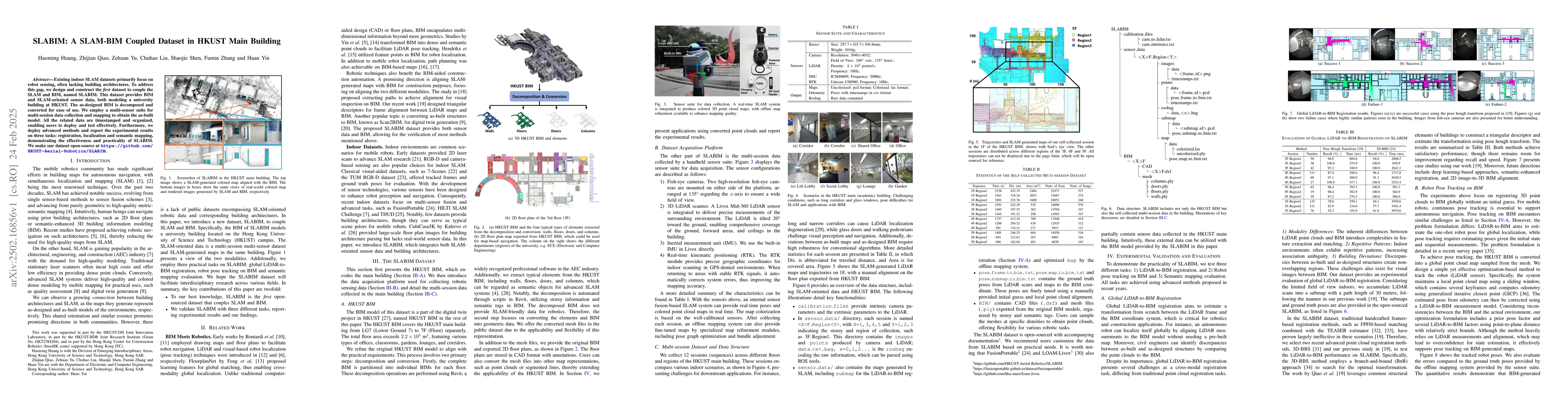
Existing indoor SLAM datasets primarily focus on robot sensing, often lacking building architectures. To address this gap, we design and construct the first dataset to couple the SLAM and BIM, named S...
Crowdsourcing enables scalable autonomous driving map construction, but low-cost sensor noise hinders quality from improving with data volume. We propose CSMapping, a system that produces accurate sem...