Academic Profile
Statistics
Similar Authors
Papers on arXiv
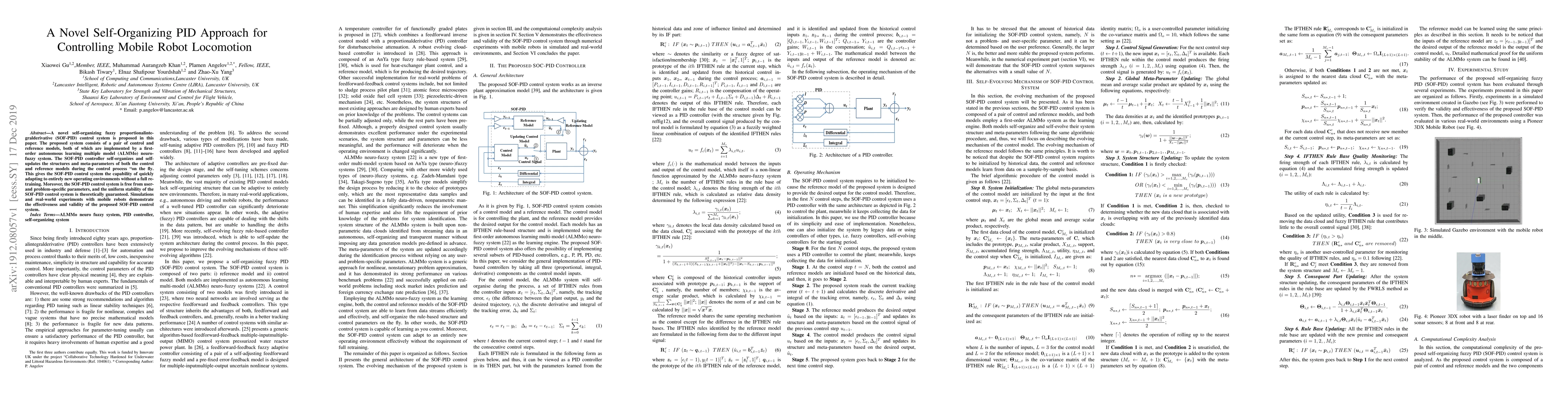
A novel self-organizing fuzzy proportional-integral-derivative (SOF-PID) control system is proposed in this paper. The proposed system consists of a pair of control and reference models, both of whi...
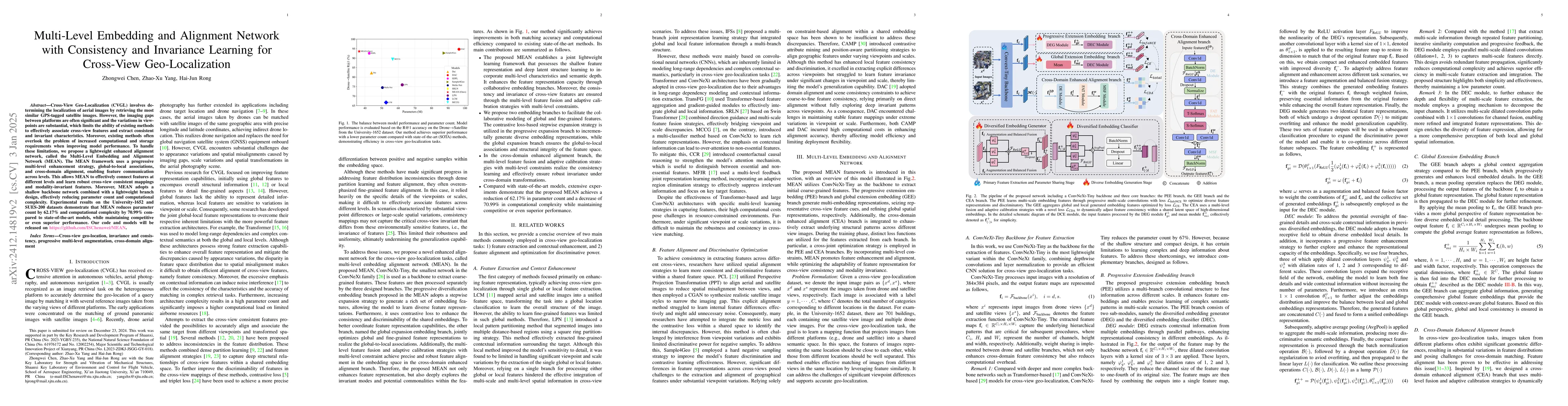
Cross-View Geo-Localization (CVGL) involves determining the localization of drone images by retrieving the most similar GPS-tagged satellite images. However, the imaging gaps between platforms are oft...
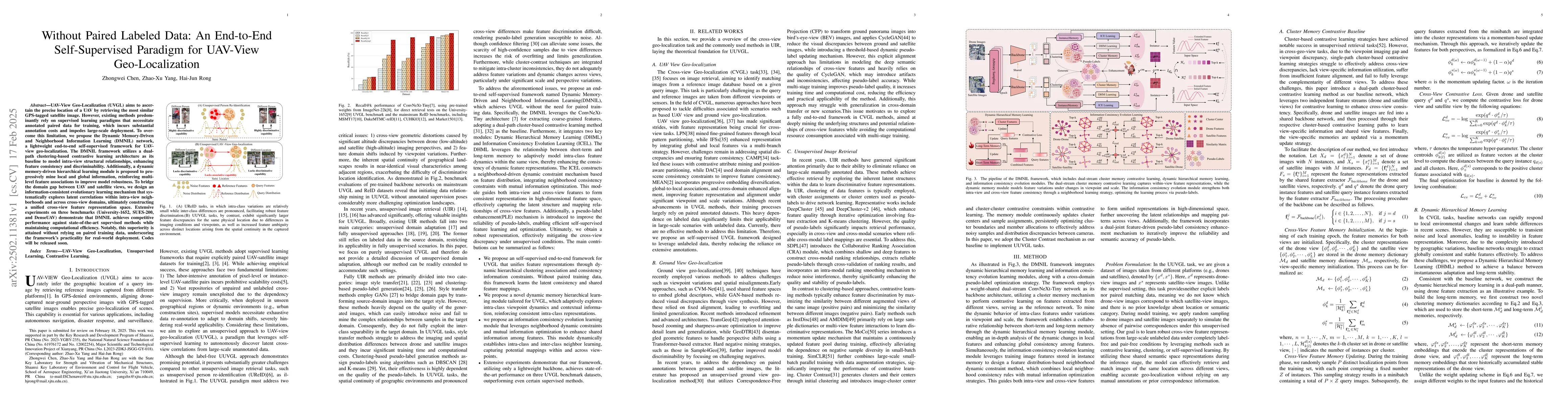
UAV-View Geo-Localization (UVGL) aims to ascertain the precise location of a UAV by retrieving the most similar GPS-tagged satellite image. However, existing methods predominantly rely on supervised l...
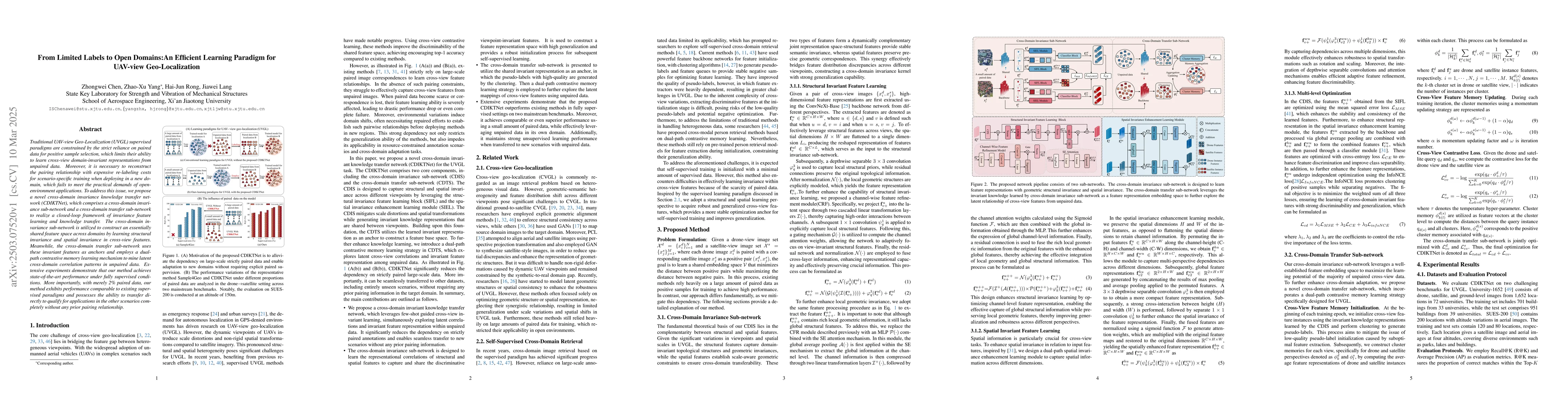
Traditional UAV-view Geo-Localization (UVGL) supervised paradigms are constrained by the strict reliance on paired data for positive sample selection, which limits their ability to learn cross-view do...
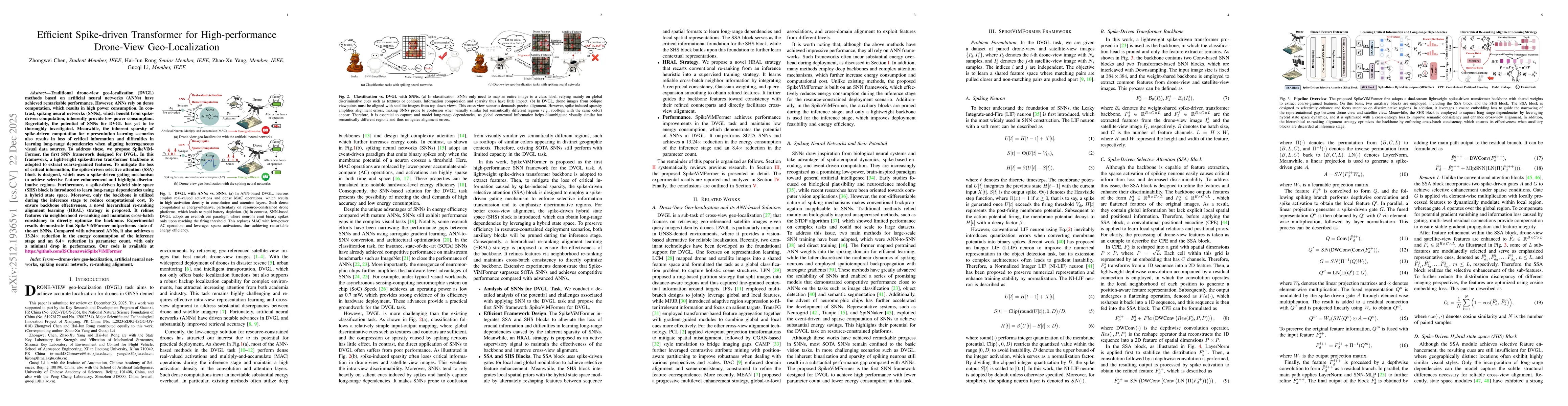
Traditional drone-view geo-localization (DVGL) methods based on artificial neural networks (ANNs) have achieved remarkable performance. However, ANNs rely on dense computation, which results in high p...
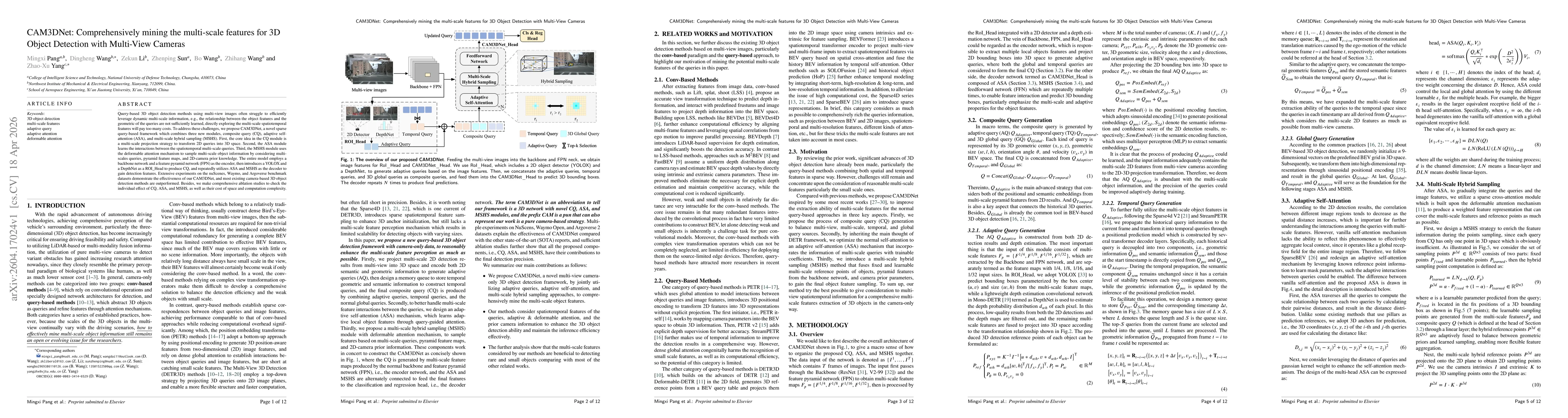
Query-based 3D object detection methods using multi-view images often struggle to efficiently leverage dynamic multi-scale information, e.g., the relationship between the object features and the geome...