Academic Profile
Statistics
Similar Authors
Papers on arXiv
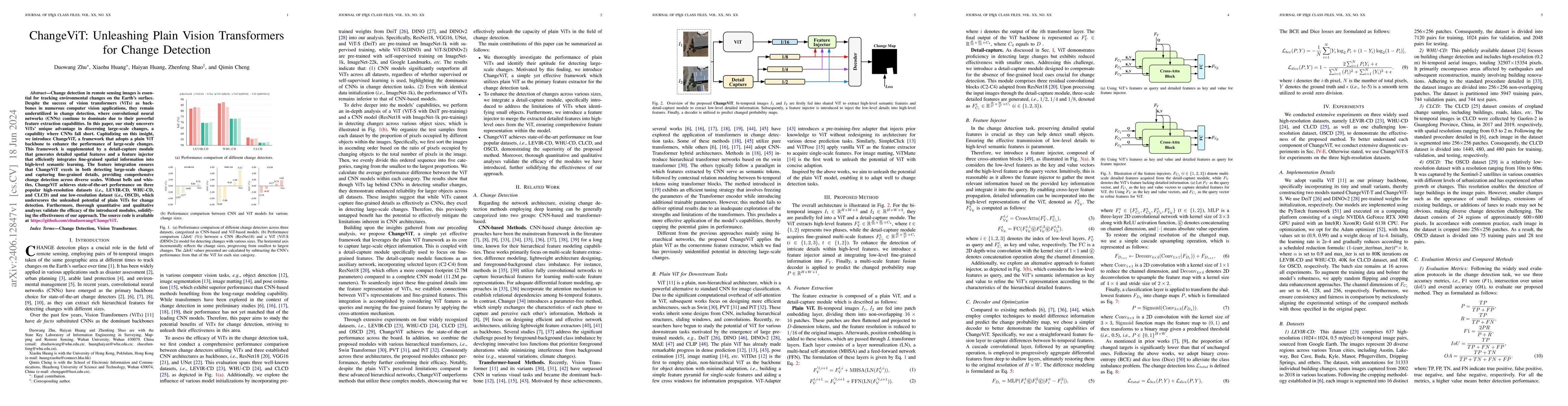
Change detection in remote sensing images is essential for tracking environmental changes on the Earth's surface. Despite the success of vision transformers (ViTs) as backbones in numerous computer vi...
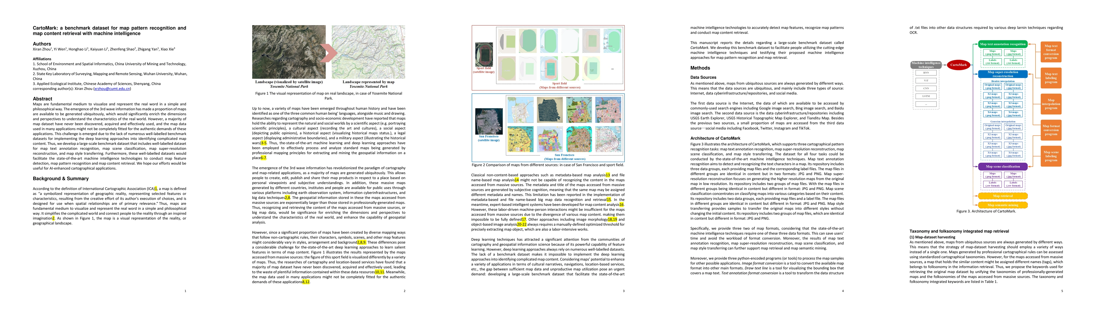
Maps are fundamental medium to visualize and represent the real word in a simple and 16 philosophical way. The emergence of the 3rd wave information has made a proportion of maps are available to be...
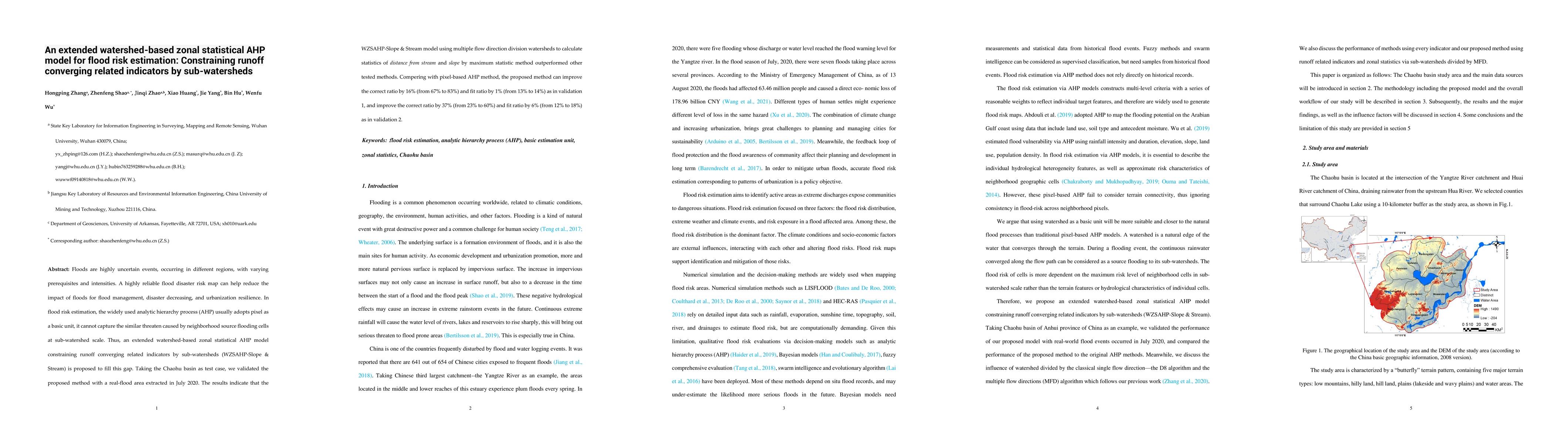
In the analytic hierarchy process (AHP) based flood risk estimation models, it is widely acknowledged that different weighting criteria can lead to different results. In this study, we evaluated and...
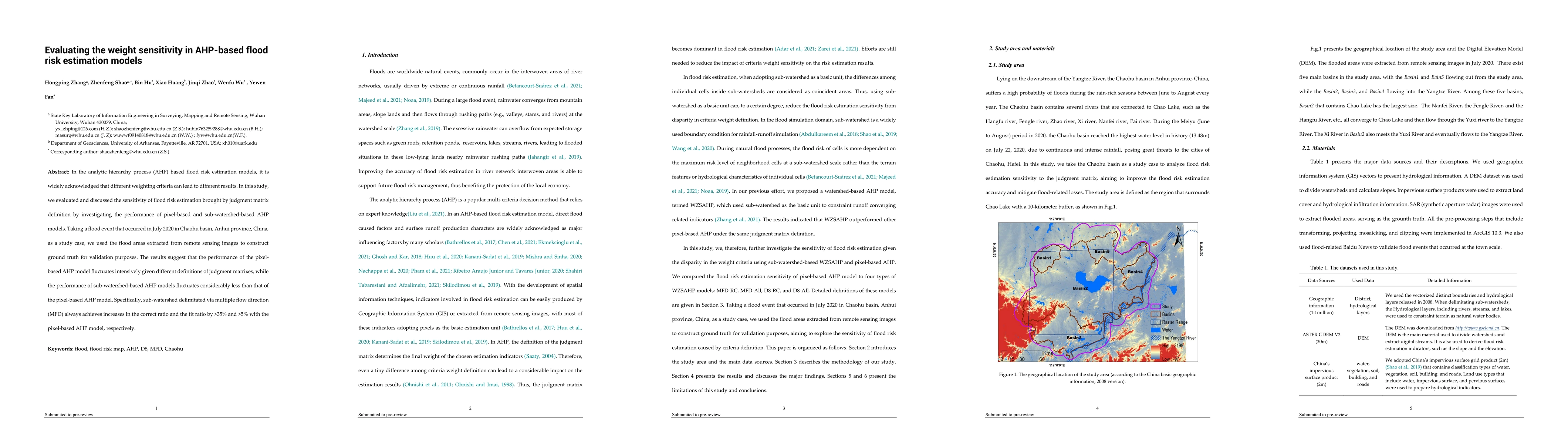
Floods are highly uncertain events, occurring in different regions, with varying prerequisites and intensities. A highly reliable flood disaster risk map can help reduce the impact of floods for flo...
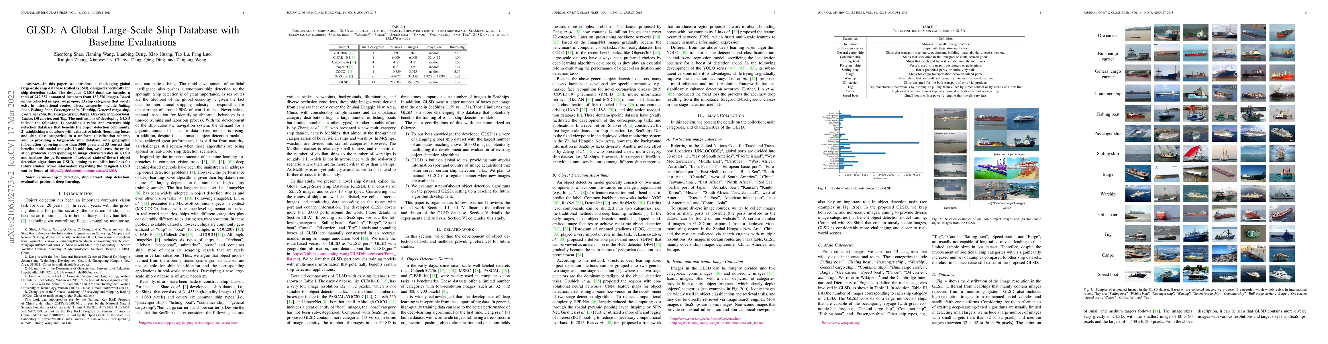
In this paper, we introduce a challenging global large-scale ship database (called GLSD), designed specifically for ship detection tasks. The designed GLSD database includes a total of 212,357 annot...
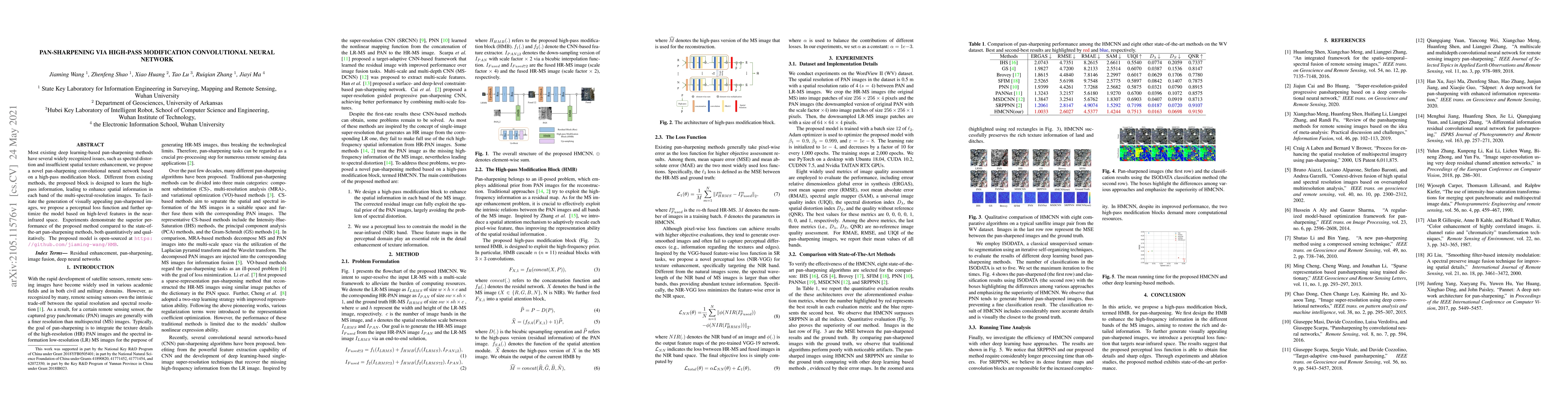
Most existing deep learning-based pan-sharpening methods have several widely recognized issues, such as spectral distortion and insufficient spatial texture enhancement, we propose a novel pan-sharp...
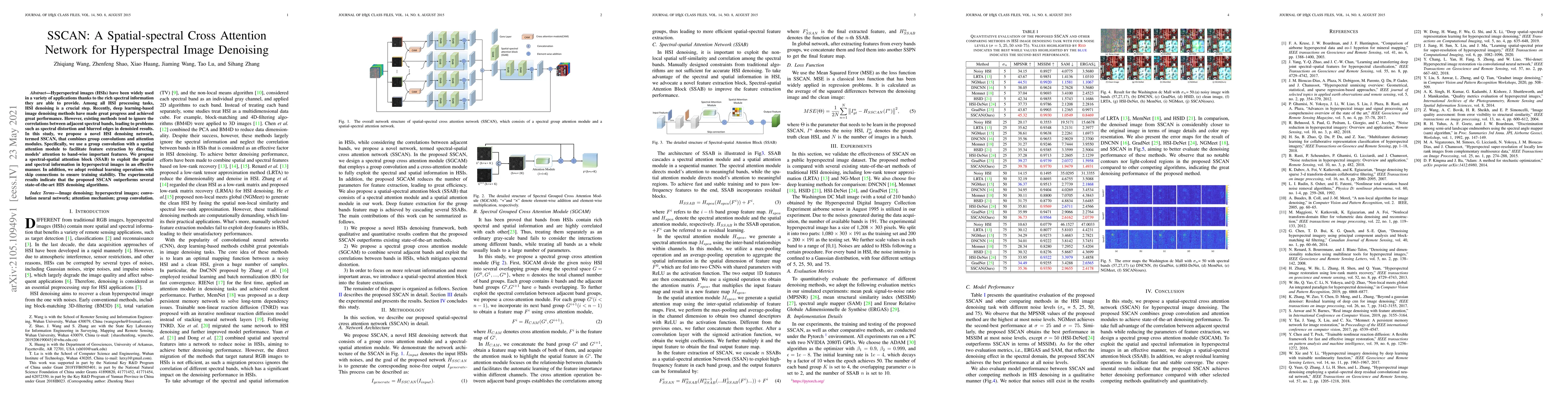
Hyperspectral images (HSIs) have been widely used in a variety of applications thanks to the rich spectral information they are able to provide. Among all HSI processing tasks, HSI denoising is a cr...
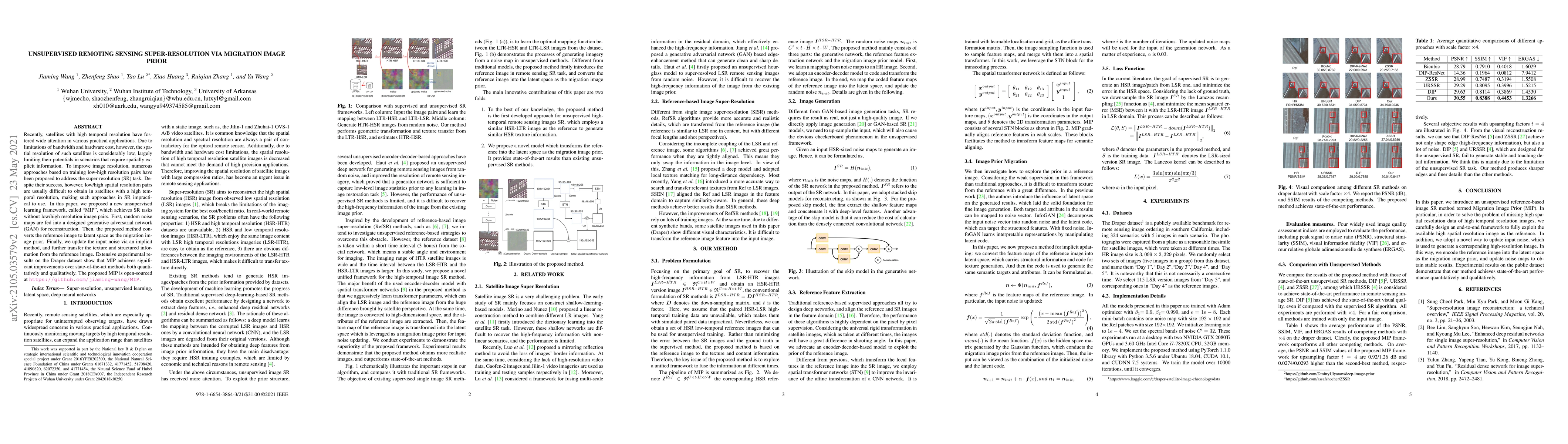
Recently, satellites with high temporal resolution have fostered wide attention in various practical applications. Due to limitations of bandwidth and hardware cost, however, the spatial resolution ...
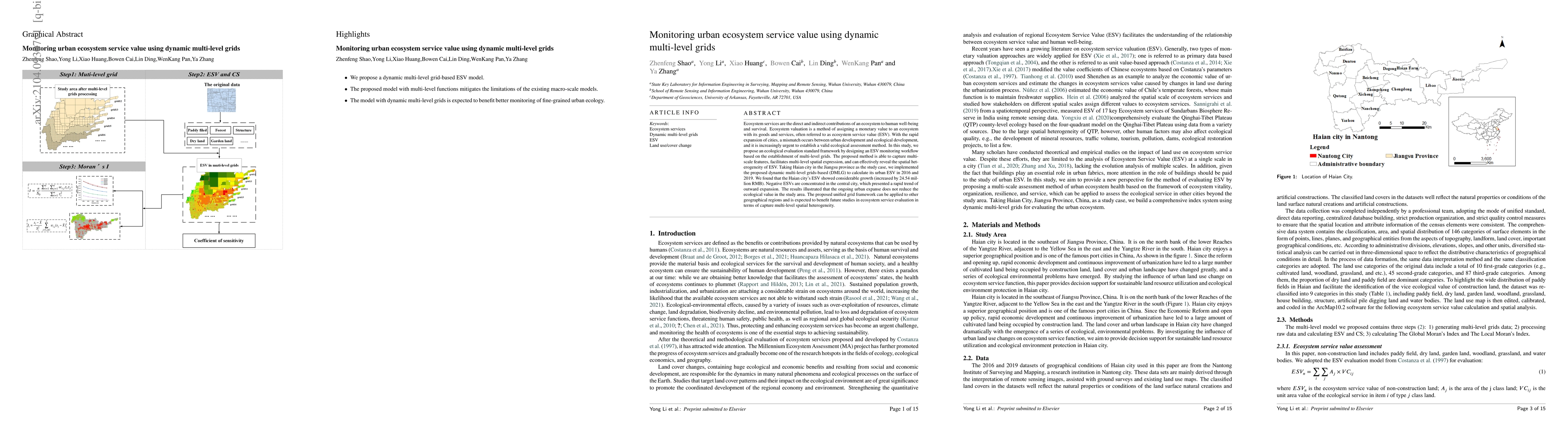
Ecosystem services are the direct and indirect contributions of an ecosystem to human well-being and survival. Ecosystem valuation is a method of assigning a monetary value to an ecosystem with its ...
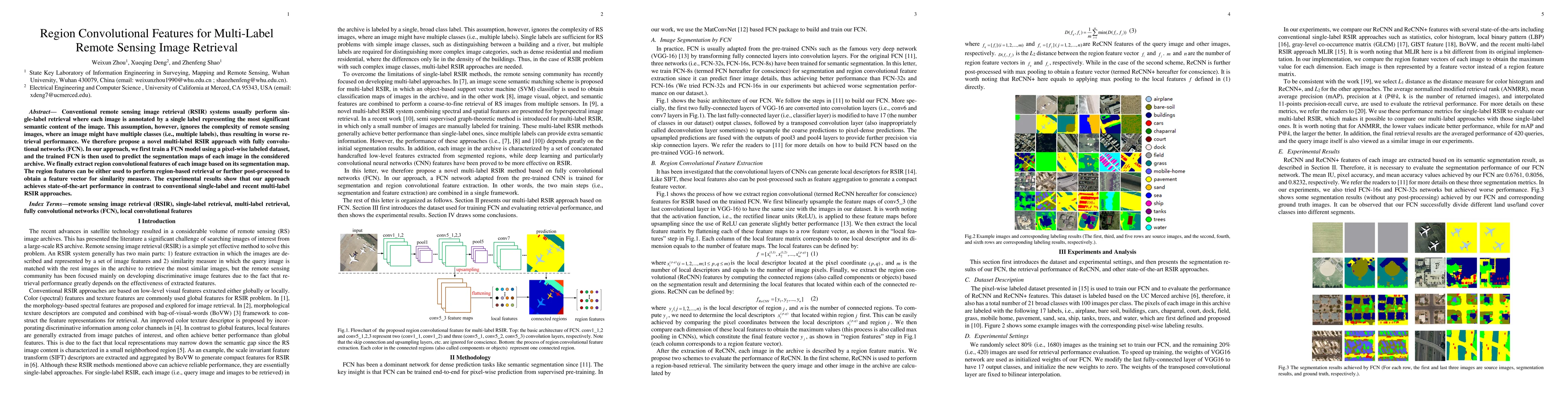
Conventional remote sensing image retrieval (RSIR) systems usually perform single-label retrieval where each image is annotated by a single label representing the most significant semantic content o...
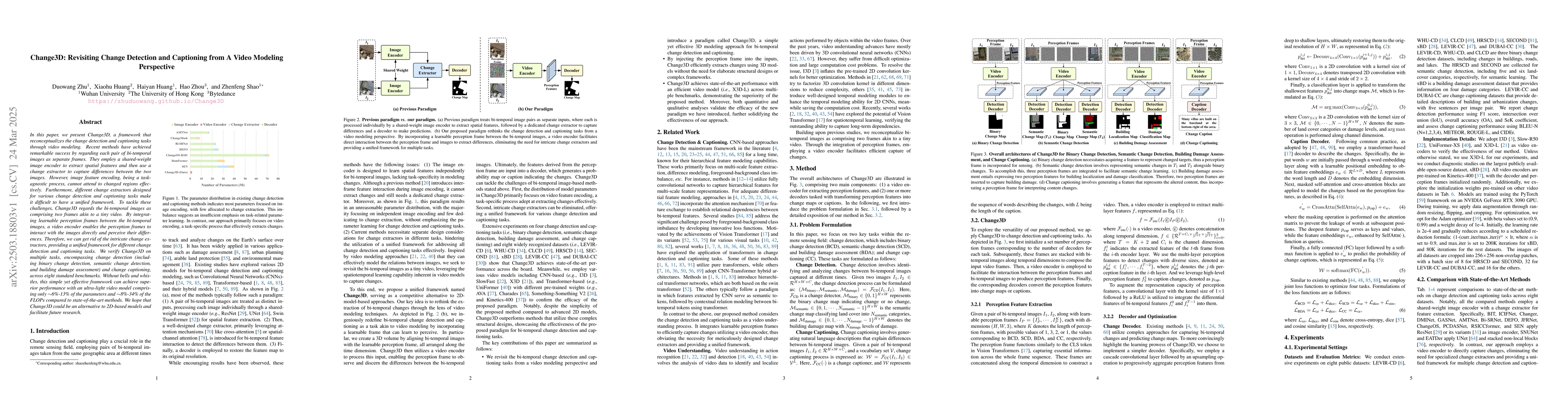
In this paper, we present Change3D, a framework that reconceptualizes the change detection and captioning tasks through video modeling. Recent methods have achieved remarkable success by regarding eac...
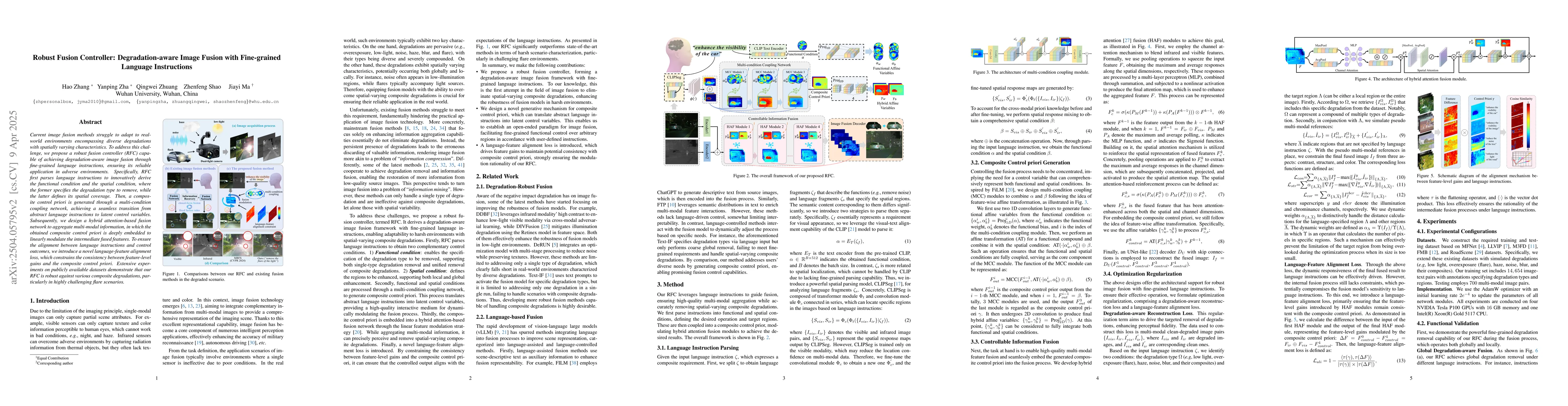
Current image fusion methods struggle to adapt to real-world environments encompassing diverse degradations with spatially varying characteristics. To address this challenge, we propose a robust fusio...
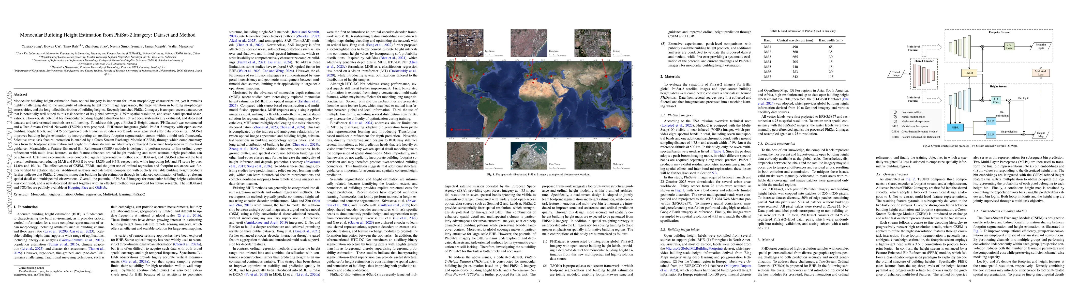
Monocular building height estimation from optical imagery is important for urban morphology characterization but remains challenging due to ambiguous height cues, large inter-city variations in buildi...