Academic Profile
Statistics
Similar Authors
Papers on arXiv
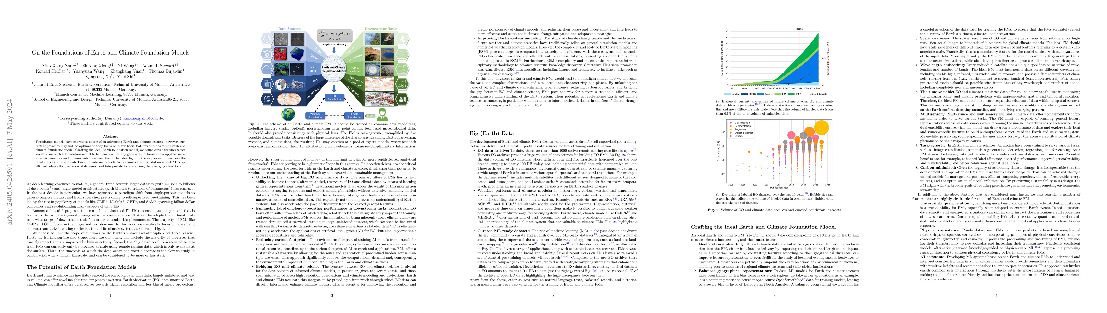
Foundation models have enormous potential in advancing Earth and climate sciences, however, current approaches may not be optimal as they focus on a few basic features of a desirable Earth and clima...
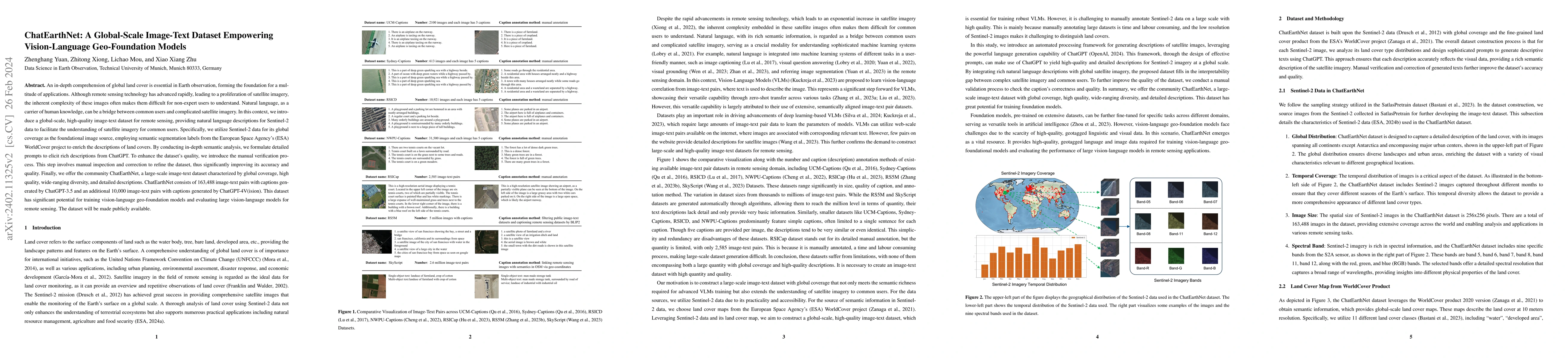
An in-depth comprehension of global land cover is essential in Earth observation, forming the foundation for a multitude of applications. Although remote sensing technology has advanced rapidly, lea...
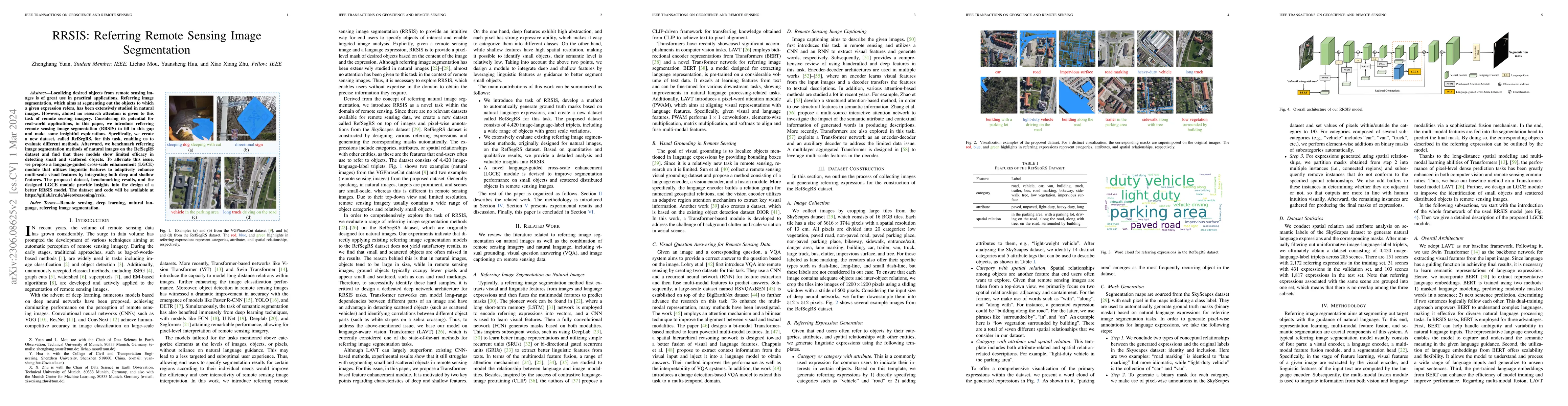
Localizing desired objects from remote sensing images is of great use in practical applications. Referring image segmentation, which aims at segmenting out the objects to which a given expression re...
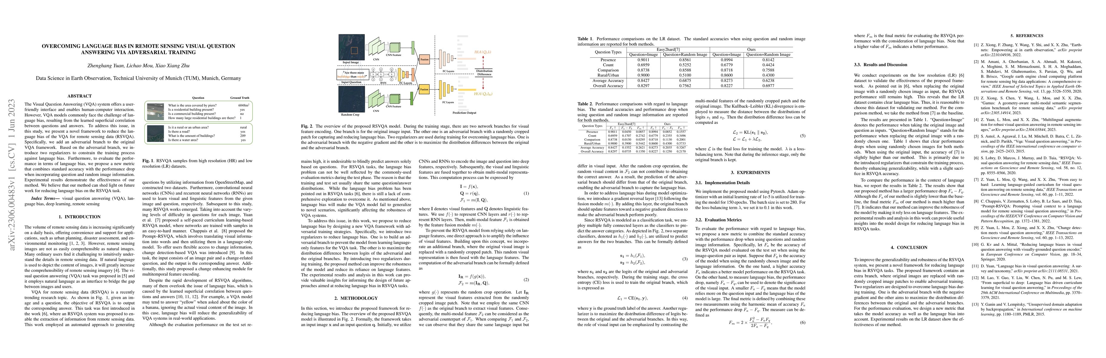
The Visual Question Answering (VQA) system offers a user-friendly interface and enables human-computer interaction. However, VQA models commonly face the challenge of language bias, resulting from t...
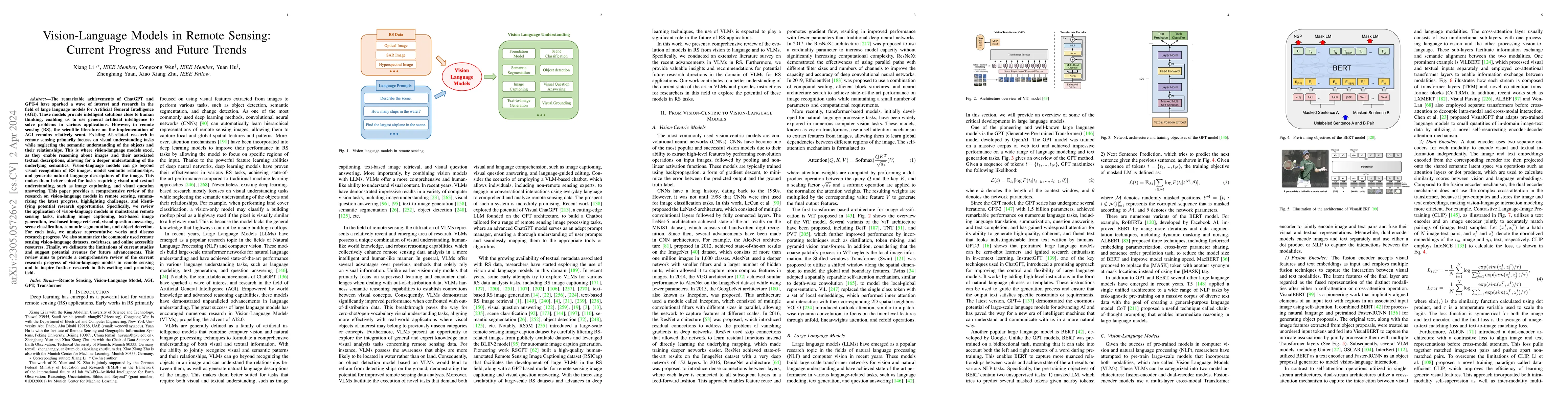
The remarkable achievements of ChatGPT and GPT-4 have sparked a wave of interest and research in the field of large language models for Artificial General Intelligence (AGI). These models provide in...

Aiming at answering questions based on the content of remotely sensed images, visual question answering for remote sensing data (RSVQA) has attracted much attention nowadays. However, previous works...
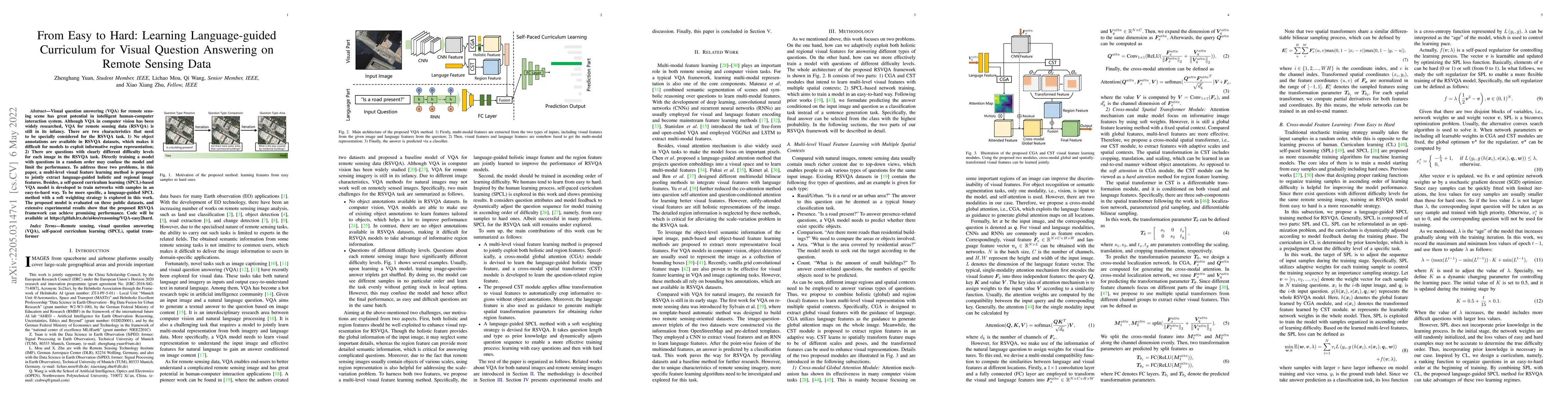
Visual question answering (VQA) for remote sensing scene has great potential in intelligent human-computer interaction system. Although VQA in computer vision has been widely researched, VQA for rem...
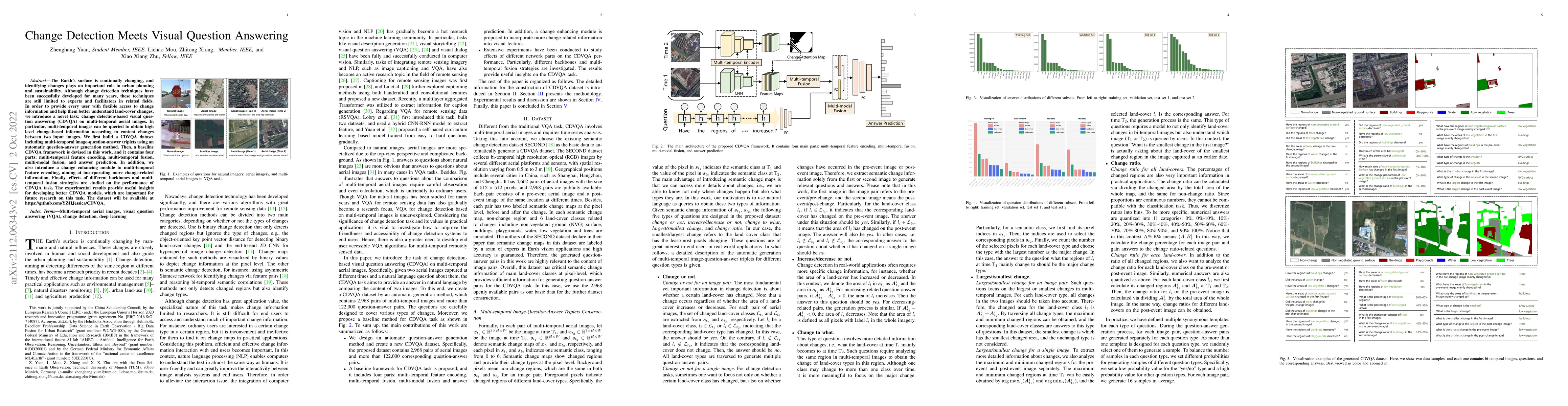
The Earth's surface is continually changing, and identifying changes plays an important role in urban planning and sustainability. Although change detection techniques have been successfully develop...
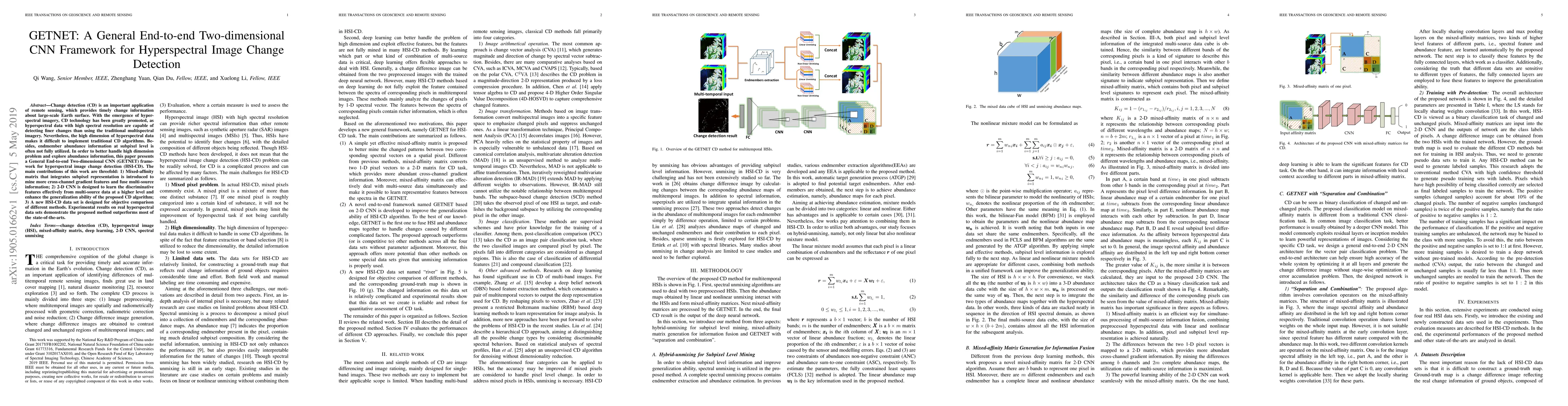
Change detection (CD) is an important application of remote sensing, which provides timely change information about large-scale Earth surface. With the emergence of hyperspectral imagery, CD technol...
Earth observation (EO) data, collected from diverse sensors with varying imaging principles, present significant challenges in creating unified analytical frameworks. We present GeoLangBind, a novel a...