Academic Profile
Statistics
Similar Authors
Papers on arXiv
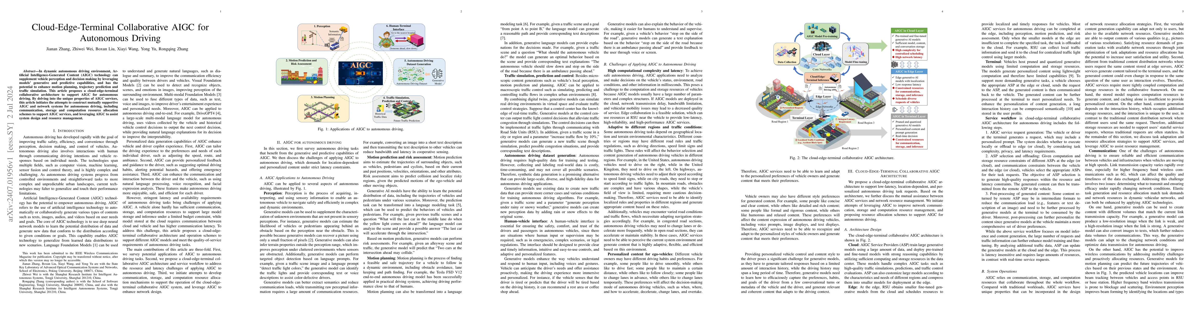
In dynamic autonomous driving environment, Artificial Intelligence-Generated Content (AIGC) technology can supplement vehicle perception and decision making by leveraging models' generative and pred...
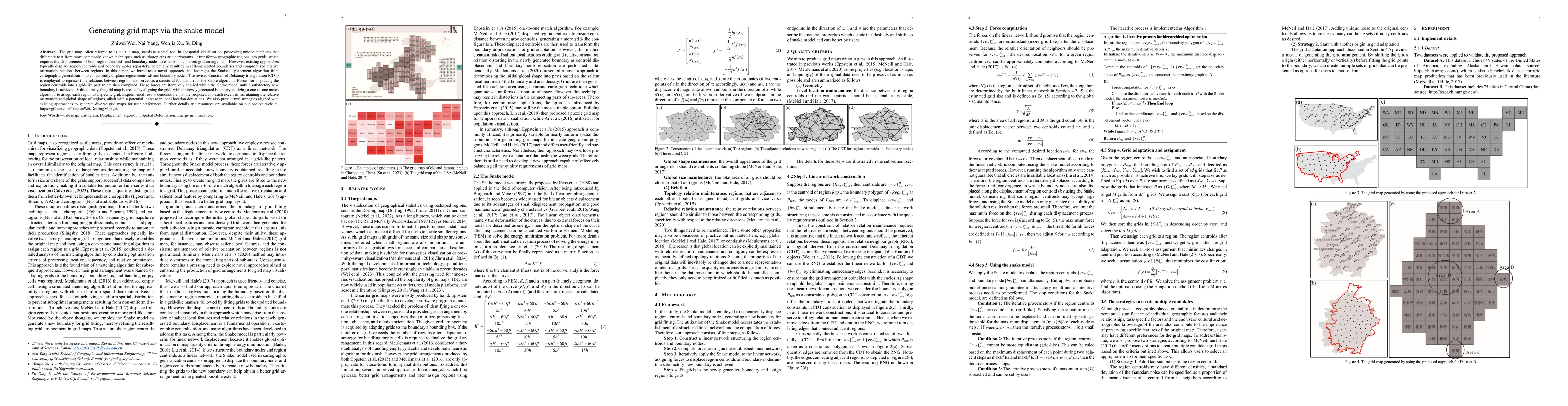
The grid map, often referred to as the tile map, stands as a vital tool in geospatial visualization, possessing unique attributes that differentiate it from more commonly known techniques such as ch...
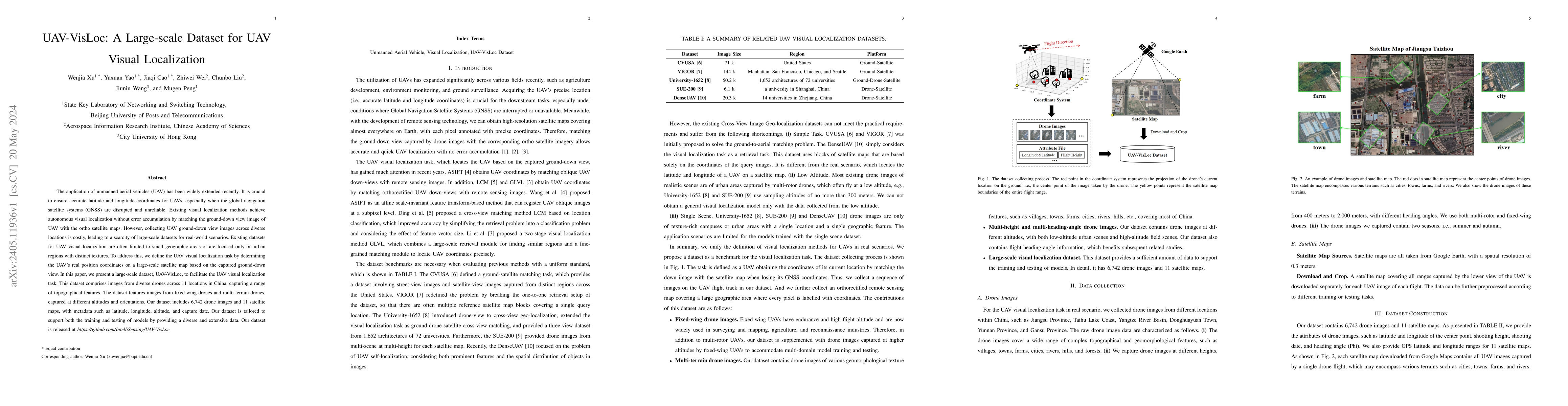
The application of unmanned aerial vehicles (UAV) has been widely extended recently. It is crucial to ensure accurate latitude and longitude coordinates for UAVs, especially when the global navigati...
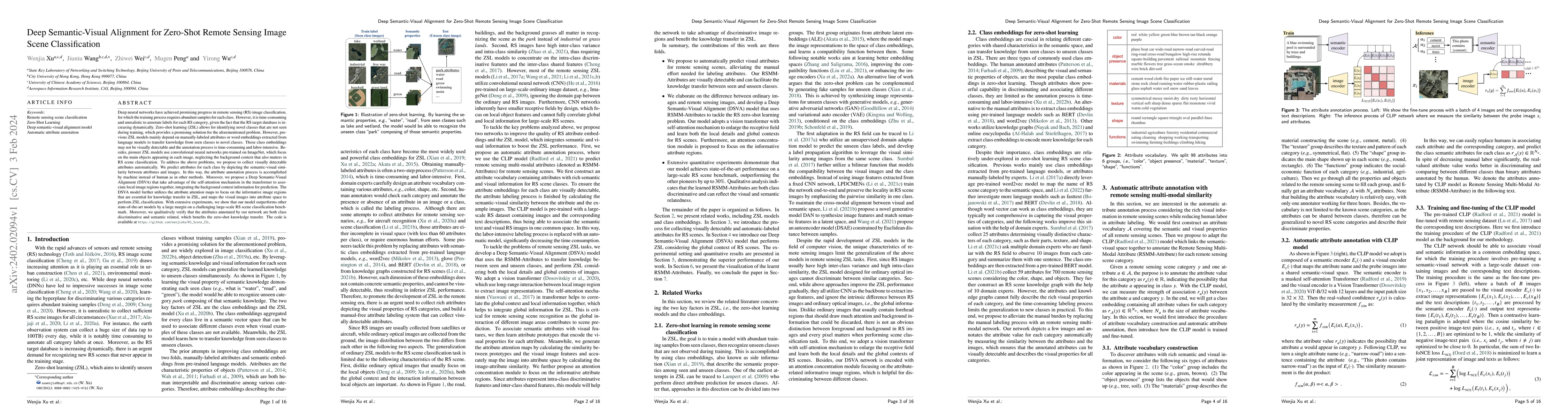
Deep neural networks have achieved promising progress in remote sensing (RS) image classification, for which the training process requires abundant samples for each class. However, it is time-consum...
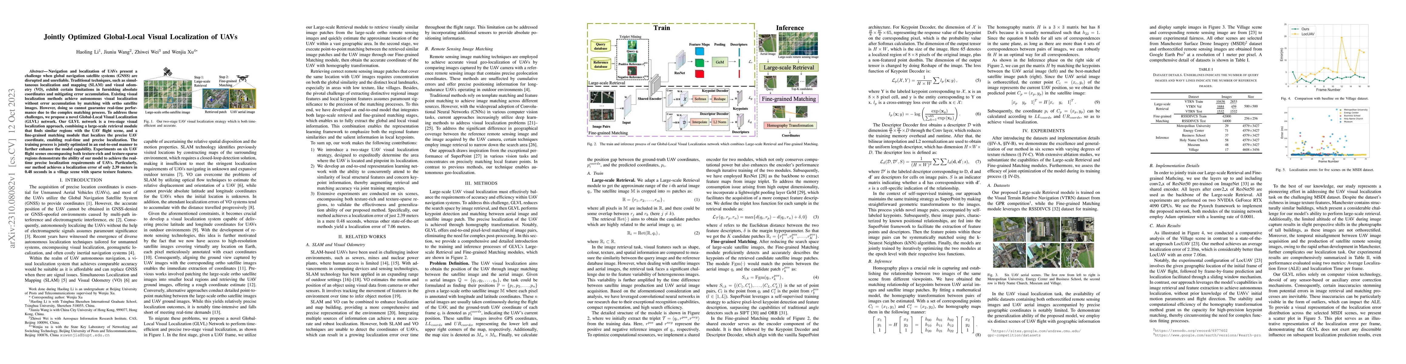
Navigation and localization of UAVs present a challenge when global navigation satellite systems (GNSS) are disrupted and unreliable. Traditional techniques, such as simultaneous localization and ma...
Multi-View Stereo~(MVS) is a fundamental problem in geometric computer vision which aims to reconstruct a scene using multi-view images with known camera parameters. However, the mainstream approach...
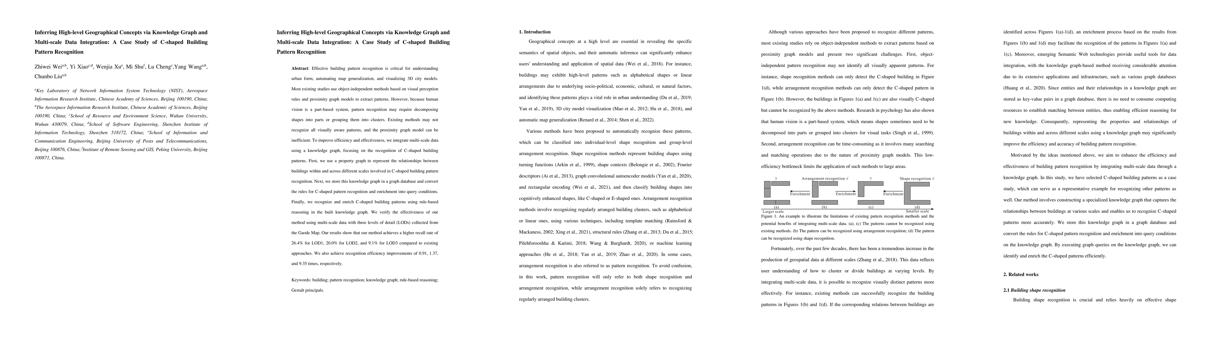
Effective building pattern recognition is critical for understanding urban form, automating map generalization, and visualizing 3D city models. Most existing studies use object-independent methods b...
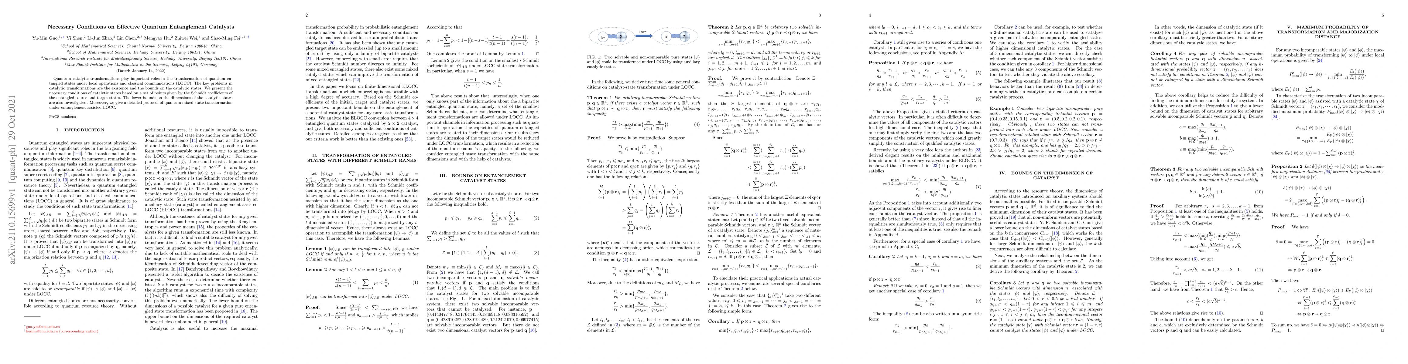
Quantum catalytic transformations play important roles in the transformation of quantum entangled states under local operations and classical communications (LOCC). The key problems in catalytic tra...
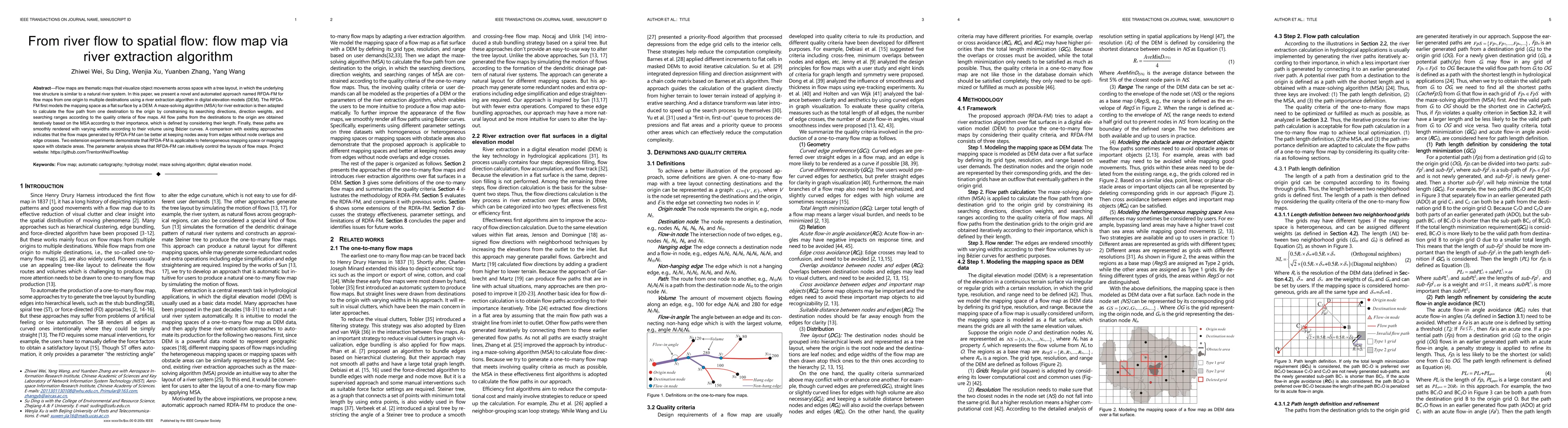
Flow maps are thematic maps that visualize object movements across space with a tree layout, in which the underlying tree structure is similar to a natural river system. In this paper, we present a ...
Crowd counting on the drone platform is an interesting topic in computer vision, which brings new challenges such as small object inference, background clutter and wide viewpoint. However, there are...
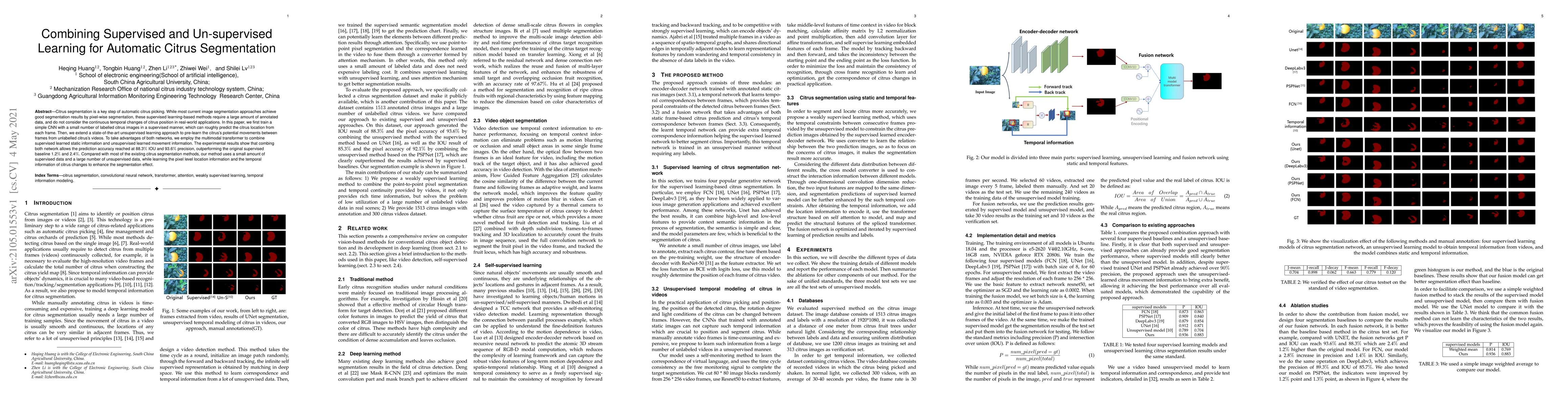
Citrus segmentation is a key step of automatic citrus picking. While most current image segmentation approaches achieve good segmentation results by pixel-wise segmentation, these supervised learnin...
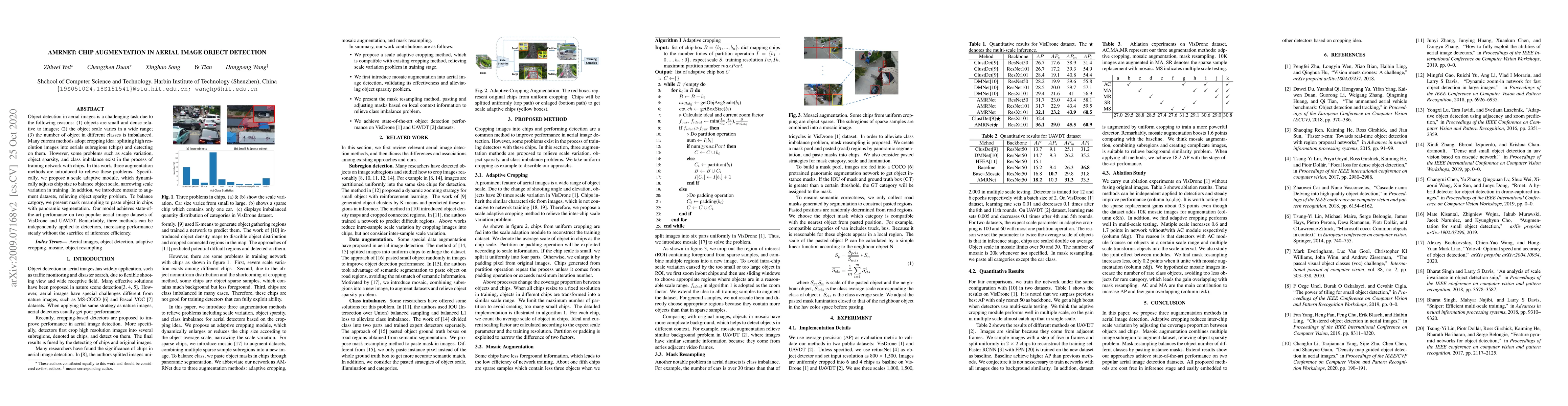
Object detection in aerial images is a challenging task due to the following reasons: (1) objects are small and dense relative to images; (2) the object scale varies in a wide range; (3) the number ...
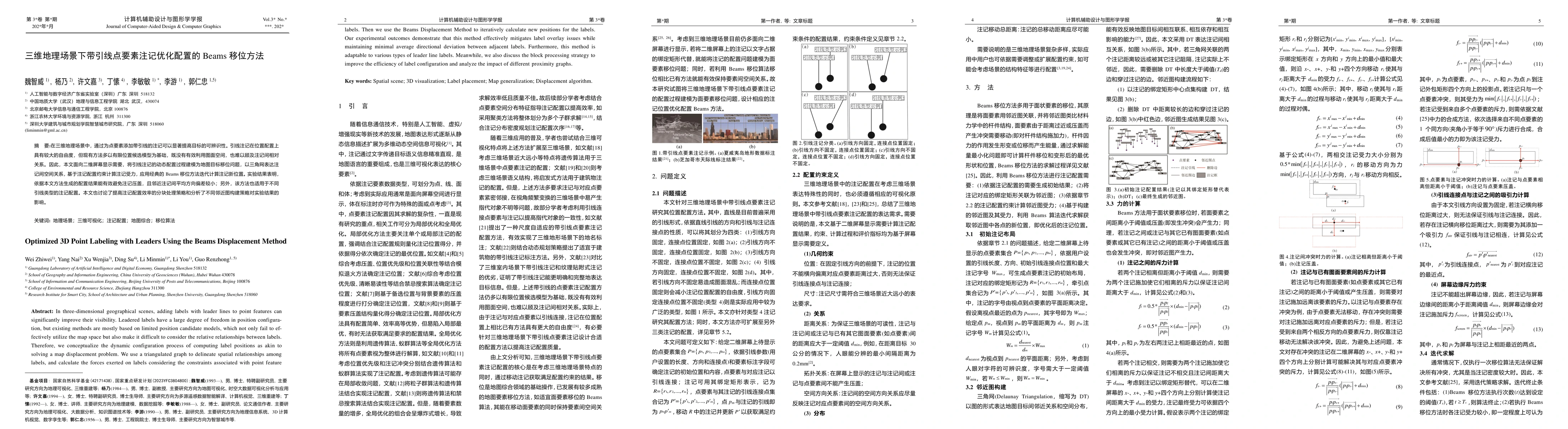
In three-dimensional geographical scenes, adding labels with leader lines to point features can significantly improve their visibility. Leadered labels have a large degree of freedom in position con-f...
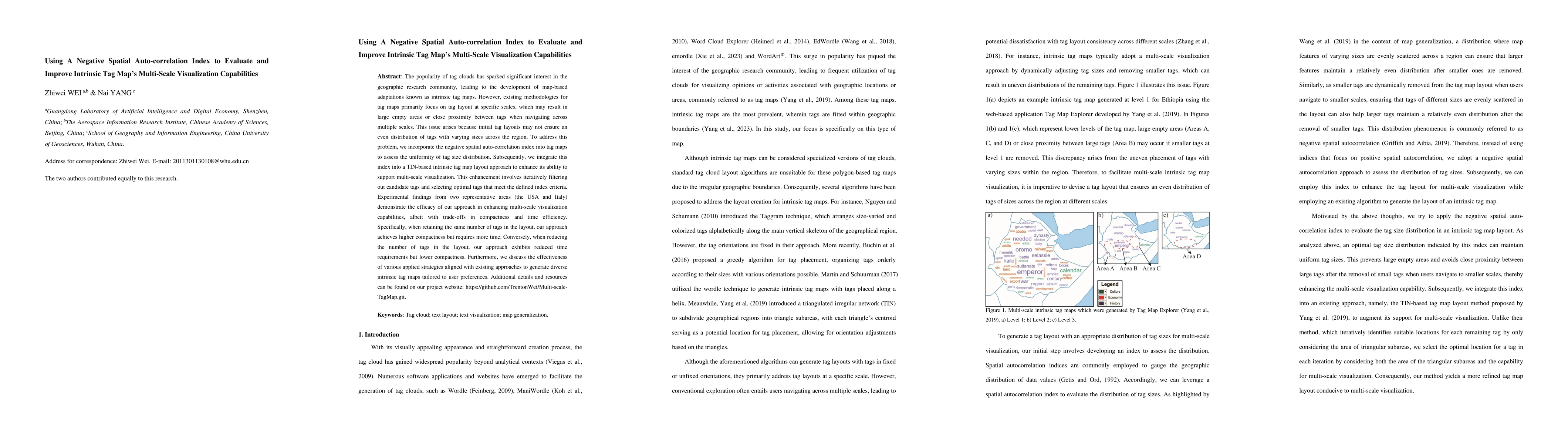
The popularity of tag clouds has sparked significant interest in the geographic research community, leading to the development of map-based adaptations known as intrinsic tag maps. However, existing m...
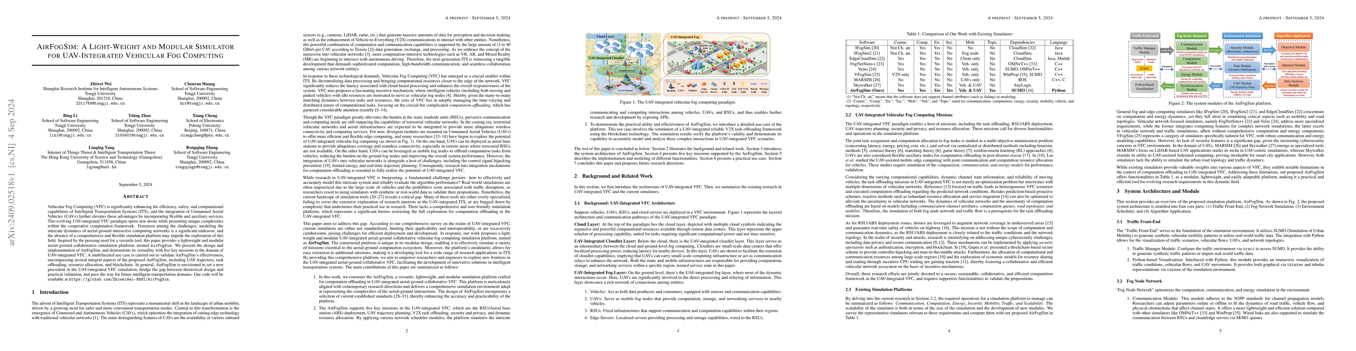
Vehicular Fog Computing (VFC) is significantly enhancing the efficiency, safety, and computational capabilities of Intelligent Transportation Systems (ITS), and the integration of Unmanned Aerial Vehi...
In this paper, we describe a novel unsupervised learning scheme for accelerating the solution of a family of mixed integer programming (MIP) problems. Distinct substantially from existing learning-to-...
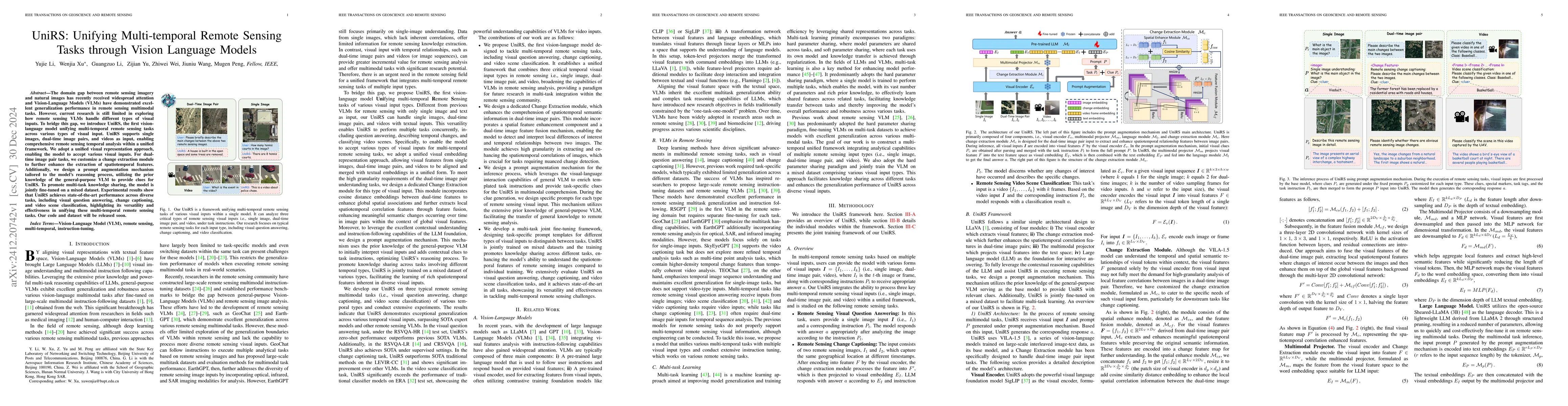
The domain gap between remote sensing imagery and natural images has recently received widespread attention and Vision-Language Models (VLMs) have demonstrated excellent generalization performance in ...
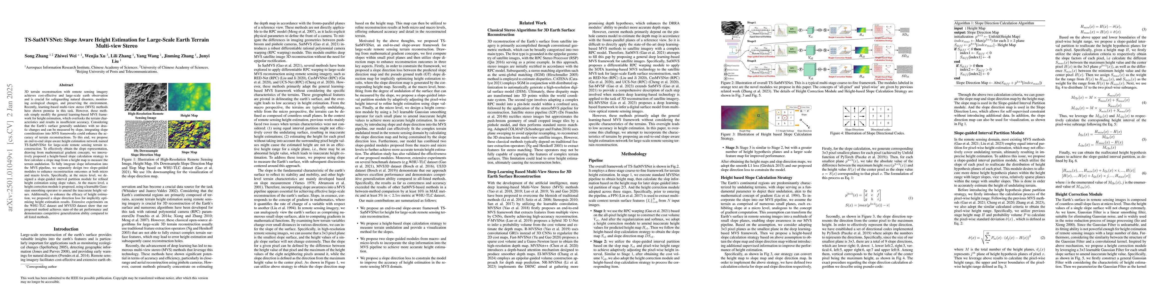
3D terrain reconstruction with remote sensing imagery achieves cost-effective and large-scale earth observation and is crucial for safeguarding natural disasters, monitoring ecological changes, and pr...
Choropleth maps, which utilize color schemes to visualize spatial patterns and trends, are simple yet effective tools for geographic data analysis. As such, color scheme design is a critical aspect of...
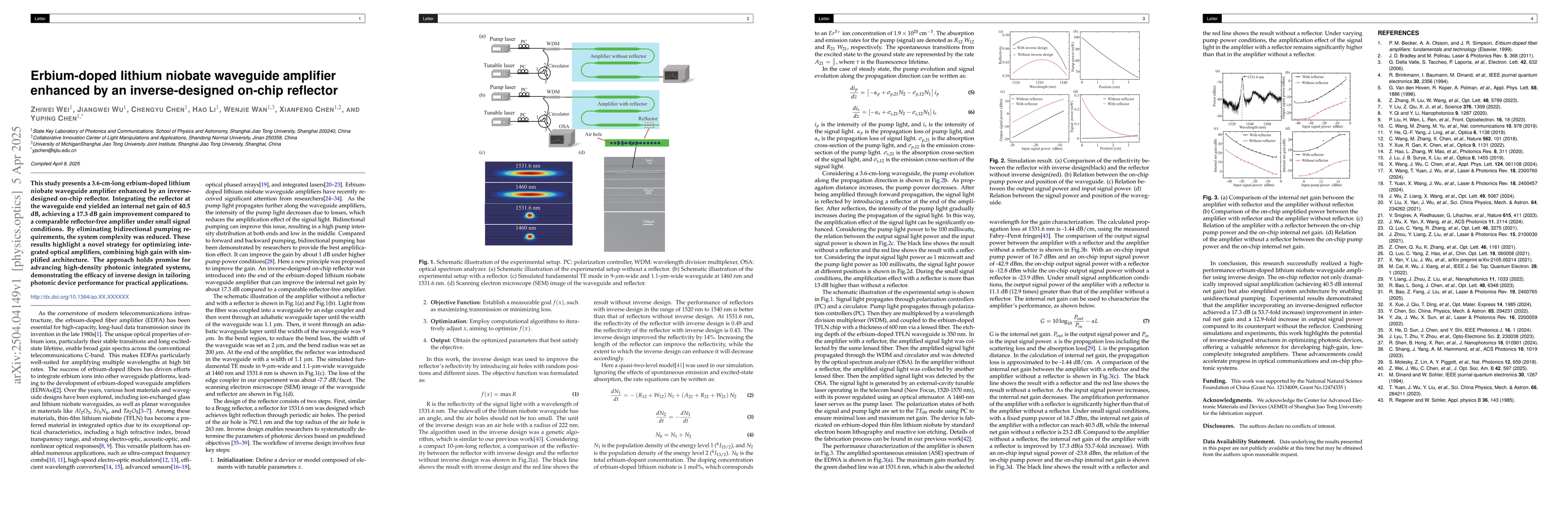
This study presents a 3.6-cm-long erbium-doped lithium niobate waveguide amplifier enhanced by an inverse-designed on-chip reflector. Integrating the reflector at the waveguide end yielded an internal...
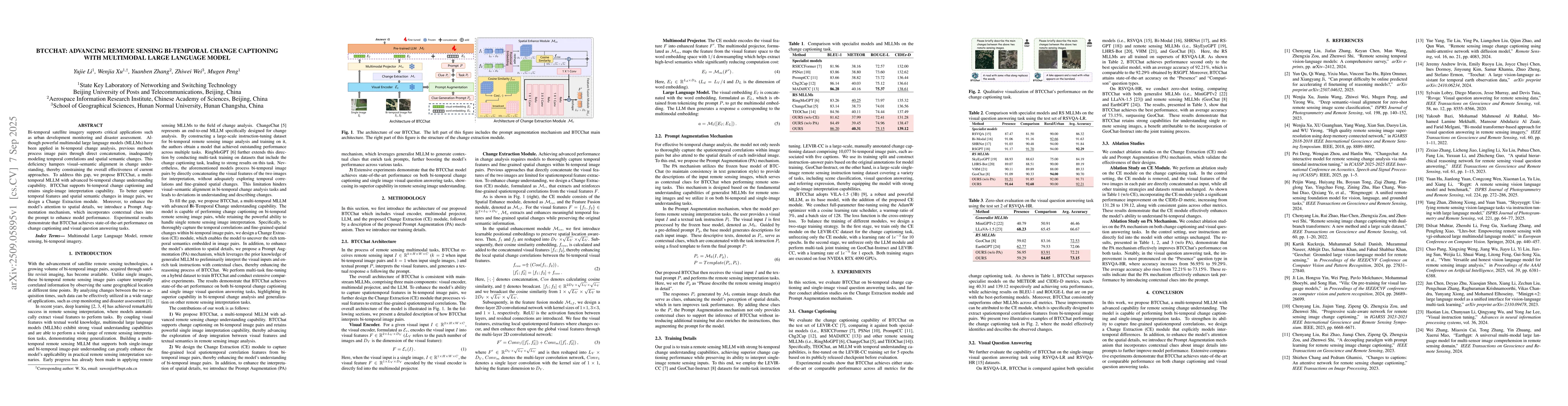
Bi-temporal satellite imagery supports critical applications such as urban development monitoring and disaster assessment. Although powerful multimodal large language models (MLLMs) have been applied ...
Map environments provide a fundamental medium for representing spatial structure. Understanding how foundation model (FM) agents understand and act in such environments is therefore critical for enabl...
Understanding urban perception from street view imagery has become a central topic in urban analytics and human centered urban design. However, most existing studies treat urban scenes as static and l...
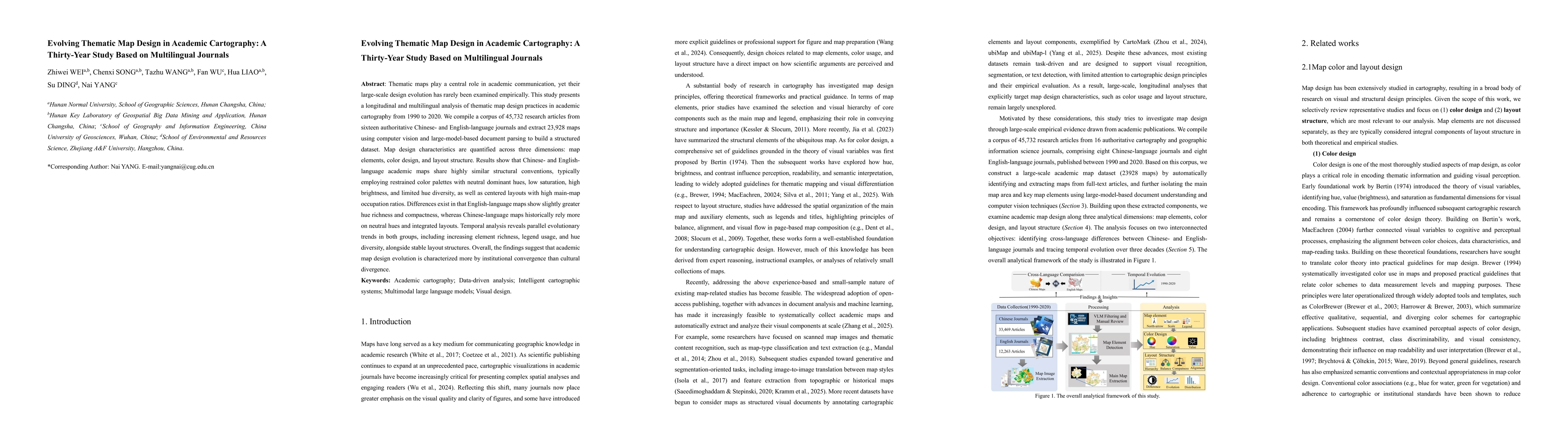
Thematic maps play a central role in academic communication, yet their large-scale design evolution has rarely been examined empirically. This study presents a longitudinal and multilingual analysis o...
Autonomous UAV systems increasingly rely on multimodal large language models (MLLMs) to operate in complex real-world environments. Such embodied scenarios require not only understanding the surroundi...