1
arXiv Papers
Profile
Academic Profile
Metrics
Statistics
1
arXiv Papers
Network
Similar Authors
Publications
Papers on arXiv
arXiv
Seeing Across Skies and Streets: Feedforward 3D Reconstruction from Satellite, Drone, and Ground Images
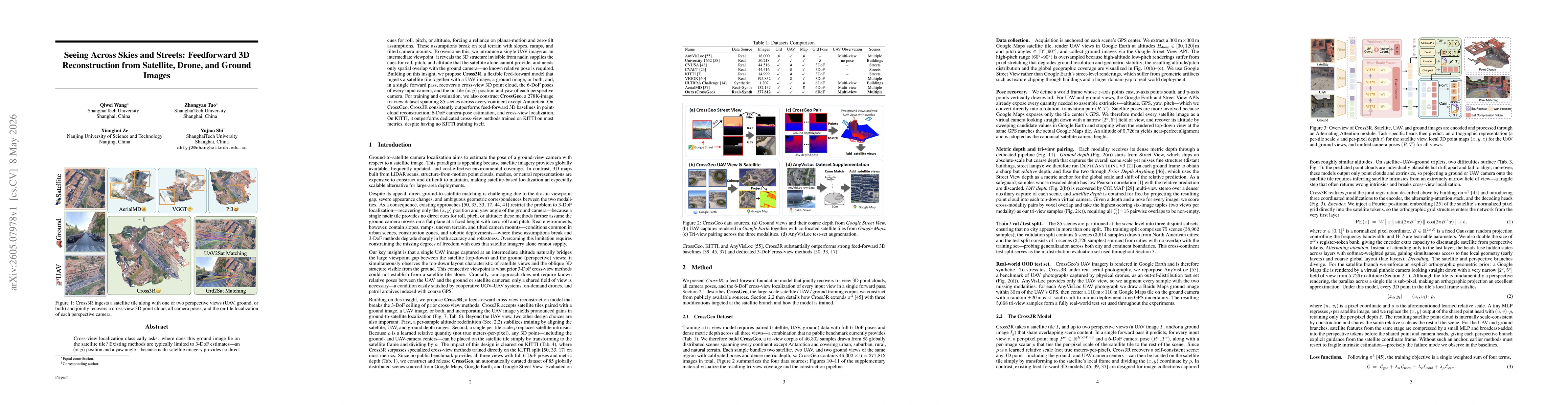
Cross-view localization classically asks: where does this ground image lie on the satellite tile? Existing methods are typically limited to 3-DoF estimates -- an $(x,y)$ position and a yaw angle -- be...