Academic Profile
Statistics
Similar Authors
Papers on arXiv
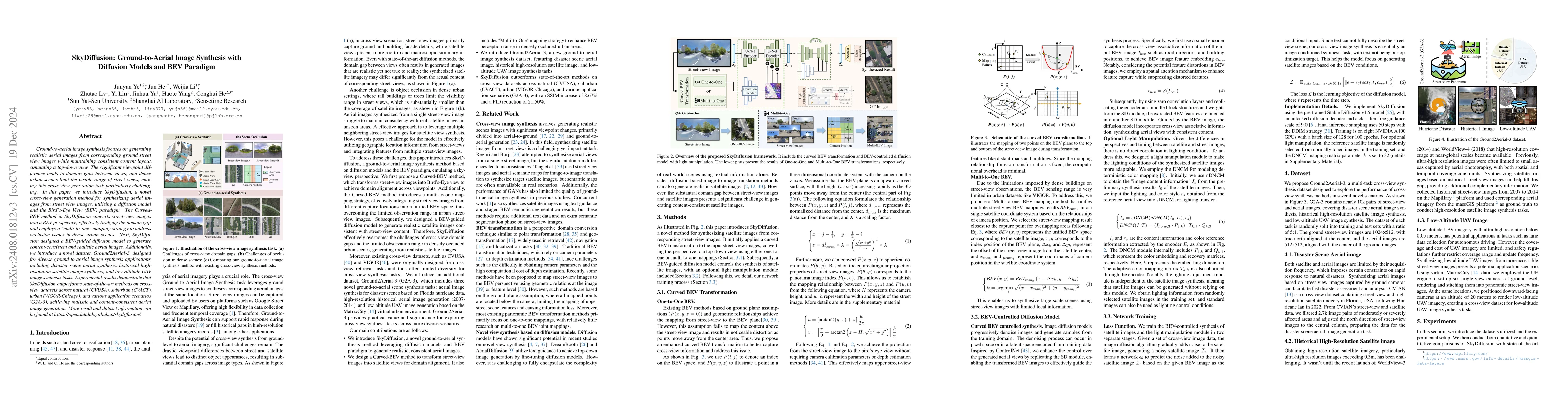
Street-to-satellite image synthesis focuses on generating realistic satellite images from corresponding ground street-view images while maintaining a consistent content layout, similar to looking down...
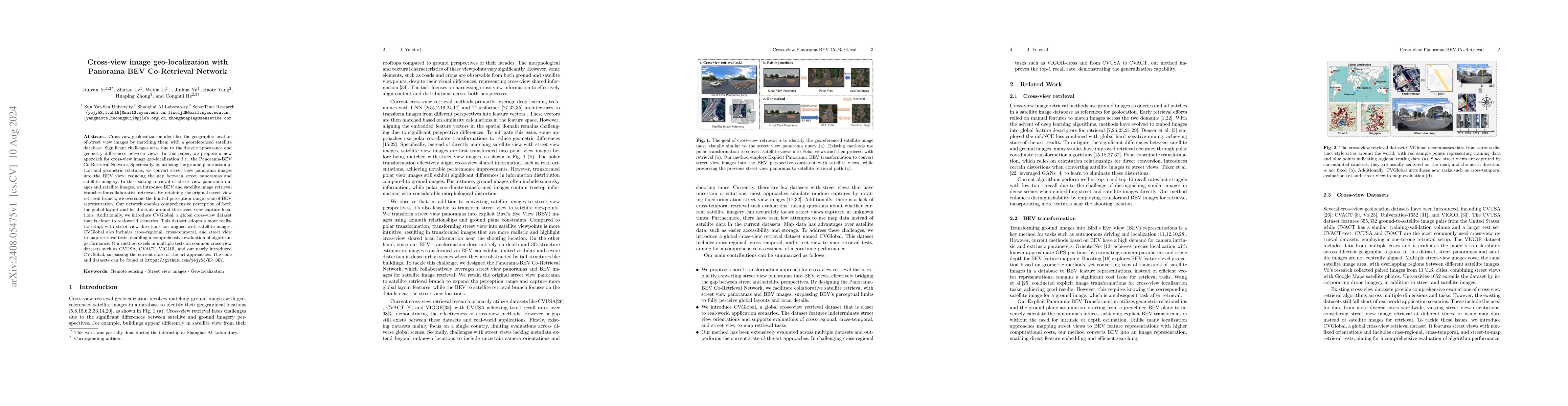
Cross-view geolocalization identifies the geographic location of street view images by matching them with a georeferenced satellite database. Significant challenges arise due to the drastic appearance...
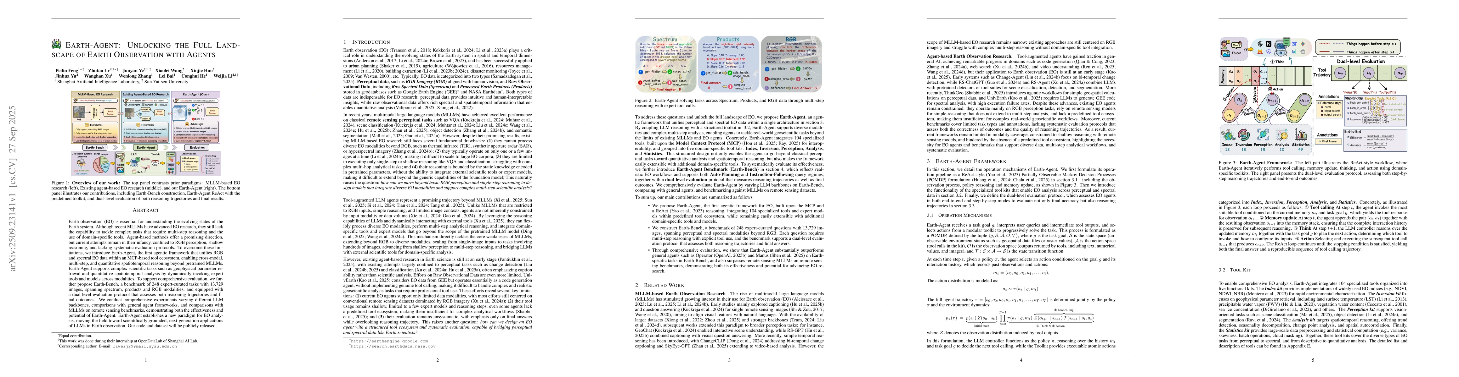
Earth observation (EO) is essential for understanding the evolving states of the Earth system. Although recent MLLMs have advanced EO research, they still lack the capability to tackle complex tasks t...