Academic Profile
Statistics
Similar Authors
Papers on arXiv
High-resolution satellite-based crop yield mapping offers enormous promise for monitoring progress towards the SDGs. Across 15,000 villages in Rwanda we uncover areas that are on and off track to doub...
Surprisingly a number of Earth's waterways remain unmapped, with a significant number in low and middle income countries. Here we build a computer vision model (WaterNet) to learn the location of wate...
Waterways shape earth system processes and human societies, and a better understanding of their distribution can assist in a range of applications from earth system modeling to human development and d...
Agricultural workers play a vital role in the global economy and food security by cultivating, transporting, and processing food for populations worldwide. Despite their importance, detailed spatial d...
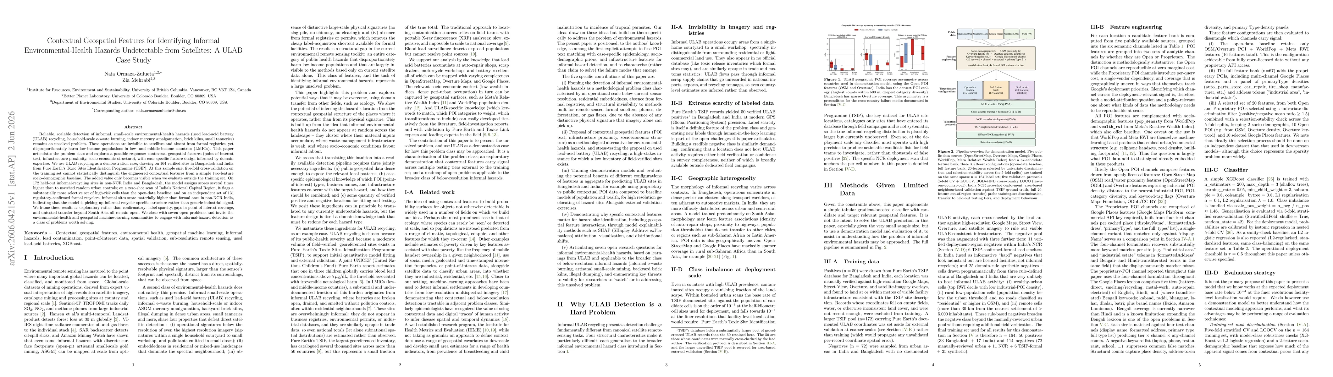
Reliable, scalable detection of informal, small-scale environmental-health hazards (used lead-acid battery (ULAB) recycling, household-scale e-waste burning, indoor mercury amalgamation, brick kilns, ...