Academic Profile
Statistics
Similar Authors
Papers on arXiv
Recent advances have demonstrated that Language Vision Models (LVMs) surpass the existing State-of-the-Art (SOTA) in two-dimensional (2D) computer vision tasks, motivating attempts to apply LVMs to ...
A building's age of construction is crucial for supporting many geospatial applications. Much current research focuses on estimating building age from facade images using deep learning. However, bui...
Accurate human mobility prediction underpins many important applications across a variety of domains, including epidemic modelling, transport planning, and emergency responses. Due to the sparsity o...
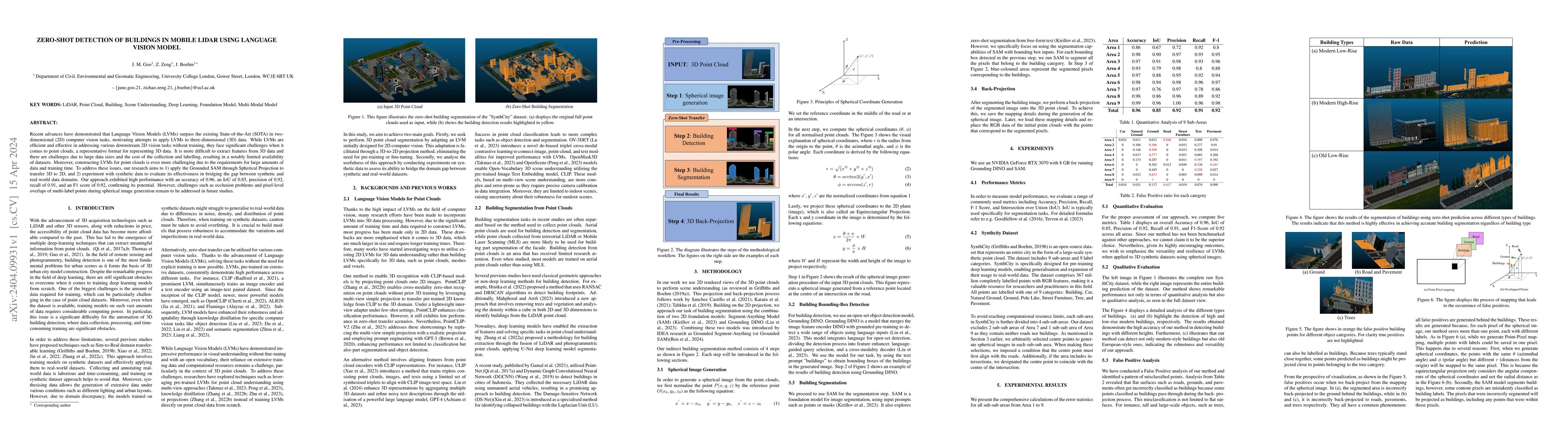
Road traffic crashes cause millions of deaths annually and have a significant economic impact, particularly in low- and middle-income countries (LMICs). This paper presents an approach using Vision La...
Existing methods for learning urban space representations from Point-of-Interest (POI) data face several limitations, including issues with geographical delineation, inadequate spatial information mod...
Predicting individuals' next locations is a core task in human mobility modelling, with wide-ranging implications for urban planning, transportation, public policy and personalised mobility services. ...
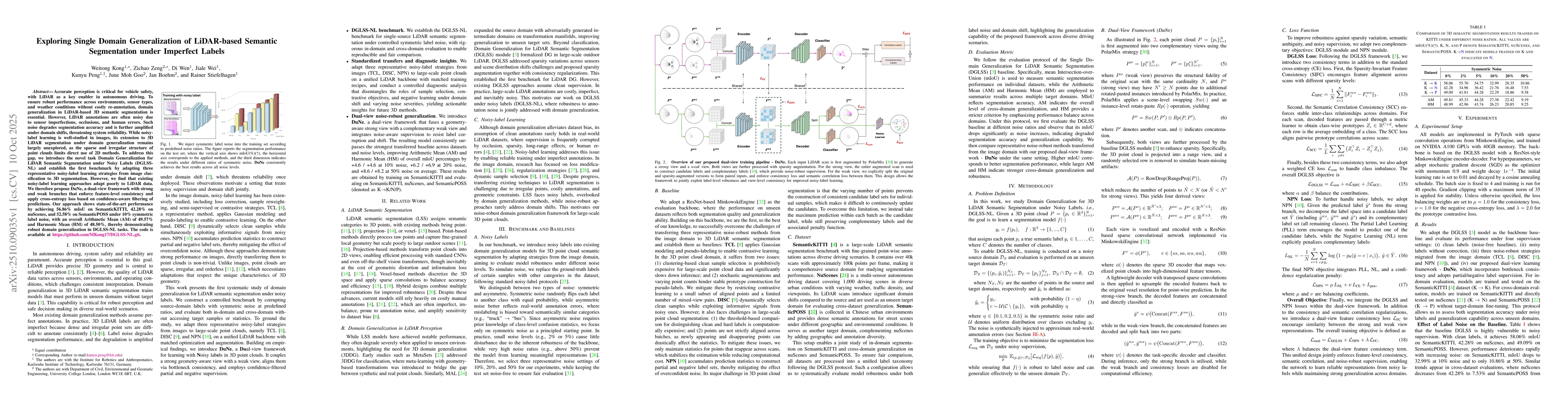
Accurate perception is critical for vehicle safety, with LiDAR as a key enabler in autonomous driving. To ensure robust performance across environments, sensor types, and weather conditions without co...
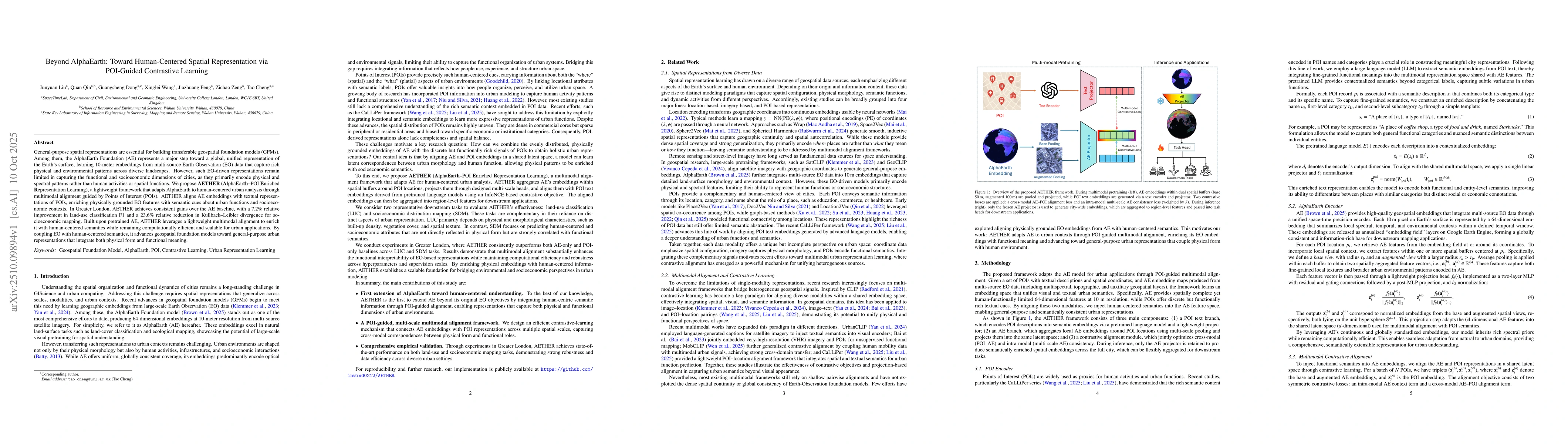
General-purpose spatial representations are essential for building transferable geospatial foundation models (GFMs). Among them, the AlphaEarth Foundation (AE) represents a major step toward a global,...
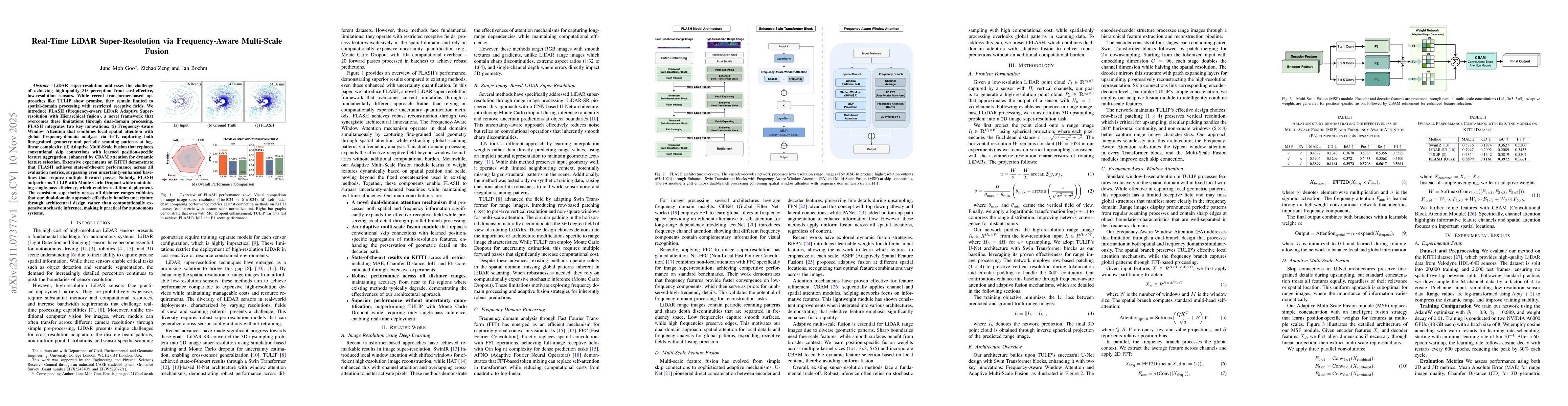
LiDAR super-resolution addresses the challenge of achieving high-quality 3D perception from cost-effective, low-resolution sensors. While recent transformer-based approaches like TULIP show promise, t...
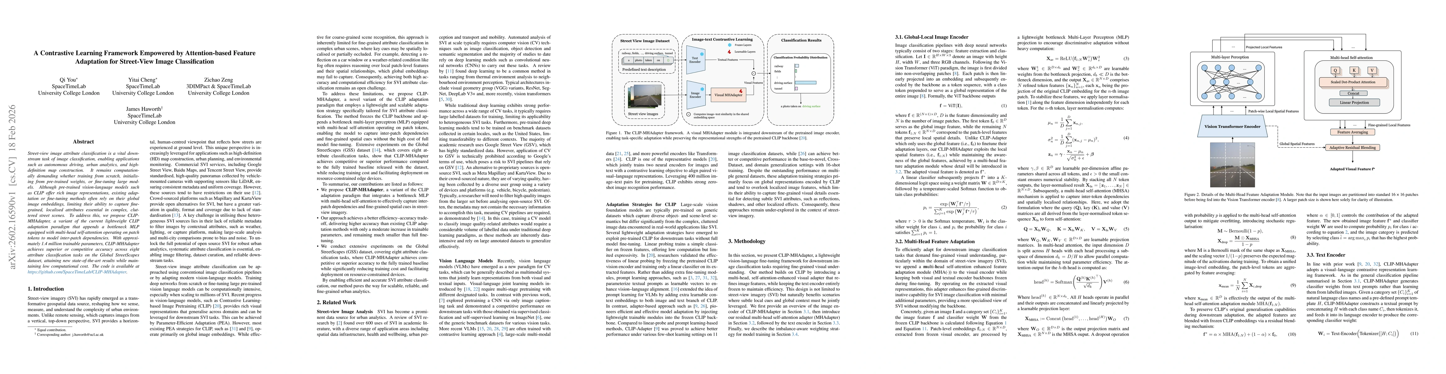
Street-view image attribute classification is a vital downstream task of image classification, enabling applications such as autonomous driving, urban analytics, and high-definition map construction. ...
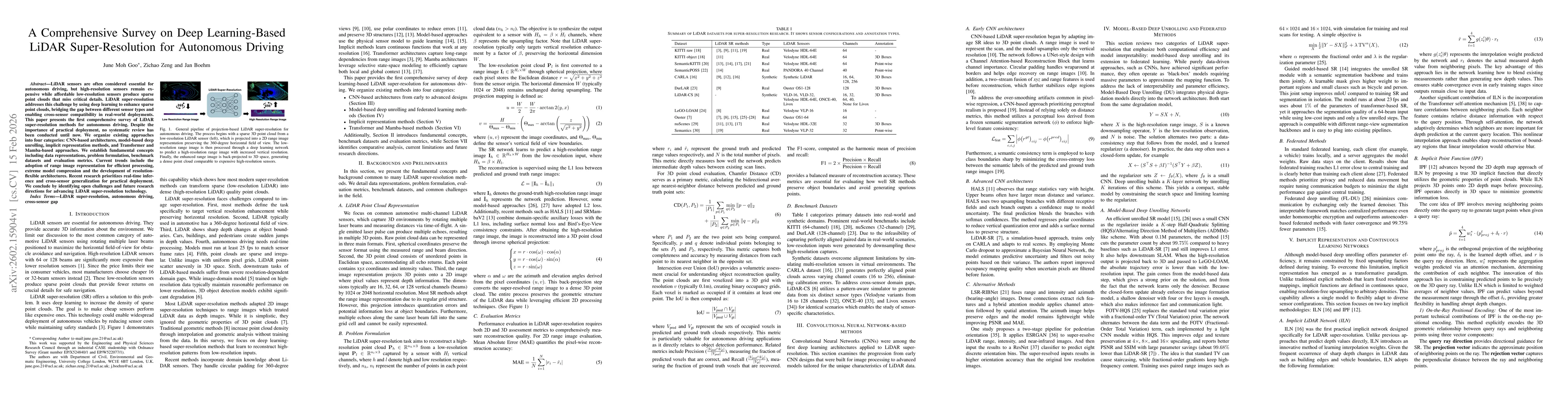
LiDAR sensors are often considered essential for autonomous driving, but high-resolution sensors remain expensive while affordable low-resolution sensors produce sparse point clouds that miss critical...
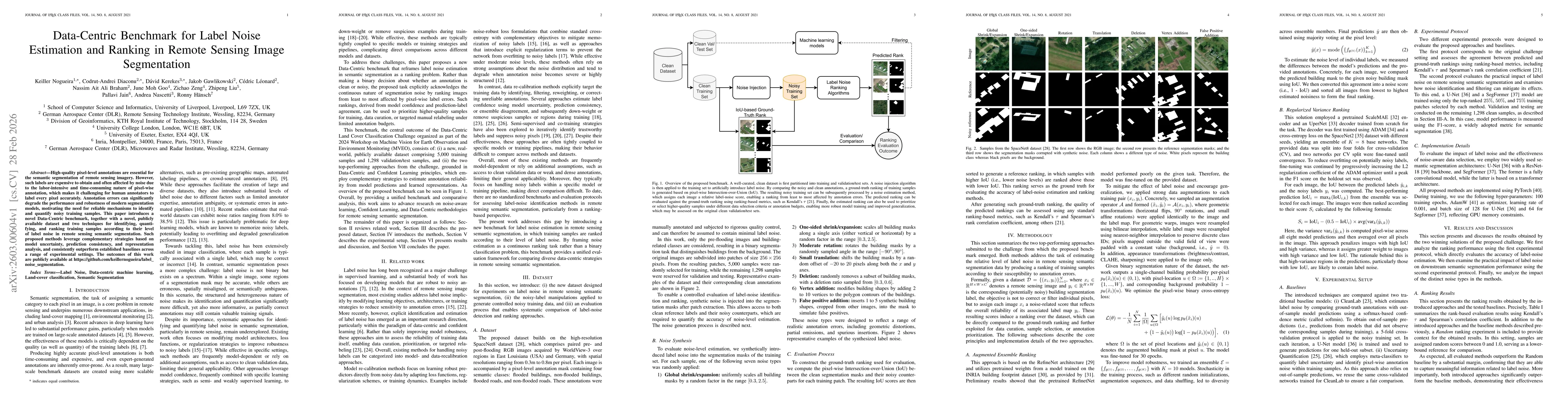
High-quality pixel-level annotations are essential for the semantic segmentation of remote sensing imagery. However, such labels are expensive to obtain and often affected by noise due to the labor-in...
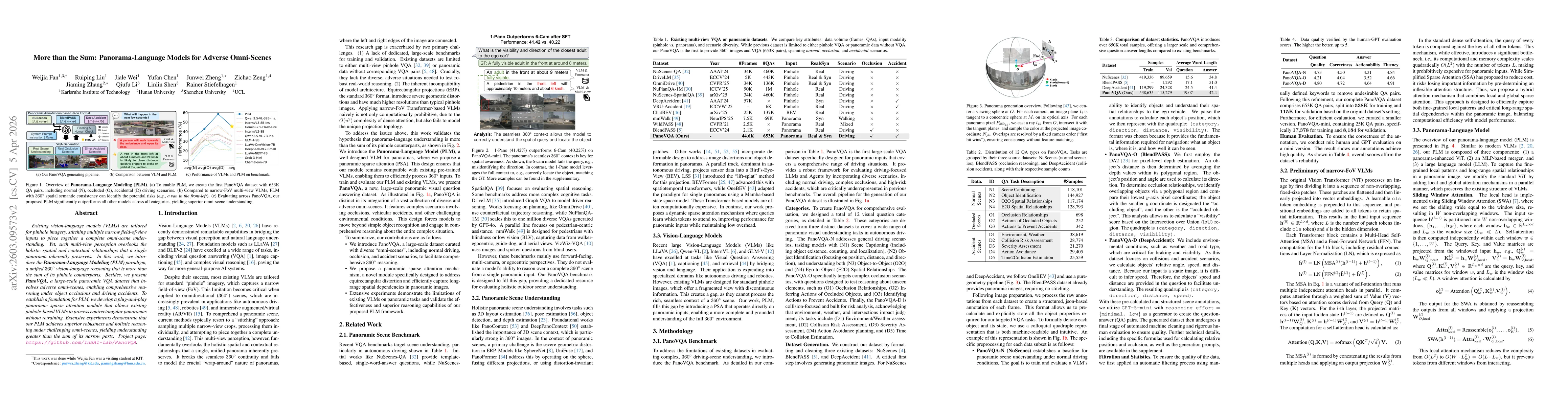
Existing vision-language models (VLMs) are tailored for pinhole imagery, stitching multiple narrow field-of-view inputs to piece together a complete omni-scene understanding. Yet, such multi-view perc...
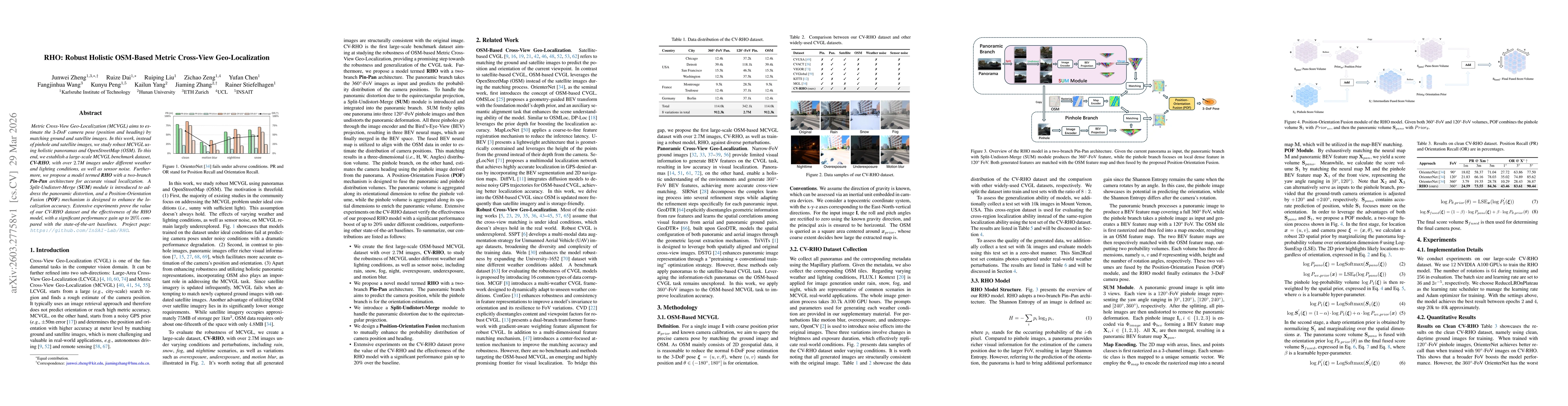
Metric Cross-View Geo-Localization (MCVGL) aims to estimate the 3-DoF camera pose (position and heading) by matching ground and satellite images. In this work, instead of pinhole and satellite images,...
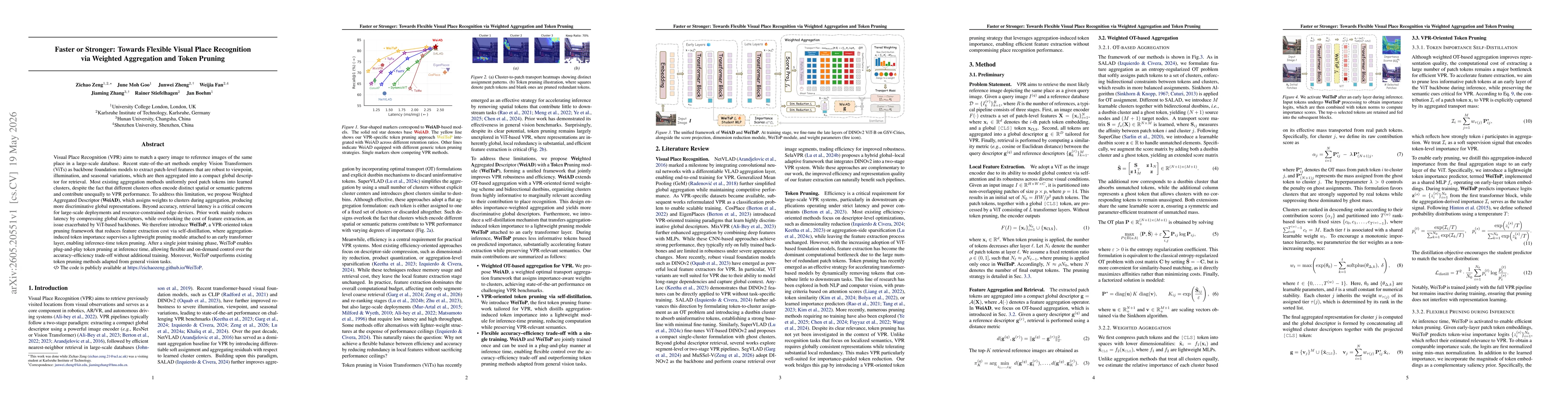
Visual Place Recognition (VPR) aims to match a query image to reference images of the same place in a large-scale database. Recent state-of-the-art methods employ Vision Transformers (ViTs) as backbon...
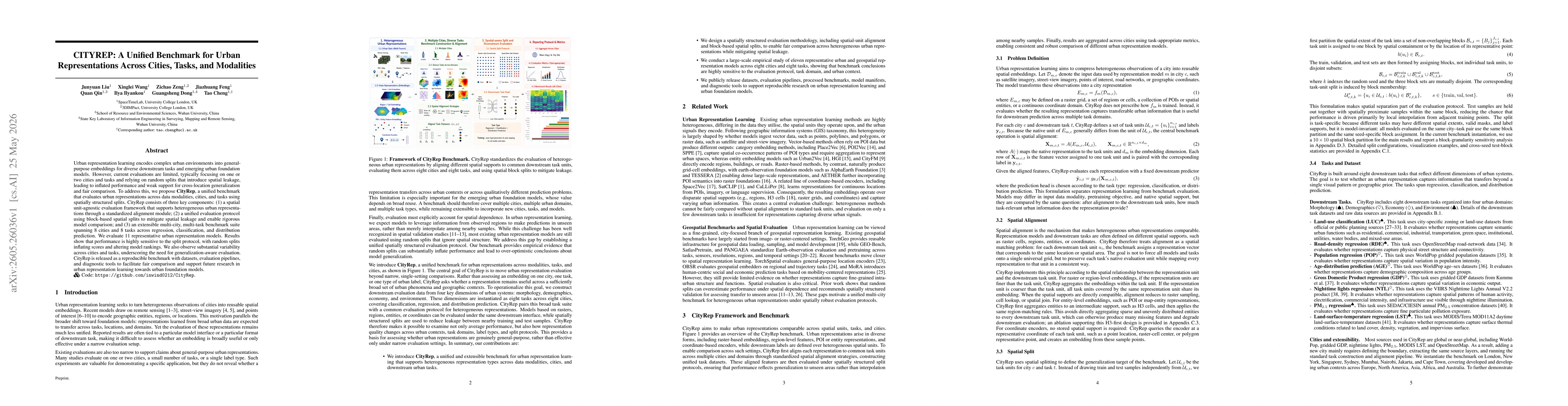
Urban representation learning encodes complex urban environments into general-purpose embeddings for diverse downstream tasks and emerging urban foundation models. However, current evaluations are lim...