Academic Profile
Statistics
Similar Authors
Papers on arXiv
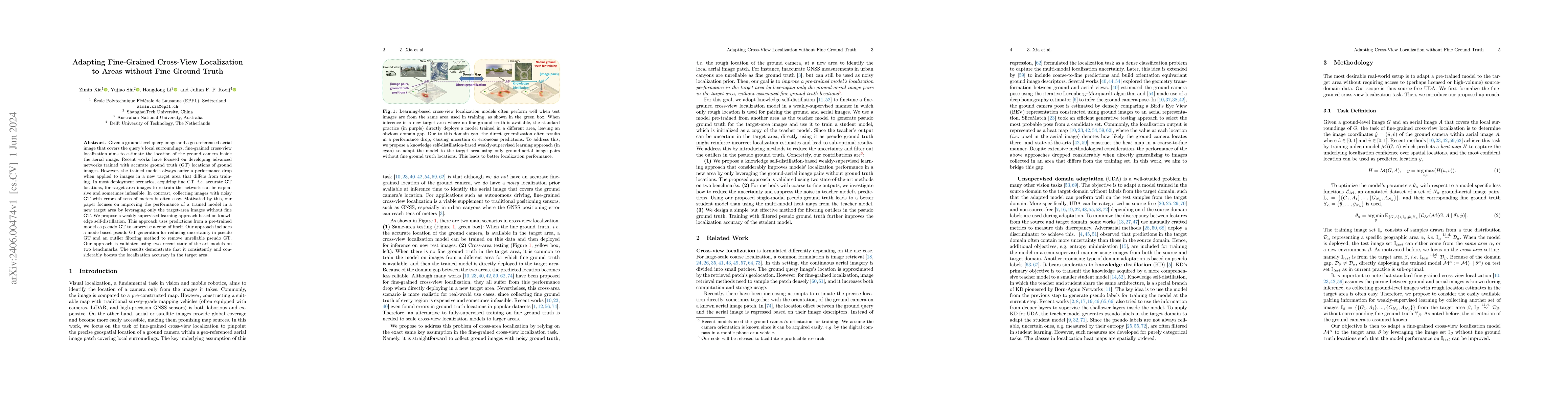
Given a ground-level query image and a geo-referenced aerial image that covers the query's local surroundings, fine-grained cross-view localization aims to estimate the location of the ground camera...
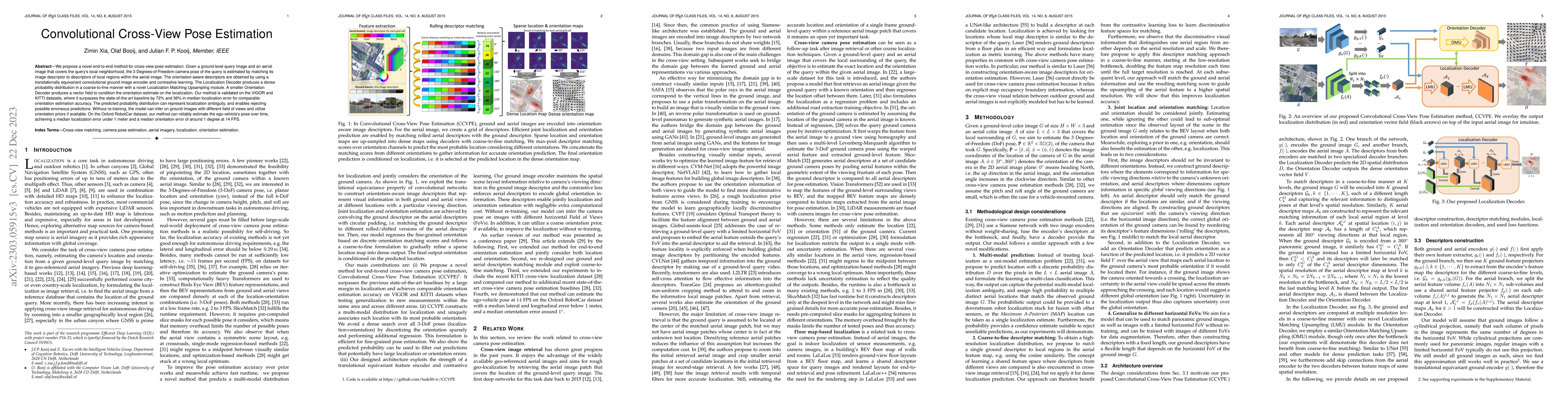
We propose a novel end-to-end method for cross-view pose estimation. Given a ground-level query image and an aerial image that covers the query's local neighborhood, the 3 Degrees-of-Freedom camera ...
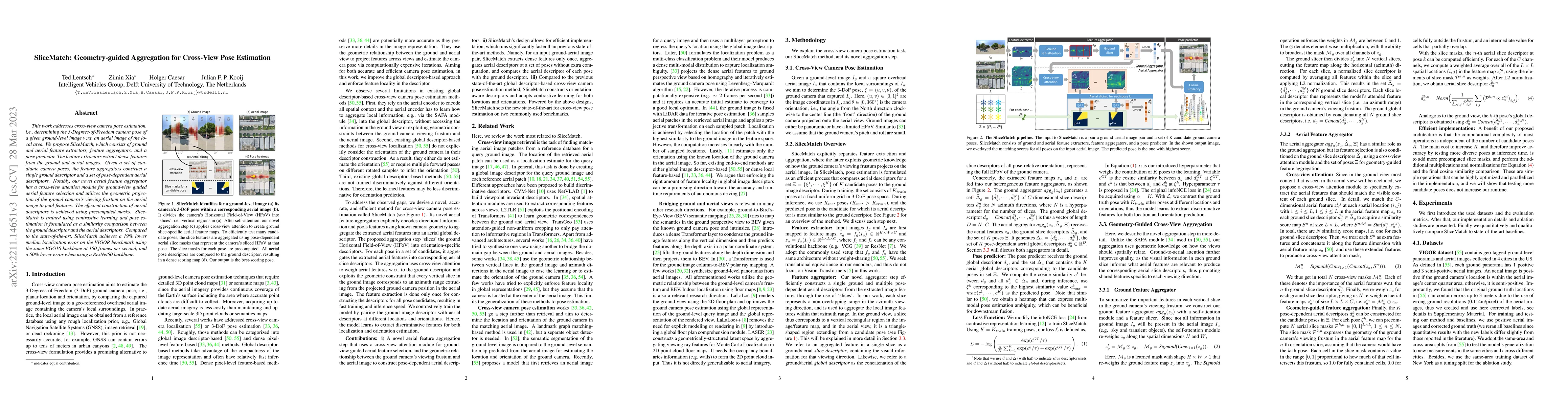
This work addresses cross-view camera pose estimation, i.e., determining the 3-Degrees-of-Freedom camera pose of a given ground-level image w.r.t. an aerial image of the local area. We propose Slice...
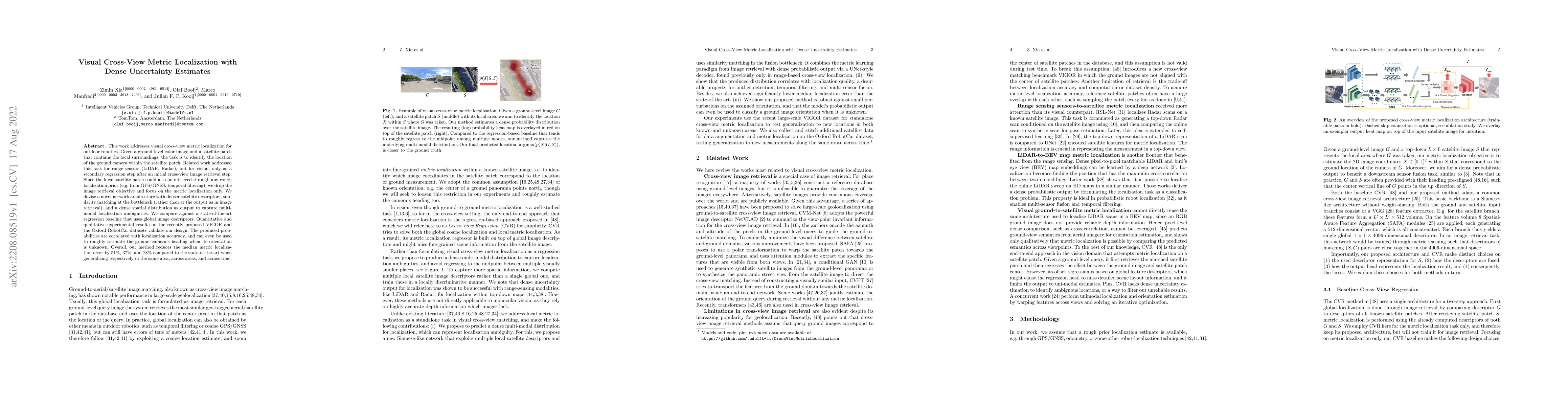
This work addresses visual cross-view metric localization for outdoor robotics. Given a ground-level color image and a satellite patch that contains the local surroundings, the task is to identify t...
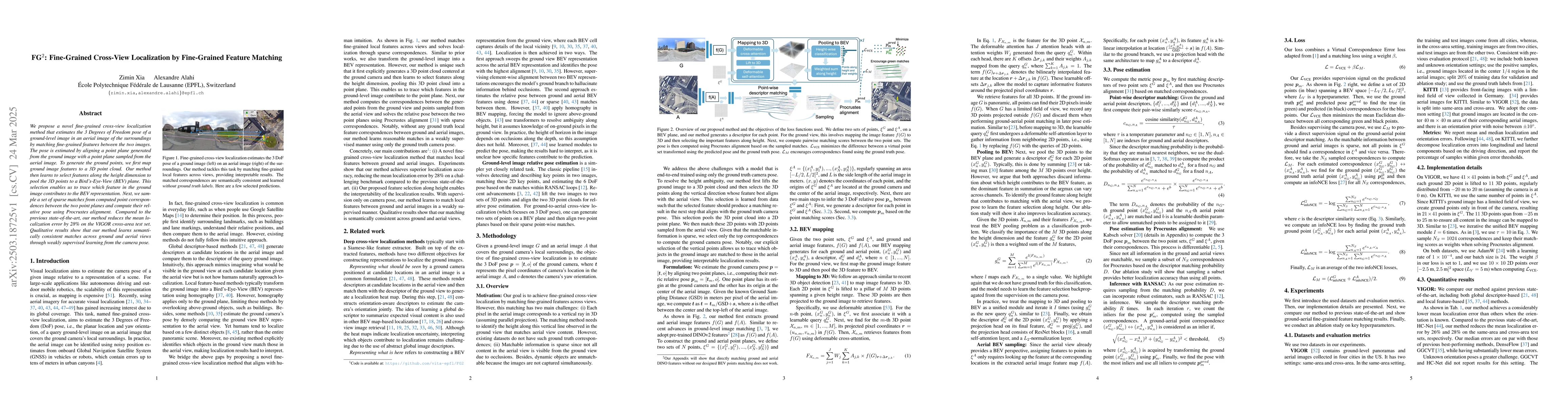
We propose a novel fine-grained cross-view localization method that estimates the 3 Degrees of Freedom pose of a ground-level image in an aerial image of the surroundings by matching fine-grained feat...
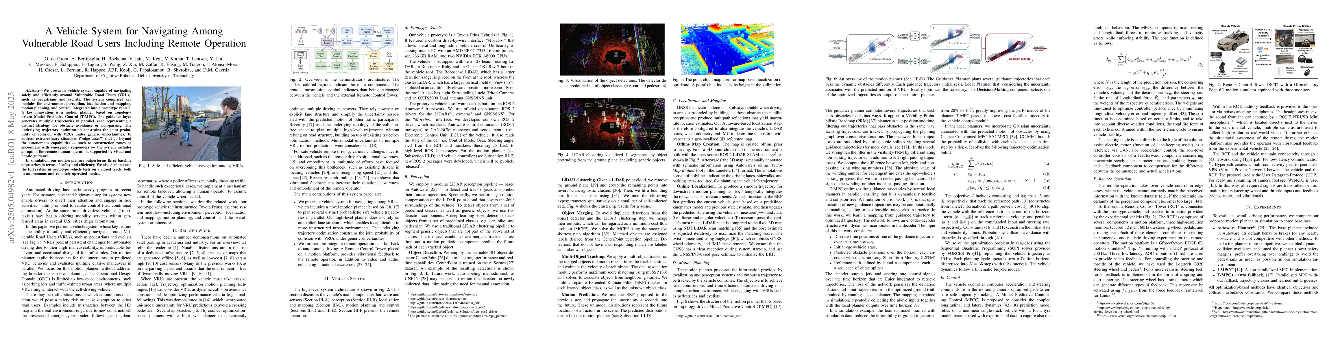
We present a vehicle system capable of navigating safely and efficiently around Vulnerable Road Users (VRUs), such as pedestrians and cyclists. The system comprises key modules for environment percept...
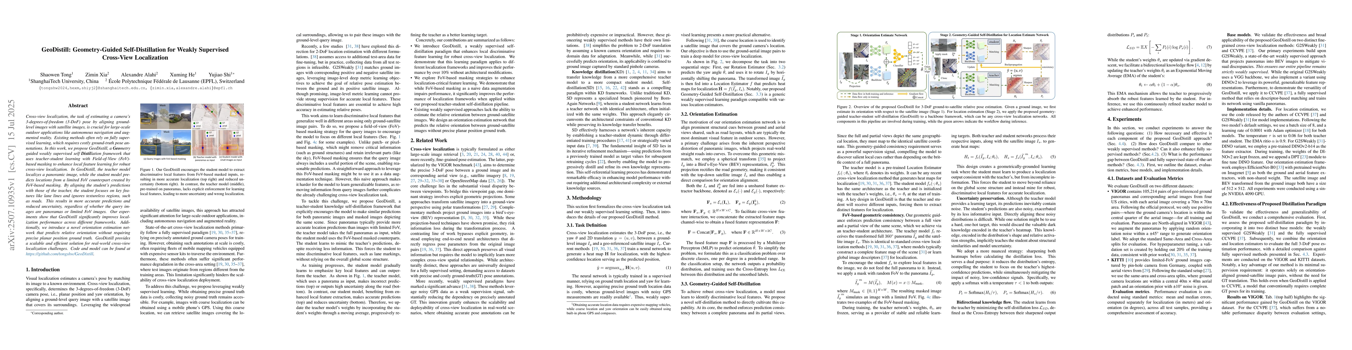
Cross-view localization, the task of estimating a camera's 3-degrees-of-freedom (3-DoF) pose by aligning ground-level images with satellite images, is crucial for large-scale outdoor applications like...
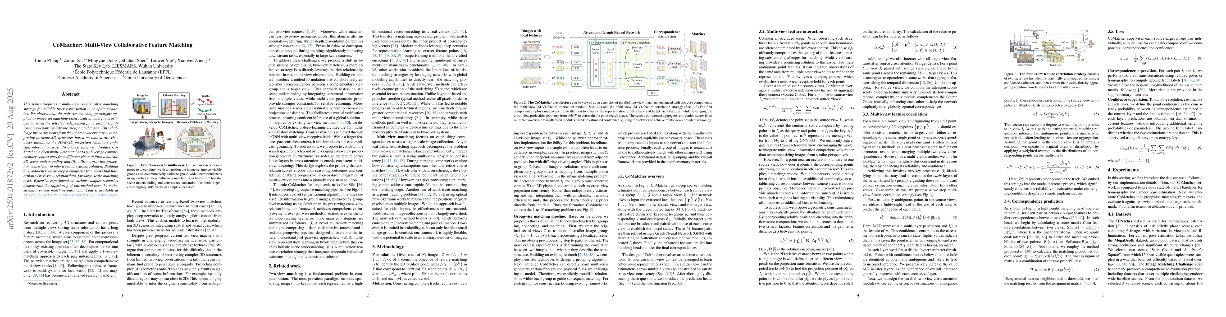
This paper proposes a multi-view collaborative matching strategy for reliable track construction in complex scenarios. We observe that the pairwise matching paradigms applied to image set matching oft...
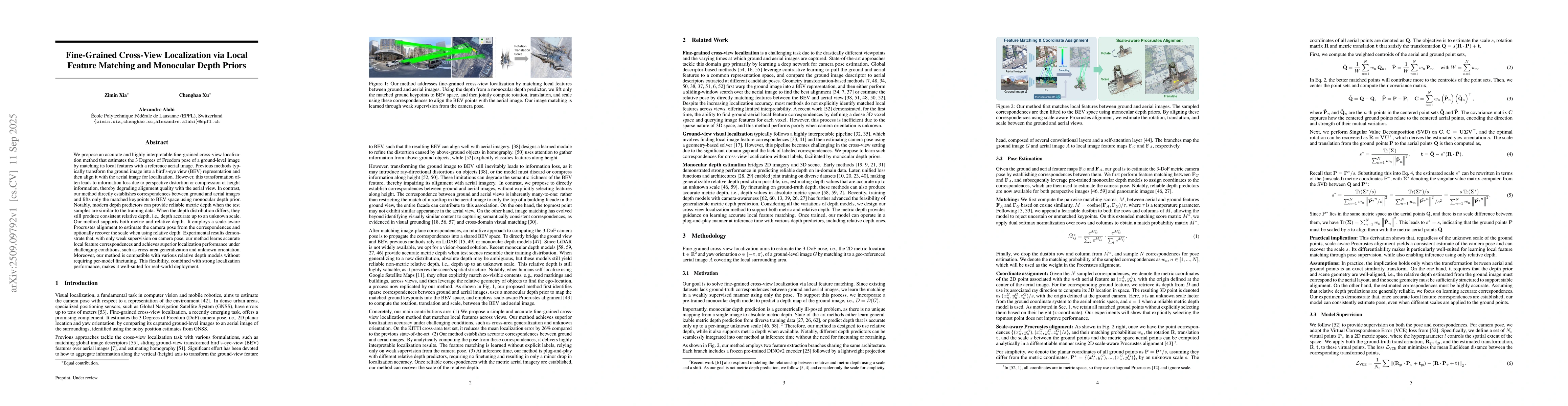
We propose an accurate and highly interpretable fine-grained cross-view localization method that estimates the 3 Degrees of Freedom pose of a ground-level image by matching its local features with a r...
Real-time 3D object detection from point clouds is essential for dynamic scene understanding in applications such as augmented reality, robotics and navigation. We introduce a novel Spatial-prioritize...

Generating a street-level 3D scene from a single satellite image is a crucial yet challenging task. Current methods present a stark trade-off: geometry-colorization models achieve high geometric fidel...
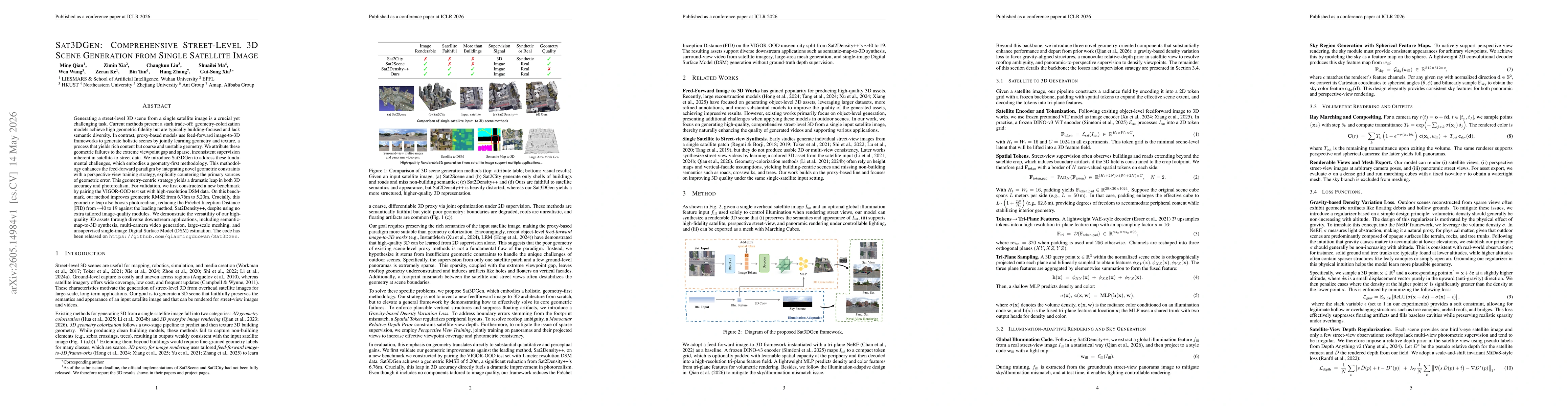
Generating a street-level 3D scene from a single satellite image is a crucial yet challenging task. Current methods present a stark trade-off: geometry-colorization models achieve high geometric fidel...
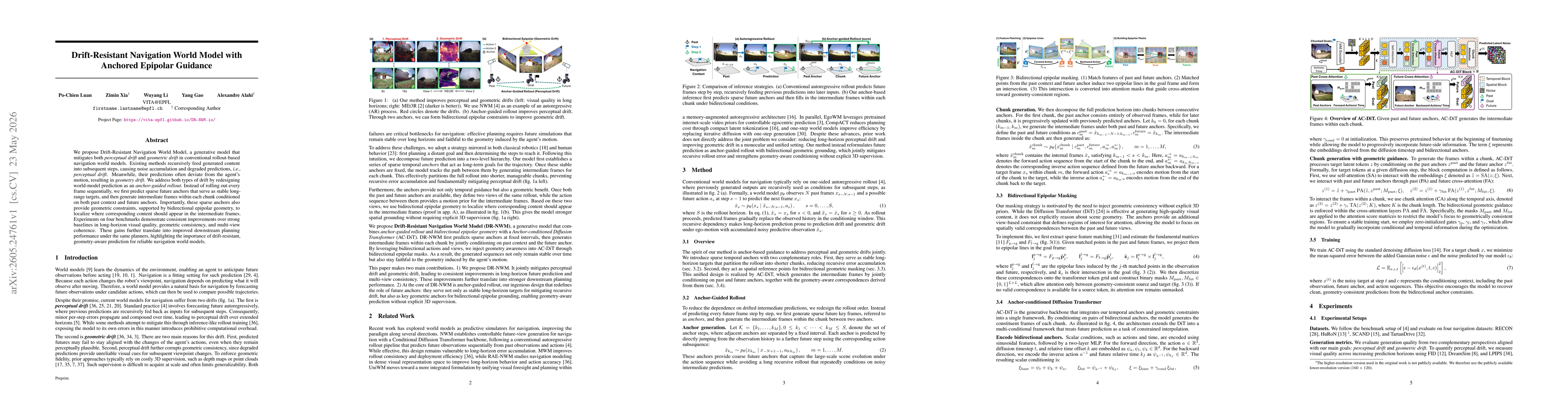
We propose Drift-Resistant Navigation World Model, a generative model that mitigates both perceptual drift and geometric drift in conventional rollout-based navigation world models. Existing methods r...
Current cross-view localization methods predominantly rely on satellite imagery as the aerial modality. Although recent work explores planimetric maps (e.g., OpenStreetMap tiles), these approaches oft...