Academic Profile
Statistics
Similar Authors
Papers on arXiv
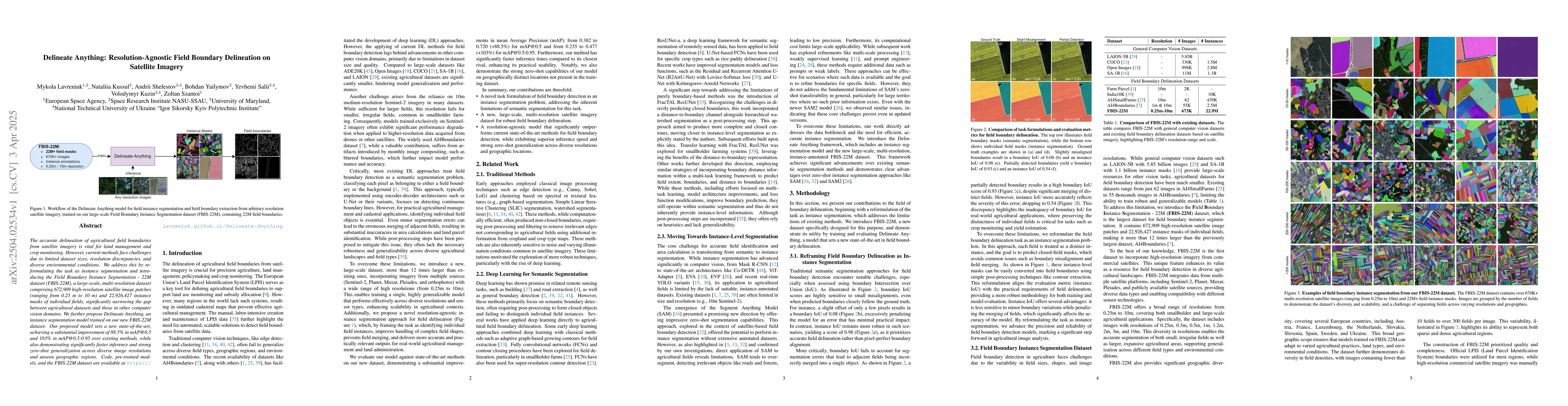
The accurate delineation of agricultural field boundaries from satellite imagery is vital for land management and crop monitoring. However, current methods face challenges due to limited dataset sizes...
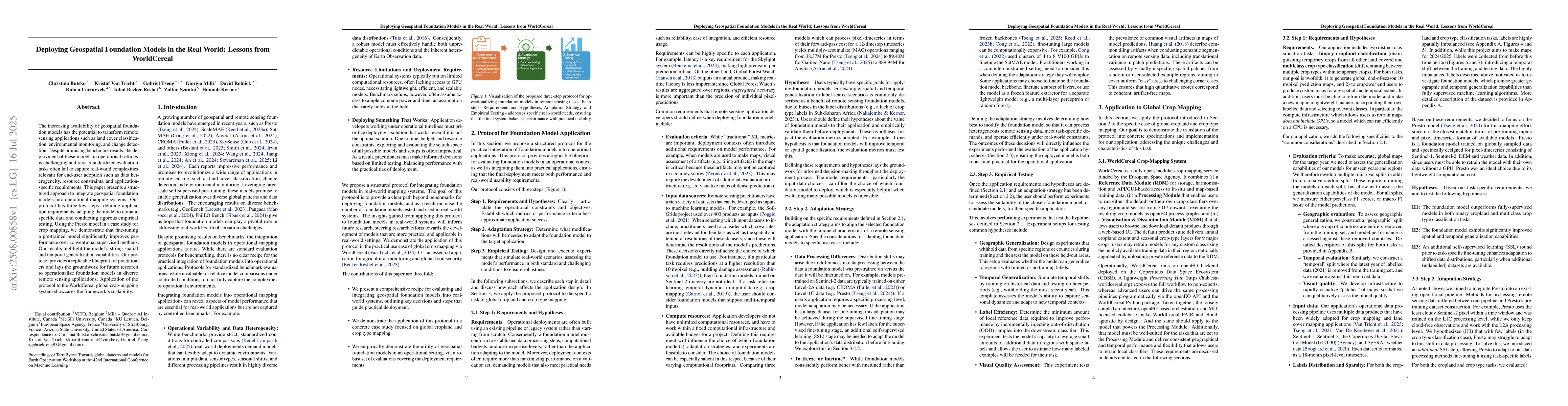
The increasing availability of geospatial foundation models has the potential to transform remote sensing applications such as land cover classification, environmental monitoring, and change detection...
Accurate delineation of agricultural field boundaries from satellite imagery is essential for land management and crop monitoring, yet existing methods often produce incomplete boundaries, merge adjac...