Publication
Metrics
AI Quick Summary
Researchers propose a new 3D scan registration method using curvelet features that outperforms existing methods in challenging planetary environments with sparse data.
Paper Preview
Abstract
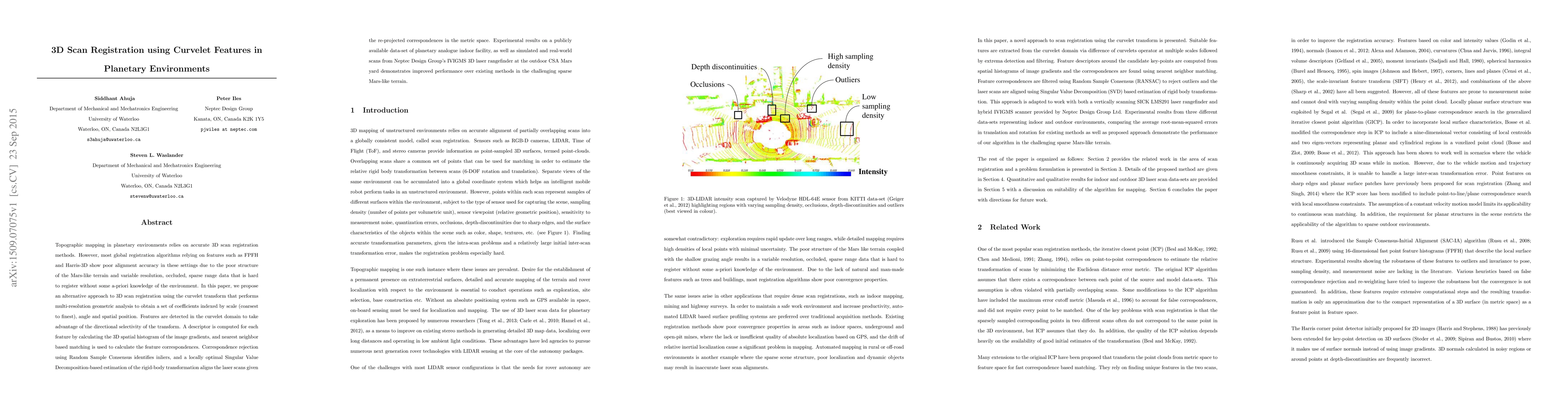
Topographic mapping in planetary environments relies on accurate 3D scan registration methods. However, most global registration algorithms relying on features such as FPFH and Harris-3D show poor alignment accuracy in these settings due to the poor structure of the Mars-like terrain and variable resolution, occluded, sparse range data that is hard to register without some a-priori knowledge of the environment. In this paper, we propose an alternative approach to 3D scan registration using the curvelet transform that performs multi-resolution geometric analysis to obtain a set of coefficients indexed by scale (coarsest to finest), angle and spatial position. Features are detected in the curvelet domain to take advantage of the directional selectivity of the transform. A descriptor is computed for each feature by calculating the 3D spatial histogram of the image gradients, and nearest neighbor based matching is used to calculate the feature correspondences. Correspondence rejection using Random Sample Consensus identifies inliers, and a locally optimal Singular Value Decomposition-based estimation of the rigid-body transformation aligns the laser scans given the re-projected correspondences in the metric space. Experimental results on a publicly available data-set of planetary analogue indoor facility, as well as simulated and real-world scans from Neptec Design Group's IVIGMS 3D laser rangefinder at the outdoor CSA Mars yard demonstrates improved performance over existing methods in the challenging sparse Mars-like terrain.
AI Key Findings
Get AI-generated insights about this paper's methodology, results, significance, and more — seven facets brought into focus.
Impact
Paper Details
PDF Preview
Key Terms
Citation Network
Current paper (gray), citations (green), references (blue)
Display is limited for performance on very large graphs.
Discussion 0