Timely assessment of structural damage is critical for disaster response and
recovery. However, most prior work in natural disaster analysis relies on 2D
imagery, which lacks depth, suffers from occlusions, and provides limited
spatial context. 3D semantic segmentation offers a richer alternative, but
existing 3D benchmarks focus mainly on urban or indoor scenes, with little
attention to disaster-affected areas. To address this gap, we present
3DAeroRelief--the first 3D benchmark dataset specifically designed for
post-disaster assessment. Collected using low-cost unmanned aerial vehicles
(UAVs) over hurricane-damaged regions, the dataset features dense 3D point
clouds reconstructed via Structure-from-Motion and Multi-View Stereo
techniques. Semantic annotations were produced through manual 2D labeling and
projected into 3D space. Unlike existing datasets, 3DAeroRelief captures 3D
large-scale outdoor environments with fine-grained structural damage in
real-world disaster contexts. UAVs enable affordable, flexible, and safe data
collection in hazardous areas, making them particularly well-suited for
emergency scenarios. To demonstrate the utility of 3DAeroRelief, we evaluate
several state-of-the-art 3D segmentation models on the dataset to highlight
both the challenges and opportunities of 3D scene understanding in disaster
response. Our dataset serves as a valuable resource for advancing robust 3D
vision systems in real-world applications for post-disaster scenarios.
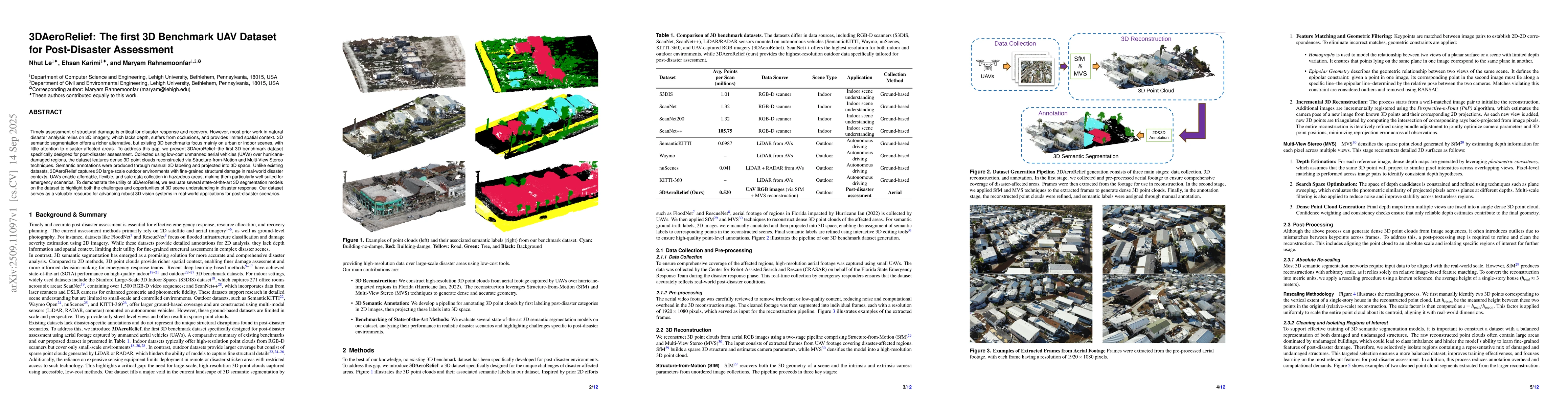
Discussion 0