Summary
In geostatistics, it is common to model spatially distributed phenomena through an underlying stationary and isotropic spatial process. However, these assumptions are often untenable in practice because of the influence of local effects in the correlation structure. Therefore, it has been of prolonged interest in the literature to provide flexible and effective ways to model nonstationarity in the spatial effects. Arguably, due to the local nature of the problem, we might envision that the correlation structure would be highly dependent on local characteristics of the domain of study, namely, the latitude, longitude and altitude of the observation sites, as well as other locally defined covariate information. In this work, we provide a flexible and computationally feasible way for allowing the correlation structure of the underlying processes to depend on local covariate information. We discuss the properties of the induced covariance functions and methods to assess its dependence on local covariate information. The proposed method is used to analyze daily ozone in the southeast United States.
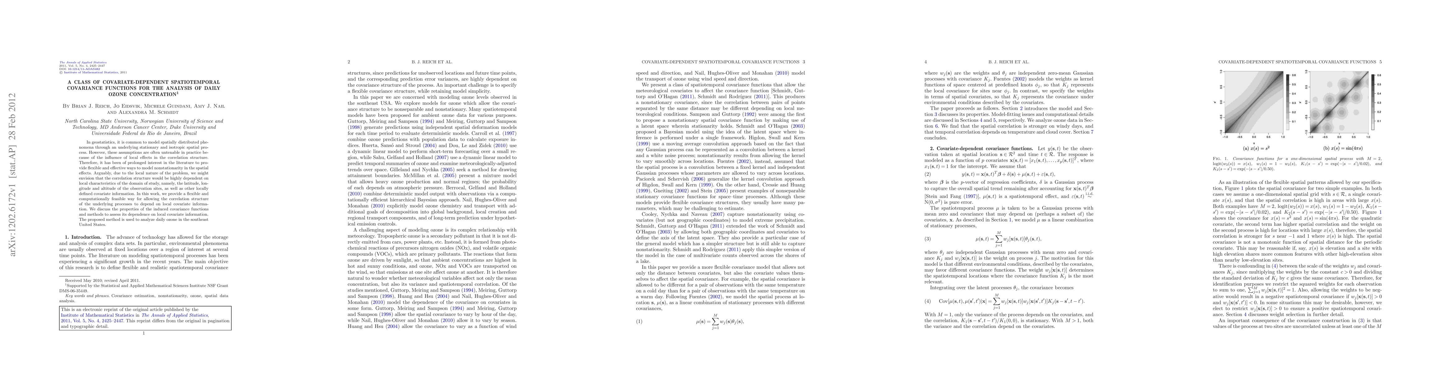
AI Key Findings
Get AI-generated insights about this paper's methodology, results, and significance.
Paper Details
PDF Preview
Key Terms
Citation Network
Current paper (gray), citations (green), references (blue)
Display is limited for performance on very large graphs.
Similar Papers
Found 4 papersA class of modular and flexible covariate-based covariance functions for nonstationary spatial modeling
Reinhard Furrer, Federico Blasi
Functional PCA with Covariate Dependent Mean and Covariance Structure
Fei Ding, Shiyuan He, Jianhua Z. Huang et al.
| Title | Authors | Year | Actions |
|---|
Comments (0)