A Conditional Denoising Diffusion Probabilistic Model for RFI Mitigation in Synthetic Aperture Interferometric Radiometer
Publication
Metrics
Paper Preview
Abstract
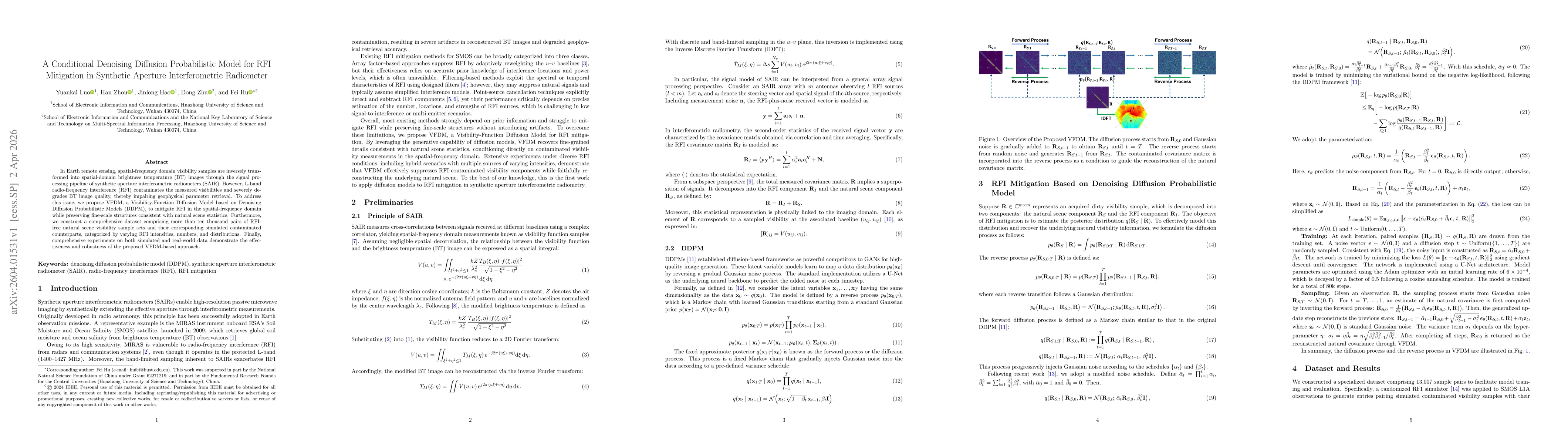
In Earth remote sensing, spatial-frequency domain visibility samples are inversely transformed into spatial-domain brightness temperature (BT) images through the signal processing pipeline of synthetic aperture interferometric radiometers (SAIR). However, L-band radio-frequency interference (RFI) contaminates the measured visibilities and severely degrades BT image quality, thereby impairing geophysical parameter retrieval. To address this issue, we propose VFDM, a Visibility-Function Diffusion Model based on Denoising Diffusion Probabilistic Models (DDPM), to mitigate RFI in the spatial-frequency domain while preserving fine-scale structures consistent with natural scene statistics. Furthermore, we construct a comprehensive dataset comprising more than ten thousand pairs of RFI-free natural scene visibility sample sets and their corresponding simulated contaminated counterparts, categorized by varying RFI intensities, numbers, and distributions. Finally, comprehensive experiments on both simulated and real-world data demonstrate the effectiveness and robustness of the proposed VFDM-based approach.
AI Key Findings
Get AI-generated insights about this paper's methodology, results, significance, and more — seven facets brought into focus.
Discussion 0