With the expanding application scope of unmanned aerial vehicles (UAVs), the
demand for stable UAV control has significantly increased. However, in complex
environments, GPS signals are prone to interference, resulting in ineffective
UAV positioning. Therefore, self-positioning of UAVs in GPS-denied environments
has become a critical objective. Some methods obtain geolocation information in
GPS-denied environments by matching ground objects in the UAV viewpoint with
remote sensing images. However, most of these methods only provide coarse-level
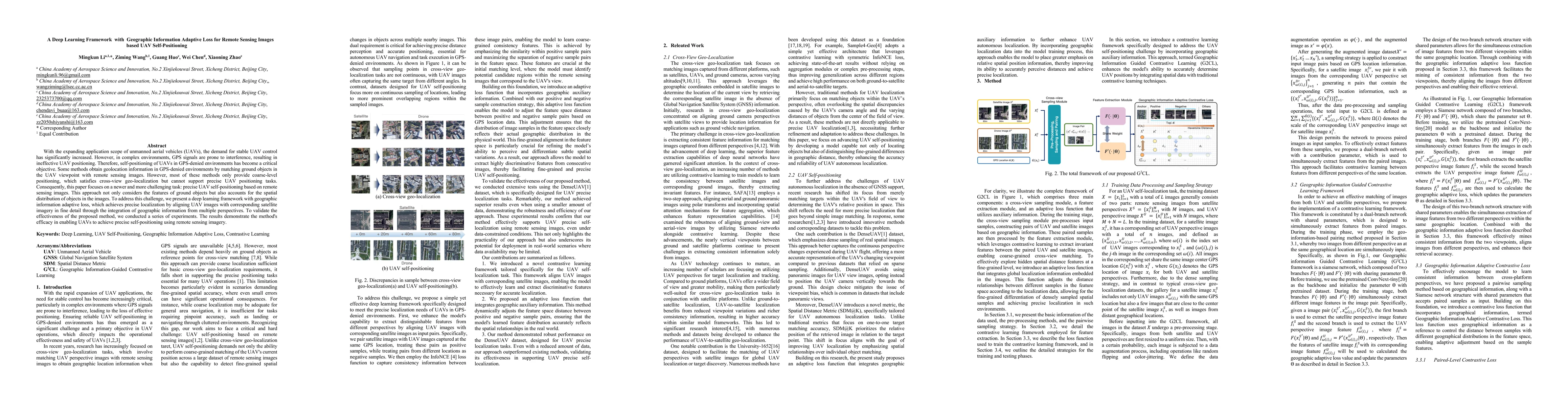
positioning, which satisfies cross-view geo-localization but cannot support
precise UAV positioning tasks. Consequently, this paper focuses on a newer and
more challenging task: precise UAV self-positioning based on remote sensing
images. This approach not only considers the features of ground objects but
also accounts for the spatial distribution of objects in the images. To address
this challenge, we present a deep learning framework with geographic
information adaptive loss, which achieves precise localization by aligning UAV
images with corresponding satellite imagery in fine detail through the
integration of geographic information from multiple perspectives. To validate
the effectiveness of the proposed method, we conducted a series of experiments.
The results demonstrate the method's efficacy in enabling UAVs to achieve
precise self-positioning using remote sensing imagery.
Discussion 0