Authors
Publication
Metrics
Quick Actions
AI Quick Summary
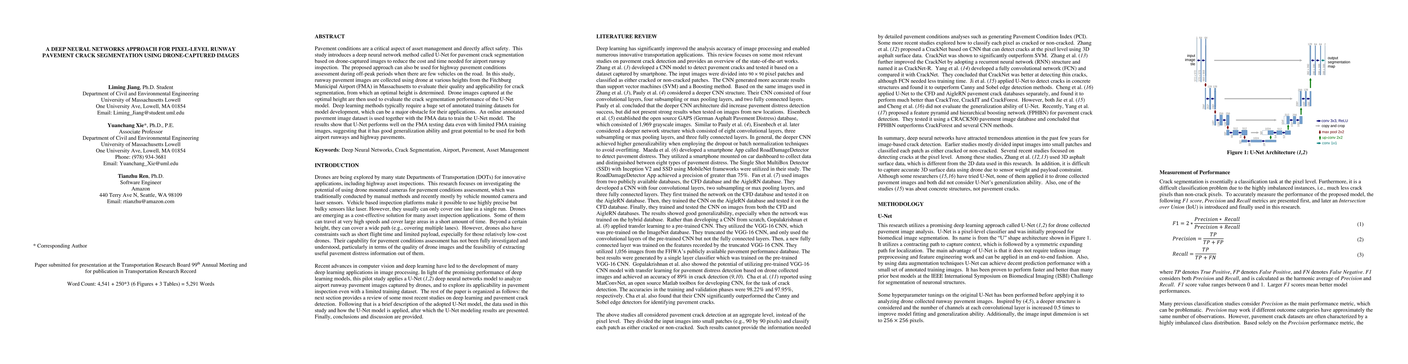
This study uses a U-Net deep neural network for segmenting pavement cracks in drone-captured images, aiming to reduce inspection costs and time for airport runways. The method shows good generalization ability even with limited training data, demonstrating potential for both airport and highway pavement assessments.
Paper Preview
Abstract
Pavement conditions are a critical aspect of asset management and directly affect safety. This study introduces a deep neural network method called U-Net for pavement crack segmentation based on drone-captured images to reduce the cost and time needed for airport runway inspection. The proposed approach can also be used for highway pavement conditions assessment during off-peak periods when there are few vehicles on the road. In this study, runway pavement images are collected using drone at various heights from the Fitchburg Municipal Airport (FMA) in Massachusetts to evaluate their quality and applicability for crack segmentation, from which an optimal height is determined. Drone images captured at the optimal height are then used to evaluate the crack segmentation performance of the U-Net model. Deep learning methods typically require a huge set of annotated training datasets for model development, which can be a major obstacle for their applications. An online annotated pavement image dataset is used together with the FMA data to train the U-Net model. The results show that U-Net performs well on the FMA testing data even with limited FMA training images, suggesting that it has good generalization ability and great potential to be used for both airport runways and highway pavements.
AI Key Findings
Get AI-generated insights about this paper's methodology, results, and significance.
Paper Details
How to Cite This Paper
@article{jiang2020a,
  title         = {A Deep Neural Networks Approach for Pixel-Level Runway Pavement Crack
  Segmentation Using Drone-Captured Images},
  author        = {Jiang, Liming and Ren, Tianzhu and Xie, Yuanchang},
  year          = {2020},
  eprint        = {2001.03257},
  archivePrefix = {arXiv},
  primaryClass  = {cs.CV},
}Jiang, L., Ren, T., & Xie, Y. (2020). A Deep Neural Networks Approach for Pixel-Level Runway Pavement Crack
Segmentation Using Drone-Captured Images. arXiv. https://arxiv.org/abs/2001.03257Jiang, Liming, et al. "A Deep Neural Networks Approach for Pixel-Level Runway Pavement Crack
Segmentation Using Drone-Captured Images." arXiv, 2020, arxiv.org/abs/2001.03257.PDF Preview
Key Terms
Citation Network
Current paper (gray), citations (green), references (blue)
Display is limited for performance on very large graphs.
Similar Papers
Found 4 papersPixel-Level Pavement Distress Assessment Using Instance Segmentation
Logan Dewick, Bibesh Pyakurel, Kong Pheng Yang et al.
Ensemble of Deep Convolutional Neural Networks for Automatic Pavement Crack Detection and Measurement
Zhun Fan, Ying Chen, Paola Di Mascio et al.
| Title | Authors | Year | Actions |
|---|
Comments (0)