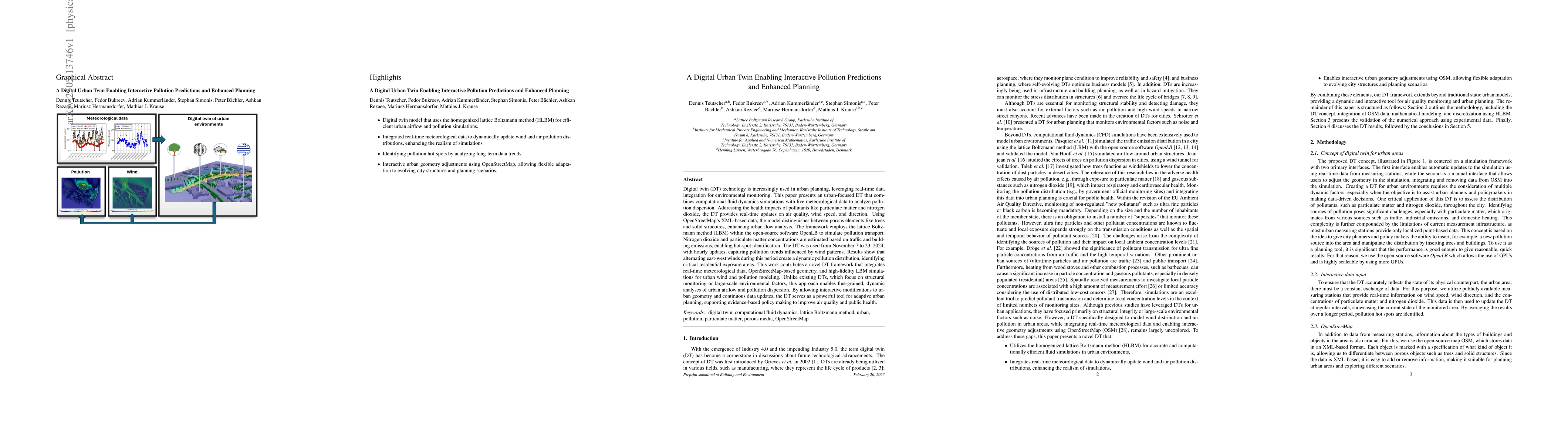
Digital twin (DT) technology is increasingly used in urban planning,
leveraging real-time data integration for environmental monitoring. This paper
presents an urban-focused DT that combines computational fluid dynamics
simulations with live meteorological data to analyze pollution dispersion.
Addressing the health impacts of pollutants like particulate matter and
nitrogen dioxide, the DT provides real-time updates on air quality, wind speed,
and direction. Using OpenStreetMaps XML-based data, the model distinguishes
between porous elements like trees and solid structures, enhancing urban flow
analysis. The framework employs the lattice Boltzmann method (LBM) within the
open-source software OpenLB to simulate pollution transport. Nitrogen dioxide
and particulate matter concentrations are estimated based on traffic and
building emissions, enabling hot-spot identification. The DT was used from
November 7 to 23, 2024, with hourly updates, capturing pollution trends
influenced by wind patterns. Results show that alternating east-west winds
during this period create a dynamic pollution distribution, identifying
critical residential exposure areas. This work contributes a novel DT framework
that integrates real-time meteorological data, OpenStreetMap-based geometry,
and high-fidelity LBM simulations for urban wind and pollution modeling. Unlike
existing DTs, which focus on structural monitoring or large-scale environmental
factors, this approach enables fine-grained, dynamic analyses of urban airflow
and pollution dispersion. By allowing interactive modifications to urban
geometry and continuous data updates, the DT serves as a powerful tool for
adaptive urban planning, supporting evidence-based policy making to improve air
quality and public health.
Discussion 0