Publication
Metrics
AI Quick Summary
The paper introduces an annotation tool designed to facilitate the collection and labeling of horizon line data for improving marine autonomous navigation systems, addressing the need for robust horizon detection under varied sea conditions. The software aims to streamline the annotation process, thereby enabling more comprehensive experimental validation of horizon line detectors.
Paper Preview
Abstract
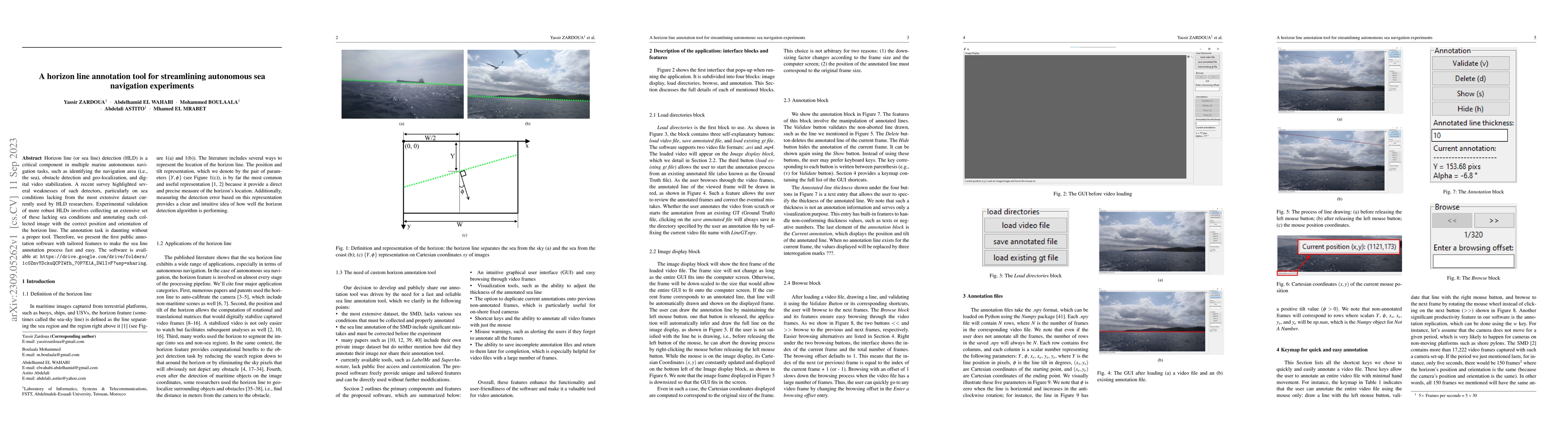
Horizon line (or sea line) detection (HLD) is a critical component in multiple marine autonomous navigation tasks, such as identifying the navigation area (i.e., the sea), obstacle detection and geo-localization, and digital video stabilization. A recent survey highlighted several weaknesses of such detectors, particularly on sea conditions lacking from the most extensive dataset currently used by HLD researchers. Experimental validation of more robust HLDs involves collecting an extensive set of these lacking sea conditions and annotating each collected image with the correct position and orientation of the horizon line. The annotation task is daunting without a proper tool. Therefore, we present the first public annotation software with tailored features to make the sea line annotation process fast and easy. The software is available at: https://drive.google.com/drive/folders/1c0ZmvYDckuQCPIWfh_70P7E1A_DWlIvF?usp=sharing
AI Key Findings
Get AI-generated insights about this paper's methodology, results, significance, and more — seven facets brought into focus.
Impact
Paper Details
Authors
PDF Preview
Key Terms
Citation Network
Current paper (gray), citations (green), references (blue)
Display is limited for performance on very large graphs.
Discussion 0