A simple method to estimate fractal dimension of mountain surfaces
Publication
Metrics
AI Quick Summary
This paper introduces a straightforward method to estimate the fractal dimension of mountain surfaces using satellite images of lakes. By analyzing the fractal dimension of lake boundaries, researchers can infer the irregularity of mountain topography, providing a quantitative characterization useful for validating mountain formation models.
Paper Preview
Abstract
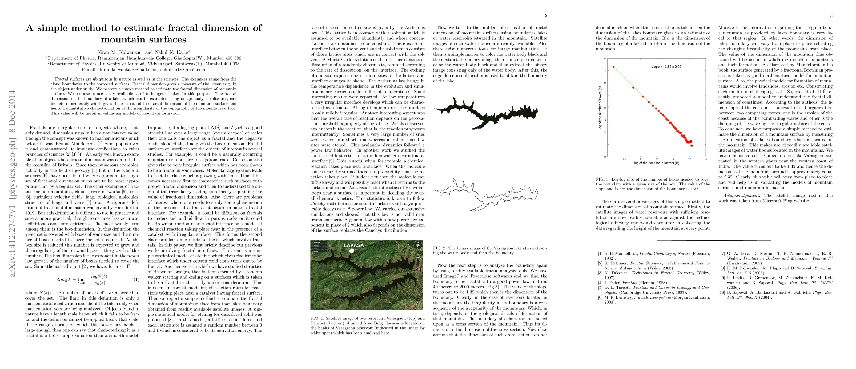
Fractal surfaces are ubiquitous in nature as well as in the sciences. The examples range from the cloud boundaries to the corroded surfaces. Fractal dimension gives a measure of the irregularity in the object under study. We present a simple method to estimate the fractal dimension of mountain surface. We propose to use easily available satellite images of lakes for this purpose. The fractal dimension of the boundary of a lake, which can be extracted using image analysis softwares, can be determined easily which gives the estimate of the fractal dimension of the mountain surface and hence a quantitative characterization of the irregularity of the topography of the mountain surface. This value will be useful in validating models of mountain formation
AI Key Findings
Get AI-generated insights about this paper's methodology, results, significance, and more — seven facets brought into focus.
Impact
Paper Details
PDF Preview
Key Terms
Citation Network
Current paper (gray), citations (green), references (blue)
Display is limited for performance on very large graphs.
Discussion 0