A Space-time Model for Inferring A Susceptibility Map for An Infectious Disease
Publication
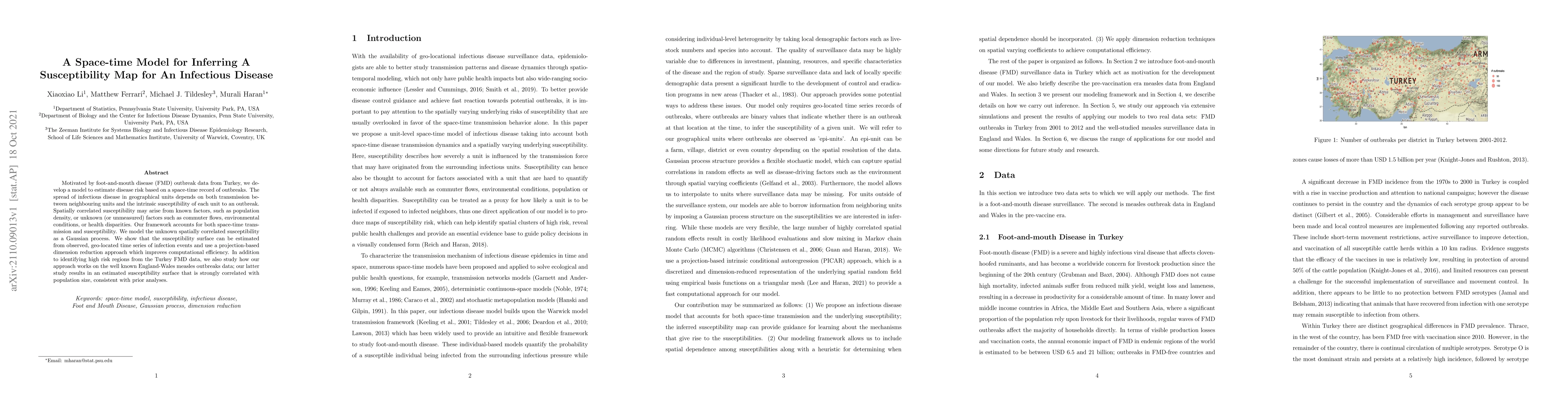
Metrics
AI Quick Summary
This paper develops a space-time model to infer susceptibility maps for infectious diseases, using foot-and-mouth disease data from Turkey and measles data from England-Wales. The model estimates disease risk by accounting for both spatial transmission and spatially correlated susceptibility, modeled as a Gaussian process.
Paper Preview
Abstract
Motivated by foot-and-mouth disease (FMD) outbreak data from Turkey, we develop a model to estimate disease risk based on a space-time record of outbreaks. The spread of infectious disease in geographical units depends on both transmission between neighbouring units and the intrinsic susceptibility of each unit to an outbreak. Spatially correlated susceptibility may arise from known factors, such as population density, or unknown (or unmeasured) factors such as commuter flows, environmental conditions, or health disparities. Our framework accounts for both space-time transmission and susceptibility. We model the unknown spatially correlated susceptibility as a Gaussian process. We show that the susceptibility surface can be estimated from observed, geo-located time series of infection events and use a projection-based dimension reduction approach which improves computational efficiency. In addition to identifying high risk regions from the Turkey FMD data, we also study how our approach works on the well known England-Wales measles outbreaks data; our latter study results in an estimated susceptibility surface that is strongly correlated with population size, consistent with prior analyses.
AI Key Findings
Get AI-generated insights about this paper's methodology, results, significance, and more — seven facets brought into focus.
Impact
Paper Details
Authors
PDF Preview
Key Terms
Citation Network
Current paper (gray), citations (green), references (blue)
Display is limited for performance on very large graphs.
Discussion 0