Publication
Metrics
AI Quick Summary
This paper presents a georeferenced virtual tour of Isaac Newton's life, modeled on an ancient itinerarium, using KML language, Google Earth, and satellite maps to highlight significant places and distances, providing an interactive and visual exploration of his timeline.
Paper Preview
Abstract
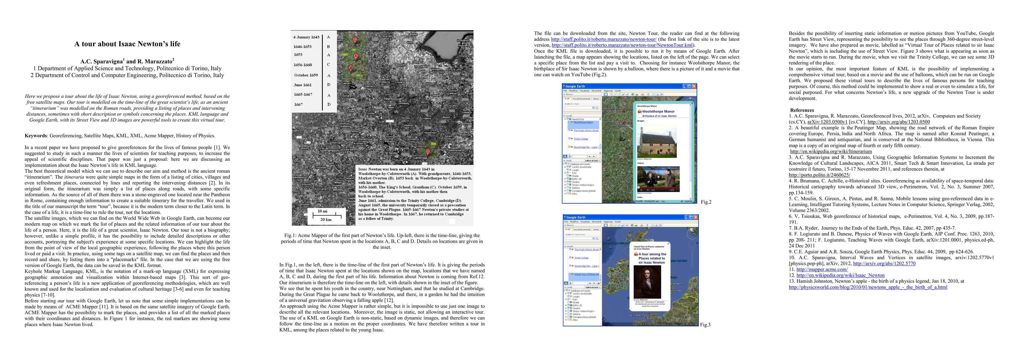
Here we propose a tour about the life of Isaac Newton, using a georeferenced method, based on the free satellite maps. Our tour is modelled on the time-line of the great scientist's life, as an ancient "itinerarium" was modelled on the Roman roads, providing a listing of places and intervening distances, sometimes with short description or symbols concerning the places. KML language and Google Earth, with its Street View and 3D images are powerful tools to create this virtual tour.
AI Key Findings
Get AI-generated insights about this paper's methodology, results, significance, and more — seven facets brought into focus.
Impact
Paper Details
PDF Preview
Key Terms
Citation Network
Current paper (gray), citations (green), references (blue)
Display is limited for performance on very large graphs.
Discussion 0