Publication
Metrics
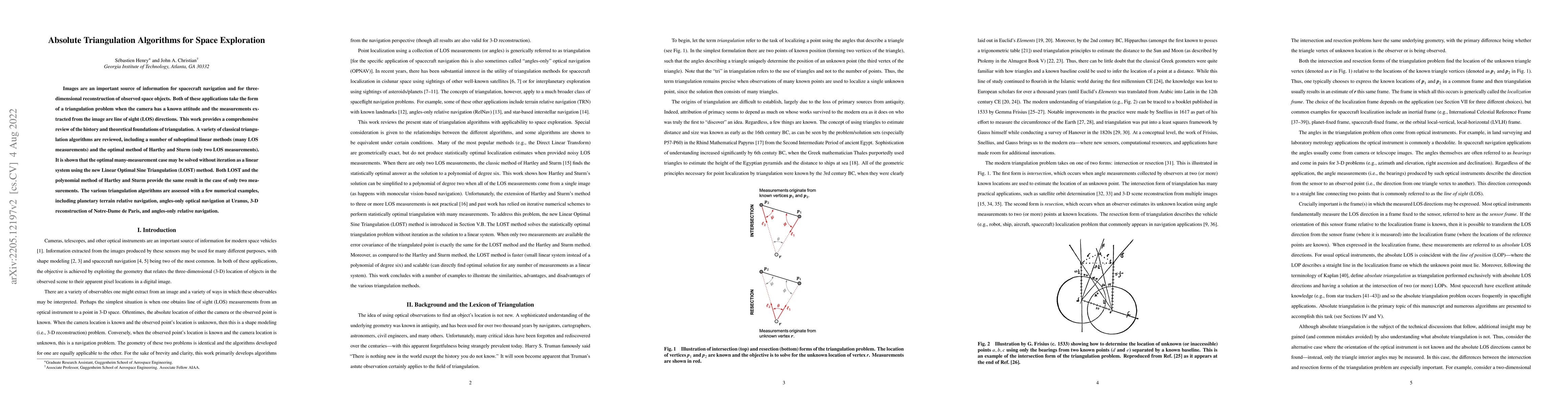
AI Quick Summary
This paper reviews triangulation algorithms for spacecraft navigation and 3D reconstruction, comparing classical methods and introducing the Linear Optimal Sine Triangulation (LOST) method. It demonstrates LOST's efficiency in solving many-measurement cases and assesses various algorithms through examples like planetary terrain navigation and 3D reconstruction.
Paper Preview
Abstract
Images are an important source of information for spacecraft navigation and for three-dimensional reconstruction of observed space objects. Both of these applications take the form of a triangulation problem when the camera has a known attitude and the measurements extracted from the image are line of sight (LOS) directions. This work provides a comprehensive review of the history and theoretical foundations of triangulation. A variety of classical triangulation algorithms are reviewed, including a number of suboptimal linear methods (many LOS measurements) and the optimal method of Hartley and Sturm (only two LOS measurements). It is shown that the optimal many-measurement case may be solved without iteration as a linear system using the new Linear Optimal Sine Triangulation (LOST) method. Both LOST and the polynomial method of Hartley and Sturm provide the same result in the case of only two measurements. The various triangulation algorithms are assessed with a few numerical examples, including planetary terrain relative navigation, angles-only optical navigation at Uranus, 3-D reconstruction of Notre-Dame de Paris, and angles-only relative navigation.
AI Key Findings
Get AI-generated insights about this paper's methodology, results, significance, and more — seven facets brought into focus.
Impact
Paper Details
Authors
PDF Preview
Key Terms
Citation Network
Current paper (gray), citations (green), references (blue)
Display is limited for performance on very large graphs.
Discussion 0