Accessible Interactive Maps for Visually Impaired Users
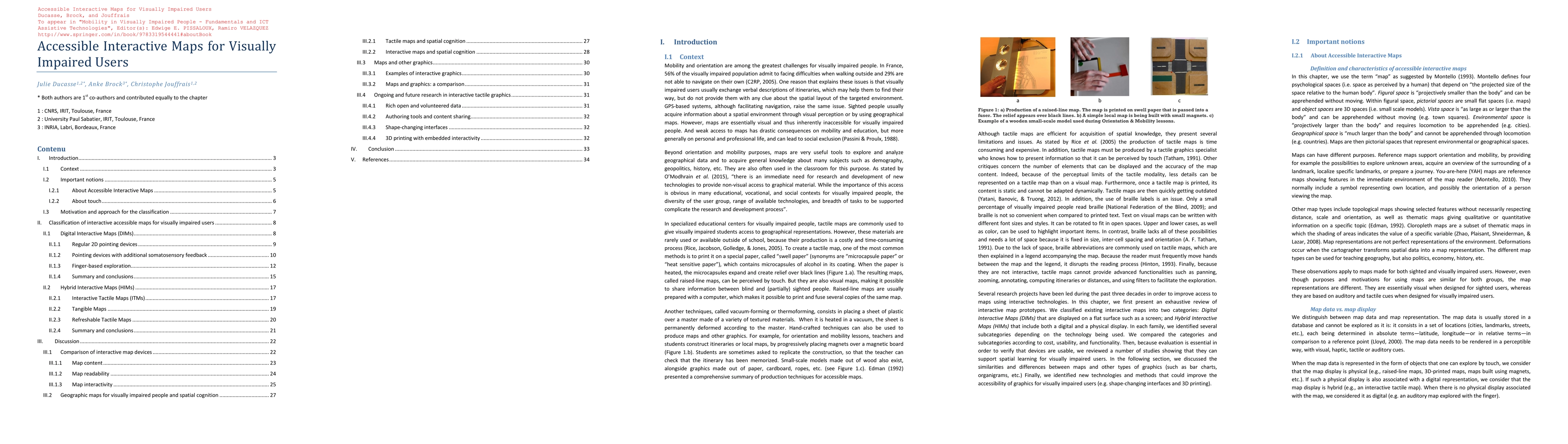
Publication
Metrics
AI Quick Summary
This paper reviews interactive map prototypes for visually impaired users, categorizing them into Digital Interactive Maps and Hybrid Interactive Maps, and evaluates their effectiveness, cost, and technological limitations. It concludes with suggestions for future advancements in accessible graphics.
Paper Preview
Abstract
Tactile maps are commonly used to give visually impaired users access to geographical representations. Although those relief maps are efficient tools for acquisition of spatial knowledge, they present several limitations and issues such as the need to read braille. Several research projects have been led during the past three decades in order to improve access to maps using interactive technologies. In this chapter, we present an exhaustive review of interactive map prototypes. We classified existing interactive maps into two categories: Digital Interactive Maps (DIMs) that are displayed on a flat surface such as a screen; and Hybrid Interactive Maps (HIMs) that include both a digital and a physical representation. In each family, we identified several subcategories depending on the technology being used. We compared the categories and subcategories according to cost, availability and technological limitations, but also in terms of content, comprehension and interactivity. Then we reviewed a number of studies showing that those maps can support spatial learning for visually impaired users. Finally, we identified new technologies and methods that could improve the accessibility of graphics for visually impaired users in the future.
AI Key Findings
Get AI-generated insights about this paper's methodology, results, significance, and more — seven facets brought into focus.
Impact
Paper Details
Authors
PDF Preview
Key Terms
Citation Network
Current paper (gray), citations (green), references (blue)
Display is limited for performance on very large graphs.
Discussion 0