Publication
Metrics
AI Quick Summary
Agronav is a vision-based autonomous navigation framework for agricultural robots using semantic segmentation and line detection. It leverages a new dataset, Agroscapes, to ensure generalizability across different robotic platforms.
Paper Preview
Abstract
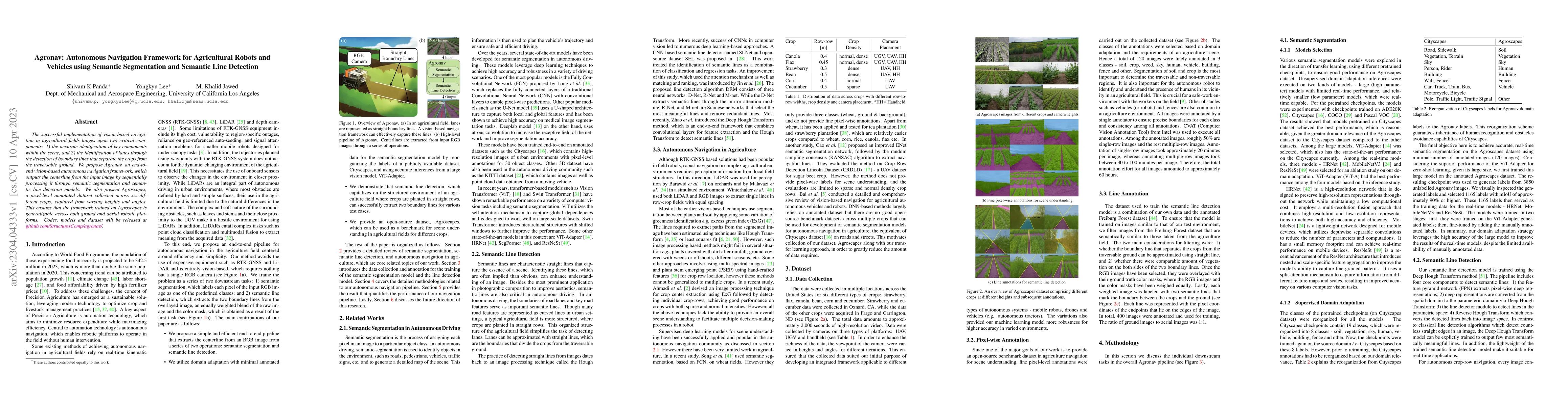
The successful implementation of vision-based navigation in agricultural fields hinges upon two critical components: 1) the accurate identification of key components within the scene, and 2) the identification of lanes through the detection of boundary lines that separate the crops from the traversable ground. We propose Agronav, an end-to-end vision-based autonomous navigation framework, which outputs the centerline from the input image by sequentially processing it through semantic segmentation and semantic line detection models. We also present Agroscapes, a pixel-level annotated dataset collected across six different crops, captured from varying heights and angles. This ensures that the framework trained on Agroscapes is generalizable across both ground and aerial robotic platforms. Codes, models and dataset will be released at \href{https://github.com/shivamkumarpanda/agronav}{github.com/shivamkumarpanda/agronav}.
AI Key Findings
Get AI-generated insights about this paper's methodology, results, significance, and more — seven facets brought into focus.
Impact
Paper Details
Authors
PDF Preview
Key Terms
Citation Network
Current paper (gray), citations (green), references (blue)
Display is limited for performance on very large graphs.
Discussion 0