Publication
Metrics
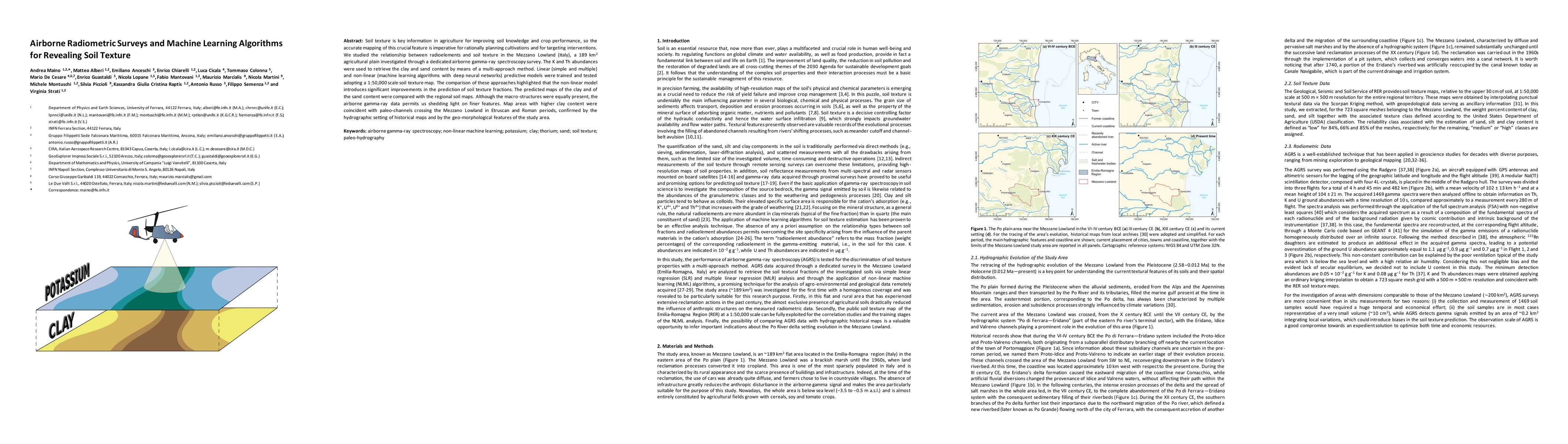
AI Quick Summary
This paper explores the use of airborne gamma-ray spectroscopy and machine learning algorithms to accurately map soil texture in the Mezzano Lowland, Italy. Non-linear predictive models, particularly deep neural networks, significantly outperform linear models in predicting clay and sand content, revealing finer geological features than traditional methods.
Paper Preview
Abstract
Soil texture is key information in agriculture for improving soil knowledge and crop performance, so the accurate mapping of this crucial feature is imperative for rationally planning cultivations and for targeting interventions. We studied the relationship between radioelements and soil texture in the Mezzano Lowland (Italy), a 189 $km^2$ agricultural plain investigated through a ded-icated airborne gamma-ray spectroscopy survey. The K and Th abundances were used to retrieve the clay and sand content by means of a multi-approach method. Linear (simple and multiple) and non-linear (machine learning algorithms with deep neural networks) predictive models were trained and tested adopting a 1:50,000 scale soil texture map. The comparison of these approaches highlighted that the non-linear model introduces significant improvements in the prediction of soil texture fractions. The predicted maps of the clay and of the sand content were compared with the regional soil maps. Although the macro-structures were equally present, the airborne gam-ma-ray data permits us shedding light on finer features. Map areas with higher clay content were coincident with paleo-channels crossing the Mezzano Lowland in Etruscan and Roman periods, confirmed by the hydrographic setting of historical maps and by the geo-morphological features of the study area.
AI Key Findings
Get AI-generated insights about this paper's methodology, results, significance, and more — seven facets brought into focus.
Impact
Paper Details
Authors
PDF Preview
Key Terms
Citation Network
Current paper (gray), citations (green), references (blue)
Display is limited for performance on very large graphs.
Discussion 0