Publication
Metrics
AI Quick Summary
This paper proposes a real-time UAV navigation system using AI-aided visual inertial odometry for object-relative localization, integrating a lightweight deep learning pose estimator with IMU and RGB camera data. The system is validated through power pole inspection experiments, demonstrating its effectiveness in closed-loop navigation.
Paper Preview
Abstract
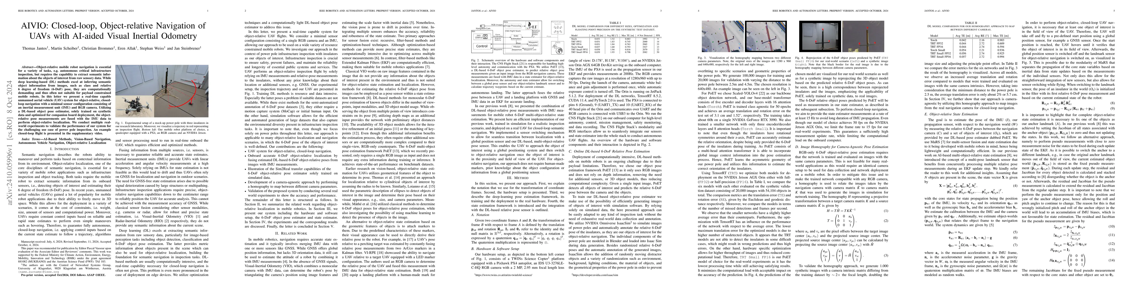
Object-relative mobile robot navigation is essential for a variety of tasks, e.g. autonomous critical infrastructure inspection, but requires the capability to extract semantic information about the objects of interest from raw sensory data. While deep learning-based (DL) methods excel at inferring semantic object information from images, such as class and relative 6 degree of freedom (6-DoF) pose, they are computationally demanding and thus often not suitable for payload constrained mobile robots. In this letter we present a real-time capable unmanned aerial vehicle (UAV) system for object-relative, closed-loop navigation with a minimal sensor configuration consisting of an inertial measurement unit (IMU) and RGB camera. Utilizing a DL-based object pose estimator, solely trained on synthetic data and optimized for companion board deployment, the object-relative pose measurements are fused with the IMU data to perform object-relative localization. We conduct multiple real-world experiments to validate the performance of our system for the challenging use case of power pole inspection. An example closed-loop flight is presented in the supplementary video.
AI Key Findings
Get AI-generated insights about this paper's methodology, results, significance, and more — seven facets brought into focus.
Impact
Paper Details
Authors
PDF Preview
Citation Network
Current paper (gray), citations (green), references (blue)
Display is limited for performance on very large graphs.
Discussion 0