All-Weather sub-50-cm Radar-Inertial Positioning
Publication
Metrics
AI Quick Summary
This paper introduces a method for precise, all-weather positioning of ground vehicles using low-cost radars and inertial sensors, achieving sub-50 cm accuracy in horizontal position and 0.5 degrees in heading, even without GNSS during 60 minutes of urban driving in Austin, TX.
Paper Preview
Abstract
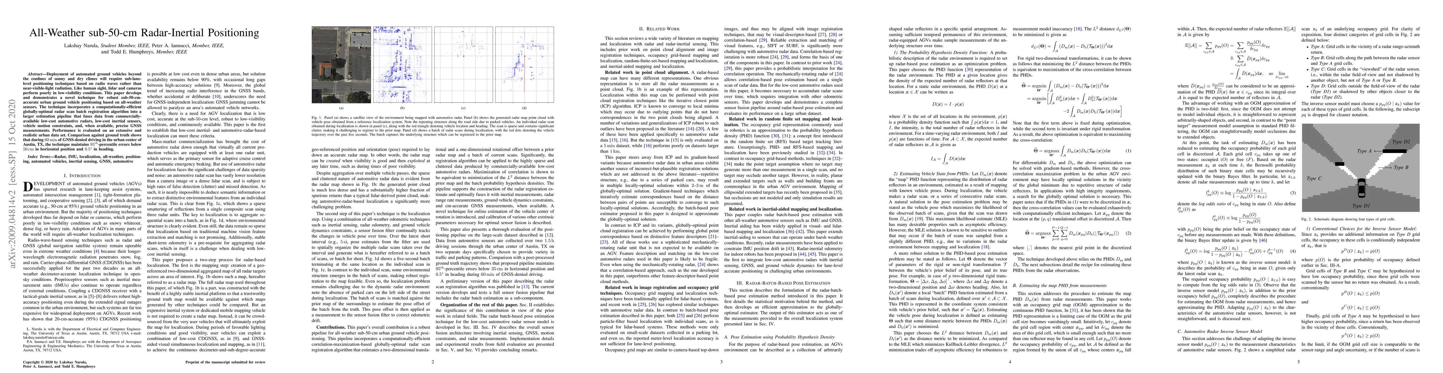
Deployment of automated ground vehicles beyond the confines of sunny and dry climes will require sub-lane-level positioning techniques based on radio waves rather than near-visible-light radiation. Like human sight, lidar and cameras perform poorly in low-visibility conditions. This paper develops and demonstrates a novel technique for robust sub-50-cm-accurate urban ground vehicle positioning based on all-weather sensors. The technique incorporates a computationally-efficient globally-optimal radar scan batch registration algorithm into a larger estimation pipeline that fuses data from commercially-available low-cost automotive radars, low-cost inertial sensors, vehicle motion constraints, and, when available, precise GNSS measurements. Performance is evaluated on an extensive and realistic urban data set. Comparison against ground truth shows that during 60 minutes of GNSS-denied driving in the urban center of Austin, TX, the technique maintains 95th-percentile errors below 50 cm in horizontal position and 0.5 degrees in heading.
AI Key Findings
Get AI-generated insights about this paper's methodology, results, significance, and more — seven facets brought into focus.
Impact
Paper Details
Authors
PDF Preview
Key Terms
Citation Network
Current paper (gray), citations (green), references (blue)
Display is limited for performance on very large graphs.
Discussion 0